
The Kyarkoti Harsil Trek climbs from Harsil village on the Bhagirathi River to Kyarkoti, a high-altitude alpine meadow (bugyal) at approximately 3,480 meters, along a route that shares its start with the far more demanding Lamkhaga Pass trek connecting through to Chitkul in Himachal Pradesh. Kyarkoti Harsil Trek Uttarakhand covers roughly 16–17 km one-way through cedar, pine, and birch forest, opening into wide meadows with an emerald-green alpine lake and sweeping views of Mt Srikanth and numerous unnamed peaks along the Gangotri range — genuinely one of Uttarkashi’s least crowded high-altitude destinations.
A note on trail difficulty: Available information on this trek is somewhat inconsistent — some accounts describe it as an easy-to-moderate trail suitable for families and first-time trekkers, while others describe a steep, demanding route recommended only for those with prior trekking experience. This guide presents the trek as genuinely moderate, and strongly recommends trekking with an experienced local guide who can assess current trail conditions and match the pace to your group’s fitness level, given the real variation in how this route is described.
Kyarkoti Harsil Trek Uttarkashi’s Offbeat Alpine Meadow
The Kyarkoti Harsil Trek is a high-altitude trek in the Gangotri valley of Uttarkashi district, Uttarakhand, running roughly 16–17 km from Harsil village to the Kyarkoti alpine meadow at approximately 3,480 meters, following the same starting trail used by the more demanding Lamkhaga Pass route.
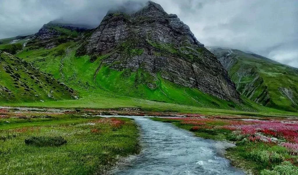
Unlike well-known Uttarakhand treks such as Kedarkantha or Valley of Flowers, Kyarkoti remains genuinely lesser-known — infrastructure is minimal, trail traffic is light, and much of the appeal lies precisely in that solitude. The route moves through dense cedar, pine, and birch forest, crosses glacial streams, and opens into the Kyarkoti Bugyal itself: a wide alpine meadow with an emerald-green lake, wildflowers in summer, and unobstructed views of Mt Srikanth and a string of unnamed Gangotri-range peaks.
Why Choose the Kyarkoti Trek?
The Kyarkoti Trek’s core appeal is exactly what it lacks: crowds. In a landscape where many popular Himalayan trails have become genuinely overrun, Kyarkoti offers hours of walking without encountering another group — a rare, increasingly valuable kind of solitude. The route also delivers real landscape variety in a single trek: dense deodar and pine forest gives way to open river valleys, then to the high alpine meadow itself, with the emerald Kyarkoti lake as a centerpiece and the Gangotri range providing a dramatic, constantly shifting backdrop, especially striking at sunrise and sunset when the peaks catch golden light.
Along the way, you may encounter local shepherds — often from Bagori village, known regionally for its woolen products — herding large flocks of sheep into the high meadows for summer grazing, adding a genuine cultural dimension to a trek that’s otherwise defined by raw, uncommercialized wilderness.
Ready for a genuinely offbeat Himalayan trek away from the crowds? Kashi of North organizes guided Kyarkoti Harsil Trek packages with experienced local trek leaders — WhatsApp +91 7253079221.
About Harsil, the Base Camp
Harsil sits on the banks of the Bhagirathi River en route to Gangotri, roughly 25 km before the temple town, and serves as the shared base camp for two significant high-altitude treks — Lamkhaga Pass and Kyarkoti — as well as the nearby Dhumdar Kandi Pass route. The village itself is worth time beyond its role as a trailhead: dense deodar forest, the sound of the Bhagirathi, traditional wooden houses, and apple orchards make it a genuinely appealing stop for nature lovers even outside trekking season.
Trek Distance
The one-way trekking distance from Harsil to Kyarkoti is reported as approximately 16–17 km, making the round trip roughly 32–35 km on foot, typically covered over 2–3 trekking days each direction depending on pace and acclimatization needs. Including the road journey from Dehradun to Harsil and back, the total trip distance (by taxi plus on foot) runs to several hundred kilometers over the full 5–7 day duration. Daily trekking hours and elevation gain vary by account — expect a genuine, sustained climb given the meadow’s 3,480 m altitude versus Harsil’s roughly 2,620 m starting elevation.
Trek Difficulty
Given the inconsistency in available descriptions of this trek — some calling it easy and family-friendly, others describing a steep, demanding route for experienced trekkers only — this guide recommends treating the Kyarkoti Harsil Trek as genuinely moderate, and strongly advises going with an experienced guide who can assess current conditions.
What’s consistent across sources: the trail’s initial section from Harsil is steep, the terrain includes stream crossings and rocky, narrow mountain paths, and the trek reaches a genuine high altitude (3,480 m) where weather and acclimatization both matter. A reasonable baseline level of fitness, prior hiking experience, and appropriate gear for sub-zero temperatures at altitude are all worth planning for, regardless of which difficulty characterization you encounter elsewhere.
Recommended backpack weight is capped around 12 kg for comfortable trekking at this altitude and distance.
Best Time to Visit
April through November is the recommended trekking window for Kyarkoti, with the trail receiving heavy snowfall and becoming largely inaccessible through winter.
- Spring (April–May): Trail opening progressively as snow clears, forest greenery returning.
- Summer (June–August): Wildflowers bloom across the meadow, making this a particularly rewarding season for the bugyal itself, though monsoon rain from July can affect trail conditions.
- Autumn (September–November): Clear skies, stable weather, and excellent mountain visibility — generally considered the best overall trekking window.
- Winter (December–March): Heavy snowfall makes the route largely inaccessible; not recommended for general trekking.
Month-wise Weather Guide
| Season | Trail Conditions | Recommended? |
|---|---|---|
| April–May | Snow clearing, trail opening | Good, verify conditions |
| June–August | Wildflowers, monsoon rain risk from July | Good, with caution in peak monsoon |
| September–November | Clear, stable, best visibility | Best window |
| December–March | Heavy snow, largely inaccessible | Not recommended |
Flora and Fauna
The trek passes through forest dominated by cedar (deodar), pine, and Himalayan birch (bhojpatra), with alpine wildflowers carpeting the Kyarkoti meadow during summer. The region’s biodiversity includes various Himalayan bird species, and the broader Gangotri valley ecosystem is documented habitat for blue sheep (bharal), Himalayan tahr, and Himalayan fox, with snow leopard present in the wider high-altitude landscape — though as with all Himalayan wildlife, sightings of larger mammals are rare and shouldn’t be treated as an expected part of the trek.
Rivers and the Kyarkoti Lake
The trek follows glacier-fed streams for much of its length, part of the broader Bhagirathi basin that defines the Harsil valley and continues down to Gangotri. The Kyarkoti Lake itself, with its distinctive emerald-green water, is the trek’s centerpiece — a high-altitude alpine lake fed by the surrounding glacial and snowmelt sources, sitting within the open meadow at the trek’s endpoint.
Camping Experience
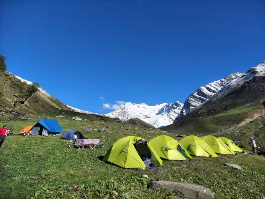
Camping is the standard accommodation for this trek beyond Harsil itself, with tented camps set up along the route and at Kyarkoti. Water is generally available from streams along the trail, though it should always be purified or filtered before drinking. Follow Leave No Trace principles throughout — camp only in established or clearly appropriate areas, avoid open fires where restricted, and carry out all waste, since there’s no infrastructure to manage it on this route.
Want your camping equipment and trek meals fully arranged? Kashi of North handles camping logistics as part of its Kyarkoti Trek packages — WhatsApp +91 7253079221.
Food During the Trek
Meals are typically camp-prepared as part of a guided trek package — hearty, high-calorie food suited to the physical demands of high-altitude trekking. Carry water purification tablets or a filter for stream water along the route, and bring high-energy trail snacks (nuts, dried fruit, energy bars) for the walking sections between camps.
Fitness Preparation
Given the trek’s genuine elevation gain and multi-day duration, cardiovascular preparation matters — regular walking, jogging, or cycling for several weeks before the trek meaningfully improves comfort. Some strength training, particularly for legs and core, helps with the steep initial ascent from Harsil and the sustained daily walking. Basic acclimatization awareness and mental preparedness for changing weather and altitude are just as important as physical fitness for a trek at this elevation.
Safety Tips
Altitude sickness is a genuine consideration given the trek’s 3,480 m maximum altitude — acclimatize properly, hydrate well, and descend if symptoms like headache, nausea, or dizziness worsen. Weather can change quickly at this altitude — be prepared for sudden shifts and follow your guide’s judgment on daily pacing. River and stream crossings along the route require care, particularly after rain when water levels can rise. Wildlife awareness — while sightings of larger animals are rare, standard precautions (making noise on the trail, not leaving food accessible) are worth following. Emergency planning — given the trek’s remote, less-commercialized nature, going with an experienced guide who knows current conditions and evacuation routes is genuinely important here, more so than on well-trafficked commercial treks.
Responsible Trekking
Follow Leave No Trace principles throughout — carry out all waste, since this route has minimal infrastructure to manage it. Avoid plastic where possible, and pack out anything you bring in. Respect the shepherd settlements and grazing activity you may encounter, particularly around Bagori-linked flocks moving through the meadows — this is working land as much as trekking terrain. Avoid disturbing wildlife, and protect the alpine ecosystem by staying on established paths through the meadow rather than cutting new routes across fragile grassland.
Distance Chart
| Origin | Distance to Harsil | Approx. Time |
|---|---|---|
| Delhi | ~500 km | 12–13 hours |
| Dehradun | ~245–260 km | 8–9 hours |
| Haridwar | ~260–280 km | 8–9 hours |
| Rishikesh | ~250–265 km | 7–9 hours |
| Uttarkashi | ~78 km | 2.5–3 hours |
| Gangotri | ~25–28 km | 45–60 minutes |
| Harsil to Kyarkoti (trek) | ~16–17 km one-way | 2–3 trekking days |
On the Trek
Tented camping is standard from Harsil onward — carried in as part of a guided package or arranged independently for experienced self-supported trekkers.
Want your pre- and post-trek Harsil accommodation booked alongside your trek package? Kashi of North handles the full arrangement — call or WhatsApp +91 7253079221.
Nearby Attractions
| Place | Distance from Harsil | Notes |
|---|---|---|
| Dharali | ~6 km | Apple orchard village |
| Mukhba | ~8 km | Winter home of Goddess Ganga |
| Bagori Village | ~8 km | Woolen craft village, source of shepherds seen on trek |
| Gangotri Temple | ~25–28 km | Char Dham temple |
| Gartang Gali | Near Bhaironghati | Historic cliff-side wooden walkway |
| Nelong Valley | Beyond Bhaironghati | Restricted zone, permit required |
| Gangnani | En route from Uttarkashi | Hot spring stop |
Conclusion
The Kyarkoti Harsil Trek offers something increasingly rare in Himalayan trekking: genuine solitude. A route that moves from deodar forest through river valleys to a wide, wildflower-carpeted meadow with an emerald lake and Mt Srikanth on the horizon, walked largely without encountering other groups, is a different kind of Himalayan experience than the well-trafficked commercial treks most visitors know. Given the real variation in how difficult this trail is described, going with an experienced local guide isn’t just a convenience here — it’s the safest way to actually experience what makes Kyarkoti worth the effort.
Ready to plan your Kyarkoti Harsil Trek? Kashi of North organizes guided treks, trek leaders, camping arrangements, hotel bookings, taxi services, and fully customized Uttarkashi trekking itineraries.
📞 Call/WhatsApp: +91 7253079221 📧 Email: kashiofnorth@gmail.com 🌐 Website: kashiofnorth.com
Frequently Asked Questions
1. What is the Kyarkoti Harsil Trek? A high-altitude trek from Harsil village to the Kyarkoti alpine meadow at roughly 3,480 meters in the Gangotri valley, Uttarkashi district.
2. Where does the Kyarkoti Trek start? From Harsil village, which also serves as the base camp for the Lamkhaga Pass and Dhumdar Kandi Pass treks.
3. What is the altitude of Kyarkoti? Approximately 3,480 meters.
4. How long is the Kyarkoti Harsil Trek? Approximately 16–17 km one-way, typically completed over 5–7 days Dehradun to Dehradun.
5. How difficult is the Kyarkoti Harsil Trek? Descriptions vary — this guide treats it as genuinely moderate, with a steep initial section, and recommends trekking with an experienced guide.
6. What is the best time to visit Kyarkoti? April through November; the trail receives heavy snowfall in winter, making it largely inaccessible.
7. Is the Kyarkoti Trek suitable for beginners? Accounts differ — some describe it as accessible for first-timers and families, others recommend prior trekking experience. Confirm suitability with a guide based on your fitness level.
8. What will I see on the Kyarkoti Trek? Cedar, pine, and birch forest, glacial streams, the emerald Kyarkoti Lake, wide alpine meadows, and views of Mt Srikanth and unnamed Gangotri-range peaks.
9. Is camping required for this trek? Yes, tented camping is the standard accommodation beyond Harsil.
10. What wildlife might I see on the trek? Various Himalayan birds are commonly seen; blue sheep, Himalayan tahr, and Himalayan fox are present in the region, though sightings aren’t guaranteed.
11. Is a permit required for the Kyarkoti Trek? Verify current permit requirements given the trek’s proximity to Gangotri National Park and border-adjacent terrain — requirements can change.
12. What is the Lamkhaga Pass connection to Kyarkoti? The Kyarkoti Trek shares its starting trail with the more demanding Lamkhaga Pass route, which connects through to Chitkul in Himachal Pradesh.
13. Can I see shepherds on the Kyarkoti Trek? Yes, herders — often from Bagori village, known for its woolens — regularly bring large flocks to the meadows for summer grazing.
14. What is Harsil, the trek’s base camp? A village on the Bhagirathi River en route to Gangotri, known for its deodar forest, apple orchards, and traditional architecture.
15. How do I reach Harsil? Via Dehradun, Rishikesh, and Uttarkashi by road, roughly 12–13 hours from Delhi or 8–9 hours from Dehradun.
16. What is the Kyarkoti Lake? A distinctive emerald-green alpine lake at the trek’s endpoint, within the Kyarkoti meadow.
17. Is the Kyarkoti Trek crowded? No, it remains genuinely lesser-known and lightly trafficked compared to popular Uttarakhand treks.
18. What should I pack for the Kyarkoti Trek? Warm layered clothing, waterproof trekking boots, a headlamp, trekking poles, and gear appropriate for sub-zero temperatures at altitude.
19. What is the recommended backpack weight for this trek? Around 12 kg or less for comfortable trekking.
20. Is a guide necessary for the Kyarkoti Trek? Strongly recommended, given the trek’s remote, less-commercialized nature and the inconsistency in published trail difficulty information.
21. What is the trek cost for Kyarkoti Harsil? Costs vary by group size, season, and inclusions — contact Kashi of North for current, accurate pricing.
22. Are there river crossings on this trek? Yes, the trail crosses glacial streams along the way, requiring extra care after rain.
23. What flora will I see on the Kyarkoti Trek? Cedar (deodar), pine, and Himalayan birch forest, with alpine wildflowers blooming across the meadow in summer.
24. Is snow leopard habitat present near Kyarkoti? The wider Gangotri valley region is documented snow leopard habitat, though sightings are extremely rare.
25. What nearby villages can I combine with a Kyarkoti Trek visit? Dharali, Mukhba, and Bagori are all near Harsil and can be added to a combined trek-and-tour itinerary.
26. Does Kashi of North offer guided Kyarkoti Harsil Trek packages? Yes, including trek leaders, camping arrangements, transportation, and hotel bookings — reach out via WhatsApp at +91 7253079221.
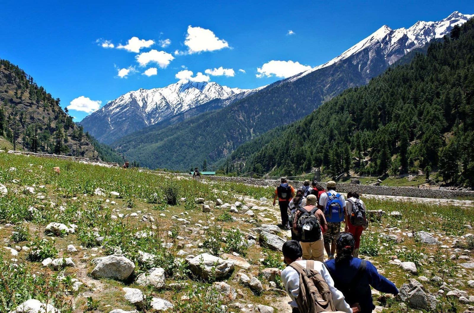
From Harsil, the trail climbs through dense cedar, pine, and Himalayan birch forest, sharing its opening stretch with the far more demanding Lamkhaga Pass route that eventually crosses through to Chitkul in Himachal Pradesh. The initial ascent out of Harsil is the steepest part of the trek — after that, the gradient eases as the path follows glacial streams and works its way up through the tree line.
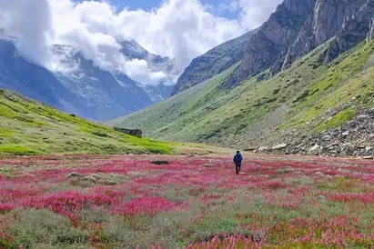
As the forest thins, the trail opens onto Kyarkoti Bugyal: a wide, high-altitude alpine meadow carpeted with wildflowers in summer, centered on the emerald-green Kyarkoti Lake. From here the views open up fully — Mt Srikanth and a run of unnamed Gangotri-range peaks fill the skyline, particularly striking at sunrise and sunset.
Kyarkoti remains genuinely lightly trafficked compared to better-known Uttarakhand treks like Kedarkantha or the Valley of Flowers — much of the walking is done without passing another group. Along the way you may cross paths with shepherds, often from nearby Bagori village, bringing flocks up to the high meadows for summer grazing — a working landscape as much as a trekking one.
Highlights
- ✨ Genuinely offbeat alternative to crowded Uttarakhand treks like Kedarkantha and Valley of Flowers Emerald-green Kyarkoti alpine lake set inside a wide high-altitude meadow (bugyal) Sweeping views of Mt Srikanth and unnamed Gangotri-range peaks Trail through dense cedar, pine, and Himalayan birch forest Shares its opening trail with the demanding Lamkhaga Pass route to Chitkul, Himachal Pradesh Chance encounters with shepherds, often from Bagori village, grazing flocks in the high meadows Base camp at Harsil — a scenic Bhagirathi-riverside village with deodar forest and apple orchards