


Dayara Bugyal Trek 2026 — Complete Guide to Uttarakhand’s Finest Alpine Meadow
Dayara Bugyal Trek | Best bugyal in Uttarakhand | Alpine meadows in Uttarakhand | Trekking in Uttarkashi
Dayara Bugyal is a high-altitude alpine meadow at roughly 3,200–3,400 meters in the upper Bhagirathi Valley of Uttarkashi district, Uttarakhand, reached by a moderate 9–11 km trek from Raithal village through dense oak and rhododendron forest. “Bugyal” is the Garhwali word for these treeless alpine grasslands, and Dayara is arguably the finest and most complete example accessible by moderate trekking anywhere in the state — genuinely spectacular in every season, from wildflower-carpeted meadows in May-June to a full snow trek destination from December through February.
This guide covers both approach routes (Raithal and Barsu), winter trekking in detail, day-wise itineraries, cost, permits, and more than 40 answered questions — everything needed to plan a Dayara Bugyal trip properly, whatever season you’re targeting.
Important note: Permit rules, camping regulations, and forest fees can change. This guide reflects information current as of mid-2026 — verify the latest requirements with the Uttarkashi Forest Division or the Raithal checkpost before traveling.
What Is Dayara Bugyal?
Dayara Bugyal is a high-altitude alpine meadow at approximately 3,200–3,400 meters in Bhatwari Tehsil, Uttarkashi district, Uttarakhand, reached by a moderate trek from Raithal village through temperate Himalayan forest.


“Bugyal” describes the treeless alpine grasslands found above the treeline across the Garhwal and Kumaon Himalaya — a landscape type with no direct English equivalent, supporting rich grass and wildflower communities and historically used as seasonal shepherd pasture. Dayara sits within this tradition but stands out for its genuine four-season character: wildflowers blanket the meadow in May-June, post-monsoon clarity peaks in October, and from December through February the entire landscape transforms into one of India’s most sought-after snow-trekking destinations. The trail from Raithal (2,200 m) passes through oak, rhododendron, and eventually silver fir forest before the treeline breaks and the meadow opens in one of the more dramatic landscape transitions on any moderate Indian trek.
A Meadow That Makes You Forget What You Were Worried About
There are landscapes that impress, and then there are landscapes that genuinely alter your internal state. Dayara Bugyal belongs firmly to the second category. The moment the treeline breaks and the alpine meadow opens before you — suddenly, without warning, an enormous green plateau suspended between the forest below and the snow peaks above — something that was tight in the chest simply releases.
This is one of the most beautiful high-altitude meadows in all of Uttarakhand, and by the assessment of those who have walked the Himalayas widely, one of the finest in the entire Himalayan range. Located in the upper reaches of the Uttarkashi district, Dayara Bugyal sits at over 3,400 metres and spreads across the mountain in a way that feels architecturally implausible — a vast, gently rolling plateau of grassland and wildflower that offers a 360-degree panorama of some of the most dramatic peaks in the Garhwal Himalaya, including the distinctive double summit of Bandarpunch to the northeast.
But the meadow is more than a viewpoint. It is a place with its own seasons, its own communities, its own history, and — in winter, when the snow transforms it into a trackless white expanse — an entirely different character from the green paradise trekkers find in summer. It is a destination for photographers, for campers, for serious trekkers moving on to higher routes, for beginners making their first real Himalayan climb, and for those who simply need to be somewhere where the sky is very large and the noise of ordinary life is very far away.
For a region as richly layered as Uttarkashi, Dayara Bugyal is the destination that tends to be the one people remember most completely.
Overview: The Meadow and Its Dimensions
Dayara Bugyal Uttarkashi sits at an altitude of approximately 3,408 to 3,650 metres across its main expanse, making it one of the most accessible of India’s great high-altitude meadows — achievable for well-prepared beginners without requiring the specialist experience that higher Himalayan objectives demand. The bugyal covers roughly 28 square kilometres of open terrain, which means that even during the busiest months of the trekking season, it absorbs visitors without feeling crowded.
The base village for the trek is Barsu, reached by road from Uttarkashi (approximately 26 kilometres), and the trek from Barsu to the main meadow covers about 8–9 kilometres with an elevation gain of roughly 1,200 metres. The walk typically takes 4 to 5 hours at a comfortable uphill pace, making it achievable as a day trek from Barsu — though the overwhelming preference of those who have made the journey is to camp on the bugyal and experience at least one sunset and one sunrise from the meadow itself.
The Dayara Bugyal Trek sits at moderate difficulty — genuine physical effort is required, and the altitude means that the body is working harder than the gradient alone would suggest, but no technical skills are needed and the trail is well-established. The best treks in Uttarkashi are often described this way: demanding enough to be meaningful, accessible enough to reward preparation rather than require expertise.
Why Visit Dayara Bugyal?
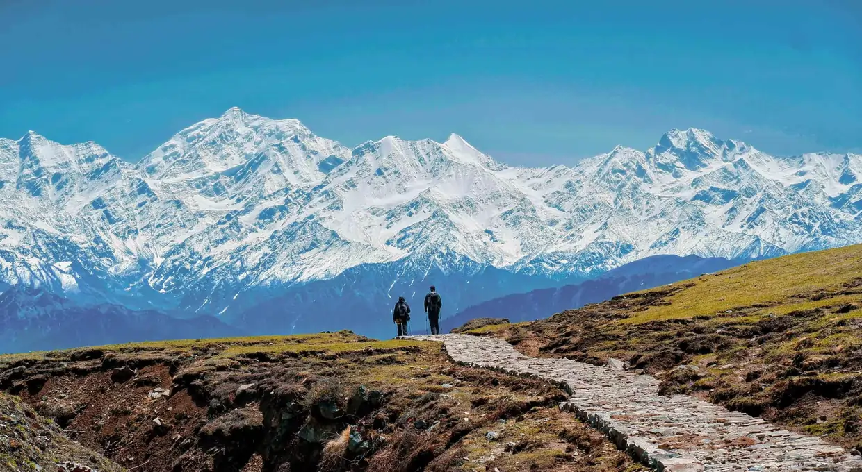
There’s a specific reset of scale that happens at treeline on this trek — the forest simply ends, and the ground rolls out in sweeping curves of grass with a 180-degree mountain panorama that the approach forest has been withholding for the previous several hours. Dayara does this with real force. The Draupadi Ka Danda massif (5,716 m) dominates the northern horizon, the Swargarohini range extends northwest, and on a clear October day, elements of the Gangotri group are visible without needing a telephoto lens.
What sets Dayara apart from other well-known Himalayan meadows is genuinely earning its reputation in every season rather than just one. In May and June, the meadow carpets with primulas, anemones, potentillas, and dozens of other alpine species — a display serious wildflower photographers specifically plan trips around. By October, the grass turns gold and mountain visibility hits its annual peak. And from December through March, snow transforms the entire landscape into one of the country’s most popular winter trek destinations. This four-season completeness, combined with a genuinely accessible difficulty level and a well-developed homestay base at Raithal, is why Dayara Bugyal is consistently recommended as one of the best first Himalayan treks in India — beginner-friendly without being unrewarding for experienced trekkers.
Ready to see the meadow in wildflower bloom, autumn gold, or full winter snow? Kashi of North offers Dayara Bugyal Trek packages tailored to your season and experience level — WhatsApp +91 7253079221.
The Trek from Barsu: Forest, Rhododendron, and Then Everything
The approach to Dayara Bugyal begins in Barsu Village, a compact mountain settlement at around 2,200 metres that serves as the practical base for the trek. The village itself is worth a morning — traditional stone houses, the sounds of a working mountain community, views down the valley that already begin to explain why people live this high.
From Barsu, the trail enters the forest almost immediately and stays within it for the better part of the climb. This forest section is one of the quietly spectacular parts of the entire route — dense stands of oak and rhododendron fill the slope, and depending on the season, the experience changes dramatically. In April and May, the rhododendrons bloom in deep crimson and pink, and the combination of flower colour against the dark green of the oaks against the white of the snowfields above creates a visual sequence that stops trekkers repeatedly on the uphill.
The forest is also genuinely inhabited by wildlife. Himalayan monal — the national bird of Nepal and a spectacular pheasant whose plumage runs through iridescent blues, greens, and coppers — is frequently seen in these forests. Musk deer move through the oak stands in the early morning. Langur monkeys occupy the higher reaches of the forest canopy. The hidden destinations in Uttarakhand quality of this trek is partly a function of how much the lower forest section contains that trekkers focused entirely on the meadow above tend to walk past without fully registering.
The gradient steepens in the upper half of the forest section before the trail makes its final push to the treeline. And then, with the abruptness that makes the moment genuinely exciting every time, the trees end and the meadow begins.
The plateau appears. The peaks appear. The sky appears, enormous and unobstructed, in every direction. For most trekkers, the first ten minutes on the bugyal are spent entirely stationary — simply absorbing what has been revealed.
What the Meadow Looks Like: Attempt at Description
The honest challenge in writing about Dayara Bugyal is that the meadow’s impact is fundamentally experiential. Photographs come closer than words, and the experience itself surpasses the photographs. But the attempt is worth making.
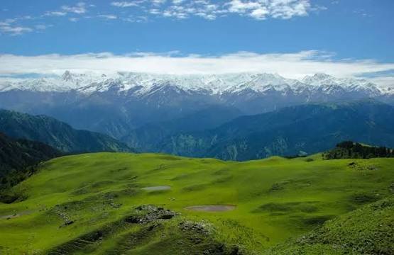
The bugyal from above might be described as a vast green quilt laid over the contours of the mountain — not flat, but gently rolling in broad swells, the grass short and close-cropped by the combined attention of grazing animals and high-altitude growing conditions. In May and June, wildflowers appear throughout the grass in colours ranging from pale yellow to violet, and the scale of the meadow means that these flower patches extend to the visible horizon in multiple directions.
Bandarpunch (6,316 metres) and its companion peak Kala Nag (Black Peak, 6,387 metres) dominate the northeastern skyline — their snow-covered massif close enough to feel almost reachable, far enough to remain unmistakably monumental. The ridgeline of peaks visible from the bugyal on a clear day includes Draupadi Ka Danda II and several unnamed but equally dramatic summits that form a continuous wall of high Himalayan terrain around the horizon.
Sunrise and sunset on the bugyal are — without inflation — among the finest light experiences available in the Uttarkashi district. The eastern horizon catches the first light on the snow before anything in the valley below, and the progression of colour across those peaks — from pre-dawn blue to the first blush of orange, then gold, then the full white of morning — takes perhaps forty-five minutes and is worth sitting entirely still for.
In winter, the entire landscape described above is replaced by another one entirely: white and windswept and trackless, the peaks invisible behind snow cloud on most days, the occasional clear window revealing the massif above the snowfield in a way that is genuinely otherworldly. Dayara Bugyal in winter is for a different traveller — one comfortable with cold, with uncertainty, with navigation in reduced visibility — but those who have experienced it tend to rank it among the most singular Himalayan experiences they have had.
Activities: More Than a Walk to a Viewpoint
The Dayara Bugyal Trek is the primary activity, but the destination supports a range of experiences that extend the visit well beyond a single day’s hiking.
Camping on the bugyal is, for most visitors, the defining experience of a trip here. The night sky at 3,400 metres with no light pollution from any direction and — on clear nights — an atmospheric transparency that reveals the Milky Way as a structural feature of the sky rather than a faint wash is the kind of experience that recalibrates how you think about ordinary city nights. Bring a warm enough sleeping bag, because temperatures drop dramatically after dark even in July, and the reward for enduring that cold to step out of the tent at 2 AM is one of the finest stargazing environments in the region.
Photography at Dayara Bugyal is essentially unlimited in its possibilities — the combination of meadow, peaks, pastoral life, wildflowers, and atmospheric conditions creates a photographic environment that professional landscape photographers have been returning to for decades. Golden hour here is extraordinary, and the meadow’s scale means that strong compositions can be found in multiple directions simultaneously.
Winter snow trekking and skiing represent a growing interest in Dayara Bugyal during the December to February window. The meadow’s open gradient makes it naturally suited to ski touring, and the Uttarakhand government has identified it as one of the most promising venues for the development of Himalayan skiing in the state. At present, it remains low-key and largely unstructured — which is precisely its appeal to those who know it.
Nature exploration in the oak-rhododendron forest below the bugyal is its own category of activity, most rewarding in the early mornings when the wildlife is most active and the light through the forest canopy is at its best.
Seasonal Guide: Three Very Different Destinations
May to June delivers the meadow at its most overtly beautiful. The grass is deeply green, the wildflowers are in bloom, the rhododendrons are still flowering in the forest below, and the snow on the surrounding peaks is consolidated and brilliant. Trekking conditions are excellent, the days are long, and the evening temperatures are cold but manageable. This is when Dayara Bugyal camping is at its most inviting for those new to the experience.
September to October is the post-monsoon season that many experienced Himalayan travellers regard as the finest trekking window in Uttarakhand overall. The air has been scrubbed clean by weeks of rain, the visibility is exceptional, and the peaks appear with a clarity and apparent proximity that feels almost theatrical. The meadow grass, still green from the monsoon moisture, begins its seasonal shift toward gold and ochre in October, adding an autumnal dimension to the landscape.
December to February is the snow season — Dayara Bugyal under deep snow is a completely different experience from the summer meadow, accessible to trekkers with winter gear and sufficient experience, and incomparably dramatic in its visual character. Alpine meadows in Uttarakhand rarely receive the attention in winter that Dayara Bugyal deserves.
Monsoon (July to August) brings the valley to vivid life — the forest is intensely green, the air smells of wet earth and pine — but the combination of slippery trails, poor visibility, and landslide risk on the access roads makes this the season to approach with caution or defer to others.
Reaching Dayara Bugyal and Nearby Destinations
Barsu Village is the practical base — 26 kilometres from Uttarkashi town, accessible by road with the final section on a mountain track that requires a capable vehicle. Most trekkers reach Barsu by jeep hired from Uttarkashi, leaving the town in the early morning to begin the trek by 8 AM.
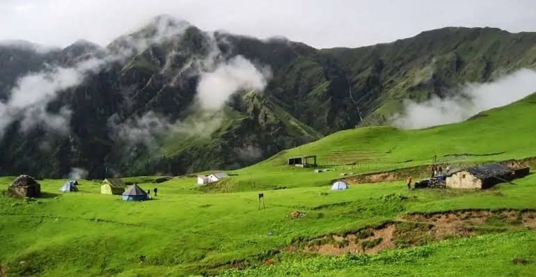
The nearby village of Raithal offers an alternative base on the other side of the bugyal, popular with those approaching from a different direction or looking for a traverse option. Raithal has established itself as a community tourism hub with homestays run by local Garhwali families — accommodation that brings travellers into direct and genuine contact with mountain domestic life.
Harsil Valley, roughly 20 kilometres from Barsu by road, is the natural extension for those wanting to combine the Dayara Bugyal trek with the cultural and scenic depth of the Bhagirathi river valley below. Dodital Trek — a higher, more remote route to a sacred Himalayan lake associated with the birthplace of Lord Ganesha — represents the natural next objective for those who want to go further. Gangotri Temple and the upper Bhagirathi valley are accessible from Uttarkashi for those building a broader Uttarkashi itinerary.
Why the Kashi of North Approach Matters Here
KashiOfNorth.com was created for destinations exactly like this one — places that are known to local communities and a small number of discerning travellers, but have not yet been processed by the machinery of mainstream tourism into something smooth, packaged, and fundamentally less interesting than the original.
Dayara Bugyal Uttarkashi is, at the moment of writing, still largely itself. The shepherds still bring their flocks. The camping is still low-density. The approach from Barsu still passes through forest that feels genuinely wild. The night sky still shows you what a night sky is supposed to look like. Kashi of North offers the local knowledge and cultural context to experience Dayara Bugyal while it is still in this condition — and to do so with the respect for the landscape and its communities that keeps it that way.
Before You Go: Essential Tips
- Begin the trek by 7–8 AM. The four-to-five-hour climb is significantly more enjoyable in the cooler morning hours, and arriving on the bugyal by early afternoon gives you the best of the afternoon light and the full evening on the meadow.
- Carry warm layers regardless of season. The temperature on the bugyal can drop by 15°C or more between midday and sunset. Base layer, mid fleece, and a wind and water resistant shell are the minimum sensible kit even in June.
- Hire a local guide from Barsu or Raithal. Not primarily for navigation — the trail is well-marked — but for the cultural depth and local knowledge a Garhwali guide brings to the experience. The difference between being told what you are looking at and understanding what it means is the guide’s contribution.
- Leave zero waste on the alpine meadow. The bugyal is a fragile high-altitude ecosystem and an active pastoral landscape. Everything carried up must come down. This is both a legal obligation within the protected zone and the basic standard of conduct that the landscape deserves.
- Carry a full day’s water from Barsu. Water is available in the forest section and occasionally on the meadow, but treating any source used above the treeline is strongly recommended. Carry a minimum of two litres per person.
- Pack backup rain protection. Mountain weather builds fast in the afternoons. A lightweight rain jacket takes almost no pack space and transforms the experience of a sudden weather change from miserable to merely wet.
- Check conditions before departing in winter. The access road to Barsu and the trail itself can be fully blocked by snowfall. Local contacts in Uttarkashi or the forest department can confirm current conditions — making this call before the journey saves significant frustration.
Dayara Bugyal is the Himalayas at their most generous — a landscape that gives itself openly, that asks relatively little in return, and that stays with you in the specific way that only genuinely beautiful places do.
Frequently Asked Questions
1. What is Dayara Bugyal? A high-altitude alpine meadow at roughly 3,200–3,400 meters in Uttarkashi district, Uttarakhand, known for wildflowers, autumn mountain clarity, and winter snow trekking.
2. What does “Bugyal” mean? A Garhwali term for high-altitude alpine meadows above the treeline, found across the Garhwal and Kumaon Himalaya.
3. Where is Dayara Bugyal located? In Bhatwari Tehsil, Uttarkashi district, accessed primarily from Raithal village, roughly 30–35 km from Uttarkashi.
4. What is the altitude of Dayara Bugyal? The meadow sits at approximately 3,200–3,400 meters; the Bakaria Top extension reaches roughly 3,810 meters.
5. How difficult is the Dayara Bugyal Trek? Rated Moderate — no technical sections, a well-defined trail, and roughly 1,000–1,200 m elevation gain from Raithal.
6. What is the best time to visit Dayara Bugyal? October for the best overall conditions, May–June for wildflowers, December–February for winter snow.
7. What is the starting village for the trek? Raithal (2,200 m) is the primary base; Barsu offers a shorter alternative approach.
8. Is the Dayara Bugyal Trek suitable for beginners? Yes, it’s widely recommended as one of the best first Himalayan treks given its gradual gradient and non-technical trail.
9. Can children do the Dayara Bugyal Trek? Yes, children 10 and above with reasonable fitness, ideally on a 4–5 day itinerary.
10. Is a guide required for Dayara Bugyal? Not mandatory in the main season, but strongly recommended, and effectively necessary for winter trekking.
11. What is Bakaria Top? The highest accessible ridge point above the meadow, at roughly 3,810 meters, offering the most comprehensive panorama.
12. What peaks are visible from Dayara Bugyal? The Draupadi Ka Danda massif, various Gangotri group peaks, and the Swargarohini range on clear days.
13. When is the wildflower season at Dayara Bugyal? Late April through June, with peak bloom typically in May–June.
14. When does snowfall begin at Dayara Bugyal? Snow typically starts at meadow level in November, building through December–February.
15. Is Dayara Bugyal good for winter trekking? Yes, it’s one of India’s premier winter snow-trek destinations, but requires significant additional preparation and an experienced guide.
16. Is a forest permit required? Yes, collected at the Raithal checkpost or the Uttarkashi Forest Division Office, for a nominal fee — verify current rates before travel.
17. Is camping allowed at Dayara Bugyal? Yes, in designated areas — verify current regulations with the forest department before your trek.
18. Can I light a campfire at the meadow? No, open fires are not permitted due to conservation concerns; use a camp stove.
19. What is the trek distance from Raithal to Dayara Bugyal? Approximately 9–11 km one-way, 18–22 km round trip.
20. Is there mobile network on the trail? BSNL has limited signal at Raithal; no reliable network above the village.
21. What sleeping bag do I need? -5°C rated minimum for summer/autumn; -20°C rated for winter.
22. Can I trek Dayara Bugyal solo? Experienced trekkers can, with proper preparation and by informing the Raithal checkpost of their itinerary; a guide is recommended for first visits.
23. What is the cost of the Dayara Bugyal Trek? Roughly ₹4,250–₹25,000+ per person depending on whether you self-organize or book a guided package.
24. Are leeches a concern on this trek? Yes, active in the lower forest sections during July–August monsoon — wear gaiters and check regularly.
25. Are bears present on the Dayara Bugyal trail? Yes, Himalayan black bears inhabit the forest sections, though encounters are rare.
26. What is the route from Raithal to Dayara Bugyal? Raithal → Gui (4 km) → Chilapada (7 km) → Dayara Bugyal (9–11 km).
27. Is there an alternative route to Dayara Bugyal? Yes, via Barsu village, roughly 6–8 km, though with somewhat less developed homestay infrastructure.
28. Is Dayara Bugyal open in monsoon? Technically yes, but with muddy trails, active leeches, and often-obscured mountain views — recommended only for experienced trekkers.
29. How fit do I need to be for this trek? Regular fitness, with the ability to walk steadily uphill for 4–6 hours carrying a pack.
30. What is the difference between Dayara Bugyal in summer and winter? Summer offers wildflowers, green meadow, and moderate temperatures; winter transforms the landscape into a deep snowfield requiring full cold-weather gear and guide support.
31. Is Dayara Bugyal good for families? Yes, one of the best family Himalayan treks in Uttarakhand, best attempted with children 10 and above on a 4–5 day itinerary.
32. What photography opportunities does Dayara Bugyal offer? Wildflower macro photography (May–June), panoramic autumn landscapes (October), and exceptional night sky photography year-round given the lack of light pollution.
33. Are drones allowed at Dayara Bugyal? Only with explicit authorization from the Forest Division, DGCA, and potentially military authorities given the district’s border-sensitive status.
34. What food should I carry for the trek? High-energy trail food (nuts, dried fruit, energy bars) and quick-cook camp meals (instant oats, noodles, dal packets), since no food is available beyond Raithal.
35. Is there a helipad near Dayara Bugyal? No regular service; helicopter access is for emergency evacuation only, coordinated through SDRF.
36. Can I see snow leopards at Dayara Bugyal? They’re present in the district but at extremely low encounter probability on this specific trail.
37. What type of vehicle can reach Raithal? An SUV or high-clearance vehicle handles the Bhatwari–Raithal approach road most comfortably.
38. Is oxygen required for this trek? No, supplemental oxygen isn’t standard preparation at this altitude, though AMS awareness is still important.
39. What is the best route for first-time trekkers? The Raithal route, given its superior forest quality and more developed homestay infrastructure.
40. Is insurance required for the Dayara Bugyal Trek? Not legally required but strongly recommended, particularly coverage for high-altitude trekking.
41. Does Kashi of North offer Dayara Bugyal Trek packages? Yes, including permit assistance, local guides, homestay and camping bookings, and season-specific gear support — reach out via WhatsApp at +91 7253079221.
Explore more hidden destinations in Uttarakhand and the best treks in Uttarkashi at kashiofnorth.com
Highlights
- ✨ Raithal: One of our largest Community Campuses, Raithal, welcomes you to a grand skyline, with Mt Srikanth, the Gangotri massif and Draupadi ka Danda on the horizon.
- ✨ The Landscaping of Dayara Meadows: Undulating meadows in every direction, not a rock or tree out of place. Sheep grazing in the distance. The calmness of the Himalayas takes over as you walk through.
- ✨ Sweeping Views of Yamunotri and Gangotri Ranges: Without much effort, you see Mt Srikanth, Jaonli, Draupadi ka Danda, the famous peaks of the Gangotri Range on one side, Bandarpoonch on the other.
- ✨ Forests of Oak, Pine and Rhododendrons: The forests to Dayara Bugyal are incredibly romantic; crunching leaves beneath your feet, sunlight filtering in gently, and easy ascents and descents. It’s postcard-perfect.