
Gaumukh Tapovan Trek | Gaumukh Trek Uttarkashi | Tapovan Trek Uttarakhand | Best treks in Gangotri
Gaumukh Tapovan Trek, From the Source of the Ganga to the Throne of Shivling
The Gaumukh Tapovan Trek is a moderate-to-difficult, roughly 41 km Himalayan trek that begins at Gangotri, follows the Bhagirathi River through Chirbasa and Bhojbasa to Gaumukh — the snout of the Gangotri Glacier — then crosses a section of the glacier itself to reach Tapovan, a high alpine meadow at the base of Mount Shivling.
“Gaumukh” means cow’s mouth, describing the shape of the glacier’s terminus, while “Tapovan” translates roughly to “forest of penance,” a name tied to the meadow’s long history as a place where sadhus and ascetics have practiced meditation. The trek’s core appeal is standing at the actual physical source of the Bhagirathi — the river that becomes the Ganga — and then continuing higher to camp beneath Shivling, with the Bhagirathi Peaks and Meru rising on the opposite side.
This is not a beginner trek in the way the standard Gaumukh-only route is. The glacier crossing, rockfall-prone moraine sections, and sustained altitude above 10,000 feet make this a genuine high-altitude undertaking that rewards real preparation. Standing at the source of a river that shapes millions of lives, then walking further to camp beneath one of India’s most beautiful peaks — that’s the pull of Tapovan.
Why Tapovan Is Famous
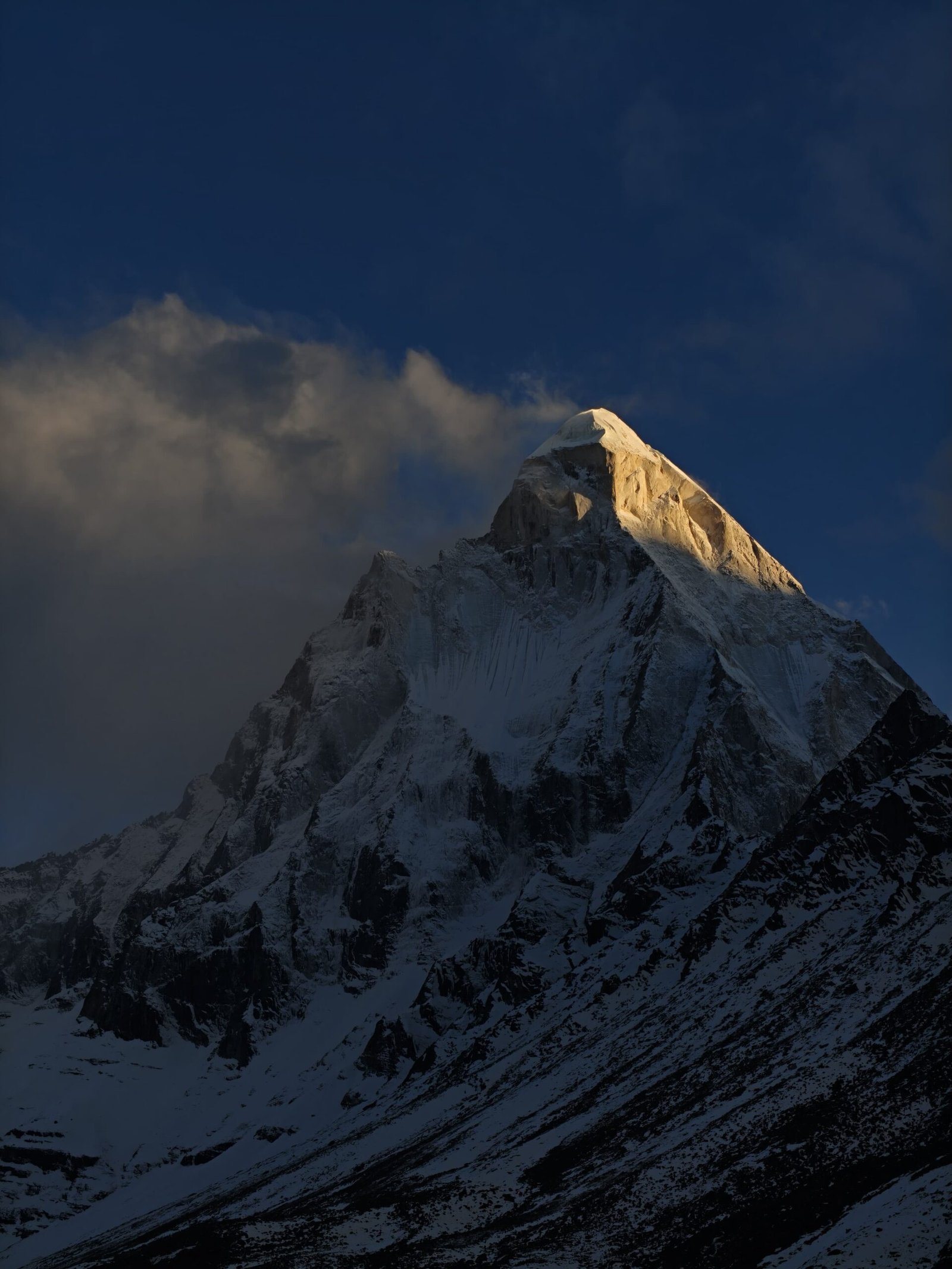
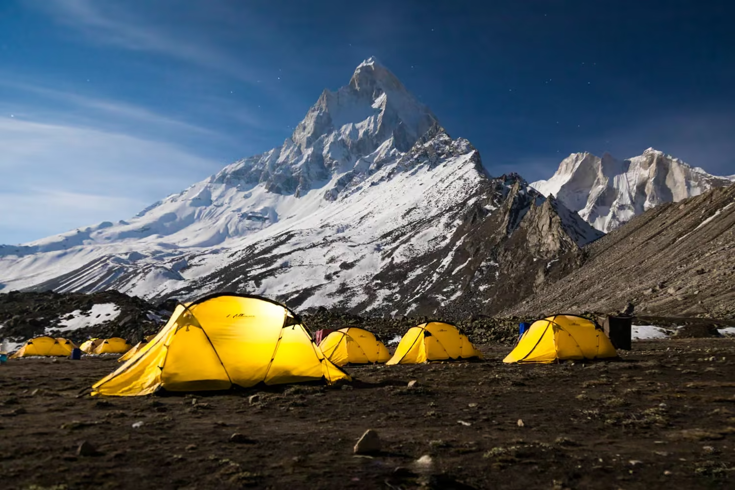
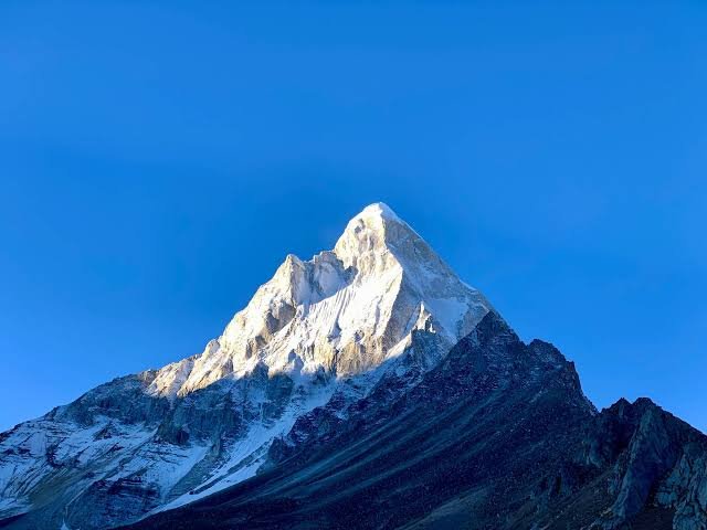
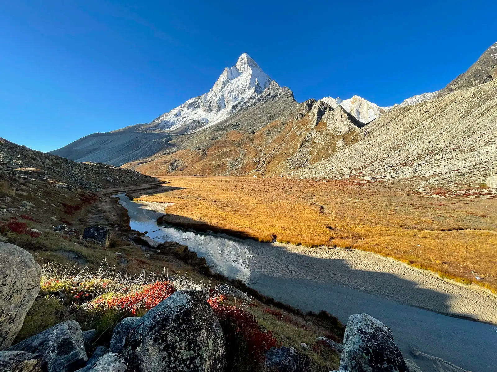
Tapovan is famous first for its view of Mount Shivling, visible base to summit directly across the meadow, with the Bhagirathi Sisters massif rising on the opposite side — combined with its long tradition as a Himalayan meditation site.
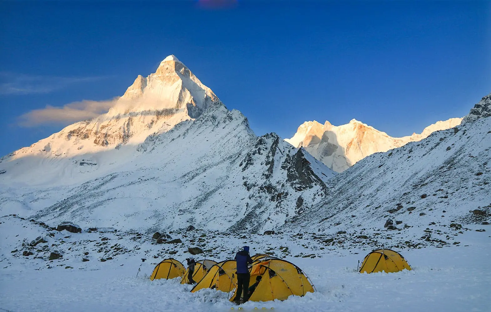
Sunrise and sunset here are genuinely dramatic: Shivling turns gold as the first light hits its summit, and in the evening the Bhagirathi massif glows in fire-orange tones — daily spectacles that trekkers consistently describe as some of the most emotionally striking moments of the entire journey.
Beyond the views, Tapovan carries a long tradition as a meditation site — sadhus have practiced here for generations, drawn by its remoteness and its direct line of sight to Shivling, regarded by many as one of the most beautiful mountains in India. The meadow itself, a mix of boulder and grass at over 14,000 feet, functions as an unofficial base camp for expeditions attempting Shivling and the surrounding peaks.

History and Spiritual Importance
The following presents Hindu religious tradition as believed and practiced — a devotional narrative, not a historical claim.
The trek’s spiritual foundation rests on the story of King Bhagiratha, who undertook extraordinary penance to bring the Ganga down from the heavens to liberate the souls of his 60,000 ancestors. Lord Shiva agreed to catch the descending river in his matted locks to break its force, releasing it as the Bhagirathi — the stream that emerges physically at Gaumukh. Gangotri temple, where the trek begins, is regarded as the river’s spiritual and ceremonial origin, while Gaumukh itself is the actual glacial source.
Tapovan carries its own layer of significance beyond this river mythology — its name, tied to penance and meditation, reflects a long tradition of sadhus and ascetics who have used the meadow’s remoteness and direct proximity to Shivling as a place for spiritual practice. Swami Tapovan Maharaj, a revered Himalayan sage, spent decades in meditation around Gangotri, Bhojbasa, and this broader glacier region — his legacy is part of why the area retains its distinctly contemplative atmosphere even amid the physical demands of the trek.
Geography
The trek runs entirely within Gangotri National Park, established in 1989 and covering roughly 1,553 sq km, part of the Western Himalayan Snow Leopard Conservation Landscape. The route climbs from Gangotri’s pine and deodar forest through birch at Bhojbasa into stark glacial and moraine terrain beyond — a genuine ecological transition compressed into a few days of walking. Tapovan itself sits above the treeline entirely, a mixed boulder-and-grass alpine meadow bordered by the Gangotri Glacier on one side and the Shivling and Bhagirathi massifs on the others.
What Does “Gaumukh” Mean?
Gaumukh means “cow’s mouth,” describing the traditional appearance of the glacier’s snout. It is widely known as the source area of the Bhagirathi River, which later meets the Alaknanda at Devprayag, after which the combined river is known as the Ganga. Because of this connection, Gaumukh holds enormous spiritual importance for pilgrims alongside real geographical significance for anyone interested in the Himalayan river system. The Gangotri Glacier that feeds Gaumukh is one of the most important glaciers in the Indian Himalayas, surrounded by major peaks including Shivling, Meru, the Bhagirathi group, Thalay Sagar, and Bhrigupanth.
The Trek Route in Detail
Gangotri → Chirbasa → Bhojbasa → Gaumukh → Tapovan
Gangotri to Chirbasa (~9–10 km, ~6 hours, 10,050 ft to 11,630 ft)
The trail begins with an initial steep ascent of roughly 300 metres before settling into a gradual, sustained climb along the Bhagirathi’s right bank through pine forest. One notable feature: a large boulder section where the trail drops directly to the river on one side — guard rails are present, but extra care is warranted, especially in rain.
Chirbasa to Bhojbasa (~5 km, ~3 hours, 11,630 ft to 12,415 ft)
A gentler day overall, with an initial 100-metre climb back onto the main trail followed by a gradual ascent to Bhojbasa. This section includes the unstable “Kachha Dhaang” stretch, genuinely prone to landslides — move through it attentively rather than lingering, particularly after rain.
Bhojbasa to Gaumukh and on to Tapovan (~6 km, ~9 hours, 12,415 ft to 14,203 ft)
The trek’s most demanding day. It begins with roughly 2.5 hours of gradual ascent to Gaumukh, followed by around 2 hours of glacier walking across the Gangotri Glacier itself, then a further hour of moderate ascent, and finally a steep 1.5-hour push to Tapovan. Along the way, between Bhojbasa and Gaumukh, trekkers cross the Bhagirathi on a government-provided hand-pulled trolley — suspended above the rushing river, pulled manually, occasionally pausing mid-crossing when the pullers need rest. It’s a controlled, safe crossing, but the sensation of hanging above the river with it audible below is genuinely thrilling for most trekkers.
The final ascent to Tapovan runs along the lateral moraine of the Gangotri Glacier and is rockfall-prone — this is where a guide’s judgment and any provided technical gear (microspikes, gaiters, sometimes ropes or helmets depending on conditions) matter most.
Tapovan Exploration
Camp beneath Shivling with unobstructed views from base to summit, and the Bhagirathi massif rising on the opposite side. Sunrise and sunset here are the trek’s signature moments — plan a full rest/exploration day if your itinerary allows it.
Return Journey
Tapovan to Bhojbasa (~6 km, ~5 hours): A level trail for much of the way before descending to Bhojbasa; moderately difficult given altitude loss and terrain.
Bhojbasa to Gangotri (~14 km, ~8 hours): A tricky descent over the boulder-heavy sections encountered on the way up — fatigue on tired legs makes this stretch one where most trekking injuries actually occur, so maintain careful footing throughout.
Trek Distance Tables
Distance to Gangotri from Major Cities
| Origin | Distance to Gangotri | Approx. Time |
|---|---|---|
| Delhi | ~490–510 km | 13–15 hours |
| Haridwar | ~262–278 km | 8–9 hours |
| Rishikesh | ~250–265 km | 7–9 hours |
| Dehradun | ~242–260 km | 8–9 hours |
| Uttarkashi | ~100 km | 3–3.5 hours |
| Harsil | ~25–28 km | 45–60 minutes |
Trek Segment Distances
| Trek Segment | Distance | Altitude Change |
|---|---|---|
| Gangotri to Chirbasa | ~9–10 km | 10,050 ft to 11,630 ft |
| Chirbasa to Bhojbasa | ~5 km | 11,630 ft to 12,415 ft |
| Bhojbasa to Tapovan (via Gaumukh) | ~6 km | 12,415 ft to 14,203 ft |
| Tapovan to Bhojbasa (return) | ~6 km | 14,203 ft to 12,415 ft |
| Bhojbasa to Gangotri (return) | ~14 km | 12,415 ft to 10,050 ft |
Note: Distances between campsites can vary by roughly 100 metres, and altitude figures by roughly 100 feet, depending on weather and the exact route taken in a given season.
Acclimatization Note
Given that Gangotri itself sits at over 10,000 feet — one of the higher trek base camps in the region — and the trek pushes above 14,000 feet at Tapovan, building in acclimatization time (even an extra rest day at Gangotri or Bhojbasa) significantly reduces AMS risk. Discuss this with Kashi of North when planning your itinerary.
Want your itinerary built with proper acclimatization buffers and a guide who knows current glacier conditions?
📞 Call/WhatsApp: 7253079221
Trek Packages
| Package Type | Typical Inclusions | Typical Exclusions |
|---|---|---|
| Budget | Permit assistance, shared transport, basic camping | Personal gear, technical equipment |
| Standard | Permit, guide, camping, meals, transport | Personal gear, insurance |
| Premium | Permit, guide, porter, technical gear (microspikes, gaiters), private transport | Personal gear, tips |
| Private Trek | Fully customized dates and pace | — |
| Fixed Departure Group | Shared costs, set dates | Date flexibility |
Given the technical sections on this trek — the glacier crossing, the trolley crossing, and the rockfall-prone moraine — a package that includes a certified guide and appropriate technical gear (microspikes, gaiters, and sometimes ropes or helmets depending on conditions) is strongly advisable over a fully independent attempt, particularly for first-time high-altitude trekkers.
Not sure which package level is right for your experience level? Kashi of North can walk you through current Gaumukh Tapovan package options based on your fitness and prior trekking history.
📞 Call/WhatsApp: 7253079221 ✉️ Email: kashiofnorth@gmail.com
Trek Cost
| Category | Per Person (approx.) |
|---|---|
| Budget (self-arranged) | ₹16,000–₹18,000 |
| Standard (guided package) | ₹18,000–₹28,000 |
| Premium (full technical support) | ₹28,000–₹40,000+ |
Cost components typically include: forest permit, transport from Dehradun/Rishikesh to Gangotri and back, guide and porter fees, camping equipment, meals, and technical gear where included. These are planning estimates only — confirm current pricing directly with Kashi of North before booking, as transport, permit fees, and package inclusions change seasonally.
📞 Call/WhatsApp: 7253079221 ✉️ Email: kashiofnorth@gmail.com
Trek Permit
Documents Required
- Government-issued photo ID (Aadhaar Card preferred)
- Passport-size photographs
- For foreign nationals: passport
Rules and Restrictions
- Camping only at designated sites — Bhojbasa and Tapovan are the recognized overnight zones
- Drones are strictly prohibited throughout the park
- Plastic restrictions apply — carry reusable containers, not single-use plastic
- Do not collect plants, rocks, or natural material
- Stay on marked routes, particularly through the moraine and glacier sections
Want your permit and technical clearances handled before you arrive at Gangotri?
📞 Call/WhatsApp: 7253079221 ✉️ Email: kashiofnorth@gmail.com
Terrain Challenges
- Gangotri to Chirbasa: A large boulder section where the trail drops directly to the river on one side — guard rails present, but caution required, especially in rain
- Chirbasa to Bhojbasa: The unstable “Kachha Dhaang” stretch, prone to landslides
- Bhojbasa to Gaumukh: The Bhagirathi River crossing via hand-pulled trolley
- Gaumukh to Tapovan: The final ascent runs along the Gangotri Glacier’s lateral moraine, rockfall-prone, following roughly two hours of actual glacier walking
Suitable Experience Level
This is not a first Himalayan trek. It suits trekkers with at least some prior high-altitude experience, or exceptionally well-prepared, genuinely fit beginners trekking with an experienced guide and full technical support. If you’re newer to trekking, the standard Gangotri–Gaumukh route (without the Tapovan extension) is the more appropriate starting point.
Best Time to Visit
Summer (Mid-May to End-June)
Day temperatures run roughly 15°C to 20°C, dropping to near 0°C at night — three warm layers are typically sufficient. Early summer still has receding snow on the trail, and trekkers cross the Bhagirathi on natural snow bridges in places, with snow persisting to Gaumukh and sometimes beyond until mid-May. By late May–early June, the last snow traces clear and sparse valley vegetation, mostly toward Chirbasa, begins turning green. Melting snow swells the Bhagirathi to full force, visible even at Suryakund in Gangotri, and pre-monsoon rain adds further force to the river. This is also the busiest Char Dham Yatra season, so expect significant pilgrim traffic on the trail up to Gaumukh — a flow that continues even into July and August, even though the Tapovan trail itself becomes untenable in monsoon.
Autumn (Mid-September to Mid-October)
Widely regarded as the best season for views across the entire valley. Day temperatures hover around 15°C, but Tapovan nights can fall to 3–5°C below zero — four to five warm layers are recommended. Skies are stable and clear with low precipitation chances. Vegetation toward Chirbasa turns yellow, brown, and maroon, and the Bhagirathi itself deepens to a richer blue with a gentler flow, since colder temperatures constrict glacier and stream melt. This season is notably short — barely 4–5 weeks — because pre-winter snow typically arrives in October, especially at higher campsites like Bhojbasa and above, after which trekking conditions deteriorate until the following summer. Tapovan is also considerably less crowded in autumn than in the pilgrim-heavy summer season.
Monsoon (July–August)
Not recommended for the Tapovan extension. Constant rain makes the landslide-prone sections genuinely dangerous, and most trek operators suspend the summer season by the end of June for this reason.
Winter
Heavy snow and severe cold make the upper trail difficult or inaccessible for regular trekking.
Month-Wise Weather Guide
| Month | Day Temp | Night Temp | Trail Conditions | Layers Recommended |
|---|---|---|---|---|
| Mid-May–June | 15°C to 20°C | Near 0°C | Receding snow, snow bridges early season | 3 warm layers |
| July–August | — | — | Untenable for Tapovan; Gaumukh pilgrim traffic continues | N/A |
| Mid-Sept–mid-Oct | ~15°C | -3°C to -5°C at Tapovan | Clear, stable, best visibility | 4–5 warm layers |
| Late Oct onward | — | — | Pre-winter snow, trekking untenable | N/A |
Food and Water
Meals are available at Gangotri guesthouses and Bhojbasa’s ashrams; beyond Bhojbasa, food is entirely camp-prepared as part of a guided trek or self-carried if trekking independently. High-energy snacks — dry fruits, nuts, energy bars, glucose tablets — and a thermos of hot liquid help maintain energy at altitude. Water is available from the Bhagirathi along most of the route, but should be purified or filtered, particularly once past Bhojbasa. Carry at least 2–3 litres per day, refilled and purified as you go.
Wildlife
Gangotri National Park’s documented species along this corridor include the snow leopard (rarely sighted, flagship species), Himalayan tahr, blue sheep (bharal), musk deer, and Himalayan griffon, alongside the Himalayan monal, Uttarakhand’s state bird. Golden eagles are occasionally seen riding thermals above the glacier valley. Early morning near Bhojbasa and the lower forest sections offers the best wildlife observation window. No sighting should ever be treated as guaranteed.
Safety Tips
AMS Prevention: Acclimatize properly, ideally with a rest day built in at Gangotri or Bhojbasa. Watch for headache, nausea, dizziness, and fatigue; confusion, inability to walk straight, or a pink frothy cough are severe warning signs requiring immediate descent.
Glacier Safety: Follow your guide’s exact route across the Gangotri Glacier — crevasses and unstable ice are real hazards, and this is not terrain to navigate independently without experience.
River Crossing: Handle the trolley pulley carefully during the Bhagirathi crossing to avoid injury, and follow guide instructions throughout.
Weather Hazards: Rain and snowfall can each transform trail conditions within hours. Trust your trek leader’s judgment if a decision is made to turn back from any point — this happens for genuine safety reasons, not caution for its own sake.
Responsible Trekking: Stay on marked routes, camp only at Bhojbasa and Tapovan, carry out all waste, and never collect rocks, plants, or ice.
Solo Trekking: Not recommended on this route given the glacier crossing and rockfall-prone moraine sections — a guide is effectively necessary here, unlike the standard Gaumukh-only trek.
Photography Guide
Sunrise on Shivling — the peak turning gold as first light strikes the summit — and sunset on the Bhagirathi massif in fiery orange tones are the trek’s defining photography moments, best captured from Tapovan camp itself. The Gaumukh glacier snout rewards both wide shots for scale and closer compositions of ice texture. Night sky photography at Tapovan, given the altitude and complete absence of light pollution, is exceptional — bring a tripod and be prepared for genuinely cold conditions during long exposures. Wildlife photography benefits from a 400mm+ lens and patience, particularly for raptors on the glacier valley’s thermals. Drones are strictly prohibited throughout Gangotri National Park.
Gaumukh Trek vs Gaumukh Tapovan Trek
| Feature | Gaumukh Trek | Gaumukh Tapovan Trek |
|---|---|---|
| Main Destination | Gaumukh | Tapovan via Gaumukh |
| Glacier Experience | Yes | Yes, plus a full glacier crossing |
| Starting Point | Gangotri | Gangotri |
| Difficulty | Easy to Moderate | Moderate to Difficult |
| High-Altitude Climb | Limited | Significant |
| Shivling Views | Limited, depending on location | Major highlight |
| Typical Experience | Pilgrimage + glacier snout | Glacier + alpine meadow + peaks |
If you simply want to visit Gaumukh itself, the shorter trek may be sufficient. If you want the more dramatic high-altitude experience with Shivling views, continue on to Tapovan.
Gaumukh Tapovan Trek vs Kedar Tal Trek
| Feature | Gaumukh Tapovan | Kedar Tal |
|---|---|---|
| Starting Point | Gangotri | Gangotri |
| Main Attraction | Glacier crossing + Tapovan meadow | Kedar Tal glacial lake |
| Difficulty | Moderate–Difficult | Moderate–Difficult |
| Famous Mountain View | Shivling | Thalay Sagar |
| Landscape | Glacier, meadow, peaks | Forest, alpine valley, glacial lake |
| Spiritual Importance | Very high (Ganga origin story) | High (Shiva association) |
| Ideal For | Glacier and high-meadow mountain views | Remote high-altitude lake and mountain views |
Who Should Do This Trek?
The trek suits travellers who enjoy high-altitude trekking, Himalayan landscapes, glaciers, mountain photography, alpine meadows, spiritual journeys, remote trekking, and genuinely challenging trails. It is particularly suitable for trekkers who have already completed moderate Himalayan treks and want to progress toward more demanding terrain.
Who Should Avoid the Trek?
Extra caution is necessary for anyone who:
- Has not prepared physically in the weeks before departure
- Has no experience with long, multi-day mountain walks
- Is uncomfortable at high altitude
- Has difficulty walking on uneven, rocky terrain
- Is travelling without proper cold-weather and technical equipment
Anyone with underlying medical conditions should seek professional medical advice before undertaking a high-altitude trek of this nature.
Responsible Trekking
The Gangotri Himalayas are ecologically sensitive. While trekking:
- Carry all waste back out
- Avoid single-use plastic
- Do not litter
- Stay on established trails
- Avoid disturbing wildlife
- Do not damage plants or collect natural material
- Avoid loud music
- Respect religious sites, including Gangotri Temple and the broader sacred geography of the region
- Follow Gangotri National Park forest regulations
- Use designated camping areas only (Bhojbasa and Tapovan)
The mountains are part of a living ecosystem, not simply a trekking destination.
Frequently Asked Questions
What is the Gaumukh Tapovan Trek? A moderate-to-difficult, roughly 41 km trek from Gangotri via Chirbasa, Bhojbasa, and a Gangotri Glacier crossing to Tapovan, a high meadow beneath Mount Shivling.
How long is the Gaumukh Tapovan Trek? Approximately 41 km covered over six trekking days, typically 7–8 days total including drive days from Dehradun.
What is the maximum altitude on the Gaumukh Tapovan Trek? Approximately 14,203 feet (about 4,330 metres) at Tapovan.
Is the Gaumukh Tapovan Trek difficult? Yes, it’s rated moderate to difficult, involving a glacier crossing, a river trolley crossing, and rockfall-prone moraine sections.
Is this trek suitable for beginners? It’s not recommended as a first Himalayan trek — it suits experienced trekkers or exceptionally well-prepared, fit beginners with strong guide support.
What is the best time for the Gaumukh Tapovan Trek? Mid-May to end-June, and mid-September to mid-October.
Is a permit required for the Gaumukh Tapovan Trek? Yes, mandatory, obtained at the Gangotri National Park Forest Department counter, with additional clearance for the Tapovan section beyond the standard Gaumukh permit.
What is the cost of the Gaumukh Tapovan Trek? Roughly ₹15,000–₹40,000+ per person depending on package type, season, and inclusions — these are planning estimates, not fixed prices. Contact Kashi of North for a current quote.
What is the Bhagirathi River trolley crossing? A hand-pulled trolley that carries trekkers across the Bhagirathi between Bhojbasa and Gaumukh, suspended above the river.
Do I need to cross a glacier on this trek? Yes, roughly two hours of walking across the Gangotri Glacier is required on the day from Bhojbasa to Tapovan.
What is Tapovan famous for? Direct, unobstructed views of Mount Shivling from base to summit, alongside the Bhagirathi Peaks massif, and its long history as a meditation site for sadhus.
Is a guide mandatory for the Gaumukh Tapovan Trek? Not strictly mandatory but effectively necessary given the glacier crossing and technical sections — solo attempts aren’t recommended.
What is the emergency exit situation on this trek? Gangotri is the only exit point on the entire route, making evacuation logistically difficult, especially beyond Bhojbasa.
Where is the nearest medical facility to this trek? A basic PHC in Harsil (~25 km from Gangotri); for better care, the District Hospital in Uttarkashi (~100 km); for advanced treatment, Dehradun.
What altitude sickness risk does this trek carry? Significant — Gangotri itself sits above 10,000 feet, and the trek climbs above 14,000 feet at Tapovan, putting all trekkers at genuine AMS risk regardless of fitness level.
Can I do the Gaumukh Tapovan Trek in monsoon? No, the Tapovan section is untenable during monsoon due to landslide risk, even though pilgrim traffic to Gaumukh continues.
What peaks are visible from Tapovan? Mount Shivling (6,543 m), and the Bhagirathi Peaks I, II, and III as a combined massif; Meru, Thalay Sagar, and Bhrigupanth are also part of the wider panorama.
What is the total elevation gain on this trek? Approximately 4,153 feet, from Gangotri at 10,050 ft to Tapovan at 14,203 ft.
Is camping the only accommodation option at Tapovan? Yes, there are no permanent structures at Tapovan — full tented camping is required.
What technical gear might I need? Microspikes, gaiters, and sometimes ropes or helmets for the glacier and moraine sections, often provided as part of a guided package.
How many warm layers do I need in summer? Around three warm layers is typically sufficient in the May–June window.
How many warm layers do I need in autumn? Four to five warm layers, given Tapovan nights can fall to -3°C to -5°C or colder.
Is mobile network available on this trek? Only at Gangotri town — no network beyond that point.
What wildlife might I see on this trek? Blue sheep, Himalayan tahr, musk deer, Himalayan griffon, Himalayan monal, and occasionally golden eagle; snow leopard sightings are rare.
Are drones allowed on the Gaumukh Tapovan Trek? No, strictly prohibited throughout Gangotri National Park.
What is the trickiest section of this trek? The final ascent to Tapovan along the Gangotri Glacier’s lateral moraine, which is rockfall-prone, combined with the preceding glacier walk.
What is the “Kachha Dhaang” section? An unstable stretch of trail between Chirbasa and Bhojbasa that is genuinely prone to landslides.
Can experienced trekkers do this without a package operator? It’s possible but not advisable given the glacier crossing and permit requirements — most trekkers benefit significantly from guide support on this specific route.
How far is Gangotri from Delhi? Approximately 490–510 km, roughly 13–15 hours by road.
What is the return descent like from Bhojbasa to Gangotri? A tricky descent over boulder-heavy sections — this is where most trek injuries occur, so maintain careful footing despite tired legs.
Does Char Dham pilgrim traffic affect this trek? Yes, summer sees heavy pilgrim traffic up to Gaumukh, though the Tapovan extension itself sees far fewer people.
What is a buffer day on this trek? An additional contingency day built into the itinerary in case weather forces a delay — whether it’s used depends entirely on conditions and your trek leader’s judgment.
Is trek insurance necessary? Strongly recommended, specifically covering high-altitude trekking and emergency evacuation.
What is the difference between the Gaumukh Trek and the Gaumukh Tapovan Trek? The standard Gaumukh Trek ends at the glacier snout and is easy to moderate; the Tapovan extension adds a glacier crossing and a further steep ascent to a high meadow, making it moderate to difficult overall.
What should I pack for glacier glare? UV400 sunglasses are essential — glacier and snow glare at this altitude is intense and can cause snow blindness without proper eye protection.
How much water should I carry per day? At least 2–3 litres, refilled and purified from the Bhagirathi where accessible; carry purification tablets or a filter.
Is the trek suitable for senior citizens? Only for those in excellent fitness with prior high-altitude experience and medical clearance, given the sustained altitude and technical sections.
What is Swami Tapovan Maharaj’s connection to this trek? A revered Himalayan sage who spent decades meditating around Gangotri, Bhojbasa, and this glacier region — the meadow Tapovan carries part of that spiritual legacy.
Can I extend beyond Tapovan to Nandanvan? Yes, for very experienced, well-acclimatized trekkers, Nandanvan lies further along the glacier system, though this requires additional planning beyond the standard Tapovan itinerary — ask Kashi of North about this option.
Does Kashi of North offer Gaumukh Tapovan Trek packages? Yes, including permit assistance, certified guides, porters, technical gear support, and full camping and transport arrangements — contact us at 7253079221 or kashiofnorth@gmail.com.
Why Book With Kashi of North?
Planning a high-altitude trek involves more than simply reaching Gangotri. You may need to arrange transportation, Gangotri accommodation, trek permits, a local guide, camping equipment, meals, porter support, technical gear, and return transportation.
Kashi of North connects these arrangements through a local, Uttarkashi-based travel network built specifically around the district’s terrain and current route conditions. Instead of coordinating every service separately, you can request a complete trek plan based on your travel dates, number of trekkers, budget, trek experience, accommodation preference, and transportation requirements.
Tell us your travel dates and group size, and Kashi of North can help you plan your Gaumukh Tapovan adventure.
Conclusion
The Gaumukh Tapovan Trek asks more of you than the standard Gaumukh route — a genuine glacier crossing, a hand-pulled river trolley, rockfall-prone moraine, and sustained altitude above 10,000 feet for the better part of a week. In return, it delivers something few Himalayan treks can match: standing at the literal source of the Ganga, then continuing higher to camp in a meadow with Mount Shivling rising directly in front of you, base to summit, glowing gold at sunrise.
This is a trek for those genuinely ready for high-altitude terrain, prepared with the right fitness, gear, and guide support — and for those who are, it’s one of the most rewarding journeys in the Indian Himalaya. Prepare properly, choose the right season, respect the fragile Himalayan environment, and travel with experienced local support.
Ready to explore Gaumukh and Tapovan? Plan your trek with Kashi of North.
Starting Your Trek at Gangotri: At 10,000 ft, Gangotri is one of the highest starting points of any of our treks. With the Bhagirathi flowing past and the marble-white Gangotri temple, it is also one of the most spiritual.
Birth of the River Ganga at Gaumukh: Witness Gaumukh, the massive snout of Gangotri Glacier. A ten-storey wall of glacial ice, cracking and calving before your eyes, Bhagirathi gushing out from beneath in a roaring flow.
Mt. Shivling at Tapovan: Arguably one of India’s most beautiful Himalayan Peaks, you see it from base to summit at Tapovan. Witnessing the first light of dawn touching its tip moves trekkers to tears.
Bhagirathi Sisters Burning at Sunset: Watch alpenglow sweep the Bhagirathi massif — thousands of metres of rock and ice turning orange, gold, then purple as the last light of day fades.
Highlights
- ✨ Starting Your Trek at Gangotri: At 10,000 ft, Gangotri is one of the highest starting points of any of our treks. With the Bhagirathi flowing past and the marble-white Gangotri temple, it is also one of the most spiritual.
- ✨ Birth of the River Ganga at Gaumukh: Witness Gaumukh, the massive snout of Gangotri Glacier. A ten-storey wall of glacial ice, cracking and calving before your eyes, Bhagirathi gushing out from beneath in a roaring flow.
- ✨ Mt. Shivling at Tapovan: Arguably one of India’s most beautiful Himalayan Peaks, you see it from base to summit at Tapovan. Witnessing the first light of dawn touching its tip moves trekkers to tears.
- ✨ Bhagirathi Sisters Burning at Sunset: Watch alpenglow sweep the Bhagirathi massif — thousands of metres of rock and ice turning orange, gold, then purple as the last light of day fades.