

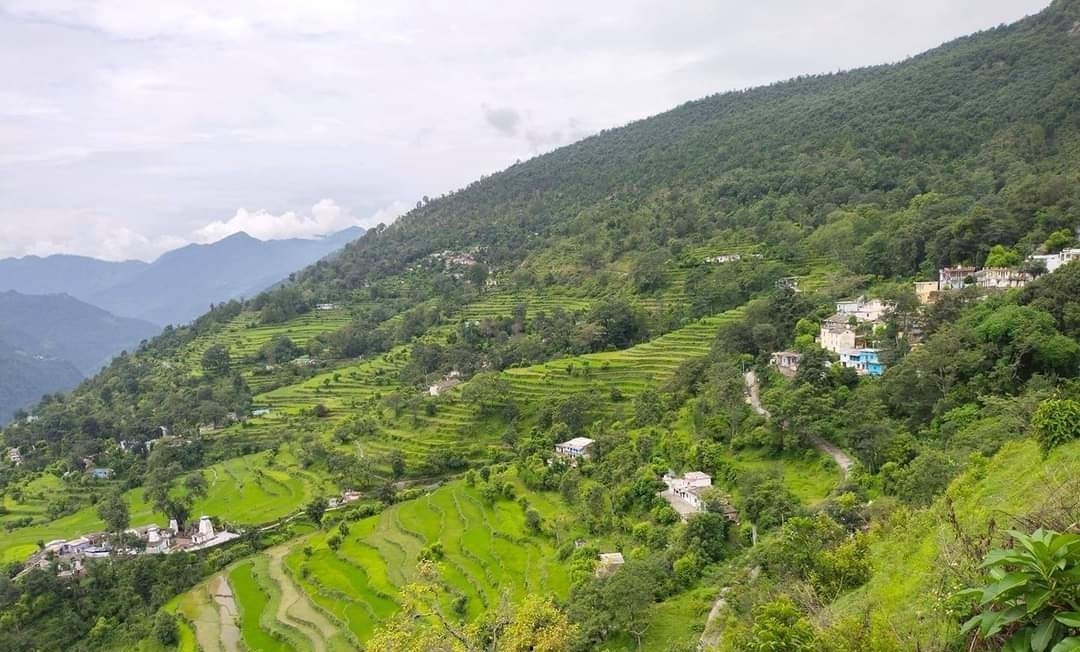
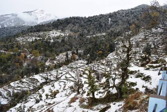

Silla is a small Garhwali village in Bhatwari Tehsil, Uttarkashi district, Uttarakhand, roughly 33 km from Uttarkashi town, best known as the base camp and starting point for the Kush Kalyan Bugyal Trek. Silla Village Uttarkashi is a genuinely working mountain community — terraced fields, traditional houses, an all-weather road connecting it to the wider district, and a population of just under 500 people according to the most recent census — rather than a village that exists for tourism. For trekkers heading toward Kush Kalyan Bugyal, it’s the last real point of civilization before the trail climbs into forest and eventually the high alpine meadow; for anyone curious about authentic Garhwali village life, it’s worth a slower visit in its own right.
This guide covers Silla’s location, village life, homestay options, how to reach it, and everything you need to know before using it as your trek base — plus more than 30 answered questions.
Silla Village: Uttarkashi’s Gateway to the Kush Kalyan Bugyal Trek
Silla is a small Garhwali village in Bhatwari Tehsil, Uttarkashi district, Uttarakhand, roughly 33 km from Uttarkashi town, best known as the trailhead and base camp for the Kush Kalyan Bugyal Trek.
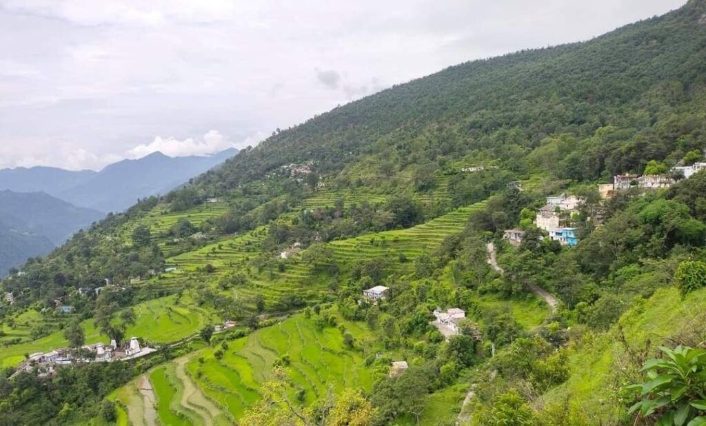
Per the 2011 Census, Silla has 492 residents across 112 households, spread over roughly 336 hectares of village land. It’s a real working mountain community rather than a tourist-built base camp — terrace farming, an all-weather road connecting it to Bhatwari and Uttarkashi, and traditional Garhwali architecture define the village, with trekking infrastructure layered on top rather than being the village’s original purpose.
Quick Travel Information
| Detail | Information |
|---|---|
| District | Uttarkashi, Uttarakhand |
| Tehsil | Bhatwari |
| Elevation | ~7,600 ft (~2,316 m), per available trekking accounts |
| Population (2011 Census) | 492 |
| Households | 112 |
| Nearest town | Uttarkashi (~33 km) |
| Trek gateway | Base camp for the Kush Kalyan Bugyal Trek |
| Best season | Spring through autumn; verify current conditions for winter access |
| Mobile network | Mobile phone coverage available per census records |
| Suitable for | Trekkers, cultural travelers, photographers, nature lovers |
Silla Village: Census and Demographic Overview
According to the 2011 Census of India, Silla village has a population of 492 — 226 males and 266 females — across 112 households, with a sex ratio of 1,177 females per 1,000 males, notably higher than both the Uttarakhand state average (963) and the national average.
Children aged 0–6 make up roughly 22.6% of the population (111 children), with a child sex ratio of 1,313 — again well above the state average of 890. Literacy in Silla stood at 73.23% as of the 2011 Census, somewhat below Uttarakhand’s state average of 78.82%, with male literacy at 87.64% and female literacy at 60.59%.
The village is governed by a Gram Panchayat headed by an elected Sarpanch, consistent with the Panchayati Raj system across rural India. Its official Census village code is 040753, PIN code 249135, and it falls under the Bhatwari CD block.
A note on other villages named Silla: There are several other villages named Silla in India and elsewhere — including a separate Silla in Dehradun district (population 1,461) and another in Dhanaulti tehsil of Tehri Garhwal district (population 280) — so when researching or booking, confirm you’re referencing Silla in Uttarkashi’s Bhatwari Tehsil specifically, the one relevant to the Kush Kalyan Bugyal Trek.
Reported Facilities (2011 Census)
| Category | Status |
|---|---|
| Government primary/middle/secondary schools | Available in village |
| Government senior secondary school | Not available; nearest is over 10 km away |
| Primary health sub-centre | Available |
| Community health centre / hospital | Not available in village |
| Tap water | Untreated tap water available; treated tap water not available |
| Mobile phone coverage | Available |
| Internet/CSC | Not available; nearest facility over 10 km away |
| All-weather road | Available |
| Public/private bus service | Not available in village; nearest 5–10 km away |
| ATM / commercial bank | Not available in village |
| Domestic power supply | Available, approximately 7 hours/day |
Important note: These figures reflect the 2011 Census and may not represent current conditions — infrastructure, connectivity, and services in rural Himalayan villages can change meaningfully over more than a decade. Always verify current facility availability, particularly around mobile network, ATM access, and road conditions, before finalizing your trip.
History and Background
Silla’s history follows the general pattern of small Garhwali mountain settlements in the Bhagirathi valley system — a farming community built around terraced agriculture, traditional stone-and-timber construction, and a subsistence economy shaped by the region’s steep terrain and seasonal accessibility. As with many villages in this part of Uttarkashi district, Silla’s land use reflects the practical limits of Himalayan agriculture: of its roughly 336 hectares, only about 77 hectares are net sown area, with the majority of the village’s land classified as barren or uncultivable given the mountainous terrain, alongside smaller areas of forest, pasture, and culturable waste land.
More recently, Silla’s profile has grown as trekking operators have begun using it as the starting point for the Kush Kalyan Bugyal Trek — a role that has brought a modest degree of visitor traffic to a village whose economy has historically centered on agriculture and livestock rather than tourism.
Why Visit Silla Village?
For trekkers, Silla’s primary value is practical: it’s the last proper village before the Kush Kalyan Bugyal trail climbs into forest, making it the natural place to acclimatize, arrange final trek logistics, and spend a night before the multi-day route begins. But the village itself is worth attention beyond its trailhead function — traditional Garhwali architecture, terraced fields set against a genuine mountain backdrop, and a community whose rhythm still runs on farming and livestock rather than tourism offer a more authentic slice of Himalayan village life than more developed trek-base towns elsewhere in the district.
For photographers and cultural travelers, Silla’s relative obscurity is itself an asset — this isn’t a village that has adapted its character for visitors, which means what you see is genuinely how the community lives.
Planning to use Silla as your base for the Kush Kalyan Bugyal Trek? Kashi of North arranges homestays, local guides, and trek logistics — WhatsApp +91 7253079221.
Silla Village and the Kush Kalyan Bugyal Trek
Silla is the preferred base village for the Kush Kalyan Bugyal Trek, serving as the starting and ending point of the loop route that climbs to the alpine meadow at approximately 3,838 meters on the Uttarkashi–Tehri Garhwal border.
Trekkers typically spend a night in Silla before beginning the ascent, using the time to finalize gear, arrange porters or guides, and acclimatize slightly before the climb into forest terrain. Given the trek’s genuinely newer, less-commercialized status, local guides based in or familiar with Silla are a particularly valuable resource — they bring current knowledge of trail conditions, campsite status, and route variations that aren’t always reflected in published trekking information.
Camping equipment and trek logistics are generally arranged either independently (requiring more preparation given the village’s limited commercial infrastructure) or through a tour operator who handles the full arrangement from Dehradun or Uttarkashi through to the trek itself.
Want your Kush Kalyan Bugyal Trek and Silla homestay booked together as one seamless trip? Kashi of North handles the full arrangement — call or WhatsApp +91 7253079221. For the complete trek details, see our Kush Kalyan Bugyal Trek guide.
Village Life
Daily life in Silla runs on the rhythms of Himalayan subsistence farming — terraced fields worked by hand, livestock tended close to home, and a domestic power supply available for roughly seven hours a day per the most recent reported figures. Traditional Garhwali stone-and-timber architecture is still the norm here, and with government primary, middle, and secondary schools present in the village (though no senior secondary school), education happens locally through the earlier years before students travel further afield for higher schooling.
Given the modest, working nature of the village — no ATM, no commercial bank, no dedicated internet facility, and a population under 500 — visitors should expect and appreciate a genuinely unpolished mountain community rather than infrastructure built around tourism. This is precisely what makes an overnight homestay here valuable for travelers genuinely interested in Garhwali village life rather than a curated version of it.
Things to Do
- Walk the village lanes and observe traditional Garhwali architecture and terraced farming up close
- Interact with local families, particularly if staying in a homestay
- Photograph the terraced fields against the mountain backdrop
- Prepare for the Kush Kalyan Bugyal Trek — gear checks, guide arrangements, acclimatization
- Stargaze in the evening, given the village’s distance from significant light pollution
- Take short forest walks on the edges of the village before committing to the full trek
- Observe seasonal farming activity, which varies through the year with the agricultural calendar
Nearby Attractions
| Place | Notes |
|---|---|
| Kush Kalyan Bugyal | The trek’s destination meadow, ~35–50 km round trip on foot from Silla |
| Bhatwari | The tehsil headquarters, gateway town on the Gangotri Highway |
| Uttarkashi | District headquarters, ~33 km away, widest range of services |
| Gangnani | Hot spring stop on the Gangotri Highway, via Uttarkashi |
| Dayara Bugyal | A more established alpine meadow trek, separate approach via Uttarkashi |
| Harsil Valley | Apple orchard valley on the Bhagirathi, via Uttarkashi/Gangotri road |
| Gangotri | Char Dham temple, further up the valley |
| Dodital | Forest lake trek, separate trailhead near Uttarkashi |
Want to combine a Silla Village stay with wider Uttarkashi district sightseeing? Kashi of North designs multi-stop itineraries — WhatsApp +91 7253079221.
Suggested Itineraries
One-Day Village Visit: Drive from Uttarkashi to Silla (allow time for the mountain road), spend a few hours walking the village and talking with residents where welcomed, return to Uttarkashi or continue toward the trek if beginning the Kush Kalyan Bugyal route.
Weekend Trip: Day 1 — travel from Dehradun/Delhi to Uttarkashi, overnight. Day 2 — drive to Silla, village exploration and homestay overnight. Day 3 — return journey, or begin the trek if extending further.
Trek Combination Tour: Use Silla as the launch point for the full Kush Kalyan Bugyal Trek, spending a night in the village before and after the multi-day loop.
Photography Tour: Time a Silla visit for morning or late-afternoon light on the terraced fields, with an overnight homestay to capture both dusk and dawn village activity.
Village Homestay Experience: A slower, unhurried 2–3 day stay focused purely on village life, farming rhythms, and genuine conversation with residents, without necessarily attempting the full trek.
Want any of these itineraries planned around your available dates? Kashi of North can build a custom Silla Village trip — call or WhatsApp +91 7253079221.
Best Time to Visit
Silla is most comfortably visited in spring through autumn, consistent with the general trekking season for the Kush Kalyan Bugyal route it serves as a base for. Monsoon months bring rain and potential road disruption on the mountain approach, and winter access should be verified given the village’s elevation and the district’s typical snowfall patterns at this altitude. If your visit is tied to the Kush Kalyan Bugyal Trek specifically, refer to the trek guide’s seasonal recommendations, since Silla’s own visiting window is largely dictated by the trek’s accessibility.
Month-wise Weather Guide
| Season | Conditions | Recommended? |
|---|---|---|
| Spring | Clearing weather, greening fields | Good |
| Summer (pre-monsoon) | Warm days, active farming season | Good |
| Monsoon | Rain, potential road disruption | Caution advised |
| Autumn | Clear, stable weather | Excellent |
| Winter | Cold, possible snow at altitude | Verify current road access |
Flora and Fauna
The forest surrounding Silla and the trail beyond it toward Kush Kalyan Bugyal includes oak, pine, and rhododendron, typical of this elevation band in the Garhwal Himalaya. Himalayan bird species are present throughout the surrounding forest, and the broader region supports typical high-altitude Garhwal wildlife, though as with most Himalayan village and forest settings, sightings of larger mammals are occasional rather than a guaranteed part of a visit.
Photography Guide
Silla’s terraced fields, photographed in early morning or late-afternoon light, offer genuinely striking compositions against the surrounding mountains. Village architecture — traditional stone-and-timber construction — rewards patient, respectful documentation, always with permission before photographing residents directly. Sunset and sunrise from the village’s higher points give good directional light on the terraces and the peaks beyond. Given the village’s distance from significant light pollution, night sky photography is a genuine option for those overnighting in a homestay. As with any working community, approach photography as documentation with consent rather than casual tourism snapshotting.
Accommodation
Silla itself has limited formal accommodation infrastructure — no hotels in the conventional sense, given its status as a small agricultural village rather than a tourism-developed base. Homestays, where available, offer the most authentic and practical option for overnighting in the village, particularly for those beginning the Kush Kalyan Bugyal Trek.
| Location | Type | Notes |
|---|---|---|
| Silla | Homestays (limited, verify availability) | Most authentic option, direct village experience |
| Bhatwari | Basic guesthouses | Wider range, gateway tehsil headquarters |
| Uttarkashi | Hotels | Widest range in the district, ~33 km away |
Need Silla homestay availability confirmed before you travel? Kashi of North verifies and books accommodation for you — call or WhatsApp +91 7253079221.
Food
Traditional Garhwali cuisine is the norm in and around Silla — home-cooked meals featuring local seasonal produce, grains, and vegetables grown in the village’s own terraced fields. Given the village’s limited commercial food infrastructure, homestay meals are typically the primary dining option, offering a genuine taste of local ingredients and cooking traditions rather than a restaurant menu. Carry your own snacks and water for the trek portion of your trip, since reliable food and water sources beyond the village itself depend on your trek’s camping arrangements.
How to Reach Silla Village
Silla is reached via Dehradun, Rishikesh, and Uttarkashi, with the final stretch running through Bhatwari and onward into the Uttarkashi district interior on an all-weather road.
By Road: Delhi/Dehradun → Rishikesh → Uttarkashi → Bhatwari → Silla. The village’s all-weather road connection (per census records) means it remains accessible in most conditions, though mountain driving conditions apply throughout.
By Air: The nearest airport is Jolly Grant Airport, Dehradun.
By Train: The nearest railway stations are Rishikesh and Haridwar.
By Bus: No public or private bus service operates directly to Silla, per the most recent census records — the nearest bus service is 5–10 km away. Private taxi or self-drive is the practical option for the final stretch.
Prefer not to navigate the Uttarkashi–Silla route yourself? Kashi of North arranges private taxi service for the full journey — WhatsApp +91 7253079221.
Distance Chart
| Origin | Distance to Silla | Approx. Time |
|---|---|---|
| Delhi | Via Dehradun/Rishikesh route | 12+ hours |
| Dehradun | Via Rishikesh/Uttarkashi route | 8–9 hours |
| Haridwar | Via Rishikesh/Uttarkashi route | 8–9 hours |
| Rishikesh | Via Uttarkashi route | 7–9 hours |
| Uttarkashi | ~33 km | 1–1.5 hours |
| Bhatwari | Shorter, within Bhatwari Tehsil | Verify current road time |
| Gangnani | Via Uttarkashi | Separate Gangotri Highway stop |
| Harsil | Via Uttarkashi | Separate valley approach |
| Dayara Bugyal | Separate trailhead via Uttarkashi | Different meadow trek |
Note: Precise drive times to Silla from major cities aren’t consistently documented across available sources — confirm exact travel time with your guide or driver, particularly given the mountain road conditions on the final approach.
Packing List
| Category | Items |
|---|---|
| Clothing | Layered clothing appropriate to season, warm layers for evenings |
| Footwear | Sturdy walking shoes for village exploration |
| Trek equipment | Full trekking gear if continuing to Kush Kalyan Bugyal (see the dedicated trek guide) |
| Medical | Basic first-aid kit, personal medications |
| Electronics | Camera, power bank (given limited/variable local power supply) |
| Documents | Government ID, cash (no ATM in village) |
Responsible Tourism
Respect village customs and daily life — Silla is a working agricultural community, not a tourist attraction, and should be treated accordingly. Support the local economy directly by staying in homestays where available and purchasing any local produce or goods respectfully. Follow plastic-free travel practices, since the village has limited waste infrastructure. Always ask before photographing residents, and stay on marked trails when walking beyond the village itself, particularly if using Silla as a trek base.
Practical Information
Mobile network: Available in the village per census records, though coverage quality should be verified given the village’s remote setting.
Internet: Not available directly in the village; the nearest facility is reported as more than 10 km away.
ATM/Banking: Not available in Silla — the nearest commercial or cooperative bank is more than 10 km away. Carry sufficient cash from Uttarkashi.
Fuel: Fill up in Uttarkashi or Bhatwari before heading to Silla.
Medical facilities: A primary health sub-centre is reported in the village, but for anything beyond basic care, the District Hospital in Uttarkashi is the appropriate facility.
Emergency Contacts
| Service | Contact |
|---|---|
| National Emergency | 112 |
| Uttarakhand Tourist Helpline | 1364 |
| District Hospital, Uttarkashi | 01374-222026 |
| Kashi of North Travel Assistance | +91 7253079221 |
Travel Tips
Road conditions: The village has an all-weather road connection per census records, but mountain driving conditions apply throughout the Bhatwari–Silla stretch — allow extra time and drive cautiously.
Homestay bookings: Given the village’s limited formal accommodation, confirm homestay availability well in advance rather than assuming a room will be available on arrival.
Trek planning: If using Silla as your Kush Kalyan Bugyal Trek base, arrange guides and camping logistics before arrival given the village’s modest commercial infrastructure.
Cash availability: No ATM in the village — withdraw everything you’ll need in Uttarkashi.
Weather changes: Mountain weather can shift quickly; pack layered clothing regardless of season.
Local etiquette: Approach the village with genuine respect for its working, non-touristic character — ask before photographing people, and engage with residents as guests in their community rather than as sightseers.
Conclusion
Silla Village offers something genuinely different from the trek-base towns that have grown up around Uttarakhand’s more famous routes — a small, working Garhwali agricultural community of fewer than 500 people, with terraced fields, traditional architecture, and a rhythm of life shaped by farming rather than tourism, that happens to also serve as the gateway to the offbeat Kush Kalyan Bugyal Trek. For trekkers, it’s a practical and genuinely atmospheric place to spend a night before and after the climb. For anyone curious about authentic Himalayan village life, it rewards the extra effort of the journey with something honest rather than curated.
Ready to plan your Silla Village visit or Kush Kalyan Bugyal Trek? Kashi of North handles homestay bookings, trek guides, camping arrangements, taxi services, and fully customized Uttarkashi itineraries.
📞 Call/WhatsApp: +91 7253079221 📧 Email: kashiofnorth@gmail.com 🌐 Website: kashiofnorth.com
Frequently Asked Questions
1. Where is Silla Village located? In Bhatwari Tehsil, Uttarkashi district, Uttarakhand, roughly 33 km from Uttarkashi town.
2. What is the population of Silla Village? 492 people across 112 households, per the 2011 Census.
3. What is Silla Village known for? Serving as the base camp and starting point for the Kush Kalyan Bugyal Trek.
4. What is the elevation of Silla Village? Approximately 7,600 feet (2,316 meters), per available trekking accounts.
5. Is there a hotel in Silla Village? No conventional hotels — homestays, where available, are the primary accommodation option.
6. How do I reach Silla Village? Via Dehradun, Rishikesh, and Uttarkashi by road, with the final stretch through Bhatwari on an all-weather road.
7. Is there an ATM in Silla Village? No, the nearest bank is more than 10 km away — carry cash from Uttarkashi.
8. Is mobile network available in Silla Village? Yes, per census records, though coverage quality should be verified given the village’s remote location.
9. What trek starts from Silla Village? The Kush Kalyan Bugyal Trek, a loop route to an alpine meadow at approximately 3,838 meters.
10. Are there schools in Silla Village? Yes, government primary, middle, and secondary schools are present; a senior secondary school is not available locally.
11. Is there a hospital in Silla Village? A primary health sub-centre is reported in the village; for more serious care, Uttarkashi’s District Hospital is the appropriate facility.
12. What is the sex ratio in Silla Village? 1,177 females per 1,000 males, per the 2011 Census — notably higher than the Uttarakhand state average.
13. What is the literacy rate in Silla Village? 73.23% overall, per the 2011 Census, with male literacy at 87.64% and female literacy at 60.59%.
14. Are there other villages named Silla in Uttarakhand? Yes, separate villages named Silla also exist in Dehradun district and in Dhanaulti tehsil of Tehri Garhwal district — confirm you’re referencing Silla in Uttarkashi’s Bhatwari Tehsil.
15. What is the best time to visit Silla Village? Spring through autumn, consistent with the trekking season for the Kush Kalyan Bugyal route.
16. Is public transport available to Silla Village? No direct public or private bus service reaches the village per recent records — private taxi or self-drive is recommended.
17. What is the road condition to Silla Village? An all-weather road connects the village per census records, though mountain driving conditions apply.
18. Can I do a day trip to Silla Village? Yes, though most visitors combine it with an overnight stay, particularly if beginning the Kush Kalyan Bugyal Trek.
19. What food is available in Silla Village? Traditional Garhwali home-cooked meals, primarily through homestays given the village’s limited commercial food infrastructure.
20. Is internet available in Silla Village? Not directly in the village; the nearest internet facility is reported as more than 10 km away.
21. What is the domestic power supply like in Silla Village? Approximately 7 hours per day, per the most recently reported figures.
22. Is Silla Village suitable for families? Yes, for families interested in an authentic village experience, though those attempting the Kush Kalyan Bugyal Trek itself should assess fitness given the trek’s own difficulty rating.
23. What is the distance from Silla to Uttarkashi? Approximately 33 km.
24. Are local guides available in Silla Village? Yes, given the village’s role as the Kush Kalyan Bugyal Trek base — arranging a guide in advance is recommended given the trek’s less-commercialized status.
25. What is the CD block for Silla Village? Bhatwari.
26. What is the PIN code for Silla Village? 249135.
27. Can I photograph village life in Silla? Yes, with respect and consent — always ask before photographing residents directly.
28. Is camping available near Silla Village? Camping is primarily associated with the Kush Kalyan Bugyal Trek route beyond the village rather than within Silla itself.
29. What nearby destinations can I combine with a Silla Village visit? Bhatwari, Uttarkashi, Gangnani, Dayara Bugyal, and Harsil Valley are all reachable via the same general route.
30. Does Kashi of North arrange trips to Silla Village? Yes, including homestay bookings, trek guides, camping arrangements, and transportation — reach out via WhatsApp at +91 7253079221.