
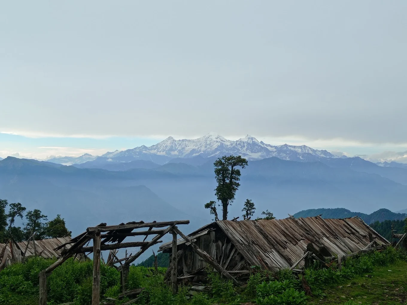
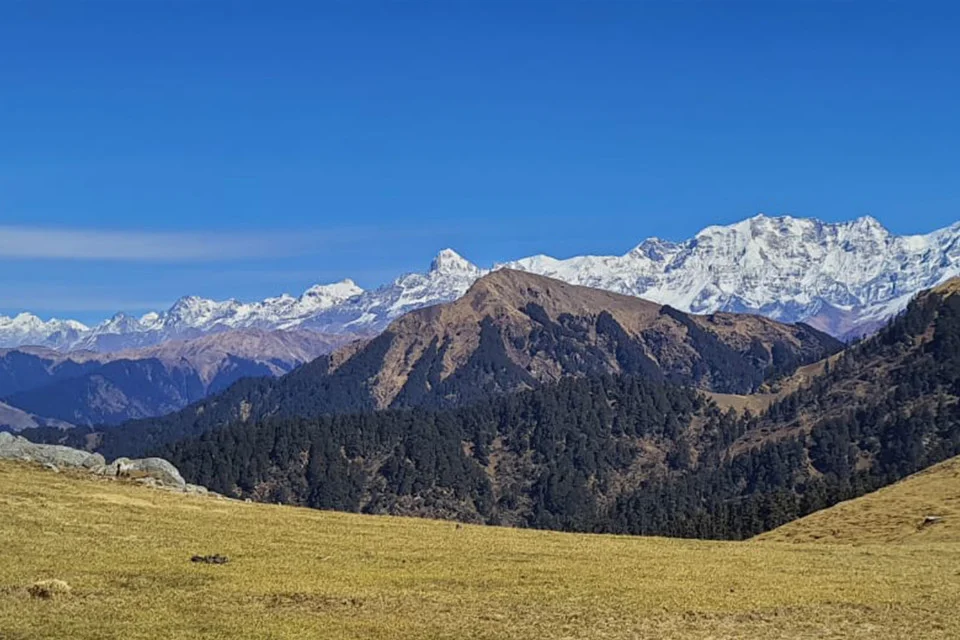
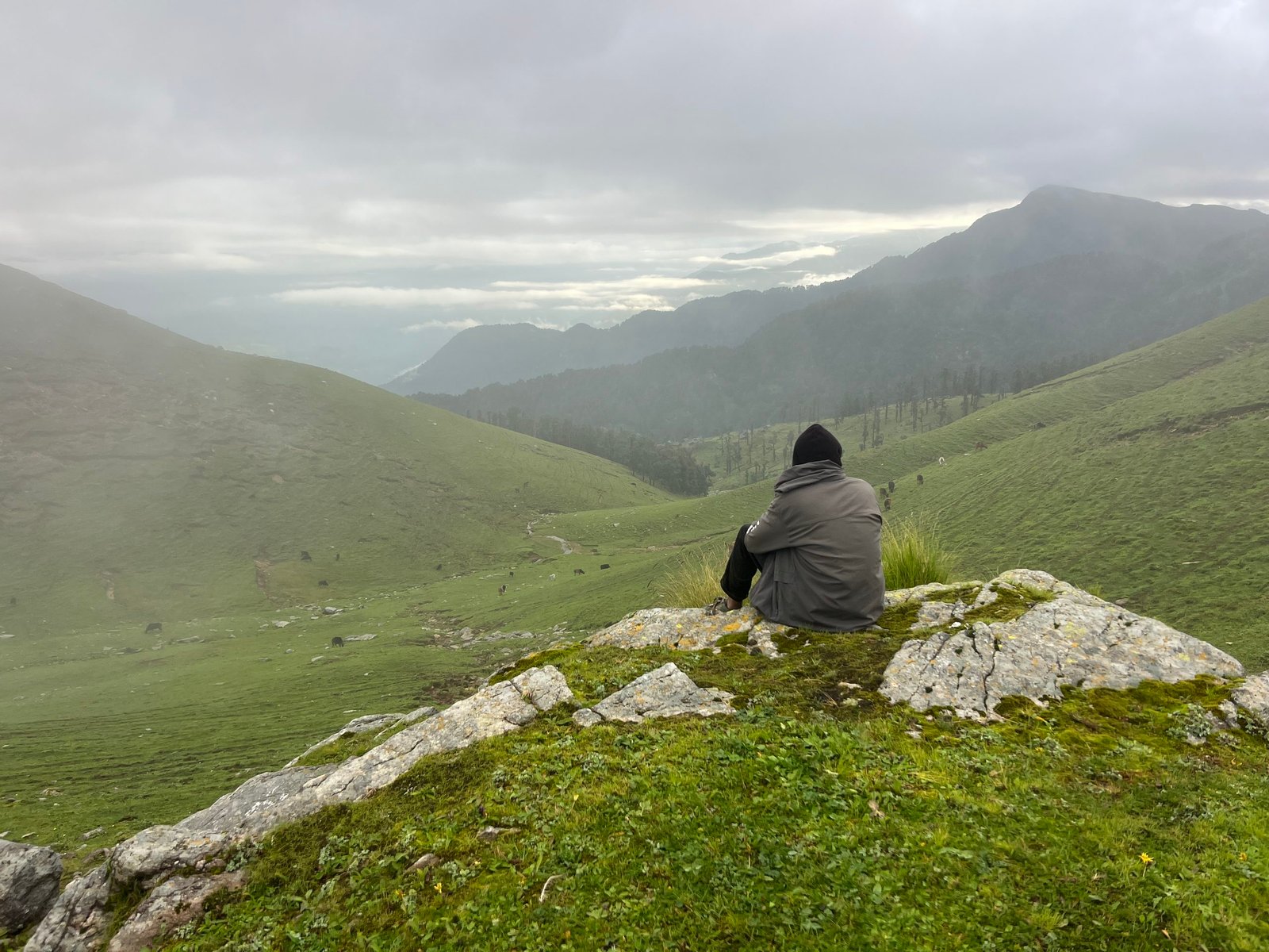
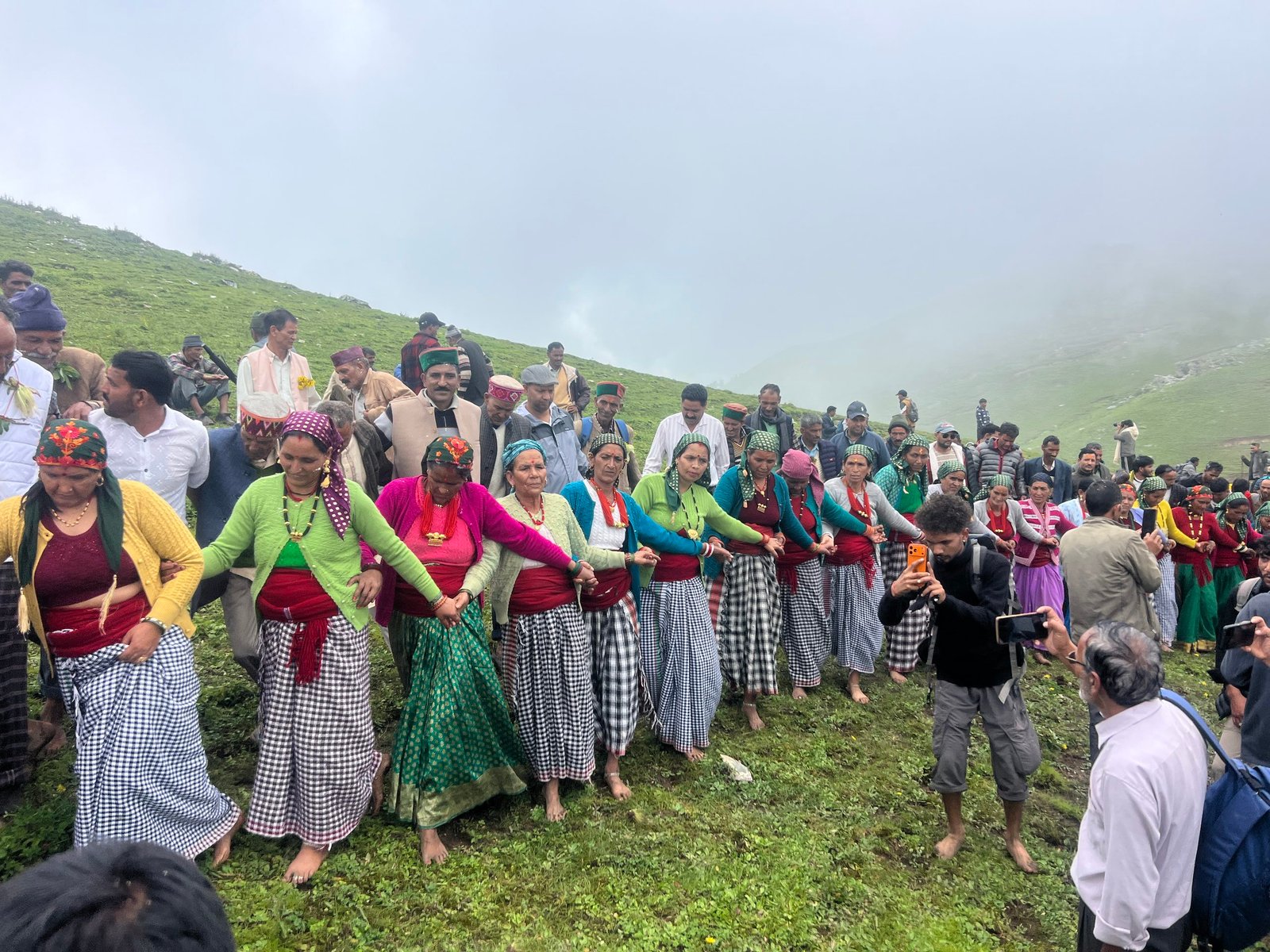
Jaurai Bugyal is a high-altitude Himalayan meadow in Uttarkashi district, Uttarakhand, reached by trekking trail rather than road. Bugyals — the alpine and sub-alpine grasslands found across this part of the Garhwal Himalayas — hold both ecological and cultural importance, serving as traditional grazing grounds and, in Jaurai’s case, the venue for local festivals including the Selku Mela. What makes Jaurai Bugyal interesting to trekkers is precisely that it remains lesser-documented and lesser-visited than Uttarkashi’s better-known meadows like Dayara Bugyal.
This guide brings together what different sources say about Jaurai Bugyal’s location, route, and altitude — including where they disagree — along with honest, practical trekking and travel information. Kashi of North, a local Uttarkashi travel resource, can confirm current trail conditions and help arrange your guide, transport, and stay for a Jaurai Bugyal trip.
Quick Facts About Jaurai Bugyal
Jaurai Bugyal is a high-altitude meadow in Bhatwari block, Uttarkashi district, reached by trekking from a village roadhead; sources give somewhat different figures for its exact altitude, starting village, and trek distance, so confirming current details with a local guide is recommended.
| Information | Details |
|---|---|
| Name | Jaurai Bugyal (also spelled Jorai Bugyal) |
| Region | Bhatwari block, Uttarkashi district, Uttarakhand |
| Country | India |
| Altitude | Sources vary: approximately 2,100 m in some accounts, 2,100–2,700 m in others — confirm current figures with a local guide |
| Starting Point / Roadhead | Sources vary: associated with Syawa Village in some accounts, and with Lata (Lata Gram Sabha) in others, with Saura village as an intermediate point — confirm the current access route before travelling |
| Trek Distance | Approximately 20 km of trekking in one route description (5 km Lata–Saura, plus roughly 15 km Saura–Jaurai Bugyal); other accounts describe access via Syawa Village without a specified distance — treat all figures as approximate |
| Trek Duration | Not independently verified as a fixed number of days; plan for a multi-day trek given the distances described |
| Difficulty | Likely moderate to demanding, given the trekking distance and elevation gain — confirm with a local guide |
| Best Time | Summer through early autumn for trekking; late August for the Selku Mela; monsoon requires caution |
| Nearest Town | Uttarkashi (approx. 25 km from Uttarkashi to Lata, per one route description) |
| Camping | Likely possible given shepherd use of the meadow, but designated sites and permissions are not independently confirmed |
| Permit | Not independently verified; check current forest/local requirements before trekking |
| Guide Required | Recommended, given route ambiguity in available sources |
| Mobile Network | Not verified; expect limited coverage typical of remote meadow trekking routes |
| Water Sources | Not independently confirmed; carry sufficient water and confirm seasonal availability locally |
What Is Jaurai Bugyal?
Jaurai Bugyal is a high-altitude Himalayan meadow (bugyal) in Bhatwari block, Uttarkashi district, Uttarakhand, reached by trekking trail, known for open grasslands, seasonal wildflowers, Himalayan mountain views, and its role as both a traditional shepherd grazing ground and a local festival venue.
Like other bugyals across the Garhwal Himalayas, Jaurai Bugyal is a sub-alpine to alpine meadow — a stretch of grassland above the tree line that transforms with the seasons, from snow cover in winter to lush green grass and wildflowers after the monsoon. It sits within the wider Uttarkashi trekking landscape, alongside better-known meadows like Dayara Bugyal, but with considerably less publicly documented information and, by most accounts, fewer visitors.
For the local community, Jaurai Bugyal is more than a scenic destination — it functions as a seasonal grazing ground for shepherds and, at least in some accounts, hosts community celebrations including flag-hoisting on Independence Day and the Selku Mela festival.
Why Is Jaurai Bugyal Special?
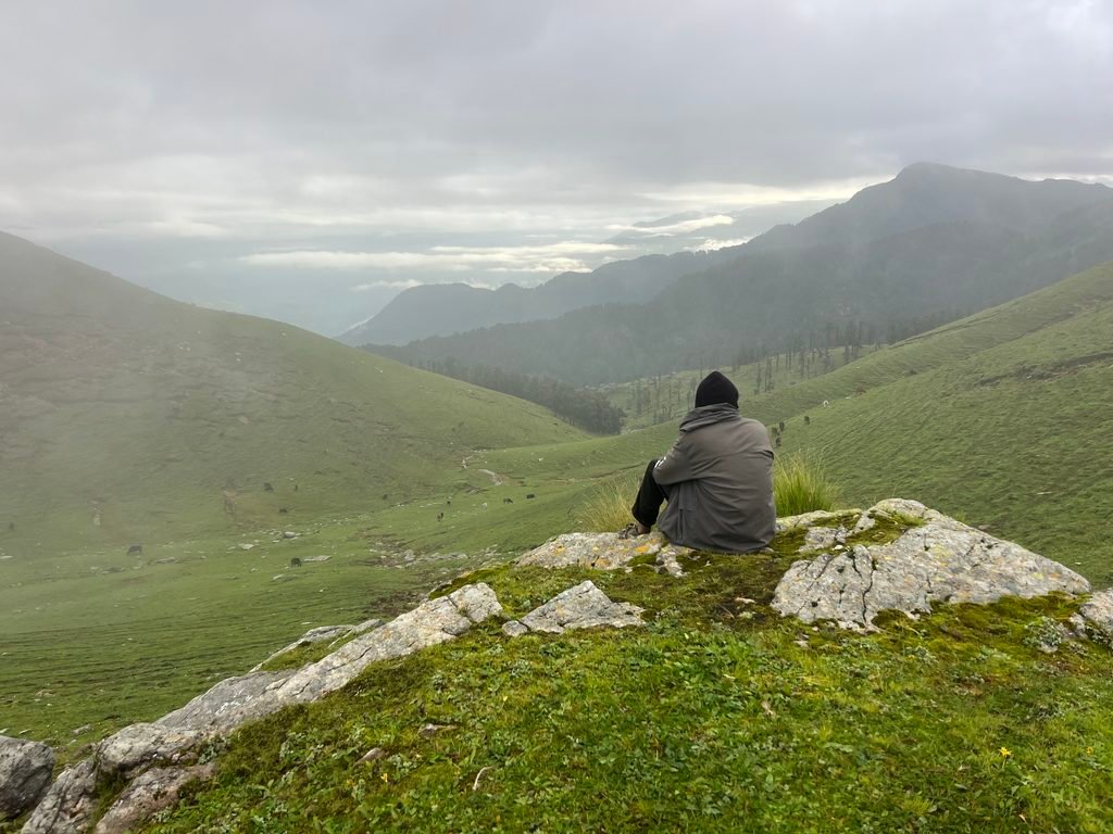
Jaurai Bugyal stands out for its open, gently sloping grasslands, seasonal wildflower cover, relative remoteness compared to more commercialized bugyals, and its layered cultural role as both a grazing ground and festival site.
Available descriptions consistently point to a few defining characteristics: expansive, softly rolling meadow terrain that some visitors compare to walking on a natural mattress once the grass reaches its typical height; a striking seasonal transformation as wildflowers bloom across the slopes after the monsoon; and genuine, ongoing use by local shepherd communities rather than a meadow maintained purely for tourism. Combined with its comparatively low visitor numbers relative to Dayara Bugyal, Jaurai Bugyal offers a quieter, more traditional bugyal-trekking experience for those willing to handle route uncertainty and arrange local guidance.
Location of Jaurai Bugyal
Where Is Jaurai Bugyal in Uttarkashi?
Jaurai Bugyal is located in Bhatwari block of Uttarkashi district, Uttarakhand, in the Garhwal Himalayas. Sources describe its administrative and village association somewhat differently — one route places it in the Lata Gram Sabha area, roughly 25 km from Uttarkashi town by road, with further trekking via Saura village; another associates it with Syawa Village as the base for reaching the meadow.
Given this variation, the most reliable approach is to treat Jaurai Bugyal as sitting within the broader Bhatwari-block mountain landscape rather than fixing on a single confirmed access route without local verification. Kashi of North can check the currently used and recommended trailhead before you travel, since local guides are likely to know which access point is presently preferred.
Altitude and Geography
Jaurai Bugyal’s altitude is reported differently across sources — approximately 2,100 metres in some accounts and a wider 2,100–2,700 metre range in others — placing it in the sub-alpine to lower-alpine zone typical of Uttarkashi’s meadow treks.
At this general elevation range, trekkers can expect a transition from forest cover in the lower sections of the trail to more open grassland as the trek approaches the meadow itself, with surrounding ridges and Himalayan peaks visible from higher points. Altitude at this range brings cooler temperatures than the valley floor, increased UV exposure, and weather that can shift more quickly than at lower elevations — factors that should inform both your packing list and your pace on the trail, even though this altitude is not extreme enough to typically require formal acclimatization days.
Jaurai Bugyal Trek
The trek to Jaurai Bugyal involves a road journey to a village roadhead followed by a multi-day trekking trail through forest and, eventually, open meadow terrain — though the exact starting village and total distance vary between available route descriptions.
One detailed route description places the roadhead at Lata (in Lata Gram Sabha, Bhatwari block), reached by vehicle from Uttarkashi, followed by a roughly 5 km trek to Saura village and then approximately 15 km further to reach Jaurai Bugyal itself. A separate source associates the trek with Syawa Village as the base point, without specifying an exact distance. Given this discrepancy, trekkers should confirm the currently used route and distance with a local guide or with Kashi of North before finalizing trek plans.
Jaurai Bugyal Trek Distance
How Long Is the Jaurai Bugyal Trek?
Trek distance for Jaurai Bugyal varies by source: one description totals roughly 20 km of trekking (5 km from Lata to Saura, plus about 15 km from Saura to the meadow), while other accounts don’t specify an exact figure. Round-trip distance would roughly double the one-way trekking distance, though this isn’t independently confirmed either.
This kind of variation is common for less-documented Himalayan treks, where published distances often depend on which starting village and exact trail a given operator or guide uses. Rather than presenting a single number as fixed, this guide recommends confirming current distance and route details directly with a local guide before departure — Kashi of North can help with this.
Jaurai Bugyal Trek Duration
Given the roughly 20 km one-way trekking distance described in available route information, a realistic Jaurai Bugyal trek likely requires multiple days, though an exact recommended duration isn’t independently confirmed and should be planned with a local guide.
Rather than presenting invented day counts, Kashi of North recommends building your itinerary together with a local guide once current trail conditions and your fitness level are known.
Jaurai Bugyal Trek Difficulty
Based on the roughly 20 km one-way trekking distance and forest-to-meadow terrain described in available sources, the Jaurai Bugyal trek is likely moderate to moderately demanding, though a fully confirmed difficulty rating isn’t available and should be assessed with a local guide before you commit.
Factors supporting a moderate-to-demanding assessment include: a meaningful trekking distance without direct road access, elevation gain from village level to the meadow’s 2,100+ metre altitude, forest sections that may be less clearly marked than popular commercial trekking routes, and general Himalayan remoteness that increases the importance of route knowledge and weather awareness. This is not a route to treat as an easy, casual walk without local guidance.
Is Jaurai Bugyal Suitable for Beginners?
Jaurai Bugyal is not clearly documented as a beginner-friendly trek; given its trekking distance, relative remoteness, and route ambiguity in available sources, first-time trekkers should approach it with a local guide and realistic expectations rather than as an easy introductory hike.
Trekkers with some prior hiking experience, reasonable fitness, and comfort with multi-day treks are better positioned for Jaurai Bugyal than complete beginners. Families or first-timers who are still keen to visit should strongly consider hiring an experienced local guide, building in extra time, and confirming current trail conditions rather than attempting the route independently based on general assumptions.
Jaurai Bugyal Trek Route
Based on one detailed route description, the trek runs Uttarkashi → Lata (by road) → Saura village (approximately 5 km trek) → Jaurai Bugyal (approximately 15 km further trek); an alternative source associates the trek with Syawa Village as the starting point, so the current preferred route should be confirmed locally.
Uttarkashi → Lata → Saura Village → Forest Trail → Jaurai Bugyal
Uttarkashi to Lata
A road journey of approximately 25 km from Uttarkashi district headquarters to Lata, within Lata Gram Sabha, Bhatwari block — typically covered by taxi or private vehicle.
Lata to Saura Village
An approximately 5 km trekking stretch connecting Lata to Saura village, the next staging point on this route description.
Saura Village to Jaurai Bugyal
The main trekking stretch, approximately 15 km, passing through forest terrain that gradually opens into meadow as you approach Jaurai Bugyal itself. Exact terrain details (gradient, water crossings, campsite locations) are not independently documented and should be confirmed with a local guide.
Alternative Route via Syawa Village
Separate source material associates Jaurai Bugyal with Syawa Village as an access point, without providing a specific distance or intermediate villages. If you’re planning your trek around the Selku Mela (held at Jaurai Bugyal and closely tied to Syawa Village), this may be the more relevant route to confirm. (read more about selku mela )
Day-Wise Itinerary
Given the route uncertainty described above, this guide offers a general framework rather than an invented fixed schedule.
Day 1: Uttarkashi → Lata (or Syawa Village) → Trek Start
Road journey from Uttarkashi to the confirmed roadhead, followed by the initial trekking stretch to the first overnight point (Saura village, on the Lata route).
Day 2: Onward Trek Toward Jaurai Bugyal
Continued trekking through forest terrain toward the meadow, covering the bulk of the remaining distance, likely with an overnight camp before or at the meadow.
Day 3: Jaurai Bugyal Exploration and Return Trek
Time to explore the meadow, take in views and photography opportunities, before beginning the return journey — either partway back to a lower camp or, for fitter groups, a longer return day.
Day 4 (if needed): Return to Roadhead and Uttarkashi
Completing the return trek and road journey back to Uttarkashi.
This framework should be treated as a starting point for planning discussions with a local guide, not a confirmed itinerary — actual day counts depend on the specific route used, group fitness, and weather.
Jaurai Bugyal Trek Package
A well-organized Jaurai Bugyal trek package should typically include:
Usually Included
- Local transport between Uttarkashi and the roadhead
- An experienced trek guide, given the route’s documented ambiguity
- Camping arrangements and sleeping equipment
- Meals during the trek
- Basic first-aid support
- Any required trek permits or local registrations
Usually Not Included
- Personal trekking gear (unless specifically rented)
- Travel insurance
- Emergency evacuation costs
- Transportation to Uttarkashi from your home city, unless separately arranged
Kashi of North can confirm exactly what’s included in any specific Jaurai Bugyal trek arrangement before you book — we don’t publish a fixed package list here without your current requirements and group size.
Planning a Jaurai Bugyal Trek?
Kashi of North can help you organize the practical parts of your Uttarkashi trekking adventure, including:
- Trek planning and route confirmation
- Local, experienced guides
- Transportation to the roadhead
- Hotels and homestays in Uttarkashi
- Customized itineraries
- Group trek arrangements
🌐 Website: https://kashiofnorth.com 📞 WhatsApp/Call: +91 7253079221 ✉️ Email: kashiofnorth@gmail.com
Best Time to Visit Jaurai Bugyal
In short: Summer through early autumn generally offers the best trekking conditions for Jaurai Bugyal, with late August of particular interest for travelers wanting to combine the trek with the Selku Mela; monsoon requires real caution given landslide and trail risk.
Spring — March to May
Snow from the winter months is likely still receding at this elevation, with trail conditions potentially variable early in the season. Exact snowmelt timing isn’t independently confirmed — check current conditions before planning a spring trek.
Summer — May to June
This is likely a favorable trekking window, with the meadow greening and shepherd activity picking up as livestock are brought up for grazing.
Monsoon — July to August
Rain significantly increases trail difficulty and landslide risk on both the road approach and the trekking sections. The Selku Mela in late August falls near the tail end of this period, so travelers attending should watch weather closely and confirm road conditions in advance.
Autumn — September to November
Skies typically clear after the monsoon, offering the best mountain visibility and generally more stable trekking conditions — a strong window for photography.
Winter — December to February
Cold temperatures and likely snow at this elevation make winter trekking considerably more demanding, requiring appropriate cold-weather equipment and experienced guidance. Regular snowfall isn’t independently confirmed, but should be assumed possible and planned for
Jaurai Bugyal in Winter
Winter conditions at Jaurai Bugyal likely bring cold temperatures and possible snow given its elevation, making the trek considerably more demanding and better suited to experienced winter trekkers with appropriate equipment and local guidance.
Specific data on snow depth, trail closure, or exact winter accessibility for Jaurai Bugyal isn’t independently documented for this guide. Trekkers considering a winter visit should plan for: frozen or reduced water sources, colder overnight camping temperatures, potentially icy or snow-covered trail sections, and the general increased risk that comes with remote winter trekking. An experienced local guide is strongly recommended for any winter attempt, and travelers should confirm current conditions with Kashi of North before committing to winter trek dates.
Flora and Wildflowers
Jaurai Bugyal’s meadow is described as covered in soft, velvet-like grass and seasonal wildflowers that bloom after the monsoon, alongside medicinal herbs and wild plants typical of this Himalayan elevation zone.
Available descriptions mention grass that grows only to a limited height in bugyal terrain, giving the meadow its characteristic soft, mattress-like walking surface, along with a burst of wildflower color across the slopes once the monsoon rains recede. Broader regional flora at this elevation in Uttarkashi commonly includes oak and conifer forest in the lower trail sections, transitioning to open grassland and alpine vegetation near the meadow itself. Specific species lists beyond these general descriptions aren’t independently verified for Jaurai Bugyal.
Wildlife
Wildlife specific to Jaurai Bugyal isn’t independently documented, but the meadow’s elevation and habitat type are broadly consistent with other Uttarkashi bugyals where species such as Himalayan monal, musk deer, Himalayan tahr, and langur are found in the wider region.
Sightings of any of these species should never be treated as guaranteed — wildlife encounters depend on season, time of day, and simple chance. Wildlife should always be observed from a safe distance and never fed or disturbed, both for visitor safety and to avoid habituating animals to human presence.
Shepherds and Bugyal Culture
Jaurai Bugyal serves as a traditional grazing ground for local shepherds, who bring cattle and sheep up to the meadow during the summer months, reflecting the seasonal pastoral lifestyle common across Uttarakhand’s high-altitude meadows.
This pattern of seasonal migration — moving livestock to higher pastures as snow melts and grass grows, then back down before winter — is a defining feature of bugyal culture across the Garhwal Himalayas. For trekkers, encountering shepherd communities at Jaurai Bugyal offers a genuine glimpse into a way of life shaped directly by the mountain seasons, and visitors are encouraged to interact respectfully rather than treating shepherds as a photo opportunity alone.
Selku Mela and Other Celebrations at Jaurai Bugyal
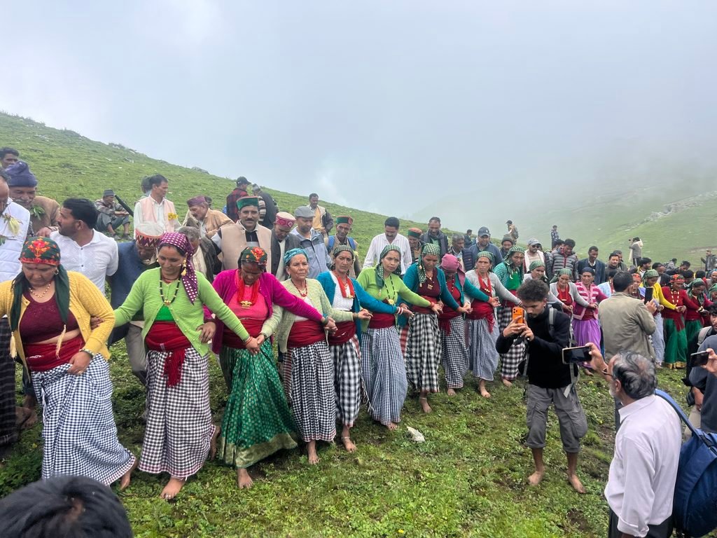
Jaurai Bugyal hosts the Selku Mela, a distinctive local festival closely associated with nearby Syawa Village, alongside reported Independence Day flag-hoisting celebrations at the meadow — making it a site of both natural and cultural significance.
According to available sources, the Selku Mela — known for its distinctive milk-and-curd version of Holi — is organized at Jaurai Bugyal, drawing residents of Syawa Village and neighboring communities together in celebration. Separately, sources also describe an Independence Day tradition of flag-hoisting ceremonies held at the meadow, involving both locals and visitors. Together, these events give Jaurai Bugyal a cultural calendar beyond its natural scenery, making certain dates — particularly around 15 August and late August — potentially rewarding times to visit for travelers interested in local celebrations, alongside the trek itself.
Want to time your visit around a festival at Jaurai Bugyal? Kashi of North can help you plan your trek and travel around these dates.
📞 Call/WhatsApp: 7253079221 ✉️ Email: kashiofnorth@gmail.com
Photography Guide
Jaurai Bugyal’s open meadow terrain, seasonal wildflowers, and Himalayan mountain views offer strong photography opportunities, particularly in the golden light of early morning and late afternoon. The forest sections of the trail, shepherd encampments (photographed respectfully), and changing cloud cover across the meadow all add visual variety beyond the meadow itself.
Always ask permission before photographing shepherds, other local people, or festival rituals during the Selku Mela or other celebrations. A respectful approach goes a long way, especially in a community that doesn’t see large volumes of tourist photography.
Camping at Jaurai Bugyal
Camping at Jaurai Bugyal appears feasible given its established use as a shepherd grazing ground, but designated camping areas, permit requirements, and formal camping infrastructure aren’t independently documented — confirm current camping rules with a local guide before your trek.
Given the meadow’s remoteness and lack of confirmed infrastructure, this guide does not advise informal or “wild” camping without local guidance, particularly regarding waste management, water source protection, and any forest department restrictions that may apply. Kashi of North can help arrange a guided camping trek that handles these logistics on your behalf.
Water Sources
Specific, verified water sources along the Jaurai Bugyal trek route are not documented in available information for this guide; trekkers should carry sufficient water and confirm current seasonal water availability with a local guide before departure.
As a general precaution on any multi-day Himalayan trek, carry a reliable water purification method in addition to your carried water supply, since even a confirmed stream or spring can vary in flow and cleanliness by season.
Permits and Permissions
Specific permit or permission requirements for trekking to Jaurai Bugyal are not independently verified for this guide; trekkers should not assume a permit is or isn’t required simply because the trek is in Uttarakhand, and should confirm current rules with a local guide or forest authority before departure.
Requirements for forest entry, local village permissions, or registration can change and vary by route and season. Kashi of North can check current requirements as part of arranging your trek.
Network and Connectivity
Mobile network and internet access along the Jaurai Bugyal trek route are not independently verified for this guide. Given the trek’s remoteness — whether accessed via Lata/Saura or Syawa Village — travelers should expect limited to no connectivity for significant stretches of the route. Download offline maps in advance, inform someone of your itinerary before setting out, and do not rely on mobile network for navigation or emergency communication once on the trail.
What to Pack
| Item | Purpose |
|---|---|
| Trekking shoes | Grip on uneven forest and meadow terrain |
| Warm layers | Cold temperatures, especially at night |
| Waterproof jacket | Rain and possible snow |
| Trekking poles | Support on steep or uneven sections |
| Backpack | Carrying essentials and personal gear |
| Water bottles | Hydration throughout the trek |
| Water purification | Safe drinking water from uncertain sources |
| Headlamp/torch | Camp use and emergencies |
| Power bank | Charging with no reliable electricity on-trail |
| First-aid kit | Basic emergency care |
| Sunglasses | UV protection at altitude |
| Sunscreen | High-altitude sun exposure |
| Gloves | Cold-weather protection |
| Woolen socks | Warmth during camping |
| Offline maps | Navigation without network coverage |
| Identity documents | For any local registration or permit checks |
Fitness Preparation
Accommodation Before and After the Trek
Most trekkers should plan to stay in Uttarkashi town before and after the Jaurai Bugyal trek, given the wider range of hotels and guest houses available there compared to the trek’s roadhead villages (Lata, Saura, or Syawa, depending on route). Homestay options may exist in these smaller villages, but availability is not independently documented for this guide — confirm current options with Kashi of North.
Looking for a place to stay before or after your Jaurai Bugyal trek? Kashi of North can help you find suitable accommodation in Uttarkashi.
📞 Call/WhatsApp: 7253079221 ✉️ Email: kashiofnorth@gmail.com
Uttarkashi Base Camp Guide
Uttarkashi town functions as the practical planning base for a Jaurai Bugyal trek, offering hotels, food options, local transport, trek supplies, ATMs, medical facilities, local guides, and taxi services that aren’t available at the remote roadhead villages.
Need a Hotel Before Your Trek?
Kashi of North can help you find accommodation in Uttarkashi before or after your Jaurai Bugyal trek.
🌐 Website: https://kashiofnorth.com
How to Reach Jaurai Bugyal
From Uttarkashi
Travel by road to the trek roadhead — Lata (approximately 25 km, per one route description) or the roadhead near Syawa Village (approximately 35 km, per village-level source material) — followed by the trekking trail to the meadow. Confirm the currently recommended route with Kashi of North before departure.
From Dehradun
Dehradun → Uttarkashi → Roadhead (Lata or Syawa area) → Trek Follow the Dehradun–Uttarkashi road via Chamba and Tehri, then continue to the confirmed roadhead for the onward trek. Exact travel times aren’t independently verified — plan for a full day of road travel before beginning the trek itself.
From Delhi
Delhi → Haridwar/Rishikesh → Uttarkashi → Trek Base This typically requires an overnight stay in or around Uttarkashi before continuing to the trek roadhead the following day, given the combined distance from Delhi.
Nearby Treks and Places
Dayara Bugyal
A well-known, more accessible high-altitude meadow trek in Uttarkashi district, useful as a comparison point for trekkers deciding between the two.
Gidara Bugyal
Another high-altitude meadow trek in the district, associated with Bhangeli village as a base point.
Dodital
A high-altitude lake trek in Uttarkashi district, associated with local mythology.
Uttarkashi
The district headquarters and natural planning base for a Jaurai Bugyal trek.
Bhatwari
The block headquarters town that Jaurai Bugyal falls under administratively.
Syawa Village
A village closely associated with Jaurai Bugyal, particularly as the community hosting the Selku Mela festival at the meadow.
Gangotri and Harsil
Further up the Gangotri road corridor, worth combining with a Jaurai Bugyal trip for a longer Uttarkashi itinerary.
Exact distances between these destinations and Jaurai Bugyal are not independently verified; Kashi of North can help plan a combined route.
Jaurai Bugyal vs Dayara Bugyal
| Feature | Jaurai Bugyal | Dayara Bugyal |
|---|---|---|
| Popularity | Lesser-known, less documented | Well-known, more established as a trekking destination |
| Altitude | Approx. 2,100–2,700 m (sources vary) | Generally higher; confirm current figures separately |
| Trek Difficulty | Likely moderate to demanding, based on distance described | Widely considered accessible for a range of trekkers |
| Route Clarity | Route and distance vary between sources; local guide recommended | More established, better-documented route |
| Crowds | Likely fewer visitors, based on lesser documentation | More visited, especially in peak season |
| Landscape | Open grassland, wildflowers, shepherd grazing, forest approach | Expansive high-altitude meadow, widely photographed |
| Best For | Trekkers wanting a quieter, less-documented meadow experience with local guidance | Trekkers wanting a well-established, more predictable meadow trek |
This comparison reflects general characteristics based on available information rather than a definitive ranking — both treks offer genuine bugyal experiences with different trade-offs in accessibility and crowd levels.
Suggested Itineraries
2-Day Plan
Best suited to fit, experienced trekkers working with a confirmed shorter route and a local guide; not recommended without route confirmation given the distances described in available sources.
3-Day Plan
A more realistic baseline given the roughly 20 km one-way distance described for the Lata–Saura–Jaurai Bugyal route, allowing a trekking day in, meadow time, and a return day.
4-Day Plan
Adds a buffer day for weather, photography, or a more relaxed pace — recommended for first-time trekkers on this route.
Weekend Planning Option
A true weekend (2 days) is unlikely to be sufficient for the full trek given the distances described; consider combining a shorter Uttarkashi village or temple visit with a partial exploration, or extend to a long weekend if attempting the full trek.
All of these should be confirmed and adjusted with a local guide based on current trail conditions and your group’s fitness.
Responsible Trekking
- Carry back all waste — there is no waste collection infrastructure on this remote route
- Avoid single-use plastic where possible
- Do not pick wildflowers or damage meadow vegetation
- Do not disturb wildlife or shepherd livestock
- Avoid loud music that could disrupt the natural and pastoral setting
- Use designated camping areas where they exist, and minimize your footprint elsewhere
- Avoid campfires where prohibited or where fire risk is a concern
- Respect shepherds and their traditional use of the meadow
- Respect local communities in Lata, Saura, or Syawa Village along your route
- Use water sources responsibly, especially given uncertain availability
Who Should Trek Jaurai Bugyal?
| Trekker | Suitability | Reason |
|---|---|---|
| Beginners | With a guide only | Route ambiguity and distance make independent beginner attempts risky |
| Families | With careful planning | Distance and remoteness require strong fitness and guide support |
| Experienced Trekkers | Good fit | Comfortable handling route uncertainty and multi-day distances |
| Solo Trekkers | Not recommended without a guide | Documented route ambiguity increases navigation risk |
| Photographers | Very good fit | Meadow, wildflower, and shepherd-culture photography opportunities |
| Nature Lovers | Very good fit | Genuine, less-commercialized bugyal ecosystem |
| Winter Trekkers | Experienced only | Cold and possible snow require specific preparation |
| Senior Travelers | Case-by-case | Depends on individual fitness given the trek’s distance and terrain |
Who Should Avoid the Trek?
Travelers should reconsider or postpone a Jaurai Bugyal trek if facing:
- Poor or deteriorating weather forecasts, especially during monsoon
- A lack of prior trekking experience combined with an unwillingness to hire a guide
- Unpreparedness for winter conditions if trekking in the colder months
- A preference for solo travel on a route with documented navigational ambiguity
- Medical conditions that could be affected by sustained physical exertion or moderate altitude — consult a doctor beforehand if uncertain
Budget Planning
| Expense | Typical Consideration |
|---|---|
| Transport | Depends on group size and vehicle type for the Uttarkashi–roadhead leg |
| Guide | Strongly recommended given route ambiguity; cost depends on trek duration |
| Porter | Optional, useful for longer or heavier-load treks |
| Camping | Depends on whether you rent equipment or bring your own |
| Food | Depends on whether meals are self-arranged or included in a guided package |
| Equipment | Personal gear vs. local rental, where available |
| Accommodation | Uttarkashi hotels/guest houses before and after the trek |
| Permits | Confirm current requirements and any associated fees locally |
Contact Kashi of North for a current cost estimate based on your specific group size, dates, and preferred route.
Frequently Asked Questions
What is Jaurai Bugyal? Jaurai Bugyal is a high-altitude Himalayan meadow (bugyal) in Bhatwari block, Uttarkashi district, Uttarakhand, known for open grassland, seasonal wildflowers, shepherd grazing, and local festivals including the Selku Mela.
Where is Jaurai Bugyal? It is located in Bhatwari block, Uttarkashi district, Uttarakhand, with route descriptions associating it with either the Lata/Saura area or Syawa Village as the access point.
Is Jaurai Bugyal in Uttarkashi? Yes, Jaurai Bugyal is in Uttarkashi district, within Bhatwari block.
Where is Jaurai Bugyal in Uttarakhand? It sits in the Garhwal Himalayas within Uttarkashi district, one of Uttarakhand’s frontier Himalayan districts.
How high is Jaurai Bugyal? Sources give different figures — approximately 2,100 metres in some accounts, and a range of 2,100–2,700 metres in others; confirm current figures with a local guide.
What is the Jaurai Bugyal trek distance? One route description totals roughly 20 km one-way (5 km Lata–Saura plus about 15 km Saura–Jaurai Bugyal); other sources don’t specify an exact distance, so treat figures as approximate.
How difficult is the Jaurai Bugyal trek? Likely moderate to moderately demanding, based on the trekking distance and terrain described, though a fully confirmed difficulty rating isn’t available.
How many days are required? Not independently confirmed as a fixed number; a 3–4 day plan is a reasonable working baseline given the described distance, to be confirmed with a local guide.
What is the best time to visit Jaurai Bugyal? Summer through early autumn generally offers the best trekking conditions, with late August of interest for the Selku Mela and mid-August for reported Independence Day celebrations.
Can beginners trek Jaurai Bugyal? Only with an experienced local guide, given the route ambiguity and distance described in available sources.
Is Jaurai Bugyal open in winter? Not independently confirmed; winter access is likely more difficult due to cold and possible snow, and would require experienced guidance.
Does Jaurai Bugyal receive snowfall? Likely, given its elevation, though regular snowfall patterns aren’t independently documented for this guide.
What is Jaurai Bugyal famous for? Its meadow landscape, shepherd grazing culture, the Selku Mela festival, and, during Shravan, its role along part of the Kanwar Yatra route toward Kedarnath.
How do I reach Jaurai Bugyal? By road to a roadhead (Lata or the Syawa Village area, depending on route) followed by a multi-day trek; Kashi of North can confirm the current recommended route.
How far is Jaurai Bugyal from Uttarkashi? The roadhead is approximately 25–35 km from Uttarkashi depending on the route used, followed by the trekking distance itself; confirm current figures locally.
How far is Jaurai Bugyal from Dehradun? Not independently verified; expect a full day of road travel from Dehradun to Uttarkashi before continuing to the roadhead.
How far is Jaurai Bugyal from Delhi? Not independently verified; typically requires an overnight stay in Uttarkashi given the combined distance from Delhi.
Is camping available? Likely, given the meadow’s use by shepherds, but designated sites and permissions aren’t independently confirmed — check current rules with a local guide.
Are permits required? Not independently verified; confirm current forest or local permission requirements before trekking.
Is a guide required? Strongly recommended, given the documented ambiguity in route and distance information.
Is mobile network available? Not verified; expect limited to no coverage along the trekking route.
Are there water sources? Not independently confirmed; carry sufficient water and a purification method, and confirm seasonal availability with a local guide.
Where should I stay before the trek? Uttarkashi town offers the widest range of accommodation; Kashi of North can help you book a stay there.
What should I pack? Trekking shoes, warm layers, a waterproof jacket, trekking poles, water purification, a headlamp, first-aid kit, and other essentials listed in the packing table above.
What shoes should I wear? Proper trekking shoes with good grip and ankle support, suited to forest and meadow terrain.
Is Jaurai Bugyal suitable for families? Only with careful planning and an experienced guide, given the trek’s distance and route ambiguity.
Is Jaurai Bugyal good for photography? Yes, particularly its meadow, wildflowers, mountain views, and shepherd-culture scenes, along with the Selku Mela festival if your timing aligns.
What wildlife can be seen? Not independently documented for Jaurai Bugyal specifically; regional species in similar habitats include Himalayan monal, musk deer, Himalayan tahr, and langur, though sightings aren’t guaranteed.
What flowers grow around the bugyal? Seasonal wildflowers bloom across the meadow after the monsoon, alongside medicinal herbs and wild plants typical of this elevation, though a specific documented species list isn’t available.
What is a bugyal? A bugyal is a high-altitude alpine or sub-alpine meadow found across Uttarakhand’s Himalayan region, traditionally used for seasonal livestock grazing.
How is Jaurai Bugyal different from Dayara Bugyal? Jaurai Bugyal is less documented and likely less visited, with more route ambiguity, while Dayara Bugyal is a more established and better-known trekking destination; see the comparison table above.
What is the Jaurai Bugyal trek cost? No fixed price is published here since cost depends on group size, duration, and arrangements; contact Kashi of North for a current estimate.
What does a Jaurai Bugyal trek package include? Typically transport, a guide, camping, meals, and basic first aid, though exact inclusions should be confirmed with your specific provider — see the trek package section above.
Is Jaurai Bugyal safe? Generally yes with proper preparation and an experienced guide; the trek’s remoteness and route ambiguity make solo, unguided attempts inadvisable.
Can Kashi of North arrange a Jaurai Bugyal trek? Yes, Kashi of North can help plan your trek, arrange a local guide, transport, and accommodation — contact us at 7253079221 or kashiofnorth@gmail.com.
Can I combine Jaurai Bugyal with another Uttarkashi destination? Yes, it can be combined with Uttarkashi town, Syawa Village (especially around the Selku Mela), or further destinations like Harsil and Gangotri as part of a longer itinerary.
What is the weather like at Jaurai Bugyal? Variable and capable of changing quickly; see the seasonal weather table above for a general guide by season.
Can I visit Jaurai Bugyal during monsoon? It’s possible but not advisable without caution, given landslide and slippery-trail risk; the Selku Mela in late August falls near the tail end of monsoon, so plan carefully if attending.
Is Jaurai Bugyal suitable for first-time trekkers? Only with an experienced guide and realistic expectations about distance and terrain; it is not documented as an easy introductory trek.
What should I do in case of bad weather? Follow your guide’s judgment on whether to continue, pause, or turn back; prioritize safety over completing the planned itinerary, and ensure you have adequate rain and cold-weather gear regardless of forecast.
Conclusion
Jaurai Bugyal offers a genuine, less-documented alternative to Uttarkashi’s more established meadow treks — open grassland, seasonal wildflowers, active shepherd culture, and a layered cultural calendar that includes the Selku Mela and, during Shravan, a place along part of the Kanwar Yatra route. What it doesn’t offer is a fully standardized, well-documented trekking route, and this guide has tried to be honest about that rather than presenting invented certainty.
For trekkers willing to work with a local guide and confirm current conditions before departure, Jaurai Bugyal can be a rewarding addition to an Uttarkashi itinerary — provided expectations are set around its genuine remoteness rather than assumptions borrowed from more commercialized bugyal treks.
Planning a Jaurai Bugyal trek? Kashi of North can help confirm your route, arrange a local guide, book transport and accommodation in Uttarkashi, and build a customized itinerary around your dates — including the Selku Mela if you’d like to time your visit around the festival.
🌐 Website: https://kashiofnorth.com 📞 Call/WhatsApp: 7253079221 ✉️ Email: kashiofnorth@gmail.com