

Kedar Tal Trek | Kedartal Trek Uttarkashi | Best treks in Gangotri | High altitude treks Uttarakhand
Some Lakes Demand to Be Earned : Kedar Tal Lake
Kedar Tal is a high-altitude glacial lake in the Gangotri region of Uttarkashi district, Uttarakhand, reached by trekking from Gangotri through the Kedar Ganga valley.
Kedar Tal sits deep inside the Garhwal Himalayas, within Uttarkashi district. The trek begins from Gangotri — one of Uttarakhand’s most important pilgrimage towns and the source region of the Bhagirathi River — and follows the Kedar Ganga valley, a lesser-travelled side valley that diverges from the main Gaumukh trail, climbing gradually toward the lake. Kedar Tal is enclosed by some of the Gangotri region’s most dramatic peaks, including Thalay Sagar, Bhrigupanth, and the Jogin group.
The combination of glacial lake, rugged mountain walls, a narrow forested valley, and high alpine terrain makes the Kedar Tal Trek Uttarkashi a destination that draws experienced trekkers and mountain photographers specifically for this landscape.
Why Is Kedar Tal Famous?
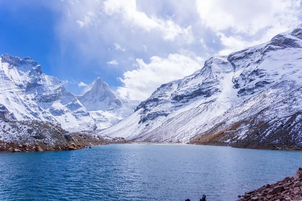
Kedar Tal is known for its harsh, dramatic high-altitude setting — rock, ice, and towering mountain walls rather than the gentler green surroundings of a typical Himalayan lake — combined with close-up views of Thalay Sagar’s near-vertical north face.
Unlike lakes set among rolling green hills, Kedar Tal sits in a stark alpine basin where the surrounding terrain dominates the scene. Highlights of the trek include:
- The Kedar Ganga valley approach
- Dense Himalayan forest in the lower sections, including silver-barked Bhojpatra (Himalayan birch)
- High-altitude alpine terrain and open ridgelines
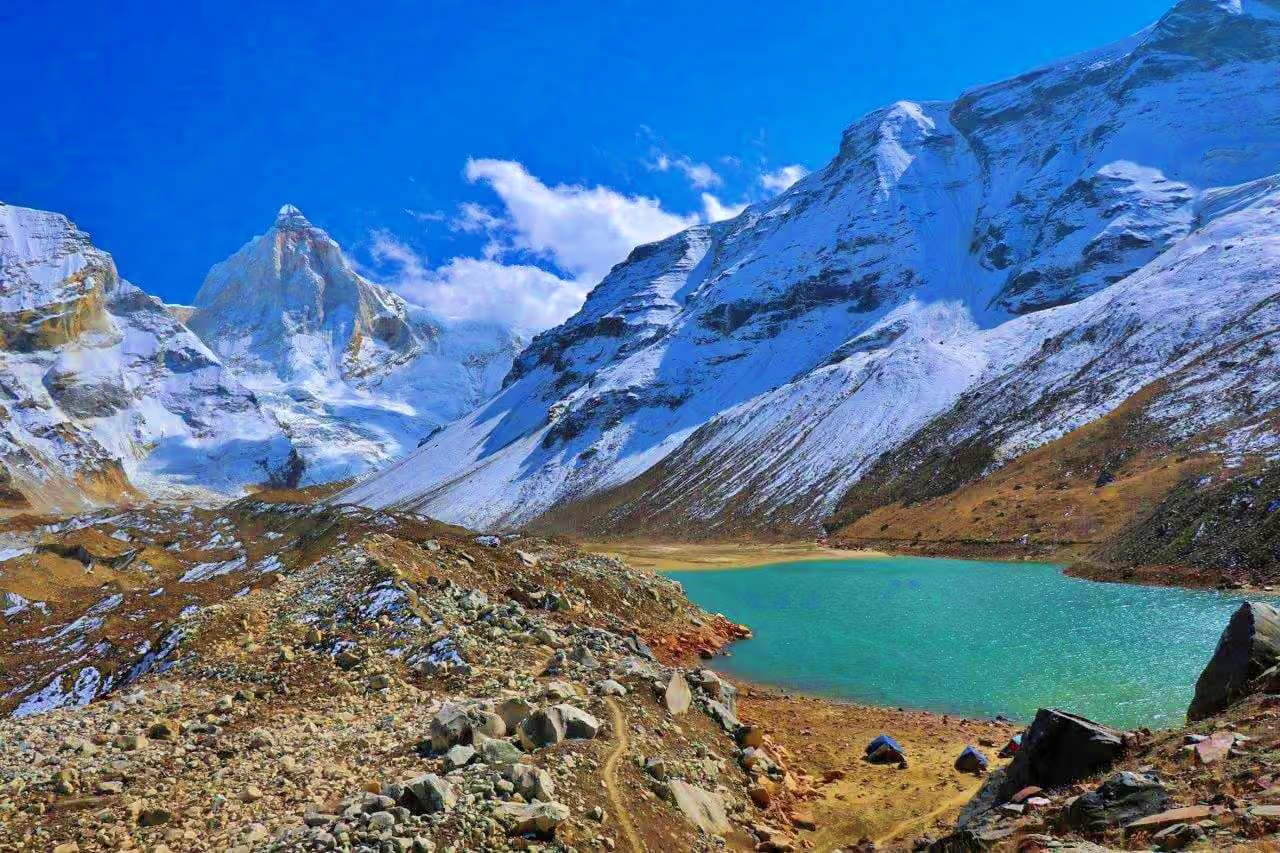
- The glacial lake itself, with its distinctive blue-green colour
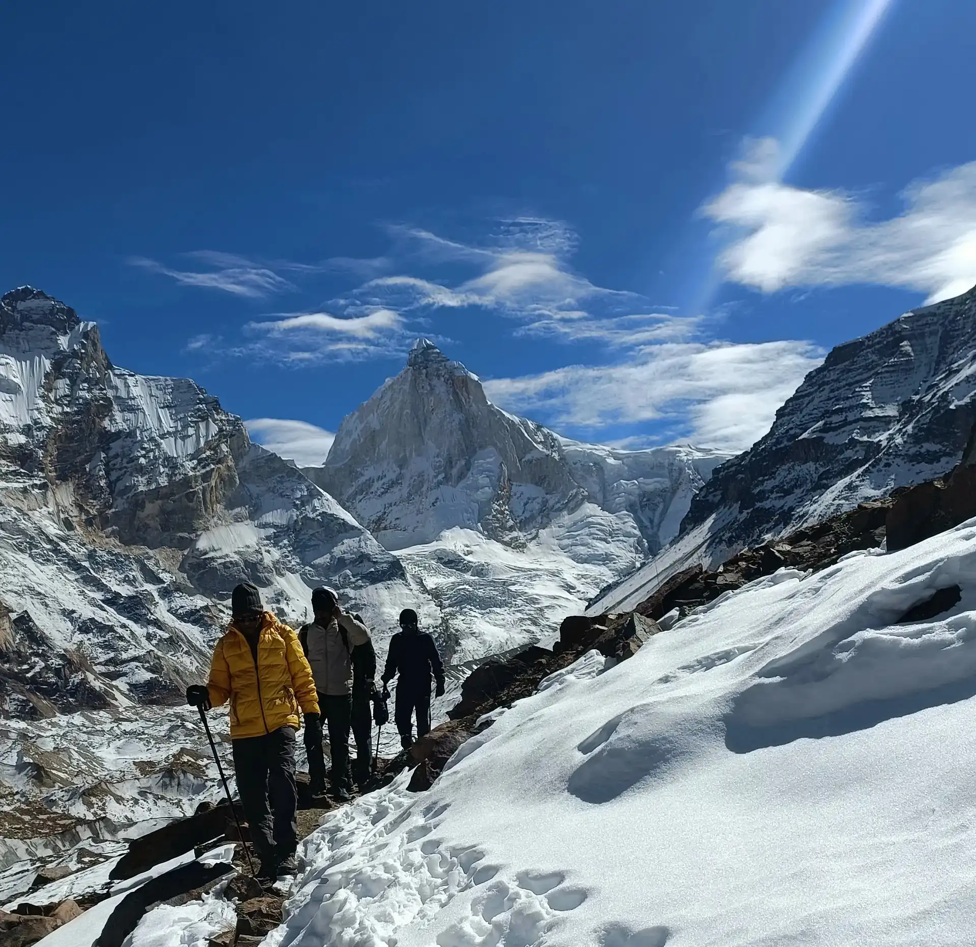
- Close views of Thalay Sagar, Bhrigupanth, and the Jogin peaks
- Remote, quiet Himalayan campsites
- Genuinely challenging trail sections, including the exposed scramble known locally as the Spider Wall
- The spiritual atmosphere carried over from the Gangotri region
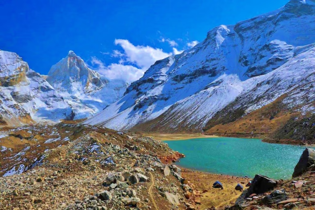
The final approach to Kedar Tal is particularly striking because the landscape shifts dramatically as the trail climbs above the tree line into rock, scree, and glacial moraine.
The Sacred Name — Kedar and Its Himalayan Resonance
“Kedar” is one of the names of Lord Shiva, the same root found in Kedarnath — one of Uttarakhand’s four Char Dham temples — and carries a traditional association with high, cold, remote places where the divine is felt through the landscape itself rather than through imagery.
A lake named Kedar in the upper Gangotri region — already connected to Shiva through the Kashi Vishwanath Temple in Uttarkashi town and the sacred geography of the Bhagirathi River — carries this association with real weight in local tradition. For trekkers aware of this context, Kedar Tal’s character — remote, silent, bounded by vertical ice on its northern shore — can feel like more than coincidence.
The surrounding peaks hold their own place in local Garhwali tradition, where mountains such as Thalay Sagar have long been understood by nearby communities as divine presences, distinct from the purely technical framework in which international mountaineers have approached the same peak.
Kedar Tal Trek Height
I Kedar Tal sits at approximately 4,750 metres (15,580 feet) above sea level, considerably higher than many popular beginner Himalayan treks in the region.
This altitude is one of the central reasons the trek demands proper preparation and acclimatization. At elevations above 4,000 metres, reduced oxygen availability can affect even fit trekkers, and weather conditions can shift quickly. Kedar Tal should not be approached as a casual high-altitude walk — it requires the same seriousness given to other major Himalayan treks at comparable elevation.
Kedar Tal Trek Distance
How Long Is the Kedar Tal Trek?
The total trekking distance depends on the specific route and itinerary used, but a typical Kedar Tal plan covers approximately 35–40 km or more across the full round trip from Gangotri, with an elevation gain of roughly 1,700 metres from the base to the lake.
Exact distance can vary depending on campsite locations, current trail conditions, weather, forest access rules, and any route diversions in effect at the time of your trek. Rather than fixating purely on kilometres, trekkers should prepare for long trekking days involving substantial and sustained elevation gain and loss — the defining physical characteristic of this route.
Kedar Tal Trek Difficulty
The Kedar Tal Trek is considered moderate to difficult, and among the more demanding treks accessible from Uttarkashi, considerably harder than beginner-friendly meadow treks such as Dayara Bugyal.
What Makes the Route So Demanding?
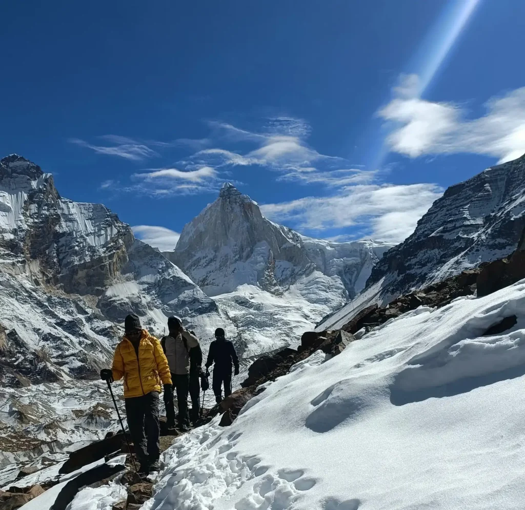
Two features distinguish Kedar Tal’s difficulty from many other Himalayan treks: the steepness is sustained and relentless rather than concentrated in a single hard section, and portions of the terrain are genuinely technical — narrow ledge paths above significant drops, loose rock requiring careful footing, and one particularly demanding stretch between Bhoj Kharak and Kedar Kharak that tests both stamina and nerve.
The trail overall includes:
- Steep, sustained ascents with little flat respite
- Rocky and uneven terrain, including scree and moraine near the lake
- A narrow, exposed scramble section often referred to locally as the “Spider Wall,” requiring hands-and-feet climbing on a steep rock face
- High-altitude sections above 4,000 metres
- Long trekking days
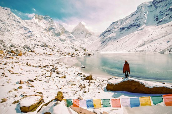
- Cold temperatures and possible snow, even outside peak winter
- River and stream crossings
- Limited facilities beyond Gangotri
- Rapidly changing mountain weather
Who Can Do the Kedar Tal Trek?
The trek suits trekkers who:
- Are physically fit with good cardiovascular endurance
- Can comfortably walk for several hours on consecutive days
- Are confident on uneven, rocky terrain
- Have prior Himalayan trekking experience
- Can handle high-altitude conditions and are prepared to acclimatize properly
Beginners can attempt the trek only with thorough preparation and experienced local guidance — this is not a route to underestimate.
Best Time for Kedar Tal Trek
May to June
This is the season opener, generally beginning after Gangotri Temple’s annual reopening. Advantages include pleasant conditions at lower elevations, longer daylight hours, and generally good mountain visibility, though snow may still linger on higher sections early in the season and can add difficulty to some stretches.
September to October
A preferred window among experienced guides and repeat Himalayan trekkers. Post-monsoon air clarity tends to be exceptional, mountain views and lake colour are often at their most vivid, and reduced pilgrim traffic on the lower approach makes the wilderness feel more complete. As October progresses toward winter, full cold-weather preparation becomes increasingly important.
Monsoon — July to August
This period requires real caution. Heavy rainfall increases the risk of landslides, slippery trails, rockfall, and swollen streams, particularly on the steep, loose-rock sections between camps. Because the trek starts from Gangotri, road access into the region should also be checked before travelling. This route is not recommended during peak monsoon.
Winter
Winter brings severe conditions — heavy snow, freezing temperatures, and largely inaccessible trails — making the standard Kedar Tal Trek unsuitable for regular trekkers during this period.
Major Peaks Around Kedar Tal
Thalay Sagar
At 6,904 metres, Thalay Sagar is one of the most recognizable and technically challenging peaks in the Gangotri region. Its near-vertical north face of ice and rock rises directly above Kedar Tal’s northern shore and has occupied elite alpinists for decades — a mountain that dominates the basin’s entire visual character.
Bhrigupanth
Another prominent Himalayan peak visible from the Kedar Tal region, its snow-covered slopes contributing further to the dramatic mountain wall surrounding the lake.
Jogin Peaks
The Jogin group forms another important part of the mountain panorama visible from the Kedar Ganga valley and the lake basin itself.
Kedar Tal and Kedar Ganga
The trek follows the Kedar Ganga valley, one of the significant side valleys in the wider Gangotri region. The Kedar Ganga originates from the Kedar Tal area and eventually joins the Bhagirathi River near Gangotri — a connection that gives the trek both geographical and spiritual significance, tying the remote high-altitude lake directly to the sacred river system that defines Gangotri’s importance as a pilgrimage destination.
Wildlife on the Trail
In short: Trekkers on the Kedar Tal route may encounter Himalayan wildlife including bharal (blue sheep) and, less commonly, musk deer, alongside various mountain birds — though sightings should never be treated as guaranteed.
The trail passes through Gangotri National Park, home to varied Himalayan biodiversity. Bharal are relatively commonly sighted on the higher, rockier sections of the route, while musk deer sightings are less frequent. As with any wildlife encounter in the mountains, observe from a distance, never attempt to feed or approach animals, and treat any sighting as a bonus rather than an expectation.
What the Eyes Take Back
The Kedar Tal Trek delivers a set of visual memories specific to this route. The lower forest approach — pine and Himalayan birch in their different textures, filtered light, occasional clearings that frame a peak above the canopy — offers a striking counterpoint to the austere high basin above. The ridge traverse between camps reveals the Gangotri valley floor far below while high peaks appear progressively above, building the kind of gradual scale-revelation that defines the best Himalayan trekking routes.
Kedar Tal’s own colour — a blue-green deepening toward blue at its centre, furthest from the glacial input streams — is characteristic of high-altitude glacial lakes, produced by the optical properties of deep, cold, glacially-fed water. Seen from the lake shore, Thalay Sagar’s north face is among the most dramatic single mountain views available on any remote trek in the Uttarkashi Himalaya. Sunrise and sunset at the lake, when conditions allow, bring golden and red hues across both the peaks and the still water — a moment many trekkers describe as the trip’s defining memory.
Kedar Tal Trek Cost
Kedar Tal Trek cost depends on group size, trek duration, guide and porter arrangements, camping equipment, transportation, meals, and season — no single fixed price applies across all trekkers, and Kashi of North can provide a current quote based on your specific plan.
Typical cost components include:
- Trek guide
- Forest/park permits
- Camping equipment (tents, sleeping arrangements)
- Meals during the trek
- Trekking and kitchen support staff
- Transportation to and from the roadhead
- Accommodation in Gangotri before/after the trek
- Porter support
- Equipment rental where needed
- Emergency support arrangements
A professionally organized Kedar Tal Trek package generally makes the experience considerably easier, since major logistics are handled before the trek begins rather than arranged piecemeal on the ground.
What Affects Kedar Tal Trek Cost?
- Number of trekkers in your group
- Trek duration (number of days)
- Accommodation type before and after the trek
- Transportation arrangements
- Porter requirements
- Equipment needs (owned vs. rented)
- Season and current demand
- Any custom itinerary requests
Want a complete Kedar Tal Trek package with a current, accurate quote?
📞 Call/WhatsApp: 7253079221 ✉️ Email: kashiofnorth@gmail.com 🌐 Book now : click here
Permits for Kedar Tal Trek
The Kedar Tal region falls within Gangotri National Park, a protected Himalayan landscape, so trekking permissions and entry regulations apply and can change over time.
Trekkers should carry:
- Government-issued photo ID
- Passport-size photographs, if required
- Trek registration documents
- Emergency contact details
- Medical/fitness documentation, required
If you book your trek through Kashi of North, we can confirm whether applicable permits and registrations are included in your package or need to be arranged separately.
How to Reach Gangotri for Kedar Tal Trek
By Road
Gangotri is connected by road to Uttarkashi and other major Uttarakhand towns. A common route is:
Dehradun → Rishikesh → Chamba → Tehri → Uttarkashi → Harsil → Gangotri
Road travel time depends heavily on traffic, weather, and current road conditions — Kashi of North can confirm the latest status before you travel.
By Train
The nearest major railway stations are generally in Dehradun, Rishikesh, or Haridwar, from where travelers continue by road toward Uttarkashi and Gangotri.
By Air
The nearest major airport is Jolly Grant Airport in Dehradun. From there, travelers can hire a taxi or use bus/shared transport toward Uttarkashi and Gangotri — Kashi of North can arrange this transfer for you.
Kedar Tal Trek Packing List
Because Kedar Tal is a high-altitude trek, proper equipment matters significantly to both comfort and safety.
Clothing
| Item | Purpose |
|---|---|
| Thermal inner layers | Base insulation |
| Fleece jacket | Mid-layer warmth |
| Down/synthetic insulated jacket | Cold camp and lake-side temperatures |
| Waterproof jacket | Rain and possible snow |
| Trekking pants | Durable, weather-appropriate legwear |
| Woollen socks | Warmth and blister prevention |
| Gloves | Cold-weather hand protection |
| Warm cap | Heat retention |
| Sun hat | UV protection at lower altitude |
Trekking Equipment
| Item | Purpose |
|---|---|
| Trekking boots with ankle support | Stability on rocky, uneven terrain |
| Trekking poles | Reduces knee strain, especially on descent |
| Headlamp | Camp use and emergencies |
| Backpack with rain cover | Carrying gear safely in wet weather |
| Water bottles | Hydration |
| Sunglasses | High-altitude UV and glare protection |
| Sunscreen | Sun exposure at elevation |
| Personal medicines | Any prescribed or altitude-related medication |
Personal Essentials
| Item | Purpose |
|---|---|
| Government ID | Registration and permit checks |
| First-aid kit | Basic emergencies |
| Power bank | Charging with limited electricity access |
| Lip balm | Dry, high-altitude air |
| Toilet essentials | Personal hygiene |
| Water purification tablets | Safe drinking water |
| Personal snacks | Energy during long trekking days |
| Garbage bags | Carrying out all waste |
| Four-season sleeping bag | Genuine cold-weather insulation at camp and lake |
For early-season or snow-affected conditions, additional equipment may be required — confirm with your guide before departure.
Fitness Preparation for Kedar Tal Trek
The Kedar Tal Trek demands sustained cardiovascular endurance more than technical climbing skill, so preparation should focus on long-duration aerobic effort and uphill walking with a loaded pack, started several weeks before departure.
Useful preparation activities include:
- Brisk walking and jogging
- Cycling
- Stair climbing
- Squats and lunges for leg strength
- Core exercises for stability on uneven terrain
A useful training goal is building toward comfortably walking for several hours at a stretch while carrying a light backpack. Consistency over the weeks before your trek matters more than attempting to reach peak fitness immediately beforehand — a body already accustomed to sustained effort will find the Kedar Tal approach demanding but manageable, while one without this preparation may struggle significantly.
Altitude and Acclimatization
Kedar Tal’s altitude of approximately 4,750 metres makes acclimatization genuinely important; trekkers should recognize the symptoms of altitude sickness and never ignore worsening signs.
Possible symptoms of altitude sickness include:
- Headache
- Dizziness
- Nausea
- Fatigue
- Loss of appetite
- Shortness of breath
A responsible trek itinerary should include adequate acclimatization time — particularly the foundation day at Gangotri (approximately 3,048 metres) before significant elevation gain begins — and should have a clear plan for descending promptly if any trekker develops serious altitude-related symptoms. Consulting a physician about altitude medication protocols before departure is worth considering, especially for first-time high-altitude trekkers.
Before the First Step — Practical Trek Advice
Train for the gradient, not just the altitude. The route’s defining characteristic is sustained steep terrain — build specifically for this with long uphill training walks under a loaded pack.
Acclimatize at Gangotri without shortcuts. With roughly 1,700 metres of elevation gain ahead, the foundation day at Gangotri matters more than it might seem.
Guide selection matters on this route. The terrain between Bhoj Kharak and Kedar Kharak includes genuinely navigational sections in poor visibility. A guide with specific, recent Kedar Tal experience is the trek’s most important safety asset — Kashi of North works with local guides who know this route.
Trekking poles are non-negotiable. The descent especially — steep, rocky, over multiple hours with tired legs — benefits enormously from the stability poles provide.
Pack for real cold at the lake. The Kedar Tal basin at 4,750 metres drops to temperatures on a clear night that require a genuine four-season sleeping bag. The best light at the lake is at dawn, which means being outside in that cold — prepare to be comfortable in it, not merely to endure it.
Check weather with local sources before departure. Weather in the upper Gangotri region is monitored by local guides and forest authorities. A same-morning check with local contacts in Gangotri is the most reliable information available for conditions on the approach ahead — Kashi of North can help coordinate this.
Leave the mountain exactly as you found it. The upper sections of the Kedar Tal route, beyond the main pilgrim traffic corridor, remain among the least-impacted high-altitude environments in the Gangotri region. Keeping it that way is every trekking group’s shared responsibility.
Responsible Trekking in Kedar Tal
Kedar Tal sits within an ecologically sensitive Himalayan landscape inside Gangotri National Park. Trekkers should:
- Carry all waste back out
- Avoid single-use plastic
- Not disturb wildlife, including bharal and musk deer
- Stay on established trails
- Avoid loud music
- Not damage vegetation
- Respect local religious traditions connected to the Kedar name and the Gangotri region
- Use designated camping areas
- Follow forest and national park regulations
The goal, on every trip, is to leave the mountain exactly as you found it.
Best Places to Visit Near Kedar Tal
Gangotri
The sacred Gangotri Temple and the Bhagirathi River make Gangotri an essential stop before or after your trek. (read more about gangotri)
Harsil
A beautiful Himalayan valley in the Bhagirathi drainage, known for its forests, traditional Garhwali villages, and apple orchards — a natural place to rest before or after the expedition. (read more about Harsil Valley )
Dharali
Located near Harsil, a peaceful settlement and convenient stop along the Gangotri road. (read more about Dharali)
Uttarkashi
The district’s main town, known for the Kashi Vishwanath Temple, the Bhagirathi River, and its role as the district’s broader trekking hub. (read more about Uttarkashi)
Gaumukh
The snout of the Gangotri Glacier and starting point for several other high-altitude routes in the region. (read more about Gaumukh)
Mukhba Village
The winter home of the Gangotri deity, adding a further cultural and religious dimension to any upper-valley Uttarkashi itinerary. (read more about Mukhba Village)
The Wider Uttarkashi Trekking World
Gangotri Temple anchors both the spiritual and logistical geography of a Kedar Tal expedition — arguably the most significant starting point for any trek in the Uttarkashi Himalaya. Nearby, the Gaumukh Glacier, Tapovan Trek, and Nandanvan Trek share the same Gangotri starting point and offer complementary experiences in the glacier world, distinct from Kedar Tal’s own northward valley. Together, these Gangotri-area treks represent one of the strongest concentrations of serious trekking destinations in the country.
Kedar Tal Trek vs Gaumukh Tapovan Trek
| Feature | Kedar Tal Trek | Gaumukh Tapovan Trek |
|---|---|---|
| Main Attraction | Kedar Tal glacial lake | Gangotri Glacier & Tapovan meadow |
| Starting Point | Gangotri | Gangotri |
| Difficulty | Moderate–Difficult | Moderate–Difficult |
| Landscape | Forest, alpine valley, glacial lake | Glacier, meadows, high mountains |
| Famous View | Thalay Sagar’s north face | Shivling and Meru peaks |
| Ideal For | A remote lake and enclosed mountain-basin experience | A glacier and high-altitude meadow experience |
Choose Kedar Tal if your priority is a remote Himalayan lake set in a dramatic, enclosed mountain basin. Choose Gaumukh Tapovan if you want to experience the Gangotri Glacier directly and the famous Shivling mountain views.
Frequently Asked Questions
Where is Kedar Tal? Kedar Tal is a high-altitude glacial lake in the Gangotri region of Uttarkashi district, Uttarakhand, reached by trekking from Gangotri.
What is the height of Kedar Tal? Kedar Tal sits at approximately 4,750 metres (15,580 feet) above sea level.
How difficult is the Kedar Tal Trek? It is generally considered moderate to difficult, due to steep, sustained sections, rough terrain including a technical scramble known as the Spider Wall, and high altitude.
How many days are required for the Kedar Tal Trek? A typical trek takes around 4–6 trekking days, depending on the itinerary and current route conditions.
What is the best time for the Kedar Tal Trek? May to June and September to October are generally considered the best trekking windows, subject to current weather and trail conditions.
Can beginners do the Kedar Tal Trek? Beginners should not treat Kedar Tal as an easy trek. Thorough physical preparation and experienced local guidance are strongly recommended.
What is the Kedar Tal Trek cost? Cost varies according to group size, duration, transportation, guide, permits, camping, and meals. Contact Kashi of North for a current, accurate quote based on your plan.
Is a guide required for the Kedar Tal Trek? A qualified local guide with specific Kedar Tal experience is strongly recommended given the route’s technical sections and navigational challenges, particularly between Bhoj Kharak and Kedar Kharak.
Can the Kedar Tal Trek be combined with Gangotri? Yes — Gangotri is the traditional starting point, so travelers naturally visit Gangotri Temple before or after the trek.
What is the Spider Wall? It’s a steep, exposed scramble section on the route, typically between Bhoj Kharak and Kedar Kharak, requiring careful hands-and-feet climbing on rock — one of the trek’s most technically demanding stretches.
Which peaks are visible from Kedar Tal? Thalay Sagar (6,904 m), Bhrigupanth, and the Jogin peaks are all visible from the lake and surrounding basin.
Is wildlife commonly seen on the trek? Bharal (blue sheep) are relatively often spotted on higher, rockier sections; musk deer sightings are less common. No sighting should be treated as guaranteed.
Does the trek pass through a national park? Yes, the route passes through Gangotri National Park, so forest and park regulations, along with any required permits, apply.
How much elevation gain is involved? Approximately 1,700 metres of elevation gain from the Gangotri base to Kedar Tal itself.
Is the trek suitable for families? Given its difficulty, sustained steep sections, and altitude, this trek is generally better suited to fit adults with prior trekking experience rather than families with young children.
What should I pack for cold at the lake? A genuine four-season sleeping bag, warm layered clothing, gloves, and a warm cap — night and dawn temperatures at 4,750 metres require serious cold-weather preparation.
Can I visit Kedar Tal during monsoon? It’s not recommended. Heavy rain increases landslide and rockfall risk on the steep, loose sections between camps, and persistent cloud cover reduces visibility.
How do I reach Gangotri to start the trek? By road via Dehradun → Rishikesh → Chamba → Tehri → Uttarkashi → Harsil → Gangotri, or by flying into Dehradun’s Jolly Grant Airport and continuing by road.
How can Kashi of North help plan a Kedar Tal Trek? Kashi of North can arrange your trek guide, transportation, Gangotri accommodation, permits guidance, and a complete itinerary based on your dates and group size — contact us at 7253079221 or kashiofnorth@gmail.com.
Why Book Your Kedar Tal Trek With Kashi of North?
Planning a high-altitude trek involves coordinating several separate arrangements — transportation, Gangotri accommodation, trek permits, an experienced local guide, camping arrangements, trek meals, porter support, equipment, and return transportation.
Kashi of North connects these arrangements through a local, Uttarkashi-based travel network built specifically around the district’s terrain and route conditions. Instead of coordinating everything separately, you can request a complete trek plan based on your dates, group size, and budget, backed by current route conditions, guide contacts with specific Kedar Tal experience, permit guidance, and the cultural context that makes the Gangotri region’s sacred geography more than a scenic backdrop.
Final Thoughts
The Kedar Tal Trek is among the most rewarding high-altitude adventures accessible from Uttarkashi. The journey from Gangotri into the Kedar Ganga valley moves steadily away from the busier pilgrimage route and into a quieter Himalayan landscape of birch forest, cliffs, alpine terrain, and glacial mountains. It is also, by most honest accounts, one of the harder treks in the region — a route that does not pretend to be easier than it is, and that delivers its reward in direct proportion to the effort it demands.
The lake itself is only part of the experience. The changing landscape across each day, the close-up view of Thalay Sagar’s imposing north face, the remote campsites at Bhoj Kharak and Kedar Kharak, and the feeling of walking deep into the Gangotri Himalayas — this is what makes the Kedar Tal Trek memorable long after the descent back to Gangotri.
If you’re planning a Kedar Tal Trek in Uttarkashi, India, prepare properly, choose the right season, and travel with experienced local support.
Ready to explore Kedar Tal? Plan your trek with Kashi of North.
🌐 Website: https://kashiofnorth.com 📞 Call/WhatsApp: 7253079221 ✉️ Email: kashiofnorth@gmail.com
Highlights
- ✨ Starting Your Trek at Gangotri: At 10,000 ft, Gangotri is one of the highest starting points of any of our treks. With the Bhagirathi flowing past and the marble-white Gangotri temple, it is also one of the most spiritual.
- ✨ Camping Among Himalayan Giants: At Kedar Kharak Campsite, you’re surrounded by giant Himalayan Peaks– Thalaysagar, Bhrigupanth, Manda Parvat and Jogin. Spending days and nights in their presence is a rare privilege.
- ✨ The High-Altitude Kedartal Lake: Close to 16,000 ft above sea-level, the huge glacial lake shimmers emerald blue. Set in a cauldron surrounded by huge Himalayan Peaks, it’s harder to imagine a grander setting.
- ✨ The Handsome Thalaysagar Peak: Thalaysagar is one of the most dramatic rock faces in the Himalayas — a legendary challenge for mountaineers worldwide. At Kedartal, witness its reflection in the still water.