
Maneri Travel Guide – Dam, Reservoir, Best Time, Weather, Attractions & Complete Visitor Information
Where the Bhagirathi Pauses
About 14 kilometres north of Uttarkashi, the Gangotri Highway rounds a bend and suddenly you are looking at something unexpected: a wide, still expanse of green-blue water filling the valley between mountain walls. After the gorge driving that characterises much of the Bhagirathi corridor, this open reservoir — the Maneri reservoir — comes as a genuine visual surprise. The mountains rise steeply on both sides, their reflections fragmented in the light chop on the water’s surface, and the dam structure sits at the valley’s lower end with a quiet, purposeful authority.
This is Maneri. And while most travellers on the Gangotri Highway stop here only briefly, or not at all, the town and its reservoir deserve considerably more attention than a passing glance through a car window.
Maneri sits at approximately 1,200 metres in the Bhagirathi Valley of Uttarkashi District, roughly 14 km from Uttarkashi town and 86 km from Gangotri. It is the site of the Maneri Bhali Hydroelectric Project — one of Uttarakhand’s significant run-of-river hydroelectric schemes — and the reservoir created by the project’s first stage barrage at Maneri has transformed the natural character of this valley section into something that is both an engineering achievement and an unexpectedly beautiful landscape feature.
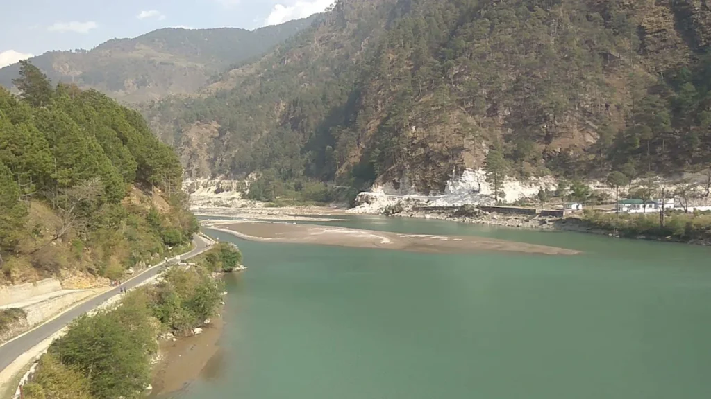
The reservoir, framed by forested mountain walls and reflecting the sky, has a quality that reservoir lakes often achieve — a stillness that the original river never possessed, and a sense of horizontal space unusual in this predominantly vertical valley landscape. For photographers, it offers compositions unavailable anywhere else on the Gangotri Highway. For road-trippers, it is the natural lunch break between Uttarkashi and Bhatwari, with several dhabas taking advantage of the view. For those with a day to spare, the wider Maneri area — the dam, the reservoir, the traditional village, the surrounding Bhagirathi landscape — constitutes a complete and rewarding day’s exploration.
This guide gives Maneri the coverage it has never quite received: detailed, honest, practical, and without the tendency of other travel resources to reduce it to a three-line mention on the way to Gangotri.
Quick Information at a Glance
| Detail | Information |
|---|---|
| Place Name | Maneri |
| Location | Maneri, Uttarkashi District, Uttarakhand, India |
| District | Uttarkashi |
| State | Uttarakhand |
| Elevation | ~1,200 metres (3,937 feet) above sea level |
| Latitude | 30.7901° N |
| Longitude | 78.4785° E |
| River | Bhagirathi |
| Nearest Town | Uttarkashi (14 km) |
| Nearest Airport | Jolly Grant Airport, Dehradun (155 km) |
| Nearest Railway Station | Rishikesh (165 km) / Haridwar (190 km) |
| Nearest Bus Stand | Uttarkashi (14 km) |
| Best Time to Visit | March–June and September–November |
| Average Temperature | Summer: 22°C–33°C / Winter: 5°C–16°C |
| Rainfall | Moderate; heaviest July–August |
| Snowfall | Rare at this elevation; higher surrounding hills may receive snow December–February |
| Entry Fee | None for reservoir viewpoints |
| Parking | Available at dam viewpoint and roadside |
| Fuel Station | Uttarkashi (14 km) recommended; limited at Maneri |
| ATM | Uttarkashi (14 km); none reliable at Maneri |
| Medical Facilities | None; nearest at Uttarkashi |
| Police Station | Uttarkashi Police: 01374-222100 |
| Mobile Network | BSNL, Jio, Airtel — reasonable along highway |
| Internet Availability | Limited; better at Uttarkashi |
| Google Map Coordinates | 30.7901° N, 78.4785° E |
| Emergency Contacts | Police: 01374-222100 / Hospital: 01374-222026 / SDRF: 01374-222755 / Tourist: 1364 |
About Maneri — History and Character
The Name and Settlement
Maneri is a small town and tehsil in Uttarkashi District, sitting in the Bhagirathi Valley approximately 14 km north of Uttarkashi on the Gangotri Highway. The name’s linguistic origin is rooted in Garhwali usage — “maner” or “maneri” appearing in various Garhwali place names to indicate a flat area or terrace beside a river, consistent with Maneri’s geography as a slightly widened section of the valley floor.
The settlement has existed as a farming community in the Bhagirathi Valley for generations — the terraced fields visible on the lower hillsides above the town are the product of centuries of agricultural work by Garhwali communities who made their lives in this river corridor. The construction of the Maneri Bhali Hydroelectric Project in the late 20th century fundamentally changed the character of the area by creating the reservoir and bringing engineering infrastructure, road improvements, and project-related employment to this valley section.
Administrative Importance
Maneri is the headquarters of Maneri Tehsil — one of the administrative subdivisions of Uttarkashi District. This status means government offices, local administrative functions, and a permanent institutional presence that makes the town more significant than its size alone would suggest.
Tourism Development
Tourism interest in Maneri has grown gradually as travellers on the Gangotri Highway have increasingly recognised the reservoir’s photographic and scenic qualities. The location — between Uttarkashi (14 km south) and Bhatwari (16 km north) — places it conveniently in the middle section of the highway where a break naturally feels welcome. Several dhabas have developed to serve highway traffic. The dam viewpoint, accessible from the road, has become a standard stop for photographers and road-trip enthusiasts.
Maneri Dam and the Maneri Bhali Hydroelectric Project
Background and Purpose
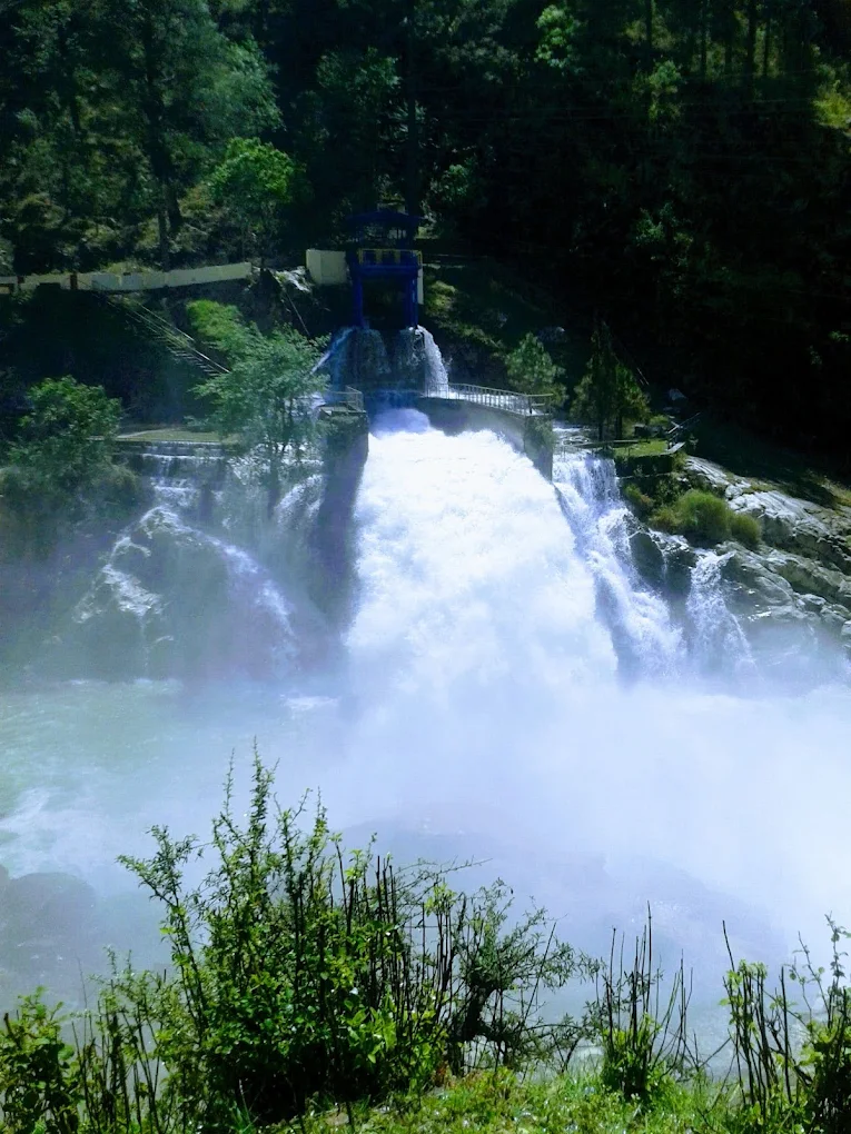
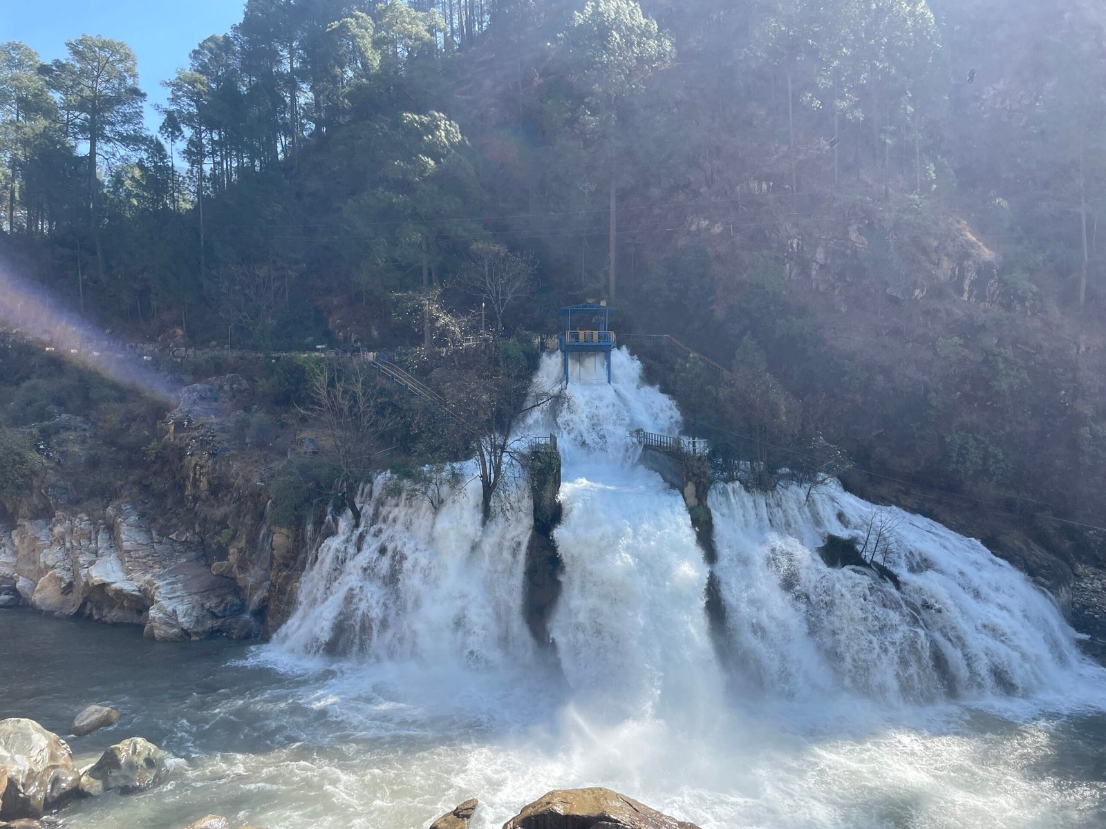
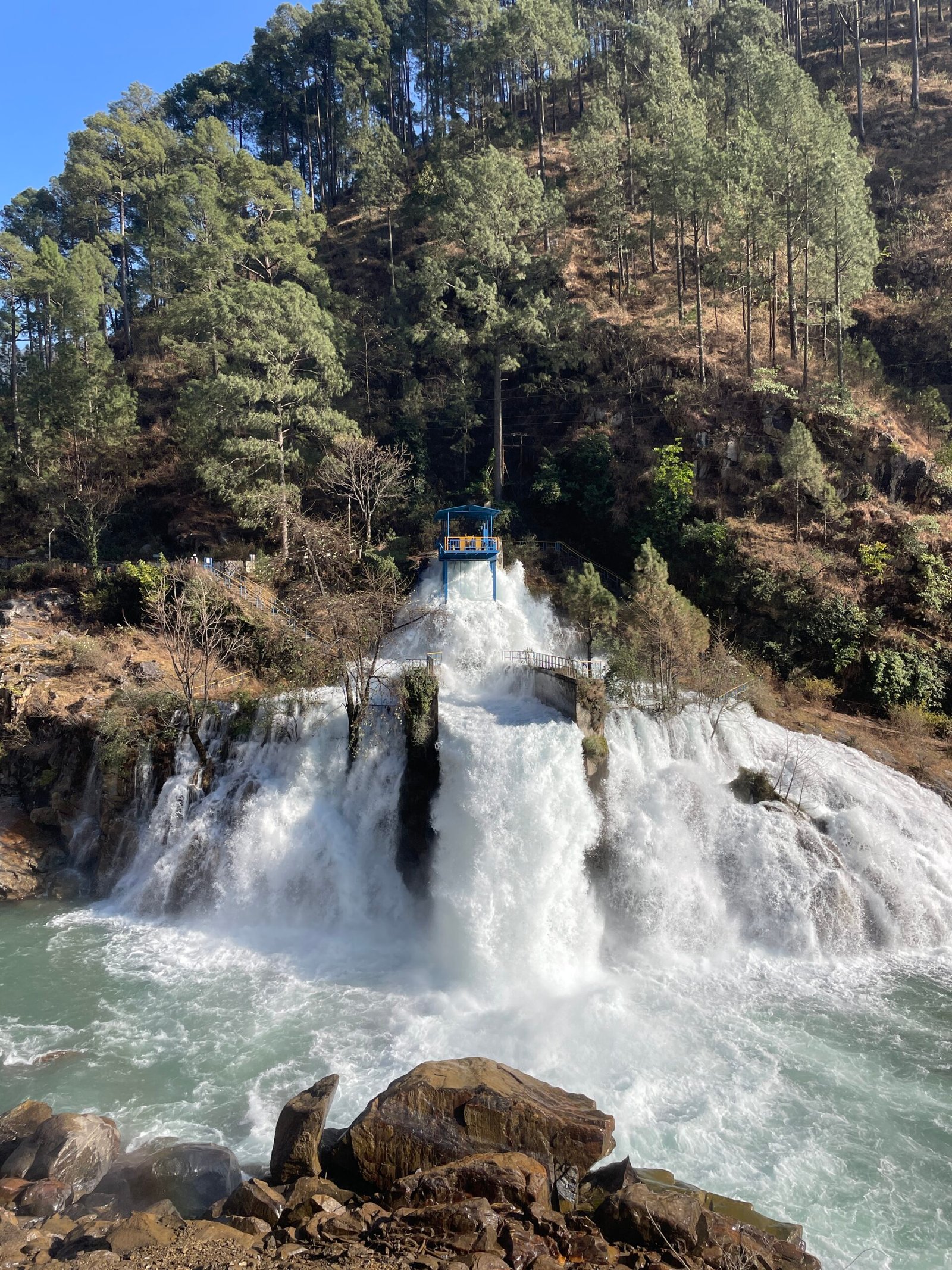
The Maneri Bhali Hydroelectric Project is a run-of-river hydroelectric scheme on the Bhagirathi River in Uttarkashi District. Run-of-river projects generate electricity from the natural flow of a river, typically with minimal water storage compared to large reservoir dams. The Maneri Bhali project uses a barrage (low dam structure) at Maneri to divert a portion of the Bhagirathi’s flow through a tunnel to a downstream powerhouse, where the controlled flow through turbines generates electricity.
The project is implemented in two stages:
- Maneri Bhali Stage I: The first stage, with the barrage at Maneri creating the reservoir that visitors see today. Water is diverted through a 8.6-kilometre tunnel to the powerhouse at Tiloth, generating approximately 90 MW of electricity.
- Maneri Bhali Stage II: The second stage uses water discharged from the Stage I powerhouse, with an additional diversion and tunnel system leading to a powerhouse at Dharasu, generating approximately 304 MW.
Together, the two stages constitute one of Uttarakhand’s significant run-of-river hydroelectric resources, contributing to the state’s electricity supply.
The Maneri Barrage and Reservoir
The barrage at Maneri is the most visible infrastructure element from the highway. It is a concrete structure built across the Bhagirathi, creating the reservoir upstream. The reservoir is several kilometres long — extending along the valley in a distinctly elongated shape that follows the river’s original course.
The reservoir’s visual character is its most notable quality for visitors: the impounded water creates a wide, still surface in a valley that is otherwise entirely dominated by fast-moving river — a textural contrast that is visually striking and that photographs extremely well.
The water colour varies considerably by season. In the dry post-monsoon months (October–November), the reservoir can appear a clear green-blue, reflecting the sky and surrounding forest walls with good fidelity. After monsoon, when sediment is still settling, the water appears murkier. In the spring snowmelt period, the incoming flow turns the reservoir a glacial grey-blue.
Engineering Details
The Maneri Bhali project involved significant engineering challenges:
- Tunnel construction: The 8.6-kilometre headrace tunnel required boring through solid Himalayan granite — a significant geological challenge in this seismically active zone.
- Barrage design: The structure had to be designed to withstand both high flood flows during monsoon and the seismic forces characteristic of the Himalayan region (Uttarkashi is in seismic zone V).
- Environmental flow: Like other Himalayan run-of-river projects, the scheme maintains a required minimum environmental flow downstream of the barrage to support aquatic ecosystems.
Did You Know? The Tiloth powerhouse, where the Stage I turbines are located, is underground — built within the mountain to protect it from the external environment and reduce environmental footprint.
Visitor Experience
Access to the dam structure itself is restricted (it is operational infrastructure), but viewpoints from the highway above the reservoir provide clear views of the reservoir, the surrounding mountain landscape, and the dam structure from above. Several viewpoints along the highway in the Maneri area give different perspectives on the reservoir.
The best viewpoints are on the western side of the highway approaching from Uttarkashi, where the road runs at an elevated position above the reservoir’s southern end.
Why Visit Maneri?
The reservoir scenery is unique on the Gangotri Highway. Nowhere else on the Uttarkashi–Gangotri route does the valley open into a still water landscape of this scale. The combination of mountain walls, forest, and the reservoir’s horizontal expanse creates a visual environment that contrasts strongly with the gorge driving that characterises most of this highway.
It is a natural road trip break. Exactly the right distance from Uttarkashi (14 km) and Bhatwari (16 km) to serve as a halfway stop in either direction, with the dhabas along the highway at this point serving reasonable food and good chai.
The photography is excellent. The reservoir reflection, the mountain framing, and the seasonal colour changes create photographic opportunities that are specific to Maneri — you cannot replicate this composition anywhere else on the highway.
The sunrise and sunset here are distinctive. The reservoir catches the light in a way that the river cannot — the still surface amplifies the colour and the reflection extends the visual space. Early morning photography at Maneri is extraordinary.
It is the gateway to both Uttarkashi’s town attractions and the upper valley. Sitting between the district headquarters and the upper valley destinations, Maneri is a natural orientation point for planning what lies north and south.
Geography and Climate
The Bhagirathi Valley at Maneri
At Maneri, the Bhagirathi Valley has a somewhat wider character than the gorge sections further north. The reservoir has further widened the effective water surface, though the valley walls remain steep. The overall effect is of a contained but open landscape — mountains on both sides, water in the valley floor, the highway running along the western wall at a slightly elevated position.
The elevation at 1,200 m places Maneri in the transition zone between the subtropical lower valley and the temperate mountain zone above. The climate is noticeably warmer than Bhatwari (30 km north) and Gangnani (34 km north), and the natural vegetation reflects this — lower temperate mixed forest and some semi-tropical species in the lower sections.
Flora and Fauna
The hillsides above Maneri support:
- Lower temperate mixed forest: Oak, rhododendron, and various deciduous species
- Pine and cedar at slightly higher elevations
- Riparian vegetation along the water’s edge
The reservoir itself has created a new aquatic habitat — fishermen are occasionally seen at accessible points, though regulations may govern fishing activities near the dam structure.
Bird life: The reservoir and its margins attract waterbirds not typically found in the gorge sections. Common Merganser and various ducks are occasionally present on the reservoir in winter and early spring. The surrounding forest supports the standard lower temperate Himalayan bird community.
Best Time to Visit Maneri
Spring (March–May): Clear and Blooming
The rhododendron forests on the hillsides above the reservoir bloom in March–April — crimson visible from the highway. The reservoir levels are moderate (before the full snowmelt raises them). The weather is warm and pleasant. The best light for reservoir photography is the low-angle spring sun.
Best for: Photography (wildflowers and reservoir), clear mountain views, comfortable road trip conditions.
Summer (May–June): Warm and Accessible
Hot in the valley (30–33°C on warm days) but pleasant in the mornings and evenings. All facilities fully operational. The Gangotri pilgrimage season means heavy highway traffic.
Best for: General visitors using Maneri as a stopover on the Gangotri route.
Monsoon (July–September): Lush but Busy
Heavy rainfall in July–August. The Bhagirathi runs extremely high during peak monsoon, and the reservoir may fill significantly. The reservoir’s sediment load is highest at this time. The surrounding landscape is intensely green. Road disruptions above Maneri are possible.
Best for: Those who specifically appreciate the monsoon landscape. Not recommended for those wanting clear reservoir views.
Autumn (October–November): The Finest Season
Post-monsoon clarity and the reservoir at its most photogenic. The water colour clears, the mountain views are exceptional, and the light quality in October is at its annual best. This is when the Maneri reservoir provides its most rewarding visual experience.
Best for: Everyone. Photography in particular is exceptional in October–November.
Winter (December–February): Cool and Quiet
The valley remains accessible year-round at this elevation (1,200 m). The reservoir is at lower levels. The surrounding hillsides may have snow at higher elevations, which provides a visual contrast with the reservoir below. Cold but manageable for those dressed appropriately.
Best for: Photographers who want winter mountain scenery with the reservoir foreground.
Monthly Weather Table
| Month | Day Temp | Night Temp | Conditions | Reservoir | Visit? |
|---|---|---|---|---|---|
| January | 10°C–16°C | 2°C–8°C | Cool, clear, occasional frost | Low level, clear | ✅ Yes (quiet) |
| February | 12°C–19°C | 4°C–10°C | Warming, rhododendron budding | Low level | ✅ Yes |
| March | 17°C–24°C | 8°C–13°C | Spring blooming | Moderate level | ✅ Excellent |
| April | 21°C–28°C | 12°C–17°C | Warm, excellent | Moderate | ✅ Yes |
| May | 25°C–33°C | 16°C–21°C | Hot in valley | Moderate-high | ✅ Yes |
| June | 24°C–31°C | 17°C–22°C | Pre-monsoon, some cloud | High | ✅ Yes |
| July | 22°C–27°C | 18°C–22°C | Monsoon, muddy | Very high, murky | ⚠️ Monsoon |
| August | 21°C–26°C | 17°C–21°C | Monsoon continuing | High, clearing | ⚠️ Caution |
| September | 18°C–24°C | 13°C–18°C | Clearing, post-monsoon | Clearing | ✅ Good |
| October | 14°C–21°C | 7°C–13°C | Outstanding, clearest | Clear, best colour | ✅ Best month |
| November | 10°C–17°C | 4°C–9°C | Cool, clear, quiet | Lower level, clear | ✅ Yes |
| December | 9°C–15°C | 2°C–7°C | Cold, clear | Low level | ✅ Yes (quiet) |
How to Reach Maneri
Maneri sits directly on the Gangotri Highway (NH-34), 14 km north of Uttarkashi. Every vehicle travelling this route passes through Maneri.
Distance Reference Points
| Origin | Distance to Maneri | Approx. Drive Time |
|---|---|---|
| Delhi | 374 km | 9.5–11 hours |
| Dehradun | 156 km | 4.5–5.5 hours |
| Haridwar | 192 km | 5.5–6.5 hours |
| Rishikesh | 166 km | 4.5–5.5 hours |
| Uttarkashi | 14 km | 20–25 minutes |
| Bhatwari | 16 km | 25–35 minutes |
| Gangnani | 34 km | 50–65 minutes |
| Harsil | 58 km | 2–2.5 hours |
| Gangotri | 86 km | 3–3.5 hours |
By Road
From Delhi: Delhi → NH334B → Haridwar → Rishikesh → Devprayag → Srinagar → Rudraprayag → Tilwara → Uttarkashi → Maneri
From Dehradun: Dehradun → Rishikesh → Chamba → Uttarkashi → Maneri
Road Conditions: The highway through Maneri is in generally good condition — this section receives regular maintenance as it is part of the critical Gangotri pilgrimage route. Landslide risk in heavy monsoon may affect sections above Maneri.
By Shared Jeep: Shared jeeps from Rishikesh to Uttarkashi (₹250–₹350/seat), then local transport onward through Maneri toward Bhatwari and Gangotri.
By Bus: GMOU and state buses on the Uttarkashi–Gangotri route pass through Maneri.
Parking: Available at highway pull-offs near the reservoir viewpoints and along the main road through town.
Things To Do in Maneri
Visit the Reservoir Viewpoint
The primary reason to stop. Several viewpoints along the highway in the Maneri area provide clear views over the reservoir and the surrounding mountain landscape. The best viewpoints are typically on the western side of the highway where the road runs elevated above the reservoir’s southern end.
Allow 20–30 minutes minimum. The view changes significantly with the light and the angle.
Photography at the Reservoir
The reservoir reflection, the dam structure, the mountain backdrop, and the seasonal variations in water colour all provide photography material that is specific to Maneri and unavailable elsewhere on this highway. Detailed guidance in the Photography Guide section.
Observe the Dam Structure
The barrage is visible from highway viewpoints. It is not possible (and not permitted) to approach the dam structure directly, but the view from above gives a clear impression of its scale and engineering character.
Bhagirathi River Walk
Downstream of the dam, the river resumes its natural character — fast-moving, rocky, the characteristic Bhagirathi. A short walk from the highway to accessible river bank sections gives direct contact with the river in its natural state.
Tea and Food Break
The dhabas along the highway at Maneri are among the better ones on this route — the combination of a view, reasonable food, and the natural break point this location represents has encouraged some investment in quality. A chai and a plate of rajma chawal at a Maneri dhaba, looking out over the reservoir, is one of the simple pleasures of the Gangotri Highway road trip.
Bird Watching
The reservoir and its margins attract waterbirds (Common Merganser, ducks in winter) that are not found in gorge sections. The surrounding forest supports the lower temperate Himalayan bird community. Early morning bird watching from the highway viewpoints is productive.
Explore Maneri Village
The traditional village above the highway has terraced fields, traditional Garhwali homes, and a community life that the pilgrimage traffic largely bypasses. A short uphill walk from the highway to the village is worthwhile for those interested in local culture and traditional architecture.
Sunrise and Sunset
The reservoir catches the light in both directions. Morning light from the east illuminates the eastern mountain wall while the western wall is in shadow, creating a dramatic high-contrast mountain reflection. Sunset reverses this, with warm light on the western slopes visible across the reservoir.
Top Nearby Attractions
Uttarkashi (14 km | 20–25 minutes)
The district headquarters and the sacred Kashi of the North — with the Kashi Vishwanath Temple, Shakti Temple, NIM Museum, Bhagirathi ghats, and the full range of district services. Our comprehensive Uttarkashi Travel Guide is the essential companion.
Best Time: Year-round | Ideal Duration: 1–2 days
Tiloth (Downstream of Maneri | 5–10 km)
The location of the Maneri Bhali Stage I powerhouse — where the water diverted through the tunnel from the Maneri barrage drops through turbines to generate electricity. The powerhouse facility is not generally open to public visitors, but the area has its own character as a river town with the highway running above and the powerhouse infrastructure visible below.
Bhatwari (16 km toward Gangotri | 25–35 minutes)
The tehsil headquarters and last reliable service hub before the upper valley destinations. The Saturday haat bazaar, Bhagirathi riverside, and surrounding traditional villages. Our Bhatwari Travel Guide.
Best Time: Saturday (haat market) | Ideal Duration: Half day to full day
Gangnani (34 km | 50–65 minutes)
The Rishi Kund natural hot spring and Parashara Rishi Temple — one of the Gangotri Highway’s finest stops. Our Gangnani guide.
Best Time: Any accessible season | Ideal Duration: 2–3 hours
Nachiketa Tal (32 km from Uttarkashi, near Maneri area)
The alpine lake associated with the Katha Upanishad — accessible by an Easy day trek from the Uttarkashi–Maneri area. Our Nachiketa Tal guide.
Best Time: March–June, September–November | Ideal Duration: Full day
Dayara Bugyal (From Bhatwari area, 30 km + trek)
Uttarakhand’s finest accessible alpine meadow. Our Dayara Bugyal guide.
Best Time: April–June, November–February | Ideal Duration: 1–2 days
Dodital (From Uttarkashi area, multi-day trek)
The forest lake of Lord Ganesha’s birthplace. Our Dodital Trek guide.
Best Time: April–June, September–October | Ideal Duration: 3–4 days
Harsil (58 km | 2–2.5 hours)
The most celebrated valley destination in the upper Bhagirathi — apple orchards, Bhagirathi at its widest, extraordinary mountain scenery. Our Harsil Travel Guide.
Best Time: September–October | Ideal Duration: 1–2 days
Gangotri (86 km | 3–3.5 hours)
The Char Dham temple of Goddess Ganga. Our Gangotri Travel Guide.
Best Time: May–June, September–October | Ideal Duration: 1 day minimum
Kashi Vishwanath Temple (In Uttarkashi, 14 km)
The sacred heart of the Kashi of the North.
Photography Guide
Reservoir Photography — The Primary Subject
The Maneri reservoir is the most distinctive photographic subject on this section of the Gangotri Highway. Key composition approaches:
The wide valley panorama: Use a wide-angle lens (16–24mm equivalent) from the elevated highway viewpoints to capture the full width of the reservoir with mountain walls on both sides and the sky above. This composition works best in early morning (light from the east) or afternoon (light from the west).
The reflection shot: On calm days — most reliable in the early morning before any wind develops — the reservoir surface reflects the eastern mountain wall with good fidelity. The best reflection windows are 7:00–9:00 AM in calm weather.
The dam structure: From the best highway viewpoints, the dam structure appears at the southern end of the reservoir. A telephoto lens (100–200mm equivalent) isolates the structure against the mountain backdrop.
Water colour variations: Return to the same spot at different seasons and you will find dramatically different water colours — clear green-blue in October, grey-blue in snowmelt season, darker and murkier after monsoon. These seasonal variations are themselves a photographic subject.
Sunrise Photography
The eastern mountain wall above the reservoir catches the first alpenglow before the sun has risen above the ridge. Positioning yourself on the highway viewpoints facing east, approximately 30 minutes before sunrise, gives you a sequence from the pre-dawn blue through the alpenglow pink and orange to the direct morning light on the water.
Best months: October–November for the clearest skies and most dramatic alpenglow.
Sunset Photography
The western slopes catch the last direct light while the reservoir below reflects this in diminished form. The best sunset positions are on the eastern side of the highway looking west — available at a few viewpoints where the road crosses to the eastern bank.
Road Photography
The Gangotri Highway itself is a photographic subject — the mountain road curving along the valley with the reservoir below is a classic Himalayan road-trip image. Best captured with a telephoto lens from elevated positions looking downstream.
Drone Regulations
The Maneri Dam and its associated infrastructure may have airspace restrictions. Verify with DGCA and local authorities before flying any drone in the Maneri area. The dam structure falls under critical infrastructure categories that typically restrict aerial photography without explicit prior authorisation.
Accommodation Guide
At Maneri
Limited accommodation exists in Maneri itself — a few basic guesthouses and roadside lodges that serve highway travellers needing an overnight stop.
| Category | Price Range | Notes |
|---|---|---|
| Basic roadside lodge | ₹500–₹1500 | Simple, functional |
| Mid-range guesthouse | ₹1500–₹2,500 | Better than basic; limited options |
In Uttarkashi (14 km — Most Recommended)
Uttarkashi has the district’s widest accommodation range and is 20–25 minutes from Maneri — making it the natural base for exploring the Maneri area.
- Budget guesthouses: ₹400–₹900/night
- Mid-range hotels: ₹900–₹2,500/night
- GMVN rest house: ₹700–₹2,000/night
- Better hotels: ₹2,500–₹5,000/night
See our Uttarkashi Hotels guide for current details.
Booking Tips
- For May–June peak season, book Uttarkashi accommodation at least a week in advance.
- Maneri’s own accommodation is limited; do not rely on finding a room on arrival if you specifically want to stay here.
- Bhatwari (16 km north) also has accommodation options — see our Bhatwari guide.
Food Guide
At Maneri
Highway dhabas at Maneri serve the standard Garhwali and North Indian highway menu.
Available items:
- Rajma Chawal — the local kidney bean and rice combination; the valley’s staple
- Aloo ke Gutke — dry-fried potato with jakhiya spice
- Dal and Roti — standard dhaba fare
- Maggi Noodles — the universal highway snack
- Chai — consistently available and consistently good
The dhabas with reservoir views represent Maneri’s finest food experience — not for the quality of the cooking, which is adequate rather than exceptional, but for the combination of decent food and an extraordinary view.
Local Specialties
At any dhaba in this valley, rajma chawal made with locally grown kidney beans has a quality that the same dish made with commercial rajma does not. The valley’s specific rajma variety — smaller, more flavourful — is available throughout the highway dhabas. If you are eating here, order this.
For Provisions
For trekkers and road-trippers needing provisions, the local shops in Maneri carry basic supplies — packaged food, biscuits, water, and basic provisions. For a more complete provisioning stop, Uttarkashi (14 km) has a full market.
Shopping Guide
Local agricultural products: Rajma and local honey may be available from roadside vendors, particularly in the agricultural season (September–October). These are among the most authentic local products you can buy on this highway.
Religious items: Basic puja supplies are available at some local shops for pilgrims continuing toward Gangotri.
Provisions: Water, packaged snacks, and basic supplies at local shops.
Maneri is not a shopping destination — its value is scenic and strategic rather than commercial. For a fuller shopping experience, Uttarkashi’s main market (14 km) has the widest range of local products in the district.
Adventure Activities
Road Trips
Maneri’s primary adventure identity is as a key stop on the Gangotri Highway road trip. See the Road Trips section in our Bhatwari guide and Uttarkashi guide for full highway road trip itineraries.
Nature Walks
Short walks from the highway to accessible river bank sections and village areas above the road constitute the available walking activity. The terrain is not organised for trekking but is pleasant for informal exploration.
Photography
As detailed above — the reservoir and its surroundings constitute the most significant single photography opportunity at Maneri.
Bird Watching
The reservoir margin and the forested slopes above the highway support interesting bird life. The lower temperate forest bird community (several warbler species, various thrushes, woodpeckers) is active in the surrounding hills. The reservoir itself attracts waterbirds occasionally, particularly in winter and early spring.
Cycling
The Gangotri Highway through Maneri is used by some touring cyclists. The gradient is moderate at this elevation — manageable for experienced cyclists, but the highway traffic requires care.
Nachiketa Tal Trek (Day Trip from Maneri/Uttarkashi Area)
The trailhead for the Nachiketa Tal trek is accessible from near Uttarkashi (14 km south of Maneri). See our Nachiketa Tal guide for the full details.
Suggested Itineraries
2-Hour Stop (Standard Road Trip Break)
- Pull off at the reservoir viewpoint
- Walk to the viewpoint (5 minutes)
- Photography and view appreciation (30–45 minutes)
- Chai and snacks at a dhaba with reservoir view (30 minutes)
- Continue toward Bhatwari or return toward Uttarkashi
Half-Day Trip (From Uttarkashi)
- 9:00 AM: Depart Uttarkashi
- 9:30 AM: Arrive Maneri; reservoir viewpoint photography
- 10:30 AM: Walk down to the river section below the dam
- 11:30 AM: Explore Maneri village (uphill from highway)
- 12:30 PM: Lunch at highway dhaba
- 1:30 PM: Return to Uttarkashi
Full Day (Maneri + Nearby Exploration)
- 7:00 AM: Depart Uttarkashi for sunrise at reservoir
- 7:30 AM: Sunrise photography at Maneri
- 9:30 AM: Drive to Bhatwari (16 km) for market exploration
- 1:00 PM: Lunch at Bhatwari dhaba
- 2:30 PM: Drive to Gangnani (18 km from Bhatwari) for hot spring
- 5:00 PM: Return to Maneri for sunset photography
- 7:00 PM: Return to Uttarkashi
Weekend Tour (Uttarkashi as Base)
Day 1 (Saturday): Arrive Uttarkashi from Delhi/Dehradun; Kashi Vishwanath Temple; evening aarti; overnight Day 2 (Sunday): Morning at Maneri (sunrise photography); continue to Bhatwari haat market (Saturday only, so plan Day 1 for Saturday); afternoon return via Maneri; depart for home
Photography Tour (2 Days)
Day 1: Arrive Uttarkashi; afternoon NIM Museum and town photography; overnight Day 2: Pre-dawn departure for Maneri sunrise; full morning at reservoir; afternoon drive toward Gangnani and Sukki Top; return to Uttarkashi for sunset; overnight or depart
Family Tour
- Uttarkashi (Kashi Vishwanath Temple, NIM Museum for children)
- Maneri (reservoir viewpoint — children enjoy the scale)
- Dhaba lunch with a view
- Return to Uttarkashi
Responsible Tourism
Respect the Infrastructure
The Maneri Dam is operational infrastructure serving Uttarakhand’s electricity needs. Do not attempt to access restricted areas of the dam or the powerhouse tunnel entrance. Treat the infrastructure with the respect due to working engineering facilities.
Protect the Bhagirathi
The river below the dam is the same river that becomes the Ganga. Do not dispose of plastic, food waste, or any material in or near the river or reservoir. The water quality of the Bhagirathi — from Maneri all the way to the plains — is affected by what happens at every point along its course.
No Plastic
Carry reusable water bottles and bags. Do not leave plastic at viewpoints or on the highway verge.
Support Local
The dhabas and small shops along the highway at Maneri serve a community that depends significantly on highway traffic. Eating at these establishments rather than bringing all your own food from the city directly benefits the local economy.
Safe Driving
The highway at Maneri involves the usual mountain road requirements — careful driving, attention at viewpoint pull-offs, and not stopping on blind curves for photography.
Travel Tips
Packing
- Warm layer for early morning photography at the reservoir (even in summer, dawn at the valley is cool)
- Sunscreen (mountain UV is significant)
- Reusable water bottle
- Camera gear with spare batteries
- Cash (no ATM in Maneri; carry from Uttarkashi)
Fuel
Uttarkashi has the nearest fuel stations (14 km). If you are continuing toward Bhatwari and beyond, fill up at Uttarkashi rather than counting on the limited fuel availability at Maneri.
Cash
No ATM at Maneri. The dhabas and shops are cash-only. Withdraw from Uttarkashi before visiting.
Medical Facilities
No medical facilities at Maneri. Nearest hospital is the District Hospital Uttarkashi, 14 km south.
For Senior Citizens
Maneri is fully accessible by vehicle and the viewpoints require minimal walking. The altitude (1,200 m) is comfortable for most senior citizens. The dhabas with reservoir views provide a comfortable sitting experience.
For Families
The reservoir viewpoint and the dam observation from the highway are naturally engaging for children. The scale of the water impoundment in a mountain setting is visually striking for all ages. The dhaba lunch with a view is a natural family stop.
For Women Travelling Solo
The highway environment at Maneri is the same as the broader Gangotri Highway — respectful pilgrimage and travel context. Standard solo travel precautions apply.
For Foreign Tourists
Maneri’s combination of mountain scenery, engineering infrastructure, and Himalayan valley atmosphere is genuinely interesting to foreign visitors. No permits required. English is limited locally but the visual experience is entirely self-evident.
Interesting Facts About Maneri
- The Maneri Bhali Hydroelectric Project’s Stage I and Stage II together generate approximately 394 MW of electricity — a significant contribution to Uttarakhand’s power needs.
- The Maneri Barrage creates a reservoir several kilometres long by impounding the Bhagirathi River — creating a still-water feature in a valley otherwise characterised entirely by fast-moving river.
- The headrace tunnel for Maneri Bhali Stage I is 8.6 kilometres long, bored through solid Himalayan granite.
- The powerhouse for Stage I is located underground at Tiloth — built within the mountain to protect it from external conditions and reduce environmental surface footprint.
- Maneri is in seismic zone V — India’s highest seismicity classification — making the engineering of both the dam and the tunnel a significant challenge requiring seismic-resistant design.
- The Bhagirathi River below the Maneri Dam resumes its natural character — the run-of-river design means the dam stores minimal water, maintaining the river’s downstream flow rather than impounding large volumes.
- The reservoir’s water colour changes dramatically by season — from the clear green-blue of October to the grey-blue of snowmelt season to the murky sediment-loaded appearance after monsoon.
- The Maneri area sits at approximately 1,200 m — significantly warmer than destinations further up the Gangotri Highway (Harsil at 2,620 m, Gangotri at 3,415 m), with a correspondingly different climate and vegetation.
- The rhododendron forests visible on the hillsides above the Maneri reservoir bloom in March–April in crimson flowers — the same flowering that occurs throughout the Garhwal hills at this elevation.
- Common Merganser (a diving duck) is occasionally seen on the Maneri reservoir in winter — a species not typically found in the gorge sections of the Bhagirathi, attracted by the reservoir’s calmer water.
- Maneri Tehsil administers a larger geographic territory than the immediate town suggests — a consequence of the tehsil system that aggregates multiple villages under a single administrative centre.
- The Gangotri Highway (NH-34) through Maneri is part of the All-Weather Road project (Char Dham Pariyojana) — a national initiative to improve connectivity to the four dhams of the Char Dham Yatra.
- The 1991 Uttarkashi earthquake (6.8 magnitude) that devastated parts of the district passed through this valley — the geological evidence of the earthquake is embedded in the landscape visible from Maneri.
- The Bhagirathi at Maneri carries water that originates in the Gangotri Glacier at 3,900+ metres — the same water that became the sacred Ganga after joining the Alaknanda at Devprayag, and that eventually reaches the Bay of Bengal.
- Several bird species visible on the Maneri reservoir use it as a migration staging point — the reservoir has created a wetland habitat in a valley where no significant still water previously existed.
- The traditional Garhwali agriculture visible on terraced fields above Maneri represents a land-use system that has maintained soil stability on these steep slopes for centuries — the terraces prevent the erosion that would otherwise affect the slopes.
- Maneri’s position exactly between Uttarkashi (14 km south) and Bhatwari (16 km north) makes it the mathematical midpoint of the highway section between the district capital and the gateway to the upper valley.
- The water in the Maneri reservoir has a residence time — the amount of time water stays in the reservoir before passing downstream — of a few days to weeks depending on flow volume. This is significantly shorter than storage reservoirs.
- The Maneri Bhali project was developed by the Uttarakhand Jal Vidyut Nigam Limited (UJVNL) — the state’s hydroelectric development corporation.
- The view of the Maneri reservoir from the highway above gives a visual impression of the valley’s pre-road geography — the flat water surface showing where the river originally flowed before the barrage redirected and impounded it.
- Fishing activity is occasionally observed at accessible Bhagirathi banks below the dam — the river below a run-of-river dam typically maintains good flow and may provide functional fish habitat.
- The Nachiketa Tal lake trek — accessible from the Uttarkashi–Maneri area — leads to an alpine lake associated with the Katha Upanishad, one of Hinduism’s most important philosophical texts.
- The highway through Maneri is the same route that pilgrims have used to travel toward Gangotri for centuries — though in its pre-motor form, the route was a foot and mule path rather than a paved highway.
- The forest diversity visible on the hillsides above Maneri reflects the transition zone ecology of the valley at 1,200 m — a mix of subtropical and temperate species that creates higher biodiversity than either zone alone.
- The Bhagirathi’s colour below the Maneri Dam is notably different from the reservoir above — while the reservoir impounds and somewhat clarifies the water, the river below resumes its characteristic Himalayan grey-blue in the dry season.
- Several geological features visible in the exposed rock faces above the Maneri reservoir show the folded, compressed rock strata characteristic of the Himalayan overthrust geology — the layers of rock visibly tilted from their original horizontal position by the collision of the Indian and Eurasian plates.
- The road through Maneri carries some of the heaviest commercial and pilgrimage traffic of any road in Uttarakhand — during the May–June Char Dham season, tens of thousands of vehicles use this route, making Maneri’s position on the highway commercially significant.
- The Maneri reservoir’s eastern bank is less accessible than the western (highway) bank — the eastern hillside rises steeply from the water’s edge, limiting development on that side and helping maintain the visual character of the reservoir.
- Uttarkashi District produces some of India’s finest mountain honey — the valley vegetation from Uttarkashi to Maneri and beyond supports bee colonies that produce distinctively flavoured honey from rhododendron, oak flower, and various alpine nectar sources.
- The dhabas at Maneri have become a standard stop for professional Himalayan road-trip bloggers and travel photographers — the combination of reservoir view, good chai, and the natural break point has given several specific establishments a modest online following.
Month-by-Month Guide
January: Cool and quiet. The reservoir is at lower levels with clear water. The hillsides above may have patches of snow at higher elevations. Very few tourists. A peaceful time to visit Maneri for those who enjoy the winter mountain character.
February: Gradually warming. The rhododendron buds become visible. Highway traffic is still minimal. The reservoir remains clear. A good month for quiet photography visits.
March: Spring arrives. Rhododendron forest on the surrounding hills begins blooming — crimson visible from the highway. Highway traffic begins building. The reservoir remains clear from the winter low. One of the finest months for photography combining the flowers and the water.
April: Full spring warmth. The rhododendron is at peak. The Char Dham season is beginning. Maneri sees increasing traffic as pilgrims head toward Gangotri. Pleasant temperatures in the valley (20–28°C).
May: Akshaya Tritiya opens Gangotri Temple and the highway reaches full pilgrimage capacity. The valley is warm (25–33°C). Maneri is busy as a break point. All dhabas fully operational.
June: Still pilgrimage season but pre-monsoon cloud begins building. The valley is warm. The reservoir levels are rising with snowmelt inflow.
July: Monsoon. Heavy rainfall. The Bhagirathi and reservoir rise significantly. The water turns murky with sediment load. Road disruptions possible above Maneri. Not the best month for reservoir photography but the surrounding landscape is dramatically green.
August: Monsoon continuing. Similar to July. The reservoir at its highest and most turbid. The hills above are intensely green. Late August sees the first hints of clearing.
September: Post-monsoon clearing. The reservoir level begins to drop and the water begins clearing. By mid-September the views are improving rapidly. The hills remain green. An increasingly rewarding month.
October: The finest month. The reservoir is clear, the water colour at its most vivid (green-blue in good light), the mountain views exceptional, and the highway has far less traffic than in May–June. Dhabas are still operating. October is when Maneri is most rewarding.
November: The season winds down. Pilgrim traffic stops after Gangotri closes. The highway becomes quieter by the week. The reservoir remains clear and beautiful. Cool temperatures but comfortable daytime. Early November is excellent.
December: Winter quiet. Very few visitors. The reservoir is at low levels, clear and reflective. The surrounding hills may have snow at higher elevations. A peaceful and atmospheric time for those who specifically want the winter mountain experience.
Common Mistakes Tourists Make
- Driving through without stopping. The reservoir viewpoint is a 15-minute detour that provides a genuinely unique composition unavailable anywhere else on the Gangotri Highway.
- Stopping only at the first viewpoint. Several viewpoints along the Maneri section of the highway give different perspectives. Drive slowly through the area and stop at multiple points.
- Not visiting at dawn or dusk. The reservoir at midday is pleasant. At dawn or dusk, it is extraordinary. Plan to be here for one of these periods.
- Not carrying cash. No ATM at Maneri. Bring cash from Uttarkashi for dhaba food and any purchases.
- Attempting drone photography without permits. The dam infrastructure is sensitive. Drone regulations apply. Verify before flying.
- Assuming the reservoir is accessible for swimming. The reservoir is associated with the dam infrastructure. Access to the water’s edge may be restricted, and the current near the dam intake can be dangerous. Do not enter the reservoir water.
- Visiting primarily during July–August. The monsoon season gives the worst water clarity and the least photogenic reservoir conditions. The far better photography months are October, March–April, and November.
- Not stopping at the roadside dhabas. The dhabas here are among the better ones on this highway section, specifically because the reservoir view has motivated some investment in quality. They are worth stopping at.
- Missing the village above the highway. The traditional Garhwali village on the terraced slopes above Maneri is rarely visited by highway travellers but is worth 30–45 minutes of exploration.
- Treating Maneri as a one-day destination alone. Maneri is best visited as part of a wider Uttarkashi District exploration — combined with Uttarkashi town, Bhatwari, and the upper valley destinations.
Note: There are no medical facilities at Maneri. The District Hospital in Uttarkashi (14 km south) is the nearest significant medical resource. In any emergency, call 112 and transport toward Uttarkashi.
Conclusion
Maneri is a place that earns more than it gets.
Most visitors to the Gangotri Highway drive through it in four or five minutes — the reservoir glimpsed through the windscreen, the dhaba noted for a possible stop that doesn’t happen, the sign reading “Maneri” observed and immediately forgotten in the business of the mountain drive. This is a reasonable response to a place that has not historically marketed itself, but it misses something genuine.
The Maneri reservoir, in the specific light of an October morning or a March afternoon, is one of the finest compositions on the Gangotri Highway. The combination of still water, steep mountain walls, the dam structure at the southern end, and the seasonal variation in water colour creates a photographic subject that serious photographers on this route have already discovered — you will increasingly find them pulled off at the viewpoints with their cameras and tripods, catching what the passing drivers don’t know they’re missing.
Beyond the photography, Maneri is a real place — a tehsil headquarters, a farming community with terraced fields above the highway, a set of dhabas that have grown up around the natural break point this location represents, and the infrastructure of a hydroelectric project that serves the state’s electricity needs. Understanding what Maneri is, rather than merely noting that it has a pretty reservoir, gives the visit a dimension that the thirty-second windscreen glimpse cannot provide.
Drive slowly through Maneri. Stop at the viewpoints. Have chai at the dhaba with the reservoir view. Walk to the river below the dam. Spend twenty minutes in the village above the highway. And if you can manage an early morning or late afternoon visit, give yourself the light that makes this ordinary-looking place reveal its particular quality.
Then continue — to Bhatwari’s market, to Gangnani’s hot spring, to Harsil’s apple valley, to Gangotri’s temple. Or turn around toward Uttarkashi’s temples and ghats and the Nachiketa Tal trek and the Dodital forest lake.
Uttarkashi District has more to offer than most travellers access. Maneri is one of the quieter parts of that offer — and sometimes the quieter parts are the ones worth seeking.
Frequently Asked Questions
1. What is Maneri famous for? Maneri is famous for the Maneri Bhali Hydroelectric Project and its associated reservoir on the Bhagirathi River. The reservoir creates a scenic still-water landscape unusual on the Gangotri Highway, making Maneri a notable scenic stop and photography destination. It is also the tehsil headquarters for Maneri Tehsil in Uttarkashi District.
2. Where is Maneri located? Maneri is located on the Gangotri Highway (NH-34) in Uttarkashi District, Uttarakhand, approximately 14 km north of Uttarkashi town.
3. What is the Maneri Bhali Hydroelectric Project? The Maneri Bhali Hydroelectric Project is a two-stage run-of-river hydroelectric scheme on the Bhagirathi River. Stage I uses a barrage at Maneri to divert water through an 8.6-km tunnel to a powerhouse at Tiloth, generating approximately 90 MW. Stage II generates approximately 304 MW at Dharasu from the Stage I discharge.
4. Can visitors access the Maneri Dam directly? The dam structure is operational infrastructure and access is restricted. Visitors can view the reservoir and dam from highway viewpoints above the southern end of the reservoir. No direct access to the dam structure is permitted for general visitors.
5. What is the best time to visit Maneri? October is the finest month — the reservoir is at its clearest (green-blue water colour), the mountain views are exceptional, and the light quality is outstanding. March–April is excellent for rhododendron blooms combined with the reservoir scenery.
6. How far is Maneri from Uttarkashi? 14 km from Uttarkashi to Maneri. The drive takes approximately 20–25 minutes.
7. How far is Maneri from Gangotri? 86 km from Maneri to Gangotri Temple. The drive takes approximately 3–3.5 hours.
8. Is there accommodation at Maneri? Limited accommodation — basic lodges and guesthouses. Most visitors stay in Uttarkashi (14 km south), which has a much wider range of options.
9. Is there an ATM at Maneri? No. The nearest ATMs are in Uttarkashi, 14 km south. Always carry cash from Uttarkashi.
10. What is the altitude of Maneri? Approximately 1,200 metres (3,937 feet) above sea level — significantly lower than destinations further north on the highway.
11. Are drones allowed at Maneri? Drone flying near the dam infrastructure requires explicit prior authorisation. The dam is critical infrastructure subject to airspace restrictions. Verify with DGCA and local authorities before flying.
12. Is the Maneri reservoir good for photography? Yes — it is one of the finest photography locations on the Gangotri Highway. The still-water reflection of the mountain walls, the seasonal water colour changes, and the dam structure create unique compositions unavailable elsewhere on this route.
13. What wildlife can I see at Maneri? Common Merganser (waterbird, in winter), various lower temperate Himalayan forest birds on the surrounding hillsides, and occasional langur monkeys.
14. Is Maneri suitable for families? Yes. The highway viewpoints are accessible by vehicle with minimal walking. The reservoir is visually engaging for children. The dhabas provide comfortable meal stops.
15. Can I swim in the Maneri reservoir? Swimming in the reservoir is not recommended and may be prohibited near the dam infrastructure. The current patterns near the dam intake can be dangerous.
16. Is Maneri on the Char Dham Yatra route? Maneri is on the highway to Gangotri, which is the second Char Dham. Our Char Dham Yatra guide covers the full circuit.
17. What food is available at Maneri? Highway dhabas serve Garhwali and North Indian vegetarian food — rajma chawal, aloo ke gutke, dal roti, and chai. No gourmet options; adequate quality at several establishments with reservoir views.
18. How do I reach Maneri from Delhi? Drive via Haridwar → Rishikesh → Devprayag → Srinagar → Uttarkashi → Maneri (374 km, approximately 10 hours).
19. What is run-of-river hydroelectric generation? Run-of-river hydroelectric generation uses the natural flow of a river — diverting water through a tunnel or channel to turbines, without storing large volumes in a reservoir. The Maneri Bhali project is run-of-river, with the barrage creating a smaller reservoir than a full storage dam.
20. What is the Tiloth Powerhouse? The Tiloth Powerhouse is the Stage I power generation facility of the Maneri Bhali Hydroelectric Project, located at Tiloth approximately 5–10 km downstream of the Maneri barrage. Water diverted from the barrage through the 8.6-km tunnel drives turbines here to generate electricity.
21. Is fuel available at Maneri? Limited and unreliable. Fill up at Uttarkashi (14 km south) before visiting. For continuing north toward Bhatwari and Gangotri, fill at Uttarkashi or Bhatwari.
22. Is mobile network available at Maneri? Reasonable coverage along the highway — BSNL, Jio, and Airtel all have some signal here. Better than destinations further north on the highway.
23. What is the Maneri reservoir’s water colour? The colour varies significantly by season: clear green-blue in October–November, grey-blue during snowmelt season (spring), and darker/murkier after monsoon when sediment load is high.
24. Are there viewpoints specifically for the reservoir? Yes — several pull-offs on the western side of the highway above the southern end of the reservoir provide the best views. The elevated road position gives clear sightlines across the reservoir.
25. Is Maneri worth a day trip from Uttarkashi? Yes — combined with Bhatwari (16 km north) and possibly Gangnani (50 km north), Maneri provides the anchor for an excellent full-day road trip from Uttarkashi.
26. What is the Bhagirathi River like below the Maneri Dam? The run-of-river design maintains environmental flow below the dam. The river below resumes its natural character — fast-moving, rocky, and cold — with the character typical of the upper Bhagirathi.
27. Can I visit Maneri in winter? Yes. The highway at Maneri remains accessible in winter (1,200 m altitude). The reservoir is at low levels, clear, and the surrounding hillsides may have snow at higher elevations. Very quiet.
28. Is Maneri good for bird watching? The reservoir attracts waterbirds (Common Merganser, various ducks in winter). The surrounding forest supports lower temperate Himalayan bird species. Early morning is best.
29. What is the best viewpoint at Maneri? The highway pull-offs on the western side of the road above the southern end of the reservoir offer the widest view across the water toward the dam structure and the mountain walls beyond. The exact best point varies slightly by light direction and time of day.
30. Why does the reservoir look different in different seasons? Water colour reflects sediment content, depth, and the colour of the sky. After monsoon, high sediment load turns the water turbid. In the dry season (October–November), sediment settles and the water clears to reveal the blue-green of the underlying depth and the reflected sky.
31. What is the engineering significance of the Maneri Bhali tunnel? The 8.6-kilometre headrace tunnel was bored through solid Himalayan granite — a significant engineering achievement requiring specialised tunnelling equipment and expertise. The tunnel operates under pressure, delivering water to the turbines at the Tiloth powerhouse.
32. Is Maneri mentioned in any religious texts? The Bhagirathi River that flows through Maneri has extensive religious literature — it is the river that King Bhagirath’s penance brought from heaven, and its banks at every point carry accumulated sacred significance. The specific Maneri site is not typically named in religious texts but is part of the sacred corridor from Devprayag to Gangotri.
33. Can I take photographs of the dam from the highway? Photography from the public highway viewpoints is generally permitted. Do not enter restricted areas of the dam facility for photography. Photography of operational infrastructure in India is subject to the usual security considerations — exercise common sense.
34. How does Maneri fit into a Gangotri Highway road trip? Maneri is the natural first major visual stop after Uttarkashi on the Gangotri route — the reservoir providing the first dramatic landscape change from the gorge driving below. Combined with Bhatwari (market), Gangnani (hot spring), Sukki Top (viewpoint), and Harsil (valley), Maneri anchors the lower section of the highway road trip.
35. What makes Maneri different from other highway stops on the Gangotri route? The reservoir — created by the Maneri Bhali barrage — gives Maneri a visual character unique on this highway. Nowhere else does the Bhagirathi Valley open into a wide still-water landscape of this scale. This is the specific quality that distinguishes Maneri from other highway stops.