
Matli Travel Guide – Best Time, Weather, Hotels, Attractions & Complete Visitor Information
The Unnoticed Gateway: Why Matli Deserves More Than a Drive-Through
Every pilgrim and traveller on the Gangotri Highway knows the rhythm: the long drive from Rishikesh or Dehradun, the approach to Uttarkashi with its familiar skyline of temple spires and the Varunavat ridge, the pause for fuel or food, and then the continued journey north toward Harsil, Gangotri, and the upper Bhagirathi Valley. In that rhythm, Matli exists as a felt presence more than a consciously noted one — a settlement that the road passes through, glimpsed from the window of a moving vehicle, registered as a cluster of buildings and the flash of the Bhagirathi River before the valley bends and moves on.
This guide is an invitation to stop.
Matli is a village-level settlement in Dunda Block, Uttarkashi District, sitting on NH-108 (now also designated as part of NH-34) approximately 7–9 kilometres north of Uttarkashi town — almost close enough to be a suburb but distinct enough, in character and setting, to be its own place. It occupies a position on the right bank of the Bhagirathi River where the valley is still relatively open before beginning the narrower gorge sections that characterise the road above Maneri and Bhatwari.
What gives Matli its particular character is a combination of factors that most travellers do not stop long enough to notice. It is a settlement with documented historical roots — the original Nautiyal caste families who settled the village can trace their arrival to approximately 1517 AD, when they migrated from village Nauti in Pauri Garhwal District. The village name itself is linked by local oral tradition to Matrika Rishi, a seer whose presence in this location gave the settlement its name. A natural hot water source — “Kyadia Rawa” — marks the site where the Rishi’s kutiya (hermitage) once stood.
Today, Matli is also the home of the 12th Battalion of the Indo-Tibetan Border Police (ITBP) — a presence that gives the settlement a certain administrative and logistical weight on this sensitive mountain highway corridor.
For travellers, Matli functions as a compact road trip stop, a fuel and food point for the highway, and — for those who choose to look beyond the highway’s edge — a village with a river, a history, and a mountain setting that rewards a short walk and a slow cup of tea in a way that the destination further up the road sometimes does not.
Note on Information Availability: Matli is a small roadside settlement with limited dedicated travel documentation. This guide draws on verifiable regional sources, the Alchetron and OneFilfyNine records on Matli village, and well-documented Uttarkashi District context. Where specific details could not be confirmed, this is explicitly stated. Travellers seeking current hotel availability, road conditions, and service details are encouraged to call ahead or enquire at Uttarkashi.
Quick Information Table
| Detail | Information |
|---|---|
| Place Name | Matli |
| Also Known As | Matli Village |
| Location | Dunda Block, Uttarkashi District, Uttarakhand, India |
| District | Uttarkashi |
| State | Uttarakhand |
| Elevation | Approximately 1,100–1,200 m (based on NH-108 corridor elevation in this stretch; the village’s specific elevation has not been independently verified) |
| Nearest River | Bhagirathi River |
| Nearest Town | Uttarkashi (~7–9 km south) |
| Nearest City | Dehradun (~160–170 km) |
| Nearest Airport | Jolly Grant Airport, Dehradun (~160–170 km) |
| Nearest Railway Station | Rishikesh (~170–175 km) |
| Nearest Bus Stand | Uttarkashi Bus Stand (~7–9 km); buses stop at Matli roadside |
| Nearest Highway | NH-108 / NH-34 (Rishikesh–Uttarkashi–Gangotri Highway) — passes directly through |
| Best Time to Visit | April–June and September–November |
| Summer Temperature | 14°C–26°C (April–June) |
| Monsoon Temperature | 14°C–22°C (July–August) |
| Winter Temperature | 2°C–12°C (December–February) |
| Rainfall | Moderate in monsoon (July–August); low in winter |
| Entry Fee | None |
| Parking | Roadside parking along NH-108; limited but functional |
| Fuel Station | Available in Matli and Uttarkashi; fill up before proceeding beyond Uttarkashi |
| ATM | Nearest reliable ATMs in Uttarkashi town (~7–9 km) |
| Medical Facilities | Basic; nearest district hospital and Community Health Centre in Uttarkashi |
| Police Station | Nearest police station in Uttarkashi; ITBP 12th Battalion headquartered at Matli |
| Mobile Network | BSNL, Jio, Airtel available |
| Internet Availability | Mobile data available; quality varies |
| Approximate Coordinates | ~30.78°N, 78.46°E (indicative; verify on Google Maps) |
| Emergency Contacts | Police: 112 | Tourist Helpline: 1364 | SDRF Uttarkashi: 01374-222694 |
About Matli
A Settlement on the Gangotri Road
Matli sits on the Gangotri National Highway approximately 7–9 kilometres north of Uttarkashi town, on the right bank of the Bhagirathi River. It falls within Dunda Block of Uttarkashi District and is close enough to Uttarkashi to share many of its services while maintaining a distinct character as a smaller roadside settlement.
The position of Matli on NH-108 gives it significance disproportionate to its size. Every vehicle travelling between Uttarkashi and Maneri, Bhatwari, Harsil, or Gangotri passes through or by Matli. During the Char Dham Yatra season — when hundreds of thousands of pilgrims travel this road between roughly April and November — Matli sees a steady stream of vehicles and serves as a practical halt for fuel, food, and rest before the longer haul to Gangotri.
The Origin of the Name
A documented local tradition preserved at Matli village provides the name’s etymology: the settlement is believed to have been named after Matrika Rishi, a sage who lived at this location in earlier times. The site of the Rishi’s hermitage (kutiya) is identified with a natural hot water source called “Kyadia Rawa” that still exists near the village. This tradition is recorded in the community’s own account of the village’s history, and while it cannot be verified through external historical sources, it reflects a consistent and specific local oral history rather than a vague legend.
Historical Settlement: The Nautiyal Migration
The documented history of the current settlement begins with the Nautiyal caste families who are recorded as the original inhabitants. According to the village’s community records: “Original inhabitants are of Nautiyal caste who migrated from village Nauti of Distt Pauri Garhwal. However, as per historical records, Nautiyal caste migrated from Dhar Malwa (Ujjain, MP) during 1517 AD.”
Over subsequent centuries, the population has diversified. Presently, people of other castes and clans including Bahuguna, Joshi, Saklani, Bhat, Chamoli, Semwal, Pant, Rawat, Bist, Chauhan, and Shah are residing.
The village deity is Lord Kapil Muni, with the Dhol and Trishul as the deity’s symbols. The village god is Lord Kapil Muni; the symbol of the god is Dhol and Trishul.
The ITBP Presence
One of the most notable documented facts about Matli is its role as the location of the 12th Battalion of the Indo-Tibetan Border Police (ITBP). A battalion of Indo-Tibetan Border Police is located at Matli. The ITBP, which is responsible for guarding India’s borders with Tibet and conducting high-altitude rescue and relief operations, maintains several installations in Uttarkashi District. The 12th Battalion at Matli is one of these — a presence that contributes to the settlement’s character as a functionally significant point on this sensitive mountain corridor.
Tourism and Commercial Significance
The Gangotri National Highway is one of the most trafficked pilgrimage roads in India during the Char Dham season. Matli, as a settled roadside point between Uttarkashi and the Maneri-Bhatwari stretch, serves a practical tourism support function: hotels for overnight stays, restaurants and tea stalls for meals in transit, a fuel station, and the general commercial infrastructure that pilgrims and travellers need on a journey that can stretch many hours.
Culture and Heritage
Traditional Garhwali Lifestyle
The village community of Matli maintains the core patterns of Garhwali mountain life: agriculture on the terraced slopes, mixed livestock keeping, the local deity festivals that mark the Garhwali calendar, and the wooden and stone domestic architecture that characterises the older parts of the settlement.
The social fabric of the village reflects the broader Garhwali caste and community structure, with multiple caste groups living together in a pattern typical of Uttarkashi District villages. The Nautiyal caste origin story — a migration from Malwa through Pauri Garhwal — is not unusual in the Garhwal Himalaya; many village communities trace origins to migrations from the plains during the medieval period.
Festivals
The festival calendar at Matli follows the standard Garhwali/Hindu pattern, with locally specific observances tied to the village deity (Lord Kapil Muni) alongside the universal festivals of Diwali, Makar Sankranti, Hariyali Teej, and Basant Panchami. The proximity to Uttarkashi town — itself a significant pilgrimage and festival center with the Kashi Vishwanath Temple — means that Matli residents participate in the larger urban religious events as well.
Cuisine
The food available in Matli reflects the practical, transit-oriented character of the settlement. Highway dhabas and small restaurants serve:
- Standard North Indian road food: Dal, rice, sabzi, roti, parathas, and omelets.
- Garhwali dishes: Aloo Ke Gutke, local rajma, seasonal vegetable preparations — available at homestays and local eateries rather than highway dhabas.
- Tea and snacks: The tea stalls along the highway are functional and welcoming; chai is the universal currency of goodwill on the Gangotri road.
For a more complete Garhwali culinary experience, Uttarkashi town (7–9 km) has a wider range of restaurants and homestay cooking.
Why Visit Matli?
The honest case for Matli is not built on spectacular attractions. It is built on the cumulative value of several modest and practical things:
As a highway stopover, it is convenient. The Gangotri Highway between Rishikesh and Gangotri is a long drive — 5–9 hours depending on your start point. Matli, at approximately 7–9 km north of Uttarkashi, sits at exactly the right point on the journey to break for a meal, fuel up, or spend the night before the higher-altitude sections above Maneri and Bhatwari.
As a base for Uttarkashi exploration, it is well-positioned. With the city just minutes away and the road north open from the same point, staying in Matli gives you access to Uttarkashi’s temples, markets, and services while offering a slightly quieter overnight environment.
As a photography stop, the river is compelling. The Bhagirathi at Matli, running between the forest-covered hillsides, offers excellent river photography particularly in the early morning and at golden hour.
As a window into working Garhwali village life, it is authentic. Walk beyond the highway into the older parts of the village and the character shifts entirely — traditional stone and timber houses, kitchen gardens, the community going about its day.
As the beginning of the Gangotri Highway experience, it marks a transition. From Matli northward, the road begins its climb into the narrower gorge sections, and the character of the journey changes. Matli is the last comfortable stop before the real mountain terrain begins in earnest.
Geography and Climate
The Bhagirathi Valley at Matli
Matli sits in the Bhagirathi River valley at a point where the valley is relatively open before narrowing into the gorge sections that characterise the road toward Maneri and beyond. The Bhagirathi river continues to flow downwards to Uttarkashi, where River Asi Ganga joins, and then through Dharasu, Chinyalisaur, and the old town of Tehri. Matli is just north of Uttarkashi in this river corridor, between the Asi Ganga confluence at Uttarkashi and the next series of tributary confluences upstream.
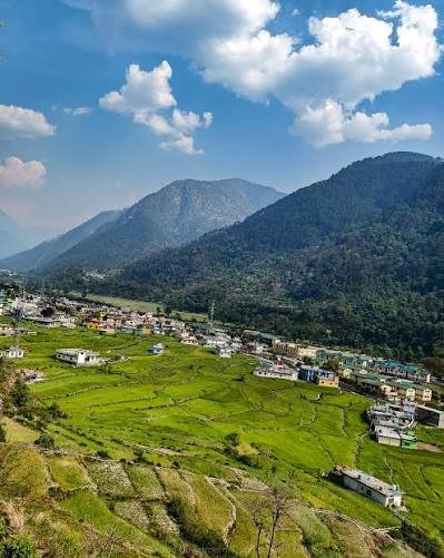
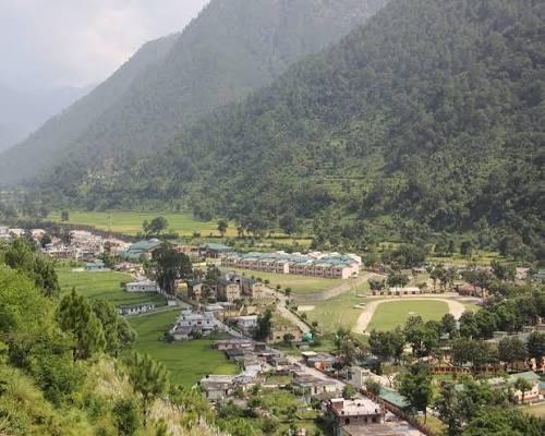
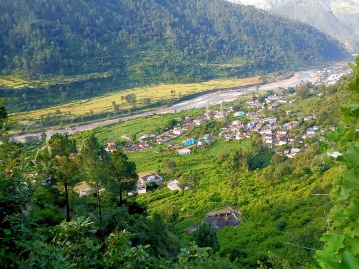
The valley floor at this elevation supports a mixed landscape: the Bhagirathi running fast and clear on one side, terraced agricultural land on the gentle slopes above the river, and the steeper forested hillsides rising above.
Flora
The hillsides above Matli support mixed temperate forest: Chir Pine (Pinus roxburghii) on the drier south-facing slopes, with Deodar Cedar (Cedrus deodara), Oak (Quercus spp.), Rhododendron (Rhododendron arboreum), and Himalayan Walnut (Juglans regia) in the moister gullies and north-facing aspects. The Rhododendron trees bloom red in February–April, visible on the slopes above the highway.
Fauna
The forested slopes above Matli are part of the broader Uttarkashi District wildlife habitat. Species documented in the broader area include Common Leopard, Himalayan Black Bear (at higher elevations), Rhesus Macaque, and various river birds along the Bhagirathi. The river itself supports Brown Dipper, Plumbeous Water Redstart, and Common Merganser — characteristic species of clean Himalayan rivers.
Climate
At approximately 1,100–1,200 m, Matli has a temperate mountain climate: warmer than the higher-altitude valley settlements but cooler than the Dehradun plains. Summers are warm and pleasant (14°C–26°C); winters are cold but manageable (2°C–12°C); the monsoon (July–August) brings significant rainfall and occasional landslide risk on the road.
Best Time to Visit
Spring: March to May
Pleasant temperatures, Rhododendron bloom on the hillsides, and good road conditions. The Char Dham Yatra season typically begins in April–May with the opening of the Gangotri Temple, bringing increased activity to the highway. A good time to visit as a stop on the Gangotri journey.
Summer: June
Long days, warm temperatures (20°C–26°C in the day), and the Yatra in full swing. The highway is at its busiest. Good conditions for the journey.
Monsoon: July to August
Significant rainfall; occasional road closures due to landslides between Uttarkashi and the higher valley sections. Matli itself is generally accessible, but check road conditions north of Uttarkashi before proceeding. Not ideal for recreational exploration; purely functional transit is manageable with caution.
Autumn: September to November
Post-monsoon clarity; the valley is vivid green; the Bhagirathi runs clear and fast after the monsoon’s glacial contribution. October is particularly beautiful — the sky is intensely blue, the light is excellent for photography, and temperatures are perfect for outdoor activity. The best season for both transit and lingering.
Winter: December to February
Cold at night (2°C–6°C); frost on the hillsides in January and February; occasional snowfall on the higher slopes above. The Gangotri Temple is closed in winter (post-Diwali), so pilgrim traffic is minimal. The highway is generally open through Uttarkashi in winter, though sections above Harsil may close with heavy snowfall.
Monthly Weather Guide
| Month | Day Temp (°C) | Night Temp (°C) | Conditions | Road Status | Visit Rating |
|---|---|---|---|---|---|
| January | 6–12 | 0–4 | Cold; clear; frost on upper slopes | Open to Uttarkashi; check above | Good for transit |
| February | 8–14 | 2–6 | Warming; Rhododendron buds | Open | Good |
| March | 12–20 | 6–10 | Rhododendron bloom begins | Open | Excellent |
| April | 16–24 | 10–14 | Yatra season opens; warm and clear | Open; Gangotri Temple opens | Excellent |
| May | 18–26 | 12–16 | High Yatra season; busy highway | Open | Excellent |
| June | 20–26 | 14–18 | Warm; busy; pre-monsoon possible | Open | Good |
| July | 16–22 | 12–16 | Monsoon; landslide risk north of Uttarkashi | Variable; check daily | Caution |
| August | 16–22 | 12–16 | Peak monsoon | Variable; check daily | Caution |
| September | 16–24 | 10–14 | Post-monsoon; clear; excellent | Open | Excellent |
| October | 14–22 | 6–10 | Finest month; golden light; clear sky | Open | Excellent |
| November | 8–16 | 2–6 | Cooling; Yatra season ending | Open; Gangotri Temple closes | Good |
| December | 4–12 | -2 to 2 | Cold; winter; quiet | Open to Uttarkashi; check above | For transit |
How to Reach Matli
Matli sits directly on NH-108 (also designated NH-34), the Rishikesh–Uttarkashi–Gangotri Highway. All vehicles on this route pass through Matli.
Distance Summary Table
| Origin | Distance to Matli | Driving Time |
|---|---|---|
| Delhi | ~475–490 km | 12–14 hours |
| Dehradun | ~168–175 km | 6–7 hours |
| Haridwar | ~180–188 km | 6–7 hours |
| Rishikesh | ~170–178 km | 5–6 hours |
| Uttarkashi | ~7–9 km | 15–20 minutes |
| Maneri | ~8–10 km (beyond Uttarkashi) | 20–25 minutes |
| Harsil | ~75–80 km | 2.5–3 hours |
| Gangotri | ~95–100 km | 3–3.5 hours |
By Road
The standard route to Matli follows NH-108 from Rishikesh: Rishikesh → Chamba → Tehri (new) → Dharasu → Uttarkashi → Matli. The road is paved national highway throughout but narrows significantly from Tehri onward. The approach to Uttarkashi from the south is dramatic — the Bhagirathi gorge narrows and the road clings to the cliff face in several sections.
From Matli, the highway continues north through Maneri, Bhatwari, Harsil, and eventually to Gangotri.
By Bus
GMOU/UKTRC state buses and private buses run from Rishikesh and Dehradun to Uttarkashi. From Uttarkashi, buses and shared taxis proceed up the highway toward Harsil and Gangotri during the Yatra season; these all pass through Matli. You can board at Uttarkashi and ride through Matli, or alight at Matli if that is your intended destination — inform the driver.
By Taxi
Shared and private taxis from Rishikesh, Dehradun, and Haridwar to Uttarkashi are the most flexible road option. From Uttarkashi, taxis to Gangotri or Harsil pass through Matli; private taxis can be hired for the full journey to any point on the highway.
By Air
Jolly Grant Airport is the nearest airport to Uttarkashi, situated at a distance of 160 km. It is well connected to Delhi with daily flights. From the airport, hire a taxi or bus to Rishikesh/Dehradun and then onward via NH-108 to Matli.
By Train
The nearest railway station to Uttarkashi is Rishikesh railway station, situated 143 km before Uttarkashi on NH58. Rishikesh is well connected by railway networks with major destinations of India. From Rishikesh, take a bus or shared taxi on NH-108.
Self-Drive
Self-driving to Matli is the most comfortable option for families, road-trip travellers, and photographers. The NH-108 is paved throughout but requires careful driving from Tehri onward — narrow sections, cliff edges, and increasing gradient. Budget 6–7 hours from Dehradun; longer during Yatra season traffic.
Fuel
Matli has a fuel station. Fill up in Uttarkashi before proceeding north, as fuel stations become less reliable from Bhatwari onward. Matli’s fuel station serves as an additional option before Uttarkashi.
Parking
Roadside parking along NH-108 at Matli is functional but limited. The ITBP camp presence means certain areas are not available for public parking. Use the space at dhabas, hotels, or the roadside areas marked for vehicle stops.
Things to Do
River Viewpoints
The Bhagirathi River alongside and below the Matli section of the highway offers accessible river viewpoints from the road edge and from short walking paths down to the bank where terrain allows. The river at this point is fast-moving, clear (outside monsoon), and framed by the forested hillsides on both banks. Early morning is the best photography window — the light enters the valley from the east and catches the river surface beautifully.
Photography
See the Photography Guide section below. The river, the highway corridor, the village architecture, and the mountain backdrop all offer strong photographic material for the traveller willing to slow down and look.
Village Walk
The older sections of Matli village, away from the highway, retain traditional Garhwali stone and timber architecture. A 30–60 minute walk through the village lanes reveals the texture of the community beyond the roadside commercial front.
Road Trip Halt
Matli functions very well as a planned stop on the Uttarkashi–Gangotri road trip: fuel at the highway station, a meal at a dhaba or sit-down restaurant, and a 30-minute walk to the river and back. This adds character and memory to a journey that can otherwise blur into a long sequence of mountain road bends.
Pilgrimage Corridor Experience
For pilgrims on the Char Dham Yatra — specifically Gangotri — Matli is an early checkpoint on the sacred journey north. A short prayer at a roadside temple or shrine, or simply sitting by the Bhagirathi for a few minutes of quiet, connects the transit experience to the spiritual purpose of the journey.
Sunrise and Sunset
From elevated points near the village, the sunrise light on the Bhagirathi valley — particularly the way it catches the ridgeline above the opposite bank — is excellent. Sunset comes early here, blocked by the western ridge, but the post-sunset glow on the eastern slopes often continues for 15–20 minutes after direct light is lost.
Shopping for Essentials
For travellers heading up to Harsil or Gangotri, Matli and Uttarkashi together are the last reliable places to stock up on essentials: medicines, packaged food, warm clothing layers, rain gear, and cash from ATMs. Beyond Uttarkashi, the highway has limited reliable supply options.
Top Attractions Nearby
Uttarkashi (~7–9 km south | 15–20 min)
The district headquarters and holy town on the banks of the Bhagirathi. Uttarkashi is situated on the banks of river Bhagirathi at an altitude of 1,158 m above sea level. It is home to a number of ashrams and temples and also to the Nehru Institute of Mountaineering. The name reflects its similarity to and location north of the city of Kashi (Varanasi).
Best for: Pilgrimage, temples, market, accommodation, medical, ATMs. Ideal duration: Half-day to overnight.
Kashi Vishwanath Temple, Uttarkashi (~7–9 km south | 15–20 min)
The defining temple of Uttarkashi — an ancient Shiva temple that gives the town its name and its identity as the “Kashi of the North.” The presiding Shivalinga and the enormous trident (trishul) in the temple courtyard are among the most significant religious objects in the Garhwal Himalaya. Read our Kashi Vishwanath Temple guide.
Best for: Pilgrimage; Shiva worship; spiritual photography. Best time: Year-round; significant festivals during Shivaratri and Shravan.
Shakti Temple (Kuteti Devi Temple), Uttarkashi (~7–9 km south | 15–20 min)
Kuteti Devi Temple is an ancient shrine located in Uttarkashi, Uttarakhand. The temple is situated on the Hari Parvat about 2 km from Uttarkashi. The temple is dedicated to the Mother Goddess and is a significant site for devotees visiting Uttarkashi. Read our Kuteti Devi Temple guide and Shakti Temple guide.
Best for: Pilgrimage; elevated views over Uttarkashi. Ideal duration: 1–2 hours.
Maneri (~8–15 km north of Uttarkashi | 25–35 min from Matli)
Maneri is a small town placed 8 km towards the north of Uttarkashi on the banks of the river Bhagirathi. The Maneri Dam is a concrete gravity dam built on the Bhagirathi River located at Maneri. This dam diverts water into a big tunnel feeding 90 megawatts of the Tiloth Power Plant — Stage 1 of the Maneri Bhali Hydroelectric Project planned in the 1960s. The dam and the reservoir behind it create a striking visual of mountain engineering against the natural gorge.
Best for: Engineering interest; river photography; dam views. Ideal duration: 30–60 minutes.
Tiloth (~Near Uttarkashi town edge | 20–30 min from Matli)
The Tiloth Power Plant is located in Tiloth village at the fringe of Uttarkashi town; Stage 1 of the Maneri Bhali Hydroelectric Project. The power plant visible from the highway is a significant piece of Uttarkashi’s infrastructure history.
Netala (~15–20 km south of Uttarkashi | 30–45 min from Matli)
A scenic village on the Bhagirathi River south of Uttarkashi, Netala is a pleasant stop on the highway approach from Rishikesh, offering river views and a traditional mountain village setting.
Best for: River photography; road trip stop. Ideal duration: 30 minutes.
Bhatwari (~25–30 km north of Uttarkashi | 45–60 min from Matli)
A roadside town and the branching point for the road to Dayara Bugyal. The road to Dayara Bugyal branches off near Bhatwari and vehicles can go up to Barsu village, from where an easy trek of 8 km commences. Bhatwari also serves as a mid-point stop for travellers between Uttarkashi and Harsil.
Best for: Dayara Bugyal trek base; road trip halt; mountain views. Ideal duration: 1–2 hours or overnight.
Gangnani (~60–65 km north of Uttarkashi | 2–2.5 hours from Matli)
The natural hot springs on the Bhagirathi, used for centuries by pilgrims heading to Gangotri. The sulphur springs have a bathing kund and a temple complex — a distinctive roadside stop on the highway.
Best for: Hot springs bathing; pilgrimage stop. Ideal duration: 30–60 minutes.
Harsil (~75–80 km north of Uttarkashi | 2.5–3 hours from Matli)
The main village of the Harsil Valley — a celebrated destination for apple orchards, Bhagirathi views, and the gateway to the higher valley. Read our Harsil Travel Guide.
Best for: Apple orchards; scenic base; village culture. Ideal duration: 1–3 nights.
Gangotri (~95–100 km north of Uttarkashi | 3–3.5 hours from Matli)
The Char Dham temple on the Bhagirathi at 3,048 m — one of the four sacred dhams of the Hindu pilgrimage circuit. Open approximately April–November. The spiritual and scenic climax of the entire NH-108 journey. Read our Gangotri Guide.
Best for: Pilgrimage; Char Dham Yatra; high-altitude photography. Ideal duration: Half-day to overnight.
Photography Guide
River Photography
The Bhagirathi at Matli offers accessible river photography from the roadside or from short walking paths toward the bank. The river is best photographed:
- Early morning: Low-angle light from the east illuminates the water surface and the cliff face on the opposite bank with warm, directional light.
- Monsoon: The river runs higher, faster, and more dramatically coloured — grey-green with glacial and surface runoff. The most dynamic water photography is in July–August, though access to the bank requires more caution.
- Post-monsoon: The river returns to its characteristic clear green-blue, photographically the most appealing condition.
A polarising filter is essential for river photography — it cuts the surface glare and allows the river’s true colour to register.
Mountain Landscape Photography
From elevated points near the village or from the road itself, the views along the Bhagirathi valley corridor — forested hillsides, the river far below, and the ridgelines above — are excellent for landscape photography. A telephoto lens (70–200mm) compresses the valley layers effectively.
Road Photography
The Gangotri Highway through this section has a distinctive character: the road carved into the hillside, pilgrims and travellers moving in both directions, the river always present below. Documentary road photography — the highway life of the Char Dham corridor — is well-supported here.
Sunrise and Sunset
The valley’s east-west orientation means sunrise light enters the Matli section first from the east, catching the opposite-bank hillside with gold and orange before the valley floor receives direct sun (typically 30–45 minutes after astronomical sunrise). Sunset is blocked by the western ridge; the post-sunset glow on the eastern face is typically the most rewarding evening photography window.
Photography Tips
- Carry a polarising filter for river shots.
- The road is active with traffic throughout the day during Yatra season — time your roadside photography outside peak vehicle hours (early morning or late afternoon).
- Be courteous to pilgrims and local residents; do not block the road for photography.
Drone Regulations
Drone use requires prior DGCA approval and is subject to local restrictions. The ITBP presence at Matli makes drone use in the immediate area particularly sensitive. Do not fly drones without specific written authorisation.
Accommodation Guide
In Matli
Matli has a small number of highway-facing hotels and guesthouses catering primarily to transit travellers on the Gangotri Highway. The Hotel Mateshwari Palace ( located on the Gangotri National Highway, Matli )is one documented option, listed on hotel booking platforms.
| Category | Approx. Price/Night |
|---|---|
| Budget highway guesthouse | ₹500–₹1,200 |
| Mid-range hotel | ₹1,200–₹2,500 |
In Uttarkashi (~7–9 km south)
Uttarkashi town offers the widest range of accommodation in the district — from budget guesthouses to mid-range hotels and a small number of better-appointed properties. Read our Hotels in Uttarkashi guide for detailed listings.
| Category | Approx. Price/Night |
|---|---|
| Budget guesthouse | ₹400–₹900 |
| Mid-range hotel | ₹900–₹2,500 |
| Better properties | ₹2,500–₹5,000 |
Booking Tips
- Book in advance for Yatra season (April–June and September–October); pilgrim traffic significantly reduces availability in Uttarkashi and on the highway.
- Matli hotels are suitable for a transit overnight; for longer stays, Uttarkashi offers more services and comfort options.
- Always call ahead to confirm availability, particularly for mid-range and budget properties that may not have reliable online booking.
Food Guide
In Matli
Highway dhabas and small restaurants serve the standard transit corridor menu:
- Dal-rice, sabzi-roti, aloo paratha, omelettes — the reliable mountain highway staples.
- Tea stalls providing chai and biscuits throughout the day and into the evening.
- Maggi noodles — universally available and universally comforting after a long drive.
The food is functional and honest. The better meals are available at sit-down restaurants rather than the smallest roadside stalls.
In Uttarkashi (~7–9 km south)
Uttarkashi’s market area has a range of restaurants offering Garhwali cuisine, North Indian, and basic Chinese dishes. For a more complete dining experience — particularly Garhwali home cooking — Uttarkashi’s hotels and homestays are the best option.
Water: Carry purified water or buy sealed bottles. Do not drink untreated tap water.
Shopping Guide
In Matli
Matli’s roadside market provides practical essentials for travellers continuing north:
- Packaged food and snacks: Biscuits, dry fruits, glucose, energy bars for the journey.
- Warm clothing: Basic woollen caps, socks, and simple winter accessories are available at roadside shops.
- Medicines: Basic OTC medicines from small chemists; for prescription items, proceed to Uttarkashi.
- Religious items: Small offerings, diyas, incense — basics for pilgrims heading to Gangotri.
In Uttarkashi (~7–9 km)
The main market in Uttarkashi is the place for:
- Pahadi Rajma: The distinctive small-grain kidney beans of the Uttarkashi highland farms — available from local traders.
- Local honey: Wild and farm honey from the Bhagirathi Valley farms.
- Woollen products: More variety and better quality than Matli’s roadside offerings.
- Religious goods: Full range of puja materials, Gangajal containers, rudraksha items.
Adventure Activities
Matli itself is not an adventure activities hub, but its position as the last large settlement before the upper highway makes it an important staging point:
Road Trips: The Gangotri Highway from Matli northward is one of the finest mountain drives in the Indian Himalaya — dramatic gorge sections, river views, and the progressive altitude gain toward Harsil and Gangotri.
Nature Walks: The forested hillsides above Matli support morning bird walks and short nature exploration — Rhesus Macaques in the trees, river birds on the Bhagirathi, and the forest sounds that the highway noise obscures.
Photography Expeditions: A morning photography session at the river, in the village, and along the highway produces a strong portfolio of the Char Dham corridor’s character.
Cycling: The road from Rishikesh to Gangotri is an established cycling route. Matli is an overnight stop for cyclists on this challenging journey.
Suggested Itineraries
Half-Day Stop (Transit travellers)
- Pull over at the Bhagirathi river viewpoint near Matli.
- 20-minute walk to the river bank.
- Fuel and meal at a dhaba.
- Short village walk into the older part of Matli.
- Continue north or south.
1 Day Trip (From Uttarkashi)
- 07:00 — Drive from Uttarkashi to Matli (15–20 min).
- 07:30 — River photography at the Bhagirathi.
- 09:00 — Village walk through Matli.
- 10:30 — Return to Uttarkashi; visit Kashi Vishwanath Temple.
- 13:00 — Lunch in Uttarkashi.
- 14:30 — Kuteti Devi Temple visit.
- 16:00 — Return to Matli; sunset photography.
- 17:30 — Return to Uttarkashi for dinner and overnight.
Weekend Tour (From Dehradun)
Day 1: Dehradun → Uttarkashi (via NH-108, 6–7 hours). Check in to hotel; evening at Kashi Vishwanath Temple. Day 2: Morning in Matli (river and village); afternoon drive to Maneri Dam; return Uttarkashi for overnight. Day 3: Early departure Uttarkashi → Bhatwari → Harsil (scenic drive); afternoon return toward Uttarkashi/Dehradun.
Photography Tour (2 Days)
Day 1: Rishikesh → Matli (5–6 hours). Afternoon Bhagirathi river photography; golden hour shoot from elevated village point; overnight Matli or Uttarkashi. Day 2: Pre-dawn sunrise photography at Bhagirathi; morning village photography; drive north to Maneri (dam and gorge photography); return to Uttarkashi; evening Kashi Vishwanath/Shakti Temple photography.
Pilgrimage Route Stop
Gangotri-bound: Matli is the natural final break before the more demanding mountain road sections above Maneri. Stop for fuel, a meal, and a river viewing before the higher altitude. Return from Gangotri: After the intensity of the Gangotri temple experience, Matli offers a quiet overnight rest before the longer drive south.
Family Tour
Day 1: Arrive Uttarkashi; settle in; temple visit. Day 2: Morning Matli village walk with children (river, nature, village architecture). Afternoon Kuteti Devi Temple. Day 3: Drive north through Maneri, Bhatwari, toward Harsil; return Uttarkashi.
Travel Budget
| Category | Estimated Per Person / Day |
|---|---|
| Budget Traveller | ₹1500–₹2,500 |
| Mid-Range Traveller | ₹2,500–₹4,500 |
| Comfort Traveller | ₹4,500–₹10,000+ |
Responsible Tourism
Support local businesses. The dhabas and small shops at Matli represent the livelihood of local families who live with the highway’s risks and traffic year-round. Choose a local dhaba over a packaged highway-chain option where one exists.
Carry waste out. The Bhagirathi River is sacred to everyone on this road. Do not discard plastic, packaging, or food waste anywhere near the river or on the hillside. The highway shoulders are not waste bins.
Respect the military presence. The ITBP camp at Matli is a functional security installation. Do not photograph it, do not approach restricted areas, and treat ITBP personnel with the respect they are due.
Slow down for the village. The highway speed through Matli should be moderated — this is not an open road but a living community where children, animals, and residents cross the highway regularly.
Do not honk unnecessarily. Noise pollution on mountain highways is a genuine quality-of-life issue for residents. Drive calmly through the village section.
Travel Tips
For All Travellers
- Carry cash from Uttarkashi (7–9 km south). ATMs are not reliable in Matli itself.
- Fill your fuel tank at Uttarkashi or Matli before heading north — fuel availability is less reliable at Bhatwari and above.
- Check road conditions for the Uttarkashi–Harsil stretch before departure, especially July–August.
Packing List
| Category | Items |
|---|---|
| Clothing | Layers for altitude gain north of Matli; warm jacket for evenings |
| Rain gear | Waterproof jacket essential July–September |
| Footwear | Comfortable walking shoes; trekking shoes if proceeding to Gangotri |
| Sun protection | Sunscreen, sunglasses, sun hat (UV increases rapidly north of Uttarkashi) |
| Health | Personal first aid, personal medication |
| Cash | Carry from Dehradun/Rishikesh; ATMs at Uttarkashi are the last reliable ones |
| Documents | Government ID; vehicle papers if self-driving |
For Women Travellers
The communities along the Gangotri Highway are conservative in dress norms. Modest clothing (covered shoulders and legs) is appropriate. Matli and Uttarkashi are well-populated and generally safe; standard urban personal safety awareness applies.
For Senior Citizens
At approximately 1,100–1,200 m, Matli does not present altitude challenges. Medical facilities are close by in Uttarkashi. The river walk and village exploration involve gentle terrain. Travel with personal medical history in mind.
For Families with Children
The river, the highway views, and the village walk are all appropriate for children of most ages. Keep children safely away from the cliff-edge sections of the highway and supervise closely near the river bank.
For Solo Travellers
Matli is a straightforward highway stop for solo travellers. The hotel-dhaba-fuel-river combination is self-sufficient. For extended solo exploration of the surrounding area, Uttarkashi (7–9 km) offers more company and more services.
For Foreign Tourists
No special permits are required for Matli. Carry your passport for any official requirement. English is spoken at most Uttarkashi hotels and by educated residents. The nearest currency exchange is in Dehradun or Rishikesh — carry sufficient rupees.
Month-by-Month Guide
January: Cold; quiet; the highway is open but pilgrim traffic is minimal (Gangotri Temple closed). A good month for photography without crowds. Frost on the hillsides; clear skies.
February: Warming slowly. Rhododendron buds begin to swell. First signs of spring activity. Travel is comfortable; the road is open and quiet.
March: Rhododendron bloom on the slopes above the highway. The Bhagirathi is running at winter-low levels — clearest and most photographically appealing. Good month for transit and for the lower Bhagirathi Valley experience.
April: The Gangotri Temple opens (Akshaya Tritiya, typically late April or early May). The Char Dham Yatra begins. The highway becomes significantly busier. Warm and pleasant; excellent for travel.
May: High Yatra season. The highway is at its busiest. Book accommodation well in advance. The valley is vivid green; the weather is ideal. One of the two best months for the overall journey experience.
June: Warm, green, busy. Pre-monsoon cloud builds toward the end of the month. Still excellent for travel; be aware of afternoon thunderstorm risk higher up.
July: Monsoon arrives. The Bhagirathi runs high and brown with silt. The hillsides are extraordinarily green. Landslide risk on the road north of Uttarkashi. Check road conditions daily; travel with buffer time.
August: Similar to July. Peak monsoon. The river is at its most dramatic. Not the ideal recreational month but functional for careful transit.
September: Post-monsoon. The sky clears; the river drops back toward its clear green-blue; the valley landscape is lush and brilliant. Excellent month. The second pilgrimage rush begins.
October: The finest month. Clear sky, golden light, comfortable temperatures. The Bhagirathi is clear and beautiful. Perfect for photography, transit, and the full Gangotri experience. The Gangotri Temple typically closes after Diwali.
November: The season winds down. Post-Diwali, the temple closes and pilgrim traffic falls rapidly. Early November is still beautiful and accessible; late November brings first snowfall to the upper sections.
December: Winter. The highway is open to Uttarkashi; sections above Harsil may close. A good month for the traveller who wants the Bhagirathi Valley without the crowds.
Common Mistakes Visitors Make
Treating Matli as invisible. The most common mistake is simply not seeing it — driving through at highway speed without registering that there is a village, a river, and a history here worth pausing for.
Not carrying cash from Uttarkashi. There are no reliable ATMs in Matli. If you need cash beyond Uttarkashi, Matli is your last realistic opportunity to find an ATM (in Uttarkashi itself, 7–9 km south) before many kilometres of mountain highway.
Photographing the ITBP camp. This is a restricted military facility. Do not attempt to photograph it.
Ignoring road condition checks during monsoon. The road north of Uttarkashi through Bhatwari and above is vulnerable to landslides in July–August. Checking the road status before departure and carrying buffer time in your itinerary is essential.
Not filling up on fuel before heading north. Matli has a fuel station; so does Uttarkashi. Above Bhatwari, fuel availability is limited. Fill up here if you have not already.
Under-packing for altitude. Matli itself is at low altitude (~1,100–1,200 m), but travellers heading north will reach 2,000–3,000+ m within a few hours. The temperature difference is dramatic; pack for the destination, not the departure point.
Frequently Asked Questions
1. Where is Matli? Matli is a village in Dunda Block, Uttarkashi District, Uttarakhand, located on NH-108 (Gangotri Highway) approximately 7–9 km north of Uttarkashi town on the banks of the Bhagirathi River.
2. How far is Matli from Uttarkashi? Approximately 7–9 km north; 15–20 minutes by road.
3. How far is Matli from Gangotri? Approximately 95–100 km north; 3–3.5 hours by road.
4. How far is Matli from Rishikesh? Approximately 170–178 km; 5–6 hours by road.
5. How far is Matli from Delhi? Approximately 475–490 km; 12–14 hours by road.
6. What is Matli known for? Matli is primarily known as a roadside stop on the Gangotri National Highway and as the location of the 12th Battalion of the Indo-Tibetan Border Police (ITBP). It is a small commercial and transit settlement near Uttarkashi.
7. What is the ITBP battalion at Matli? The 12th Battalion of the Indo-Tibetan Border Police is headquartered at Matli. ITBP is responsible for guarding India’s borders with Tibet and conducting high-altitude rescue and relief operations in the Himalaya.
8. What is the origin of the name Matli? According to local oral tradition, the name “Matli” is derived from Matrika Rishi, a sage who lived at this location. The site of his hermitage is associated with a natural hot water source called “Kyadia Rawa” that still exists near the village.
9. Who are the original inhabitants of Matli? The original inhabitants are of Nautiyal caste, who migrated from village Nauti in Pauri Garhwal District. Historical records indicate the Nautiyal caste migrated from Dhar Malwa (Ujjain, Madhya Pradesh) around 1517 AD.
10. Is there accommodation in Matli? Yes. Matli has a small number of highway hotels and guesthouses. Hotel Mateshwari Palace is one documented option on the Gangotri National Highway in Matli. Uttarkashi (7–9 km south) offers a wider range.
11. Are there restaurants in Matli? Yes. Highway dhabas and small restaurants serve standard North Indian road food (dal-rice, sabzi-roti, parathas) and Garhwali dishes. Tea stalls operate throughout the day.
12. Is there an ATM in Matli? Not reliably. The nearest ATMs are in Uttarkashi town (~7–9 km south). Carry sufficient cash from Uttarkashi.
13. Is there a fuel station at Matli? Yes. Matli has a fuel station on the highway. Fill up here or in Uttarkashi before proceeding north, as stations become less reliable beyond Bhatwari.
14. What is the best time to visit Matli? April–June and September–November. October is the finest month — clear skies, golden light, comfortable temperatures, and the valley at its most beautiful.
15. What is the nearest river to Matli? The Bhagirathi River flows alongside and below Matli on the highway route.
16. Is Matli accessible year-round? Yes. The road through Matli on NH-108 is generally open year-round. Sections above Bhatwari/Harsil may close with winter snowfall or monsoon landslides; Matli itself is not typically affected.
17. What is the nearest hospital to Matli? The nearest district hospital is in Uttarkashi town (~7–9 km south). There is also a Community Health Centre in Uttarkashi.
18. Is Matli safe for women travellers? Yes, with standard personal safety awareness. The community is conservative in dress norms; modest clothing is appropriate. The ITBP presence adds a layer of institutional security to the settlement.
19. What cultural traditions are associated with Matli? The village deity is Lord Kapil Muni (symbols: Dhol and Trishul). The Nautiyal caste community maintains traditional Garhwali religious and social practices. The natural hot water spring “Kyadia Rawa” is associated with the village’s founding tradition.
20. Is the Gangotri Temple visible from Matli? No. Gangotri is approximately 95–100 km north of Matli. The Gangotri temple is not visible from Matli.
21. What temples are near Matli? The Kashi Vishwanath Temple and Shakti Temple (Kuteti Devi Temple) in Uttarkashi are approximately 7–9 km south. These are the most significant temples in the immediate region.
22. Can I see the Bhagirathi River from Matli? Yes. The Bhagirathi River runs alongside the highway through the Matli area. Viewpoints are accessible from the road edge and from short walking paths.
23. What is the Maneri Dam? The Maneri Dam is a concrete gravity dam built on the Bhagirathi River located at Maneri, about 5.3 km east of Uttarkashi. It feeds 90 megawatts to the Tiloth Power Plant — Stage 1 of the Maneri Bhali Hydroelectric Project planned in the 1960s. It is approximately 20–25 km north of Matli.
24. Is Matli on the Char Dham Yatra route? Yes. NH-108 through Matli is the road that all Gangotri-bound Char Dham pilgrims travel. Matli is an early stop on the Gangotri Yatra route.
25. What is the elevation of Uttarkashi? Uttarkashi has an average elevation of 1,158 m (3,799 ft). Matli, approximately 7–9 km north on the same river corridor, is at a similar elevation (~1,100–1,200 m; not independently verified for the specific village).
26. How long does it take to drive from Rishikesh to Matli? Approximately 5–6 hours in normal conditions; longer during Yatra season and monsoon.
27. What birds can I see near Matli? The Bhagirathi River at Matli supports river specialist birds: Brown Dipper, Plumbeous Water Redstart, Common Merganser, and Little Forktail. The forested hillsides above the highway support various woodland species including Himalayan species of woodpeckers, flycatchers, and raptors.
28. Is camping possible near Matli? There are no organised camping facilities documented at Matli. For camping in the broader Uttarkashi area, options exist along the Bhagirathi above the town; contact Uttarkashi-based operators.
29. Is there mobile network in Matli? Yes. BSNL, Jio, and Airtel are all available in Matli, consistent with coverage along the main NH-108 highway corridor.
30. What language is spoken in Matli? Hindi and Garhwali are the primary languages. English is spoken by educated residents and by hotel staff.
31. How far is Harsil from Matli? Approximately 75–80 km north; 2.5–3 hours by road.
32. What is the Kyadia Rawa? A natural hot water spring near Matli village, associated in local tradition with the hermitage of Matrika Rishi — the sage whose name the village is believed to bear.
33. Is Matli in Dunda Block or Uttarkashi Block? Matli is in Dunda Block, Uttarkashi District, as recorded in the administrative census records.
34. What is the Uttarkashi Tunnel mentioned near Matli? The Uttarkashi Tunnel is a road tunnel project in the Uttarkashi area. In November 2023, the tunnel made international news when 41 construction workers were trapped following a collapse; all were rescued on November 28, 2023. The tunnel location is near Matli on the highway corridor.
35. How should I plan my stop at Matli? The ideal Matli stop is 30–90 minutes: fuel the vehicle, eat a meal at a dhaba, walk 15–20 minutes to the river bank or into the village, take photographs, and continue your journey. For an overnight, Hotel Mateshwari Palace or similar highway hotels are practical options.
30 Interesting Facts About Matli
- Matli is located in Dunda Block, Uttarkashi District, on NH-108 (Gangotri Highway) approximately 7–9 km north of Uttarkashi town.
- The name “Matli” is believed to derive from Matrika Rishi, a sage who historically lived at this location — as documented in the village’s community records.
- The site of Matrika Rishi’s hermitage is associated with a natural hot water spring called “Kyadia Rawa” that still exists near the village.
- The village deity is Lord Kapil Muni, with the Dhol (drum) and Trishul (trident) as the deity’s traditional symbols.
- The original inhabitants of Matli are of Nautiyal caste, who migrated from village Nauti in Pauri Garhwal District.
- Historical records indicate the Nautiyal caste migrated to the Garhwal Himalaya from Dhar Malwa (Ujjain, Madhya Pradesh) around 1517 AD.
- Today, multiple castes and communities live in Matli, including Bahuguna, Joshi, Saklani, Bhat, Chamoli, Semwal, Pant, Rawat, Bist, Chauhan, and Shah families.
- The 12th Battalion of the Indo-Tibetan Border Police (ITBP) is headquartered at Matli — one of the few Battalion-level ITBP postings in the Uttarkashi District area.
- The ITBP conducts high-altitude search-and-rescue operations throughout the Garhwal Himalaya from installations like Matli.
- Matli is on the standard route for all pilgrims travelling the Gangotri Char Dham Yatra, making it a functionally significant point on one of India’s most trafficked pilgrimage corridors.
- The Bhagirathi River flows alongside the Matli section of NH-108 — one of the two main headstreams of the Ganga, rising from the Gangotri Glacier.
- The Pin code for Matli and the surrounding area is 249193, shared with Uttarkashi town.
- The Hotel Mateshwari Palace is documented as a Deluxe-category hotel on the Gangotri National Highway in Matli.
- Matli is approximately 96 km from Gangotri, 600 m from the Kashi Vishwanath Temple (being between Matli and central Uttarkashi), and 3.7 km from Kuteti Devi Temple — as documented by hotel records in the area.
- The Uttarkashi Tunnel project — which made international news in November 2023 when 41 workers were trapped in a collapse — is located near Matli on the highway corridor.
- Matli’s elevation (~1,100–1,200 m) places it in the temperate zone, with year-round accessibility that makes it a reliable highway stop in all seasons.
- The Bhagirathi River at Matli runs at approximately 1,100–1,200 m above sea level, after collecting the Asi Ganga at Uttarkashi but before the Jalandhari Gad and other tributaries above Harsil.
- Upstream from Matli on NH-108, the road passes through Maneri Dam (~15 km from Uttarkashi) and the Tiloth Power Plant — the first stage of the Maneri Bhali Hydroelectric Project.
- The Maneri Bhali Hydroelectric Project diverts Bhagirathi water into a tunnel feeding 90 megawatts of electricity to the Tiloth Power Station, planned in the 1960s.
- The natural vegetation on the hillsides above Matli includes Chir Pine, Deodar Cedar, Oak, Rhododendron, and Himalayan Walnut — characteristic species of the temperate Bhagirathi Valley.
- Rhododendron trees on the slopes above the highway bloom red in February–April, visible from the road.
- Brown Dipper and Plumbeous Water Redstart — characteristic Himalayan river birds — inhabit the Bhagirathi near Matli.
- The Gangotri Highway (NH-108) through Matli is the same road used since ancient times for the Gangotri pilgrimage, though the motorable surface was developed in the modern era.
- The broader Uttarkashi area around Matli was historically under the rule of the Garhwal Kingdom and later the Gurkhas (1803) before returning to British administration after the Anglo-Nepalese War (1814–16).
- Uttarkashi and the surrounding area including Matli was incorporated into the present Uttarkashi District from the former Tehri Garhwal state — it became a separate district in 1960.
- Matli’s position between Uttarkashi and Maneri makes it a practical reference point for distances on the Gangotri Highway: approximately 8–15 km from Maneri and 95–100 km from Gangotri.
- The nearest Char Dham shrine to Matli is Gangotri (~95–100 km north), followed by Yamunotri (~130 km via Uttarkashi and Dharasu).
- The Nehru Institute of Mountaineering (NIM) — one of India’s premier mountaineering training institutions — is located in Uttarkashi, approximately 7–9 km south of Matli, and sends expedition teams through this corridor regularly.
- Kuteti Devi Temple — an ancient shrine approximately 2 km from central Uttarkashi (~9–11 km from Matli) — sits on Hari Parvat hill and is one of the significant sakti shrines of the Uttarkashi region.
- Matli’s roadside market serves as a practical supply point for the upper Bhagirathi Valley, providing essentials (food, fuel, basic medicines, and religious items) to pilgrims and travellers who may not have fully provisioned in Uttarkashi before proceeding north.
Conclusion: Matli Is More Than a Mile Marker
Every great journey has places that are passed through rather than arrived at. Matli is the Gangotri Highway’s best example of this — a settlement that most people who have travelled the road could not name, even though they have been through it dozens of times between them. It is the flat section before the road bends north; the dhaba where someone stopped for tea; the flash of the Bhagirathi visible for a moment before the gorge turns.
But Matli is also a community that has been here since the early 16th century at least, maintaining a relationship with this river and this mountain corridor across five hundred years of changing kingdoms, religions, and administrative boundaries. The Nautiyal families who first settled here knew this river before there was a road beside it; they knew the hot water spring at Kyadia Rawa before there were cars to refuel. The village deity they worship — Lord Kapil Muni — has been receiving that devotion for as long as there have been families to offer it.
For the traveller heading to Gangotri, Matli is where the highway begins to mean something. North of here, the road enters its most dramatic sections; the altitude begins to rise; the valley narrows; the Bhagirathi becomes more urgent. Stopping in Matli — even for thirty minutes, even just to walk to the river and stand at its edge for a moment before continuing — is a way of acknowledging that the journey you are on has been made by others for a very long time, and that the places it passes through are not just waypoints but lives.
For more about Uttarkashi and the Gangotri Highway corridor, explore our guides to Uttarkashi, Kashi Vishwanath Temple, Shakti Temple, Kuteti Devi Temple, Maneri, Tiloth, Netala, Bhatwari, Gangnani, Harsil, Gangotri, and the complete Char Dham Yatra Guide. For accommodation and transport, browse our Hotels in Uttarkashi directory and Taxi Services.