🗻
Uttarkashi Town · Joshiyara
Uttarkashi: The Saumyakashi Complete Travel Guide to the Kashi of the North
The City Where the Mountains Begin
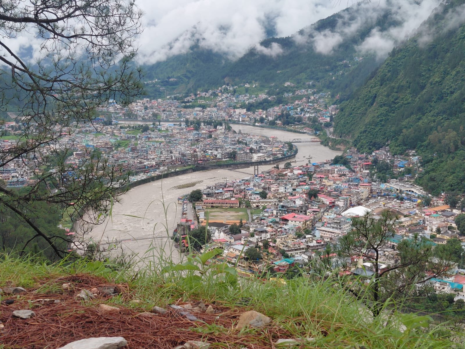
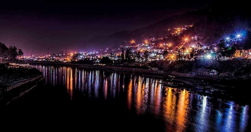
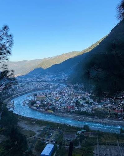
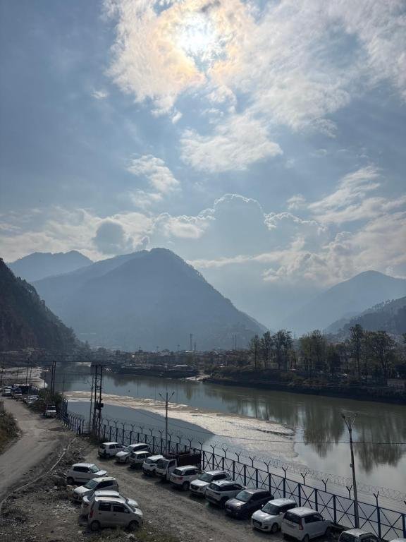
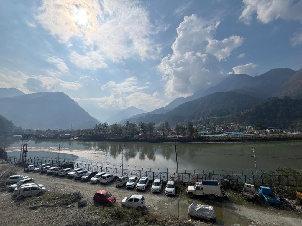
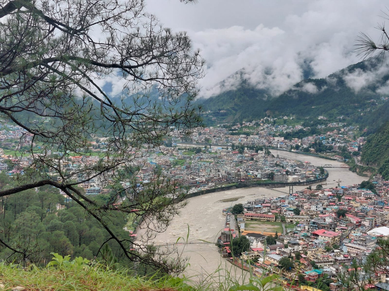
There is a particular hour in Uttarkashi — just after the temple bells finish their morning round and before the tea stalls on the Bhagirathi’s bank get crowded — when the town feels less like a destination and more like a doorway. Mist sits low over the river. Prayer flags shift on the pedestrian bridge. Somewhere up the valley, a truck loaded with apples from Harsil grinds down through the gears. This is Uttarkashi, India, the district headquarters of Uttarkashi Uttarakhand, sitting at roughly 1,150–1,165 metres above sea level on the banks of the Bhagirathi River in the Garhwal Himalayas.
Most people arrive here by accident of geography rather than intention. Uttarkashi sits directly on the road to Gangotri, one of the four shrines of the Char Dham, so millions of pilgrims pass through it every year on their way further up the valley. But treating Uttarkashi as a fuel stop is one of the most common mistakes a traveler to this part of the Himalayas can make. This town — and the vast, thinly populated district that shares its name — is a destination in its own right: a place of ancient Shiva temples, glacier-fed rivers, alpine meadows called bugyals, cold-desert valleys that look like Ladakh, and some of the most rewarding beginner-to-advanced trekking routes in the entire Indian Himalaya.
Uttarkashi is famous for three overlapping identities. It is a pilgrimage town, revered as the spiritual double of Varanasi and known to devotees as the place Lord Shiva himself is said to inhabit. It is a mountaineering capital, home to the Nehru Institute of Mountaineering, which has trained generations of Indian climbers. And it is a gateway, the last major town before the road climbs toward Gangotri, Harsil, and the high, restricted valleys near the Indo-Tibetan border. Add to this a wildlife-rich national park, some of the country’s most photogenic high-altitude lakes and meadows, and a slow-paced Garhwali culture that has changed remarkably little, and you start to understand why seasoned Himalayan travelers rate Uttarkashi district as one of Uttarakhand’s most complete destinations — not a stopover, but a reason to come back.
This guide is built to be the only page you need before, during, and after your trip to Uttarkashi. It covers the town’s deep history and religious significance, every major attraction in and around it, trekking routes with distances and difficulty ratings, weather and altitude tables, road distances from major cities, where to stay, what to eat, sample itineraries from two days to a full week, and more than thirty commonly asked questions. Wherever something has changed recently — road conditions after the 2025 Dharali disaster, current park permit rules, Char Dham registration — we’ve noted it, because a travel guide to the Himalayas is only useful if it’s current.
Why Is Uttarkashi Called “Kashi of the North”?
If you ask a local why their town carries the same name as one of Hinduism’s seven holiest cities, they won’t point you to a plaque or a museum. They’ll point across the river, toward a hill, and start describing a geography that maps onto Varanasi so precisely it feels almost engineered.
The Meaning of the Name
Uttarkashi literally translates to “Kashi of the North” — Uttar meaning north, and Kashi being the ancient name for Varanasi, the city on the Ganga in Uttar Pradesh regarded as Shiva’s earthly home. The town is also known locally as Shivnagri (“the city of Shiva”) and, in some older texts, as Somya Kashi. This isn’t a marketing name invented for tourism — it’s a centuries-old identity rooted in a genuine topographical resemblance between the two towns, and in the belief that Uttarkashi is a spiritual reflection of Varanasi, transplanted into the mountains.
A Geography That Mirrors Varanasi
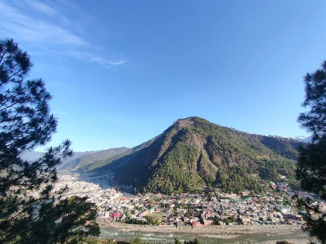
Just as Varanasi sits on the Ganges beside a hill called Varunavat, at the confluence of two rivers named Varuna and Asi, with a Manikarnika Ghat and a Shiva temple called Kashi Vishwanath at its centre, Uttarkashi sits on the Bhagirathi — regarded in Hindu tradition as the Ganga’s own mountain form — beside its own Varunavat hill, at the meeting point of streams that carry the same names, Varuna and Asi, with its own Manikarnika Ghat and its own Kashi Vishwanath Temple in the middle of town. This is not a loose comparison drawn by travel writers; it is the reason pilgrims have treated Uttarkashi as the Kashi of the mountains for generations, and it is why, before the road to Gangotri existed in its modern form, this town functioned as a preparatory pilgrimage stop — a place where devotees paused, bathed, and sought blessings before continuing on toward the source of the Ganga.
The Kashi Vishwanath Temple and Its Legends
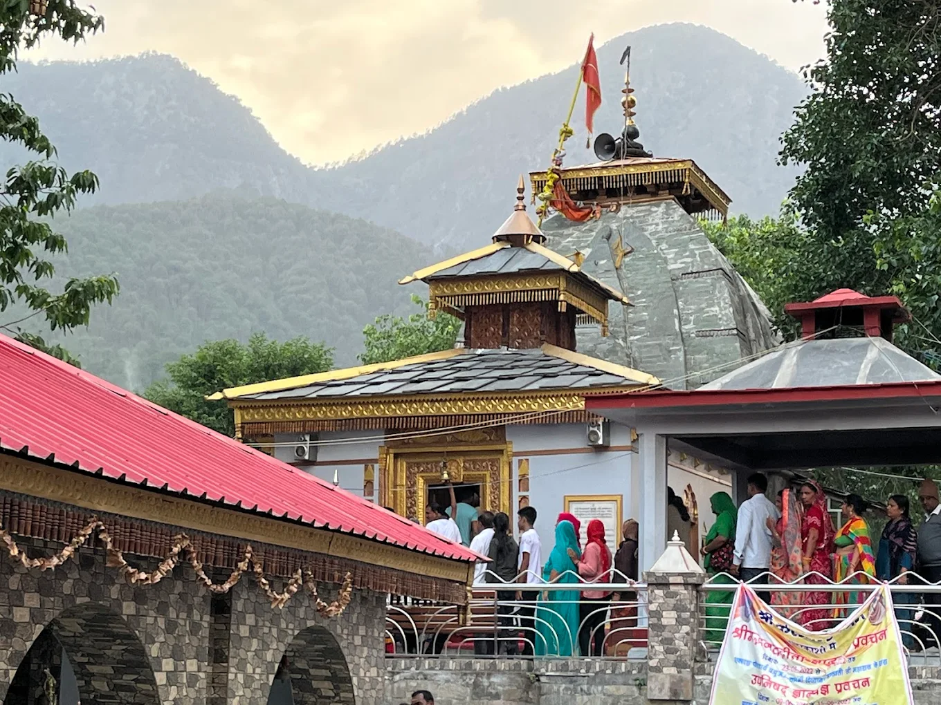
At the spiritual centre of this identity is the Kashi Vishwanath Temple, an ancient shrine dedicated to Shiva that stands on the Bhagirathi’s bank in the middle of the old town. Its precise age is impossible to pin down — its origins are described in local tradition as reaching back to the era of the Puranas — but its stories are told with total conviction by priests and pilgrims alike. The temple’s most distinctive physical feature is its Shivling, which sits not in the exact centre of the sanctum but tilted noticeably toward the south, and this quirk has its own legend attached to it.
The most repeated story concerns the sage Markandeya, who was destined, according to a curse, to die at the age of sixteen. Markandeya meditated with such devotion at this very spot that when Yama, the god of death, arrived to claim him, the sage embraced the Shivling so tightly that Shiva himself intervened and spared his life — an event devotees believe permanently shifted the lingam off-centre. A second tradition credits the temple’s establishment to Sage Parashurama, who is said to have performed penance here after his campaigns against the Kshatriya clans, seeking to calm his anger in the stillness of the Bhagirathi valley. A third belief, repeated by priests to this day, holds that if Varanasi were ever submerged, the deity of Kashi Vishwanath would relocate here — making Uttarkashi not just a symbolic double of Kashi, but its designated successor.
Shiva, the Bhagirathi, and the Idea of a Northern Kashi
The Bhagirathi River is central to why this identification carries weight beyond a shared place name. In Hindu cosmology, the Ganga that flows through Varanasi and the Bhagirathi that flows through Uttarkashi are the same sacred river in different reaches of its journey — the Bhagirathi is the Ganga’s Himalayan form, named for King Bhagiratha, who is said to have performed centuries of penance to bring the goddess Ganga down from the heavens to liberate his ancestors. Every temple, ghat, and ritual in Uttarkashi draws its sanctity from this same river, which means a pilgrim bathing at Uttarkashi’s ghats is, in the traditional understanding, bathing in the very same Ganga that flows past the temples of Varanasi — just closer to her source, and closer to the god most associated with her.
This is also why Uttarkashi carries such weight for Shaivite pilgrims specifically. The Kashi Vishwanath Temple’s dedication to Shiva, combined with the town’s role as the last major settlement before Gangotri — itself linked to Shiva through the legend of the Ganga descending through his matted hair — makes Uttarkashi feel like a natural threshold. Many pilgrims still choose to visit the Kashi Vishwanath Temple, take a dip near the Manikarnika Ghat, and only then continue toward Gangotri, treating the town exactly as its name suggests: a northern gateway into the same devotional world as Varanasi, but set against glaciers instead of plains.
An Ancient Trade and Pilgrimage Crossroads
Long before it became a fixed stop on the modern Char Dham circuit, Uttarkashi was already a meeting point of trade and faith. Every January, the town hosts the Magh Mela, a fair timed to Makar Sankranti that traces its roots to a centuries-old trans-Himalayan trade fair once known as “Bada Haat,” when Tibetan traders would arrive with wool, rock salt, gold, and herbs, exchanging them for grain grown in the valleys below. The Mahabharata’s Adi Parva is even said to place the Pandavas in this valley during their exile — a claim locals repeat with the same casual certainty they use to describe the tilted Shivling. Whether or not you take the epic connection literally, the fact that Uttarkashi has functioned as a crossing point for pilgrims, traders, sadhus, and mountaineers for so many centuries is not in dispute — it’s written into the layout of the town itself, in its ghats, its ashrams, and its temple bells that still call people down to the river every morning, exactly as they would in the Kashi four hundred kilometres to the south.
Overview of Uttarkashi
History
Modern Uttarkashi district was carved out on 24 February 1960 from the Rawain and Uttarkashi parganas of the former princely state of Tehri Garhwal, shortly after Tehri Garhwal merged into independent India. Its creation as a distinct border district reflected its strategic position along the frontier with Tibet and Himachal Pradesh, and its importance only grew as Gangotri and Yamunotri — two of the four Char Dham shrines — fell within its boundaries.
The district’s more recent history has been shaped by two seismic events, one literal and one social. On 20 October 1991, a magnitude 6.8 earthquake centred near Uttarkashi killed close to 768 people, injured thousands more, and destroyed or damaged over 40,000 homes across the Garhwal Himalaya — one of the deadliest earthquakes the region has recorded and a event still referenced in local memory and in national seismic-safety planning. More recently, on 5 August 2025, a catastrophic cloudburst-triggered flash flood tore through the Kheer Ganga catchment above the village of Dharali, near Harsil, killing and leaving missing dozens of people and burying part of the Dharali market under debris. The Gangotri National Highway was severely damaged between Harsil and Dharali; the Army, ITBP, NDRF and SDRF ran a multi-week rescue and rebuilding operation, and the Gangotri Yatra resumed roughly five weeks later, in September 2025, once road connectivity was restored. Reconstruction of the highway and the affected settlements has continued into 2026, and travelers heading toward Harsil, Dharali, and Gangotri should always check current road status before departure (see Travel Tips).
Older history sits more gently on the district: centuries of pilgrim traffic to Gangotri and Yamunotri, a long history as a Indo-Tibetan trade corridor through valleys like Nelong and Jadung (severed after the 1962 Sino-Indian war and only reopened to tourism in 2015), and a lineage of Garhwali kingdoms and temple-building that predates any of it.
Geography and Location
Uttarkashi district sits in the northwestern corner of Uttarakhand, in the Garhwal Himalaya, bordered by Himachal Pradesh to the northwest, the Tibet Autonomous Region of China to the north and northeast, and the districts of Tehri Garhwal, Dehradun, Chamoli, and Rudraprayag along its other edges. The district covers roughly 8,016 square kilometres, making it one of the largest in Uttarakhand by area — and one of the least densely populated, since a huge proportion of that land is high-altitude wilderness, glacier, and protected forest.
Uttarkashi town itself sits at approximately 1,150–1,165 metres (about 3,800 feet) above sea level on the Bhagirathi’s true right bank, though district elevations range enormously — from valley towns around 1,200 metres up to glaciated peaks in the Bhagirathi Massif that exceed 6,800 metres. This range is the district’s defining geographic fact: within a single day’s drive, you can move from subtropical river valley to alpine meadow to genuine high-altitude cold desert.
Altitude at a Glance
| Location | Approximate Altitude |
|---|---|
| Uttarkashi town | 1,150–1,165 m (3,770–3,820 ft) |
| Maneri | 1,220 m (4,000 ft) |
| Dharali / Harsil | 2,600–2,700 m (8,500–8,900 ft) |
| Barsu / Raithal (Dayara base) | 1,800–2,400 m (5,900–7,900 ft) |
| Dayara Bugyal meadow | 3,048–3,639 m (10,000–11,900 ft) |
| Dodital Lake | 3,024–3,307 m (9,920–10,850 ft) |
| Gangotri town | 3,415 m (11,204 ft) |
| Nelong / Jadung Valley | 3,400–3,824 m (11,150–12,550 ft) |
| Kedartal | 4,912 m (16,115 ft) |
| Bhagirathi I (highest peak) | 6,856 m (22,493 ft) |
Landscape and Climate
Geographically, the district falls into three broad bands. The lower valleys around Uttarkashi town and along the Bhagirathi as far as Bhatwari are subtropical to warm-temperate, terraced with fields and pine and oak forest. The middle Himalaya, from around Harsil up through Bhaironghati, brings in deodar forests, apple orchards, and the first genuinely alpine scenery. Beyond that, the high Himalaya — Gangotri, Nelong Valley, Kedartal, the upper reaches of Dayara and Dodital — is a world of meadows, glaciers, cold-desert valleys, and peaks that stay snow-bound most of the year. Uttarkashi town’s own climate is classified as warm-temperate with a pronounced monsoon; see the full weather section below for month-by-month detail.
Culture, People, and Language
The population of Uttarkashi district is overwhelmingly Garhwali — part of the broader Pahari (hill) culture of Uttarakhand — with distinct pockets of Bhotia communities in the higher valleys near the Tibet border (historically traders and herders) and Jaunsari and related Mahasu Pahari-speaking communities in the district’s western tehsils. Hindi is the official language and the one you’ll hear in shops and hotels; Garhwali is the language of the home, the fields, and the folk songs you’ll hear drifting from village courtyards during festival season.
Life in most of the district still runs on an agricultural and pastoral calendar — terraced farming of wheat, rice, and millets in the valleys, and seasonal migration of livestock up to high-altitude bugyals like Dayara in summer. This rhythm shows up in the district’s festivals: the Magh Mela in January, timed to Makar Sankranti, which draws pilgrims for a ritual dip in the Bhagirathi and traces its roots to the old India-Tibet trade fair; the Anduri Utsav, or Butter Festival, celebrated at Dayara Bugyal in honour of the region’s pastoral, cattle-herding traditions; and countless smaller village fairs (melas) tied to local deities, harvests, and the opening and closing of high-altitude grazing grounds.
Economy
Uttarkashi’s economy runs on three pillars: pilgrimage and tourism (the single largest driver, given the district’s position on the Gangotri and Yamunotri legs of the Char Dham Yatra), agriculture and horticulture (apple orchards around Harsil are locally famous, alongside terraced grain and vegetable farming in the lower valleys), and hydropower, with the Maneri-Bhali Hydroelectric Project — built in two stages on the Bhagirathi — supplying a meaningful share of the district’s employment and revenue. Handicrafts, wool weaving, and small-scale trade round out the picture, particularly in villages that once thrived on the now-restricted trade routes toward Tibet.
Forests, Flora, and Fauna
Roughly nine-tenths of Uttarkashi district is under forest, snow, or high-altitude pasture, and this is reflected in an extraordinary range of plant and animal life across its elevation bands. Lower slopes are covered in chir pine and broadleaf forest; the middle elevations — the zone most treks pass through — are dominated by oak, deodar, maple, and rhododendron, which turns entire hillsides red and pink through April; and above the treeline, the district opens into bugyals, the high-altitude meadows that are one of Garhwal’s signature landscapes, rich in medicinal herbs long used in Ayurveda.
Fauna ranges just as widely by altitude. Lower and mid-elevation forests support Himalayan langur, wild boar, leopard, and a huge range of birdlife. Higher up, inside Govind Pashu Vihar National Park and Gangotri National Park, you’re in classic snow leopard territory, alongside Himalayan brown bear, Himalayan black bear, musk deer, bharal (blue sheep), serow, and Himalayan tahr. Birdwatchers should have the Himalayan monal (Uttarakhand’s state bird), koklas and cheer pheasant, western tragopan, lammergeier (bearded vulture), golden eagle, and Himalayan snowcock on their list — the district’s parks alone host around 150 recorded bird species. Full detail is in the Wildlife section below.
Photography, Road Trips, and Eco-Tourism
Uttarkashi rewards photographers at every altitude: the ghats and temple spires of the old town at dawn, the terraced green valleys around Bhatwari and Netala, the apple-blossom season in Harsil, the stark cold-desert light of Nelong Valley, and the reflected peaks of Dodital and Kedartal. The Uttarkashi–Gangotri road (NH34) is itself one of Uttarakhand’s classic Himalayan road trips, threading through Bhatwari, Gangnani, Jhala, Harsil, and Bhaironghati before reaching Gangotri, with pull-offs and viewpoints at almost every bend.
Because so much of the district sits inside ecologically sensitive protected areas — Govind National Park and Wildlife Sanctuary, Gangotri National Park, and the Inner Line border zone around Nelong Valley — responsible, low-impact travel isn’t optional here; it’s the reason these landscapes have stayed intact. Carry out everything you carry in, avoid single-use plastic (many checkpoints now enforce this directly), stick to marked trails in meadows and near lakes to protect fragile alpine vegetation, use registered guides and porters from local villages, and treat homestays as your default lodging choice over larger hotels wherever they’re available — the direct economic benefit stays in the community that is maintaining the trail and the forest around it.
Pilgrimage and Adventure Tourism, Side by Side
What makes Uttarkashi genuinely unusual among Himalayan districts is how comfortably its identity as a pilgrimage corridor sits alongside its identity as an adventure-sports hub. The same town that sends thousands of Char Dham pilgrims north toward Gangotri every summer is also home to the Nehru Institute of Mountaineering, one of Asia’s most respected climbing schools, and is the trailhead district for treks ranging from family-friendly meadow walks to serious multi-day mountaineering approaches. You can spend a morning in temple courtyards and an afternoon being fitted for crampons, and neither experience feels out of place.
Top Attractions in Uttarkashi Town
Kashi Vishwanath Temple
History and importance: The spiritual heart of the town, discussed in depth above. This ancient Shiva temple, built largely in traditional Himalayan wood-and-stone style, is the reason Uttarkashi carries its name and its reputation. Highlights: the distinctively tilted Shivling; a large trishul (trident) in the courtyard, said to be extremely old and remarkably light for its size, which many visitors try to lift as an act of devotion; subsidiary shrines to Parvati, Ganesh, Kartikeya, and Nandi. Photography: the temple is at its most atmospheric in the very early morning, during the aarti, when the courtyard is lit by butter lamps and largely free of the midday pilgrim crowds. Visitor tips: dress modestly, remove footwear before entering, and expect a significant rise in footfall during Shivratri and the Magh Mela. Nearby: Manikarnika Ghat, the main town market, and Joshiyara across the river. Approximate visit duration: 45 minutes to 1 hour.
Shakti Temple
A striking temple in Uttarkashi town centred on a massive ancient iron trident (trishul) rather than a conventional idol — one of the town’s most photographed religious landmarks. Importance: dedicated to Shakti, the divine feminine energy, and closely associated in local belief with the same protective power that surrounds the Kashi Vishwanath Temple nearby. Visitor tips: it’s a short walk from Kashi Vishwanath, so the two are almost always visited together. Approximate visit duration: 20–30 minutes.
Kuteti Devi Temple
Perched on Hari Parvat hill across the Bhagirathi from the main town, this temple dedicated to Kuteti Devi (regarded as a form of Durga) is reached by a short, gradual uphill walk from a footbridge. Legend: local tradition connects the temple to a Maharaja of Kota who, after losing a bag of money on his way to Gangotri and having it miraculously returned, is said to have married his daughter into a local family devoted to the goddess — a story still told by the temple’s priests. Highlights: panoramic views over the town and the river valley, which make the modest climb worthwhile even for visitors more interested in scenery than ritual. Best time to visit: cooler morning hours; October to May generally offers the clearest weather. Nearby: Kashi Vishwanath Temple, the Nehru Institute of Mountaineering. Approximate visit duration: 1–1.5 hours round trip including the walk.
Nehru Institute of Mountaineering (NIM)
Founded on 14 November 1965 in honour of Jawaharlal Nehru, India’s first Prime Minister and an avid mountain enthusiast, NIM sits on a hill overlooking the town at the confluence of the Bhagirathi and a smaller tributary. It is recognised by the UIAA (International Federation for Climbing and Mountaineering) as India’s benchmark mountaineering institute, and its Basic and Advanced Mountaineering Courses have trained generations of Indian climbers, several of whom have gone on to summit Everest and other 8,000-metre peaks. Highlights for visitors: a small mountaineering museum documenting Himalayan expedition history, a memorial to NIM’s own climbers and instructors (including those lost in a 2022 avalanche on Draupadi Ka Danda II), equipment and training grounds, and sweeping views over the Bhagirathi valley. Visitor tips: casual visitors can usually walk the grounds and museum; if you want to actually train here, courses need to be booked well in advance directly through NIM. Nearby: the town centre, Kuteti Devi Temple. Approximate visit duration: 1–2 hours for a casual visit.
Bhagirathi River and the Ghats
The Bhagirathi isn’t a single attraction so much as the organising element of the entire town — every temple, ghat, and neighbourhood in Uttarakashi orients itself around this glacier-fed river, which begins at Gaumukh near Gangotri and eventually merges with the Alaknanda at Devprayag to form the Ganga proper. Highlights: the ghats near the Kashi Vishwanath Temple, popular for a ritual dip and for simply sitting with a chai and watching the river; the pedestrian suspension bridge connecting the main town to Joshiyara and the Kuteti Devi hillside; and the confluence points where smaller streams (the local Varuna and Asi Ganga) join the main river, echoing Varanasi’s own sacred geography. Photography: the golden hour just before sunset, when the river catches the last light against the darkening hillside, is consistently the best window.
Markets, Old Town, and Joshiyara
Uttarkashi’s Main Bazaar is a compact, walkable strip of shops selling everything from trekking gear rentals and woollens to religious articles and Garhwali handicrafts — genuinely useful for last-minute supplies before heading up to Gangotri, Dayara, or Dodital. Across the river, Joshiyara — once a separate village, now effectively a neighbourhood of the town — is worth a short visit for the Kaleshwar Mandir, a Shiva temple with its own devoted local following, and for a quieter, more residential feel than the main bazaar.
Hidden Gems and Nearby Villages
A short drive or walk from the town centre opens up a handful of lesser-visited spots that most Char Dham pilgrims never see: Gyansoo and Palla Gyansoo, old suburbs on the road toward New Tehri with a distinctly older village character; Matli, a short distance from town, where a battalion of the Indo-Tibetan Border Police is stationed and which serves as a helipad point during emergencies; and the Maneri Dam and reservoir (detailed below), which functions as both an engineering landmark and an easy half-day picnic and photography spot.
Maneri Dam
A concrete gravity dam on the Bhagirathi, roughly 8.5 km east of Uttarkashi at about 1,220 metres altitude, forming Stage I of the Maneri-Bhali Hydroelectric Project. Commissioned in 1984, the dam diverts water through a tunnel to the 90 MW Tiloth Power Plant downstream. Highlights: the turquoise reservoir set against green hillsides, popular for photography and a quiet half-day trip; Stage II of the project (the Bhali Dam) sits further downstream near Joshiyara. Visitor tips: there are no formal visitor facilities at the dam itself, so treat it as a scenic stop rather than a full attraction — best combined with a drive toward Netala or Gangnani. Approximate visit duration: 30–45 minutes.
Best Places Near Uttarkashi
The real richness of a trip to Uttarkashi district reveals itself once you leave the town and follow the Bhagirathi upstream, or turn off toward one of the side valleys. Here’s what’s worth your time, roughly in the order you’d encounter them heading north from Uttarkashi town.
Netala, Tiloth, and Jhala — The Waypoint Villages
Small settlements strung along NH34 between Uttarkashi and Gangotri, these villages rarely get their own paragraph in most guides, but they’re worth knowing about. Tiloth, right at the edge of Uttarkashi town, hosts the Tiloth Power Plant that receives water diverted from the Maneri Dam. Netala and Jhala, further up the valley, are classic Himalayan roadside hamlets — a good place to stop for tea, watch the river narrow and quicken, and get a first sense of the terrain changing from broad valley to tighter gorge as you climb toward Harsil.
Bhatwari
The headquarters of Bhatwari tehsil (the district’s largest by both area and population) and a natural stopping point on the Gangotri road. Bhatwari sits close to the trailhead for the Assi Ganga valley treks (including Dodital) and is also close to the epicentre region of the 1991 earthquake, a fact still occasionally discussed by older residents. It’s a practical rather than glamorous stop — fuel, food, and a base for treks branching off the main highway.
Gangnani
Known for its natural hot-water spring, Gangnani is a popular pilgrim halt roughly midway between Uttarkashi and Gangotri. Many Char Dham travelers stop here specifically to bathe in the warm sulphur spring before continuing the journey — a welcome contrast after hours on a winding mountain road. It’s also the access point for the Nachiketa Tal trek described below.
Nachiketa Tal
A high-altitude lake at roughly 2,450 metres, named after Nachiketa, the young seeker from the Katha Upanishad who questioned Yama, the god of death, about the nature of the soul. Reached via a moderate trek through dense rhododendron and oak forest from near Gangnani (or combined with the Dodital route), Nachiketa Tal is one of the district’s most serene, least-crowded lakes — a good half-day to full-day add-on for travelers who’ve already made it to Gangnani.
Raithal and Agora — Gateway Villages
Raithal, at about 1,800 metres, is the primary base village for the Dayara Bugyal trek, and one of the more charming, self-contained Himalayan villages in the district, with terraced fields and wood-and-stone houses climbing the hillside. Agora (also spelled Agoda), the last village in the Assi Ganga valley before the trail becomes true wilderness, serves the same gateway function for the Dodital trek — since the road now reaches Agora, the walk to Dodital has become noticeably shorter and more accessible than it was a decade ago.
Dayara Bugyal
One of the largest and most beautiful high-altitude meadows in Uttarakhand, and — deservedly — one of the most recommended first Himalayan treks in India. Full trekking details are in the dedicated section below; as a destination, Dayara offers rolling grasslands at 3,000–3,800 metres framed by views of Bandarpunch, Srikanth, and the Gangotri range of peaks, a small forest lake (Barnala Tal / Gui Lake) en route, and — in winter — some of the most accessible snow-trekking and beginner ski terrain in the country.
Dodital
A pristine, deodar-ringed lake at roughly 3,024–3,307 metres in the Assi Ganga valley, revered as the birthplace of Lord Ganesha and home to a small lakeside temple dedicated to him. Dodital is also one of the very few Himalayan lakes known for Himalayan trout — introduced from Scotland by the British in the 1860s and still found in its waters today. Full trekking details are below.
Har Ki Dun
Slightly further afield but firmly within Uttarkashi district, the Har Ki Dun valley — “the Valley of the Gods” — lies inside Govind Pashu Vihar National Park, accessed via the village of Sankri. Its cradle-shaped valley, views of the Swargarohini and Bandarpunch peaks, and connection to Mahabharata legend (locals believe the Pandavas passed this way en route to heaven) make it one of the most storied treks in the Garhwal Himalaya. See Trekking for details.
Harsil
A picture-perfect Himalayan army-cantonment town at around 2,600 metres, set among towering deodar forest on the Bhagirathi’s bank. Harsil is famous for its apple orchards (introduced by the Anglo-Swiss trader Frederick “Pahari” Wilson in the 19th century, whose legacy still shapes the valley’s economy), its scenic beauty — several sequences of Bollywood films have been shot here — and its role as a base for exploring Mukhba, Dharali, and Nelong Valley. The neighbouring village of Bagori, with its blend of Hindu and Bhotia cultural influences, is worth a wander for anyone interested in the district’s border-community heritage.
Dharali
A small market village a short distance from Harsil, on the pilgrim route to Gangotri, and the site of the devastating flash flood of 5 August 2025, in which a cloudburst over the Kheer Ganga catchment sent a wall of water and debris through the village market, killing and leaving missing dozens of residents and destroying homes, hotels, and a stretch of the national highway. Reconstruction has continued through 2026, and the Gangotri Yatra route through Dharali has reopened, but travelers should treat this as an evolving situation — check current road conditions before planning a trip through this stretch, and approach the area with the sensitivity it deserves; this is a community still rebuilding.
Mukhba (Mukhwa)
The winter seat of Goddess Ganga — every year when Gangotri Temple closes for the winter (traditionally around Diwali), the deity’s idol is ceremonially carried down to Mukhba, where it remains until the temple reopens around Akshaya Tritiya in spring. A short trek or drive from Dharali, Mukhba offers a quieter, more intimate darshan experience than the crowded high season at Gangotri itself, along with genuine insight into how the Char Dham tradition adapts to the Himalayan winter.
Gangotri
The source-shrine of the Ganga and one of the four Char Dham temples, sitting at 3,415 metres near the snout of the Gangotri Glacier. The temple itself, along with the nearby Bhagirathi Shila (where King Bhagiratha is said to have performed his penance) and the trailhead for the Gaumukh-Tapovan trek, make Gangotri both a pilgrimage destination and an adventure base in its own right. Read our dedicated Gangotri Guide for temple timings, the Gaumukh trek, and full pilgrimage planning.
Bhaironghati and Gartang Gali
A short distance beyond Harsil at around 2,806 metres, Bhaironghati marks the junction where the road to Nelong Valley splits from the main Gangotri highway, and it’s also the access point for Gartang Gali — a roughly 150-year-old wooden stairway carved directly into a vertical cliff face above the Jadh Ganga gorge, built by Peshawari traders as part of the historic India-Tibet trade route and restored and reopened to visitors in 2021. Walking it is equal parts historical curiosity and genuine (if brief) thrill, given the sheer drop below the wooden planking.
Nelong Valley and Jadung
Often described as the “Ladakh of Uttarakhand,” Nelong Valley is a stark, high-altitude cold-desert landscape inside Gangotri National Park, close to the Indo-Tibetan border, that was closed to civilians for decades after the 1962 war and reopened to tourism in 2015. Its cold-desert ecology supports species like Himalayan blue sheep (bharal) and, at the very edges of luck, snow leopard. Jadung, roughly 16 km beyond Nelong village, is a ghost village of abandoned wooden houses — the last physical trace of the Jadh Bhotiya trading community that lived and worked this route before the border closed.
Because Nelong and Jadung sit inside an Inner Line Permit zone, visiting requires advance paperwork: Indian nationals only, a permit obtained through the Sub-Divisional Magistrate’s office in Uttarkashi (typically alongside a Forest Department permit for Gangotri National Park), photocopies of ID for every traveler, and — because this is genuinely close to a sensitive international border — no overnight stay; everyone must return to the Bhaironghati checkpoint before evening. Explore our full Nelong Valley guide for the current step-by-step permit process.
Sukki Top
A high viewpoint and trekking destination near Harsil that, like Dharali, was affected by the August 2025 flash flood event (the twin flood that hit the region struck both Dharali and the Sukhi Top area). It’s slowly returning to the tourist circuit as the region rebuilds, and is worth checking current status on before planning a visit.
Kedartal
Technically a trek rather than a “place,” but worth flagging here for travelers scanning the map: Kedartal (“Shiva’s Lake”) sits at roughly 4,912 metres near the base of Thalay Sagar peak, reached via a demanding trail from Gangotri, and is covered in full in the trekking section next.
Trekking in Uttarkashi
Few districts in India offer this range of trekking difficulty within such a compact area — from a meadow walk a first-timer can complete comfortably to a technical, high-altitude approach that experienced mountaineers train for at NIM. All treks below start from villages within Uttarkashi district.
Popular Treks at a Glance
| Trek | Base Village | Distance (round trip) | Max Altitude | Difficulty | Duration | Best Season |
|---|---|---|---|---|---|---|
| Dayara Bugyal | Raithal / Barsu | ~18–22 km | 3,639–3,800 m (Bakaria Top) | Easy–Moderate | 3–5 days | Mar–Jun, Sep–Dec (winter for snow trek) |
| Dodital | Agora (Sangamchatti) | ~18–22 km | 3,024–3,307 m | Easy–Moderate | 3–4 days | Apr–Nov |
| Dodital–Darwa Pass–Yamunotri | Agora | ~40+ km | 4,150 m (Darwa Top) | Moderate | 6–7 days | May–Jun, Sep–Oct |
| Har Ki Dun | Sankri | ~44–48 km | 3,500–3,566 m | Easy–Moderate | 6–7 days | Mar–Jun, Sep–Dec |
| Kedartal | Gangotri | ~26 km | 4,912 m | Moderate–Difficult | 5–6 days | May–Jun, Sep–Oct |
| Gaumukh–Tapovan | Gangotri | ~48 km | 4,463 m (Tapovan) | Moderate–Difficult | 4–5 days | May–Jun, Sep–Oct |
| Nachiketa Tal | Gangnani | ~10 km | 2,453 m | Easy | 1–2 days | Mar–Jun, Sep–Nov |
| Gartang Gali | Bhaironghati | ~4–6 km | 2,900 m | Easy–Moderate | 1 day | May–Oct |
Distances and durations vary by operator and exact route; treat this table as a planning guide, and confirm current figures with your trek operator.
Trek Notes
Dayara Bugyal is the district’s flagship beginner trek — a well-marked trail through oak, maple, and rhododendron forest that opens dramatically onto rolling alpine grassland, with Bandarpunch, Srikanth, and the Gangotri range visible from the highest points. It’s graded Level 2 (easy) by most Indian trekking operators, making it a genuinely good first Himalayan trek, and it doubles as one of India’s most accessible winter snow-treks between December and March.
Dodital carries mythological weight as Ganesha’s traditional birthplace and offers a gentler gradient than its distance suggests, especially now that the road reaches Agora village. Trekkers with more time and better fitness can extend past the lake to Darwa Pass (4,150 m) and down toward Yamunotri, connecting two Char Dham-adjacent regions in a single multi-day trek.
Har Ki Dun is one of the oldest documented trekking routes in the Himalaya, following the Supin River through Govind National Park past the villages of Taluka, Osla, and Seema — settlements with genuinely old wood-carved architecture and their own Mahabharata-linked folklore. The gradient is gentle by Himalayan standards; the challenge is cumulative distance rather than steepness, which is why it’s popular with families whose children are old enough to walk 8–10 km a day.
Kedartal is a different order of trek entirely — moderate to difficult, with steep, sometimes landslide-prone sections, recommended only for trekkers with prior high-altitude experience. The reward is a glacial lake at nearly 4,900 metres directly beneath Thalay Sagar’s dramatic granite spire, arguably the single most cinematic high-altitude lake in the district.
Gaumukh-Tapovan starts from Gangotri and follows the Bhagirathi upstream to Gaumukh, the actual snout of the Gangotri Glacier and the river’s physical source, before climbing to the meadow of Tapovan beneath Shivling peak. This route falls inside Gangotri National Park and requires a Forest Department permit (see below).
Permits
- Gangotri National Park (covers Gaumukh-Tapovan, and part of the approach to Kedartal and Nelong Valley): entry fee and mandatory permits, obtainable online via the state’s Pathik portal or in person at the Uttarkashi Forest Office; the Gaumukh-Tapovan trail has a daily trekker cap. The park is typically open from 1 April to 30 November each year, closed through winter.
- Govind Pashu Vihar National Park (covers Har Ki Dun and Kedarkantha-adjacent routes): permits required, arranged through the Forest Department, usually via your trek operator.
- Nelong Valley / Jadung / Gartang Gali: Inner Line Permit required (Indian nationals only), issued by the SDM’s office in Uttarkashi.
- Foreign nationals should always check current permit rules directly with the Uttarakhand Forest Department or a registered local operator before finalising plans, as restricted and protected-area rules for international travelers are updated periodically.
Fitness, Altitude, and Safety
Most treks in this list top out between 3,000 and 5,000 metres, which puts altitude sickness (AMS) squarely in the picture even on the “easy” routes once you’re above 3,500 m. Build in acclimatisation days on any trek above 3,500 metres, drink far more water than feels necessary, avoid alcohol during the trek, and know the early symptoms of AMS (headache, nausea, disturbed sleep, loss of appetite) well enough to descend immediately if they worsen rather than push through. A basic level of cardiovascular fitness — the ability to walk 10–15 km a day on undulating terrain — is enough for Dayara Bugyal, Dodital, or Har Ki Dun; Kedartal and Gaumukh-Tapovan reward prior high-altitude trekking experience.
Packing Essentials
Layering is everything in this terrain: a moisture-wicking base layer, a fleece or light insulating mid-layer, and a windproof/waterproof outer shell will cover you from warm valley afternoons to below-freezing high-camp nights, even outside winter. Add broken-in trekking boots, wool socks, a warm hat and gloves, trekking poles (genuinely useful on the steeper descents), a headlamp, a reusable water bottle or hydration bladder with a way to purify water, sun protection (UV exposure is intense above 3,000 m even in cold weather), and any personal medication, including something for altitude-related headaches. In winter, add a proper down jacket, gaiters, and microspikes or crampons for snow-covered trails like Dayara Bugyal in December through March.
Adventure Activities Beyond Trekking
- Camping: Riverside and meadow camping is available across the district, from organised campsites near Harsil and Sangamchatti to high-altitude trek camps at Dayara, Dodital, and Kedartal.
- Rock climbing and mountaineering training: The Nehru Institute of Mountaineering runs structured courses (Basic, Advanced, Search & Rescue, and instructor-level) for both first-timers and experienced climbers, using training walls and nearby rock faces around Uttarkashi.
- River activities: The Bhagirathi’s upper reaches are generally too fast and cold for casual rafting compared to the gentler stretch around Rishikesh, but riverside walks, photography, and quiet fishing spots (permit-dependent) are popular around Uttarkashi and Maneri.
- Mountain biking: The Uttarkashi–Gangotri highway and the network of village roads around Bhatwari, Netala, and Dunda are increasingly used by touring cyclists, though steep gradients and thin, winding traffic mean this is for experienced riders only.
- Nature walks and bird watching: The forested trails around Dodital, Dayara, and Har Ki Dun are excellent for spotting Himalayan monal, pheasants, and raptors, especially in the early morning.
- Village tourism and homestays: Raithal, Agora, Bagori, Osla, and Sankri all offer genuine homestay experiences that put a portion of tourist spending directly into the household hosting you — one of the most meaningful ways to experience Garhwali and Bhotia culture up close.
Wildlife and National Parks
Uttarkashi district contains two major protected areas, both central to the region’s conservation story.
Gangotri National Park stretches from around Gangotri town up to the Gangotri Glacier and shares its high-altitude terrain with the Nelong Valley cold-desert zone. It protects snow leopard, Himalayan brown bear, blue sheep (bharal), Himalayan tahr, and — at the birding level — species like the golden eagle and Himalayan snowcock. The park is open seasonally, typically from 1 April to 30 November, with permits required for treks like Gaumukh-Tapovan.
Govind Pashu Vihar National Park and Wildlife Sanctuary, established in 1955 and covering roughly 958 square kilometres in the district’s western reaches (encompassing the Har Ki Dun valley), is one of the sites selected for India’s national Snow Leopard Project. Altitude within the park ranges from about 1,400 to 6,323 metres, supporting around 15 species of large mammals — snow leopard, Himalayan black bear, brown bear, common leopard, musk deer, bharal, Himalayan tahr, and serow — and roughly 150 bird species, including the bearded vulture (lammergeier), one of the Himalaya’s most striking and threatened raptors, along with monal, koklas, and western tragopan pheasants.
Responsible wildlife viewing: Snow leopard sightings are rare and should never be the goal of a trip (guides who promise them are overselling); focus instead on the broader experience of birdlife, blue sheep herds, and the sheer scale of undisturbed alpine habitat. Stick to marked trails, keep noise to a minimum near meadows and water sources, never feed wildlife, and use local, licensed guides who know current wildlife movement and can help you spot species ethically, from a respectful distance.
Best time for wildlife viewing: April to June and September to November, when both parks are accessible and animal activity at lower, visible elevations is highest; the upper reaches see heavy snow and are largely inaccessible from December through March.
Best Time to Visit Uttarkashi
Uttarkashi town itself can genuinely be visited year-round — each season simply changes what you’ll be doing. Higher-altitude destinations like Dayara Bugyal, Dodital, and Gangotri have narrower windows, noted below.
Season-Wise Guide
| Season | Months | Weather | Advantages | Disadvantages | Recommended Activities |
|---|---|---|---|---|---|
| Spring | March–May | Mild, gradually warming; rhododendrons bloom | Clear skies, blooming forests, trails reopening after winter | Some higher trails still snow-patched in early March | Trekking (Dayara, Dodital), temple visits, photography |
| Summer | June (pre-monsoon) | Warm days, cool evenings | Best window for high-altitude treks and Gangotri Yatra opening | Char Dham crowds and traffic on the Gangotri road | Char Dham Yatra, Gaumukh-Tapovan, Kedartal |
| Monsoon | July–September | Heavy rainfall, landslide risk | Lush, dramatic green landscapes | Road disruptions, landslide and flash-flood risk, poor visibility | Not recommended for trekking or driving; short town visits only |
| Autumn | October–November | Crisp, clear, cool | Best visibility of the year, comfortable trekking temperatures | Nights get cold at altitude | Trekking, road trips, photography, wildlife viewing |
| Winter | December–February | Cold, snow at altitude | Snow trekking at Dayara Bugyal, quiet temple visits, dramatic scenery | Gangotri and high routes closed/inaccessible; some roads snowbound | Winter/snow trekking, Magh Mela (January), peaceful low-season travel |
Overall Recommendation
For most travelers — trekkers, photographers, families, and pilgrims alike — late March to mid-June and mid-September to November are the two sweet spots: stable weather, open high-altitude routes, and (outside the absolute peak Char Dham weeks) manageable crowds. Serious winter and snow-trekking enthusiasts should target late December to February specifically for Dayara Bugyal. Avoid the core monsoon months of July and August for anything beyond a stay in Uttarkashi town itself — this is also the period of highest landslide and flash-flood risk on the Gangotri highway, as the events of August 2025 near Dharali underscored.
Approximate Temperature Table (Uttarkashi Town)
| Month | Avg. Max (°C) | Avg. Min (°C) | Notes |
|---|---|---|---|
| January | 15–16 | 1–2 | Cold, occasional snow at higher elevations nearby |
| February | 17–18 | 3–4 | Still cold; clearing skies |
| March | 20–22 | 7–8 | Pleasant, rhododendrons starting to bloom |
| April | 24–26 | 11–12 | Warm days, ideal for trekking |
| May | 27–29 | 14–15 | Warm; good high-altitude trekking window |
| June | 28–30 | 17–18 | Hot in the valley; monsoon approaches late in the month |
| July | 26–28 | 18–19 | Wettest month; heavy rainfall |
| August | 25–27 | 18–19 | Continued monsoon rain |
| September | 24–26 | 15–16 | Rain tapering off; clearing by late month |
| October | 22–24 | 10–11 | Excellent visibility, comfortable trekking |
| November | 19–21 | 5–6 | Cold nights, clear days |
| December | 16–18 | 2–3 | Cold; snow possible at higher elevations |
Figures are approximate seasonal averages for Uttarkashi town (~1,160 m); expect noticeably colder conditions at Harsil, Gangotri, Dayara Bugyal, and other high-altitude destinations year-round, especially at night.
Uttarkashi Weather, Month by Month
Uttarkashi has a warm-temperate climate with a pronounced monsoon: average annual rainfall runs around 1,850–1,900 mm, heavily concentrated between July and September, and the driest month is reliably November.
| Month | Weather Summary | Rainfall | Clothing Recommendation |
|---|---|---|---|
| Jan–Feb | Cold, crisp, occasional light snow at town level | Low | Heavy woollens, down jacket, gloves, cap |
| Mar–Apr | Mild and improving, rhododendrons in bloom | Low–moderate | Light layers, a fleece for evenings |
| May–Jun | Warm by day, monsoon builds toward month-end | Increasing (esp. late June) | Breathable layers, light rain shell |
| Jul–Aug | Warm, humid, heavy monsoon rain | Very high (peak in July) | Rain gear essential; avoid high-altitude travel |
| Sep | Rain tapering, skies clearing by late month | Moderate, decreasing | Light layers, rain shell as backup |
| Oct–Nov | Crisp, dry, excellent visibility | Very low (driest: Nov) | Fleece and light jacket by day, warmer layers at night |
| Dec | Cold, first snow at higher elevations | Low | Heavy woollens, down jacket, thermals |
Snowfall in Uttarkashi town itself is occasional and light; genuine snow travel and snow trekking are concentrated at higher elevations — Dayara Bugyal, Harsil, and Gangotri — typically from December through March.
How to Reach Uttarkashi
By Air
The nearest airport is Jolly Grant Airport, Dehradun (DED), roughly 160–165 km from Uttarkashi, connected by regular domestic flights to Delhi and other major Indian cities. From the airport, hire a taxi directly to Uttarkashi (around 5–6 hours) or travel via Rishikesh.
By Train
The nearest major railheads are Rishikesh and Dehradun, both around 160–165 km from Uttarkashi and well connected to Delhi and other cities via regular express trains, including the Shatabdi Express. From either station, onward travel is by shared taxi, bus, or private cab.
By Road
Uttarkashi is well connected by NH34, a scenic but winding mountain highway. Buses (including Uttarakhand Transport Corporation services) and shared taxis run regularly from Dehradun, Rishikesh, and Haridwar, typically departing early in the morning.
Road Distance Table
| From | Approximate Distance | Approximate Travel Time |
|---|---|---|
| Dehradun | 145–150 km | 4.5–5.5 hours |
| Rishikesh | 160–165 km | 5–6 hours |
| Haridwar | 190–195 km | 6–7 hours |
| Delhi | 430–440 km | 9–11 hours |
| Mussoorie | ~130 km (via Suwakholi) | 4–4.5 hours |
| Gangotri | ~100 km | 4–5 hours |
| Yamunotri (via Barkot) | ~135 km | 5–6 hours |
| Harsil | ~75 km | 2.5–3 hours |
Driving Tips and Road Conditions
The road from Dehradun via Mussoorie and Suwakholi is shorter and more scenic than the Rishikesh route, though both are entirely viable; many travelers prefer starting from Rishikesh simply to avoid Dehradun’s city traffic. Beyond Uttarkashi, the road toward Gangotri narrows considerably and includes stretches that are still being repaired following the August 2025 Dharali flash flood — expect possible convoy systems, temporary one-way traffic, or shuttle arrangements around Harsil and Dharali during peak Yatra season, and always check same-day road status (via the Uttarakhand Police, your hotel, or local transport unions) before setting out on this stretch. Hire a driver experienced with mountain roads if you’re not driving yourself, avoid night driving on the upper stretches, and build in buffer time — what looks like a short distance on the map routinely takes far longer on switchback mountain roads.
Where to Stay in Uttarkashi
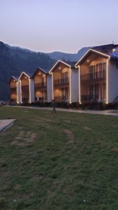
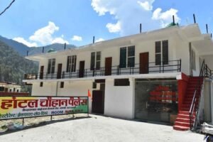
Uttarkashi town and its surrounding villages offer everything from basic pilgrim guesthouses to comfortable mid-range hotels and increasingly popular homestays, though genuine luxury properties are rare this far into the mountains — most travelers looking for five-star comfort base themselves in Dehradun or Rishikesh instead and treat Uttarkashi as a mountain-focused leg of the trip.
- Budget: Simple guesthouses and dharamshalas (pilgrim rest-houses) cluster near the Main Bazaar and around the bus stand, popular with backpackers and pilgrims alike; expect basic but clean rooms, squat or Western toilets depending on the property, and limited hot water hours.
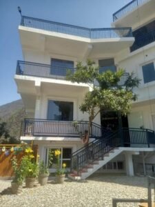
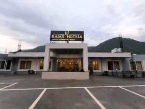
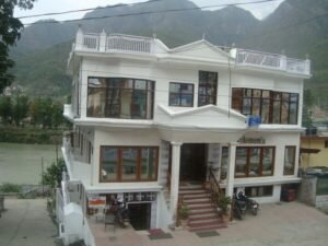
- Mid-range hotels: A good number of comfortable, well-reviewed hotels are concentrated along the Gangotri highway on the edge of town and near Joshiyara, offering private bathrooms, reliable hot water, and river or valley views — this is the sweet spot for most independent travelers and small families.
- Homestays: Increasingly the best option for anyone heading toward Dayara Bugyal, Dodital, or Har Ki Dun — villages like Raithal, Agora, Bagori, and Osla offer genuine family homestays that are both more atmospheric and more directly beneficial to the local economy than a hotel room.
- Camping: Available at organised sites near Harsil and Sangamchatti, and as part of most guided trek packages at high-altitude campsites (Dayara, Dodital, Kedartal).
- GMVN (Garhwal Mandal Vikas Nigam) guesthouses: The state tourism corporation runs government guesthouses at several points along the Gangotri route, a reliable, no-frills option especially useful during peak Yatra season when private hotels fill up fast.
Booking tips: During the Char Dham Yatra season (roughly late April through November) and around Diwali and the Magh Mela, book well ahead — Uttarkashi functions as the last major stop before Gangotri, and beds fill quickly. Outside peak season, walk-in availability is generally good, and rates drop noticeably.
Local Food of Uttarkashi
Uttarkashi’s food culture is classic Garhwali mountain cooking — built around lentils, local millets, seasonal greens, and a handful of dishes you genuinely won’t find much beyond Uttarakhand.
Must-try dishes:
- Phaanu — a slow-cooked, soupy lentil dish made from a mix of pulses soaked overnight and simmered into a rich, aromatic stew, usually eaten with rice; considered the signature dish of Garhwali cuisine.
- Chainsoo — roasted and ground black gram (urad dal) slow-cooked in ghee and spices into a thick, protein-rich curry.
- Kafuli (or Kaafuli) — a creamy green curry made from spinach, fenugreek leaves, or other seasonal greens, cooked with rice flour or besan.
- Baadi — a hearty preparation made from mandua (finger millet/ragi) or kwada (buckwheat) flour, typically paired with Phaanu.
- Jhangora ki Kheer — a dessert made from jhangora (barnyard millet) cooked with milk and dry fruits; light, gluten-free, and popular during fasts and festivals.
- Aloo ke Gutke — pan-fried potatoes tempered with jakhya (wild mustard seed) and red chilli, a staple side dish and festival food.
- Til ki Chutney and Bhang ki Chutney — sesame- and hemp-seed based chutneys with a distinctive earthy, tangy flavour, served alongside most meals.
- Arsa — a traditional sweet made from rice flour, jaggery, and mustard oil, typically reserved for festivals and celebrations.
Where to eat: Uttarkashi’s Main Bazaar has a good spread of simple, sit-down dhabas and small restaurants serving both Garhwali thalis and standard North Indian fare (dal, sabzi, roti), along with a handful of cafes catering to trekkers with pancakes, Maggi noodles, and strong tea. Roadside stalls along the Gangotri highway are your best bet for hot, fresh street food — pakoras, samosas, and Maggi — especially at the popular halts of Gangnani and Bhatwari. For an authentic Garhwali meal, homestays in villages like Raithal, Agora, and Bagori are consistently the best option, since the food is home-cooked and reflects what local families actually eat.
Shopping in Uttarkashi
Uttarkashi’s Main Bazaar is compact but well stocked for both practical trekking needs and souvenir shopping. Woollens — shawls, caps, gloves, and sweaters, often hand-knitted in surrounding villages — are a genuinely good buy given the town’s mountain-wool tradition. Religious items connected to the Kashi Vishwanath Temple and the wider Char Dham circuit (rudraksha malas, brass idols, prayer items) are widely available near the temple itself. Local handicrafts, including wood carvings and woven goods reflecting Garhwali craft traditions, can be found in smaller shops around the bazaar. Organic and local produce — Harsil’s celebrated apples in season, along with local honey, herbs, and pulses — make for good edible souvenirs, and are best bought directly in Harsil or from roadside stalls if you’re driving that route. Trekking gear rental and last-minute purchases (rain covers, gaiters, trekking poles) are also readily available in the bazaar, useful if you’re heading up to Dayara or Dodital without a full kit.
Suggested Itineraries
2-Day Itinerary (Uttarkashi Town Focus)
| Day | Plan |
|---|---|
| Day 1 | Arrive Uttarkashi; check in; evening aarti at Kashi Vishwanath Temple; walk the ghats and Main Bazaar |
| Day 2 | Morning visit to Shakti Temple and Kuteti Devi Temple; drive to Maneri Dam; afternoon at Nehru Institute of Mountaineering; depart |
3-Day Itinerary (Town + Gangnani/Nachiketa Tal)
| Day | Plan |
|---|---|
| Day 1 | Arrive Uttarkashi; temple circuit (Kashi Vishwanath, Shakti Temple); Bhagirathi ghats at sunset |
| Day 2 | Day trip to Gangnani (hot spring) and Nachiketa Tal; return to Uttarkashi |
| Day 3 | Maneri Dam and NIM in the morning; departure |
5-Day Itinerary (Dayara Bugyal Trek)
| Day | Plan |
|---|---|
| Day 1 | Arrive Uttarkashi; explore town and temples |
| Day 2 | Drive to Raithal; begin trek to Gui/Chilapada campsite |
| Day 3 | Trek to Dayara Bugyal meadow; explore Bakaria Top; overnight camp |
| Day 4 | Descend to Raithal; drive back to Uttarkashi |
| Day 5 | Leisure morning in Uttarkashi; departure |
7-Day Itinerary (Full Bhagirathi Valley Circuit)
| Day | Plan |
|---|---|
| Day 1 | Arrive Uttarkashi; temple visits |
| Day 2 | Drive to Harsil via Gangnani, Netala, Jhala; explore Harsil and Bagori |
| Day 3 | Day trip to Dharali and Mukhba (check current road status) |
| Day 4 | Drive to Gangotri via Bhaironghati; temple darshan; short walk toward Bhagirathi Shila |
| Day 5 | Nelong Valley and Gartang Gali day trip (permit required, arrange in advance) |
| Day 6 | Return to Uttarkashi via Bhatwari; evening free |
| Day 7 | Maneri Dam and NIM; departure |
Backpacker Itinerary (Budget, 4–5 Days)
Bus/shared-taxi travel from Rishikesh to Uttarkashi; budget guesthouse stay; self-guided temple and ghat exploration; day hike to Nachiketa Tal via shared transport to Gangnani; homestay stay in Raithal or Agora with a short local trek; return by shared taxi or bus.
Pilgrimage Itinerary (5–6 Days)
Uttarkashi (Kashi Vishwanath and Shakti Temple darshan, 1 night) → Harsil (1 night) → Mukhba, for darshan at Ganga’s winter seat if visiting outside the Gangotri temple season (or straight to Gangotri in season) → Gangotri Dham (1–2 nights, temple darshan and Bhagirathi Shila) → return to Uttarkashi via Bhatwari. Combine with our Gangotri Guide and Char Dham registration steps in Travel Tips below.
Photography Itinerary (5 Days)
Day 1: Uttarkashi ghats at golden hour. Day 2–3: Dayara Bugyal for sunrise-over-meadow shots and Himalayan peak panoramas. Day 4: Harsil and Bagori for deodar-forest and village-life photography. Day 5: Nelong Valley for stark cold-desert landscapes and Gartang Gali’s dramatic cliffside architecture (permit required).
Family Itinerary (5 Days)
Day 1–2: Uttarkashi town, temples, and an easy Maneri Dam outing. Day 3–4: Har Ki Dun’s gentler stretches or a short, guided Dayara Bugyal day-hike suitable for children over 10. Day 5: Relaxed return via Gangnani’s hot spring.
Adventure Itinerary (7 Days)
Day 1: Uttarkashi, gear check and NIM visit. Day 2–4: Kedartal trek from Gangotri (moderate–difficult, prior trekking experience recommended). Day 5: Rest and recovery in Uttarkashi. Day 6–7: Gartang Gali and Nelong Valley for a contrasting, lower-altitude but permit-gated adventure day.
Travel Tips for Uttarkashi
Mobile network and internet: Coverage is reliable in Uttarkashi town and along the main Gangotri highway up to Harsil, though it thins out noticeably beyond Bhaironghati and disappears in stretches of Nelong Valley and at high-altitude trek campsites. Jio and Airtel generally have the widest coverage in this belt; carrying a second SIM from a different provider is a sensible backup. Don’t rely on connectivity for navigation or emergencies once you’re on a trek — download offline maps in advance.
ATMs and cash: ATMs are available in Uttarkashi town and larger stops like Harsil, but they can run out of cash during peak Yatra season and are essentially non-existent beyond Bhaironghati. UPI is widely accepted in town shops and restaurants, but carry sufficient cash for homestays, small villages, and any trek where you’re paying porters or local guides directly.
Petrol pumps: The last reliably stocked fuel station heading toward Gangotri is in Uttarkashi town itself; fill up here regardless of your gauge reading, as pumps further up the valley are less consistent, especially post-monsoon while roads are under repair.
Medical facilities: Uttarkashi town has a district hospital and several private clinics; facilities thin out significantly beyond this point. Carry a basic first-aid kit, any personal medication, and diamox or a doctor-approved altitude-sickness precaution if you’re heading above 3,000 metres. For serious high-altitude emergencies, evacuation typically depends on road access or, in severe cases, helicopter rescue coordinated through the district administration.
Permits: Confirm and arrange Gangotri National Park, Govind National Park, and Nelong Valley Inner Line Permits in advance of your trip — see the Trekking and Best Places Near Uttarkashi sections for specifics. Foreign nationals should double-check current eligibility for restricted zones like Nelong Valley directly with the district administration, since these rules can change.
Char Dham Yatra registration: If your trip includes Gangotri or Yamunotri, online registration is mandatory before you travel, via the official Uttarakhand Tourism portal (registrationandtouristcare.uk.gov.in) or the touristcareuttarakhand mobile app; registration is free, and a QR code or registration slip is checked at highway checkpoints. Register well before your travel dates during peak season, as daily pilgrim caps can affect availability.
Safety and road conditions: The Gangotri highway beyond Uttarkashi is a genuine mountain road — narrow, winding, and periodically affected by landslides, especially during and just after the monsoon. Following the August 2025 Dharali flash flood, sections between Harsil and Dharali have seen ongoing repair work; always check same-day conditions with local authorities, your hotel, or the Uttarakhand Police before setting out on this stretch, particularly outside the core April–November season.
Altitude advice: Ascend gradually wherever your itinerary allows, especially above 3,000 metres; build a rest or acclimatisation day into any multi-day trek to Dayara Bugyal, Dodital, Kedartal, or Gaumukh-Tapovan; and treat any worsening headache, nausea, or breathlessness at altitude as a signal to stop ascending and, if needed, descend.
Solo travel and women’s safety: Uttarkashi town and the main pilgrim route are generally safe and well-travelled, with a steady flow of pilgrims, trekkers, and locals; standard precautions (sharing your itinerary with someone, avoiding isolated stretches after dark, using registered taxis and trek operators) apply as they would anywhere in the Himalaya. Solo trekkers heading to more remote routes like Kedartal or deep into Govind National Park should register with the local forest or trekking authorities and, ideally, travel with a guide.
International traveler tips: Carry your passport for Inner Line Permit applications (required for Nelong Valley) and for hotel check-ins; confirm visa validity covers the length of your Himalayan travel plans; and be aware that some remote homestays and guesthouses may only accept cash.
Responsible and plastic-free travel: Carry a reusable water bottle and avoid single-use plastic wherever possible — many checkpoints along the Gangotri route and inside the national parks now actively discourage or restrict it. Pack out everything you pack in on treks, respect temple dress codes and photography restrictions, use registered local guides and homestays to keep tourism revenue in the community, and give the Dharali and Harsil area the sensitivity it deserves given the events of August 2025 — this is a region actively rebuilding, not simply a scenic backdrop.
Frequently Asked Questions About Uttarkashi
1. Where is Uttarkashi located? Uttarkashi is a town and district headquarters in the Garhwal Himalaya region of Uttarakhand, India, situated on the banks of the Bhagirathi River at roughly 1,150–1,165 metres above sea level, about 145–150 km from Dehradun.
2. Why is Uttarkashi called “Kashi of the North”? Because its geography closely mirrors Varanasi (Kashi): both sit on a sacred river beside a hill called Varunavat, at the confluence of streams named Varuna and Asi, with a Manikarnika Ghat and a central Kashi Vishwanath Temple dedicated to Shiva. See the dedicated section above for the full history and legends.
3. What is the altitude of Uttarkashi? Uttarkashi town sits at approximately 1,150–1,165 metres (about 3,770–3,820 feet) above sea level. Altitudes across the wider district range from around 1,200 metres in the valleys to over 6,800 metres at the district’s highest peaks.
4. What is Uttarkashi famous for? Uttarkashi is famous for the Kashi Vishwanath Temple and its identity as the “Kashi of the North,” the Nehru Institute of Mountaineering, its role as the gateway town on the Gangotri leg of the Char Dham Yatra, and a cluster of major Himalayan attractions including Dayara Bugyal, Dodital, Harsil, and Nelong Valley.
5. How do I reach Uttarkashi? By air, fly into Jolly Grant Airport, Dehradun (~160–165 km away) and continue by road. By train, the nearest railheads are Rishikesh and Dehradun (~160–165 km). By road, Uttarkashi is well connected via NH34 from Dehradun, Rishikesh, and Haridwar by bus, shared taxi, or private car. Full details are in the How to Reach section.
6. What is the best time to visit Uttarkashi? Late March to mid-June and mid-September to November offer the most stable weather and the widest range of open trekking and pilgrimage routes. Winter (December–February) is best for snow trekking at Dayara Bugyal; the monsoon (July–August) is best avoided for travel beyond Uttarkashi town.
7. Is Uttarkashi part of the Char Dham Yatra? Uttarkashi town itself is not one of the four Char Dham shrines, but it is the primary gateway town on the route to Gangotri, one of the four dhams, and is also on the approach route toward Yamunotri.
8. Do I need to register for the Char Dham Yatra if I visit Gangotri from Uttarkashi? Yes. Registration is mandatory for all pilgrims visiting Gangotri, Yamunotri, Kedarnath, Badrinath, or Hemkund Sahib, and can be completed online via the official Uttarakhand Tourism portal before you travel. See Travel Tips for details.
9. How far is Uttarkashi from Rishikesh? Approximately 160–165 km, generally taking 5–6 hours by road depending on traffic and weather conditions.
10. How far is Uttarkashi from Dehradun? Approximately 145–150 km, typically a 4.5–5.5 hour drive via NH34 (or slightly less via the Mussoorie–Suwakholi route).
11. How far is Uttarkashi from Delhi? Approximately 430–440 km, generally a 9–11 hour drive.
12. How far is Uttarkashi from Gangotri? Approximately 100 km, typically a 4–5 hour drive on the mountain highway.
13. What is the Kashi Vishwanath Temple in Uttarkashi known for? An ancient Shiva temple on the Bhagirathi’s bank whose Shivling is tilted noticeably toward the south — a feature explained through the legend of the sage Markandeya’s devotion — and whose overall setting mirrors the Kashi Vishwanath Temple of Varanasi.
14. Is Uttarkashi safe for solo travelers? Generally yes, particularly in the town itself and along the well-travelled Gangotri pilgrim route, which sees heavy footfall from trekkers and devotees alike. Standard Himalayan travel precautions apply on more remote treks — see Travel Tips.
15. What is the temperature in Uttarkashi in summer? Daytime highs typically run 27–30°C in May and June, with cooler nights around 14–18°C — pleasant compared to the plains, though it can feel warm in direct sun.
16. What is the temperature in Uttarkashi in winter? Daytime highs typically run 15–18°C in December and January, with nighttime lows commonly dropping to 0–3°C or below; nearby higher-altitude spots see regular snowfall.
17. Does it snow in Uttarkashi town? Uttarkashi town itself sees only occasional, light snowfall; genuine, reliable snow is found at higher elevations nearby — Dayara Bugyal, Harsil, and Gangotri — typically from December through March.
18. What are the best treks near Uttarkashi? Dayara Bugyal (easy, ideal for beginners), Dodital (easy–moderate, mythologically significant), Har Ki Dun (easy–moderate, scenic valley trek), and Kedartal (moderate–difficult, for experienced trekkers). Full details are in the Trekking section.
19. Is Dayara Bugyal trek suitable for beginners? Yes. It’s widely recommended as one of the best introductory Himalayan treks in India, with a well-marked trail, gradual ascent, and rewarding alpine-meadow scenery, typically graded easy to moderate.
20. How difficult is the Dodital trek? Generally easy to moderate, especially since the road now reaches Agora village, shortening the walk. Extending to Darwa Pass adds meaningful difficulty and altitude.
21. What permits do I need for Nelong Valley? An Inner Line Permit, issued by the Sub-Divisional Magistrate’s office in Uttarkashi, is required for Indian nationals visiting Nelong Valley, Jadung, and Gartang Gali, since these sit close to the Indo-Tibetan border. Overnight stays are not permitted; all visitors must exit before evening.
22. Can foreign tourists visit Nelong Valley? As of current rules, Nelong Valley’s Inner Line Permit is generally issued to Indian nationals only. Foreign travelers should confirm current eligibility directly with the district administration before planning a visit, as restricted-area rules can change.
23. What is the Nehru Institute of Mountaineering? India’s premier mountaineering institute, founded on 14 November 1965 in Uttarkashi, offering structured mountaineering and adventure courses and recognised by the UIAA as the country’s benchmark climbing school.
24. What wildlife can be seen in Uttarkashi district? Snow leopard, Himalayan brown and black bear, musk deer, bharal (blue sheep), Himalayan tahr, serow, and around 150 recorded bird species including the Himalayan monal, western tragopan, and bearded vulture, primarily within Gangotri National Park and Govind Pashu Vihar National Park.
25. Is it safe to travel to Harsil and Dharali after the 2025 flash flood? The Gangotri Yatra route through Harsil and Dharali reopened in September 2025 and reconstruction has continued through 2026, but always check current road status before travelling this stretch, particularly outside the main April–November season, since repair work is ongoing.
26. What is the Magh Mela in Uttarkashi? An annual fair held from 14–21 January, timed to Makar Sankranti, tracing its roots to a historic India-Tibet trade fair known as “Bada Haat.” It features processions of local deities, a ritual dip in the Bhagirathi, and cultural performances.
27. What local food should I try in Uttarkashi? Phaanu (a lentil stew), Chainsoo (black gram curry), Kafuli (a leafy-green curry), Baadi (mandua flour flatbread), and Jhangora ki Kheer (millet dessert) are the essential Garhwali dishes to try. See Local Food for the full list.
28. Are there ATMs and mobile network in Uttarkashi? Yes, in Uttarkashi town and along the highway up to Harsil, though coverage and ATM reliability drop significantly beyond Bhaironghati and disappear on higher treks and in Nelong Valley.
29. What should I pack for a trip to Uttarkashi? Layered clothing (base, insulating, and waterproof/windproof layers), sturdy trekking shoes, a warm hat and gloves, sun protection, a reusable water bottle, and any personal medication. See Trekking for a fuller packing list if you’re heading above 3,000 metres.
30. How many days are enough to explore Uttarkashi? A minimum of 2–3 days covers the town and its immediate attractions well; 5–7 days allows for a proper trek (like Dayara Bugyal or Har Ki Dun) or a full Harsil–Gangotri–Nelong Valley circuit. See Suggested Itineraries for detailed day-by-day plans.
31. What is the population of Uttarkashi district? Approximately 330,000 people (2011 census), spread across roughly 8,016 square kilometres, making it one of Uttarakhand’s largest but least densely populated districts.
32. When was Uttarkashi district formed? Uttarkashi district was formally created on 24 February 1960, carved out from the Rawain and Uttarkashi parganas of the former princely state of Tehri Garhwal.
33. Is Uttarkashi connected to Yamunotri as well as Gangotri? Uttarkashi district contains the Yamunotri shrine within its boundaries too (accessed via Barkot, in the district’s Chinyalisaur/Rajgarhi area), making the district relevant to both major legs of the Char Dham Yatra, though the more common gateway route to Yamunotri runs via Barkot rather than through Uttarkashi town itself.
34. What language do people speak in Uttarkashi? Hindi is the official language used in shops, hotels, and government offices; Garhwali is the everyday spoken language of most local communities, with Bhotia and Mahasu Pahari/Jaunsari spoken in certain higher-altitude and western tehsils of the district.
35. What wildlife can I see near Uttarkashi? In the forests near town: langur monkey, various Himalayan birds. In the wider district: snow leopard (at high altitude), Himalayan serow, musk deer, Himalayan black bear. The Gangotri National Park protects the district’s finest wildlife habitat.
36. Can I learn mountaineering in Uttarkashi? Yes — the NIM offers Basic and Advanced Mountaineering Courses (28 days each) as well as shorter specialist programs. Applications must be submitted in advance; courses fill up quickly. Visit the NIM website for current schedules.
37. What is the famous iron trident at Uttarkashi? The massive iron trishul (trident) in the Shakti Temple courtyard is one of Uttarkashi’s most distinctive religious monuments. It is associated in tradition with Goddess Durga and is estimated to be several hundred years old.
38. Is Uttarkashi suitable for first-time Himalayan visitors? Yes. The comfortable altitude (1,165 m), good services, hospital, and range of accessible day trips make Uttarkashi one of the best introductions to the Garhwal Himalaya for first-time visitors.
39. What is the Kedartal Trek? A demanding 4–5 day trek beginning near Uttarkashi, leading to a glacial lake (Kedartal) at approximately 4,750 m beneath Thalay Sagar peak. One of the finest and most challenging alpine treks in Uttarkashi District. Our Kedartal Trek guide covers the full route.
40. Are foreign nationals allowed in Uttarkashi? Yes. Uttarkashi town and the standard tourist areas (Gangotri, Gaumukh, Dayara Bugyal, Dodital) require no special permit for foreign nationals. The Nelong Valley near the Tibet border requires an Inner Line Permit. Carry passport at all times.
41. What is the Dayara Bugyal trek? A 2-day (or longer) trek to one of Uttarakhand’s finest high-alpine meadows, beginning from Raithal or Barsu villages near Bhatwari (30 km from Uttarkashi). Outstanding wildflowers in summer, golden meadows in autumn, snow in winter. Our Dayara Bugyal guide has full details.
42. Can I see the Gangotri peaks from Uttarkashi town? Limited visibility from the town itself due to the valley walls. The hills above town provide viewpoints from which distant peaks are visible. Sukki Top (60 km north) and Harsil (72 km) offer the best accessible panoramic mountain views on the Gangotri Highway.
43. What is the Phool Dei festival? A specifically Garhwali spring festival celebrated around Uttarkashi in which young girls scatter flowers (particularly rhododendron/buransh flowers) at community thresholds. One of the most distinctive local festivals of the region.
44. How long should I stay in Uttarkashi? A minimum of 2 nights for the town experience. 3–5 nights if you are using Uttarkashi as a base for upper valley day trips. 7+ nights if you are beginning a multi-day trek from here.
45. Is Uttarkashi vegetarian-friendly? The town has both vegetarian and non-vegetarian options. The highway above Uttarkashi toward Gangotri operates as a vegetarian corridor. Most dhabas in town serve predominantly vegetarian food with non-vegetarian options available at some establishments.
46. What is the Harela festival? A planting festival unique to Uttarakhand, celebrated in July. Small seedlings are sprouted in soil and kept for several days before being distributed as agricultural blessings. Celebrated throughout Uttarkashi District.
47. Is there a tourist information office in Uttarkashi? Yes — the Uttarakhand Tourism office in Uttarkashi can provide maps, information, and assistance for planning visits to district destinations.
48. What is the standard of roads between Uttarkashi and Gangotri? Paved but mountain standard — narrow in sections, with steep drops and sharp curves. An SUV or high-clearance vehicle is recommended. The road quality improves progressively as highway improvements continue. Landslide risk during monsoon.
49. Can I combine Uttarkashi with the Yamunotri Dham? Yes — Yamunotri is approximately 120 km from Uttarkashi via Purola and Barkot. It can be combined as part of a wider Char Dham circuit, typically visited before Gangotri in the standard pilgrimage sequence.
50. What makes Uttarkashi unique compared to other Uttarakhand hill towns? The combination of sacred city status (Kashi of the North), district headquarters function, NIM mountaineering institution, gateway position for both Char Dham (Gangotri) and major treks (Gaumukh, Dayara Bugyal, Dodital, Kedartal), river town character, and the full range of services available in no other town between Rishikesh and the upper Himalaya makes Uttarkashi unique in Uttarakhand.
Conclusion
It’s easy to see Uttarkashi as a waypoint — the last big town before the Char Dham road climbs toward Gangotri, a place to refuel, sleep, and move on. But that reading misses almost everything that makes this district remarkable. This is a town whose very name carries a claim most places never get to make: that it is a northern mirror of one of the oldest continuously inhabited cities on Earth, built into the same sacred geography, watched over by the same god. It’s a district where a two-hour walk can take you from a temple courtyard filled with pilgrims to an alpine meadow with no one else in sight, and where a permit and a day’s drive can put you in a cold-desert valley that looks, and once functioned, like a piece of Tibet.
Beyond the Char Dham pilgrimage, Uttarkashi rewards exactly the kind of traveler who’s willing to slow down: the trekker who adds an acclimatisation day and gets a clear-morning view of Bandarpunch from Dayara Bugyal in return; the pilgrim who visits Kashi Vishwanath at dawn instead of noon; the family that chooses a homestay in Raithal over a hotel and ends up learning a Garhwali recipe from their host; the photographer who waits out an overcast afternoon at Kedartal for the one hour when Thalay Sagar clears. None of that comes from rushing through.
It’s also, right now, a district in the middle of rebuilding parts of itself — the Gangotri highway through Harsil and Dharali, the community around it — and traveling here responsibly means checking current conditions, supporting local guides, homestays, and businesses, and treating the landscape and the people who maintain it with real care, not just admiration from a car window. Do that, and Uttarkashi will give you one of the most complete Himalayan experiences available in India: spiritual, wild, historic, and genuinely alive. The road to Gangotri runs straight through it — but the reasons to stop are the whole point.cier-fed rivers, alpine meadows called bugyals, cold-desert valleys that look like Ladakh, and some of the most rewarding beginner-to-advanced trekking routes in the entire Indian Himalaya.
Uttarkashi is famous for three overlapping identities. It is a pilgrimage town, revered as the spiritual double of Varanasi and known to devotees as the place Lord Shiva himself is said to inhabit. It is a mountaineering capital, home to the Nehru Institute of Mountaineering, which has trained generations of Indian climbers. And it is a gateway, the last major town before the road climbs toward Gangotri, Harsil, and the high, restricted valleys near the Indo-Tibetan border. Add to this a wildlife-rich national park, some of the country’s most photogenic high-altitude lakes and meadows, and a slow-paced Garhwali culture that has changed remarkably little, and you start to understand why seasoned Himalayan travelers rate Uttarkashi district as one of Uttarakhand’s most complete destinations — not a stopover, but a reason to come back.
This guide is built to be the only page you need before, during, and after your trip to Uttarkashi. It covers the town’s deep history and religious significance, every major attraction in and around it, trekking routes with distances and difficulty ratings, weather and altitude tables, road distances from major cities, where to stay, what to eat, sample itineraries from two days to a full week, and more than thirty commonly asked questions. Wherever something has changed recently — road conditions after the 2025 Dharali disaster, current park permit rules, Char Dham registration — we’ve noted it, because a travel guide to the Himalayas is only useful if it’s current.
This guide was written for KashiOfNorth.com — the definitive tourism directory for Uttarkashi District, Uttarakhand. Explore our guides to every destination in the district: Gangotri, Harsil, Gangnani, Sukki Top, Bhatwari, Dharali, Mukhba Village, Bagori Village, Gaumukh Trek, Dayara Bugyal, Dodital Trek, Kedartal Trek, Yamunotri, and the complete Char Dham Yatra.