

Jhinda Bugyal Trek — Complete Trekking Guide (Uttarkashi, Uttarakhand)
The Jhinda Bugyal Trek is a moderate-to-difficult meadow trek in Uttarkashi district’s Harsil Valley, climbing from Dharali village through cedar, pine, oak, and rhododendron forest to the high-altitude grassland of Jhinda Bugyal at roughly 3,680 m, with an optional summit push to the Srikanth View Point at around 4,418 m. It’s one of the less-documented treks in the Uttarkashi trekking calendar — steeper and higher than a beginner meadow walk, but rewarding with genuinely wide Himalayan views and very light foot traffic compared to the region’s better-known routes.
A quick note on location before we go further: This guide covers the Jhinda Bugyal trek in Uttarkashi district’s Harsil Valley, starting from Dharali — the route Kashi Of North operates, and the one associated with the Srikanth View Point summit trail
This guide covers the full route, a realistic day-by-day itinerary, difficulty and altitude considerations, best season, weather, packing, cost, and how to get to the trailhead — everything you need to plan the Jhinda Bugyal Trek properly.
Jhinda Bugyal Trek !!
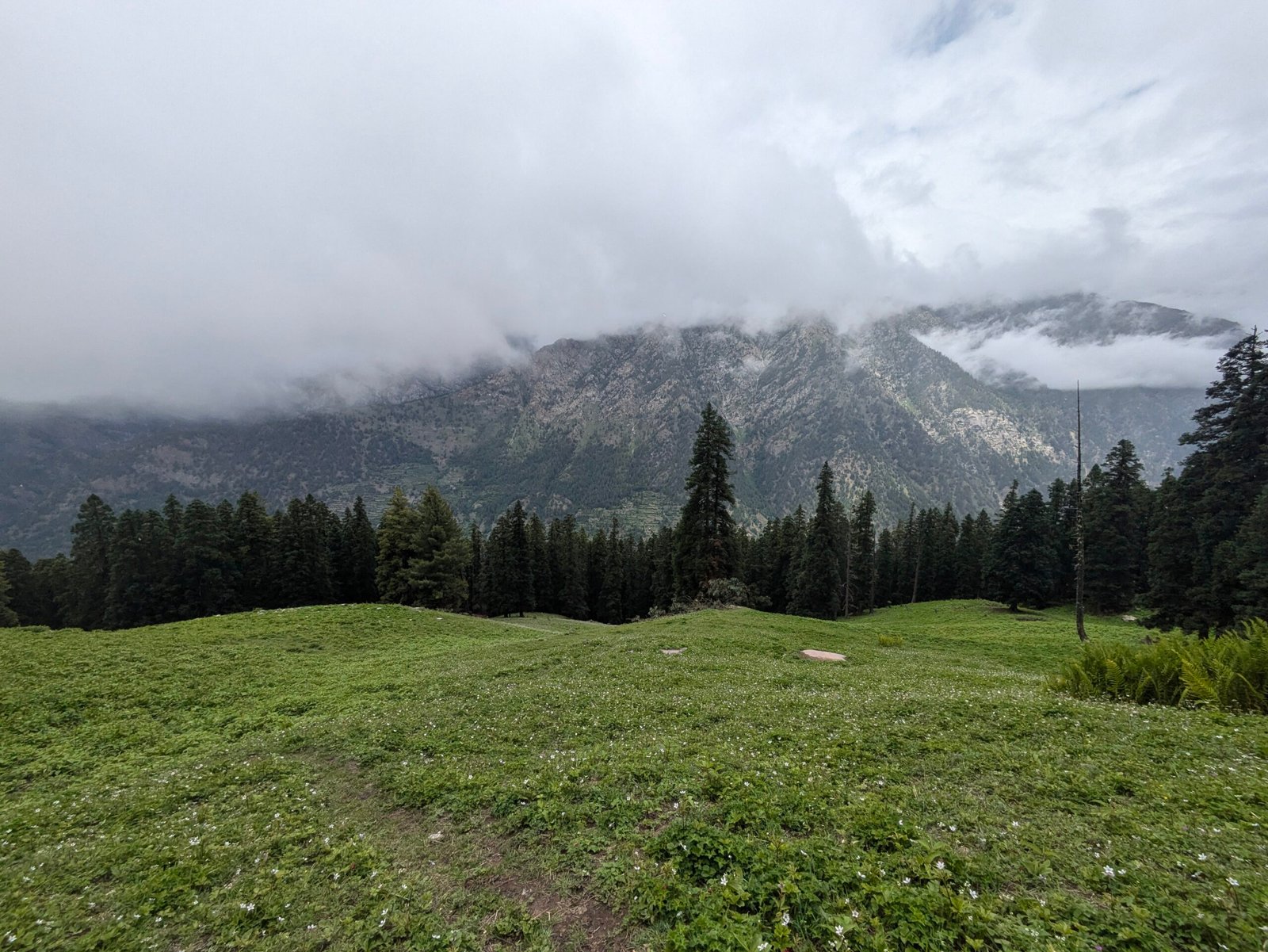
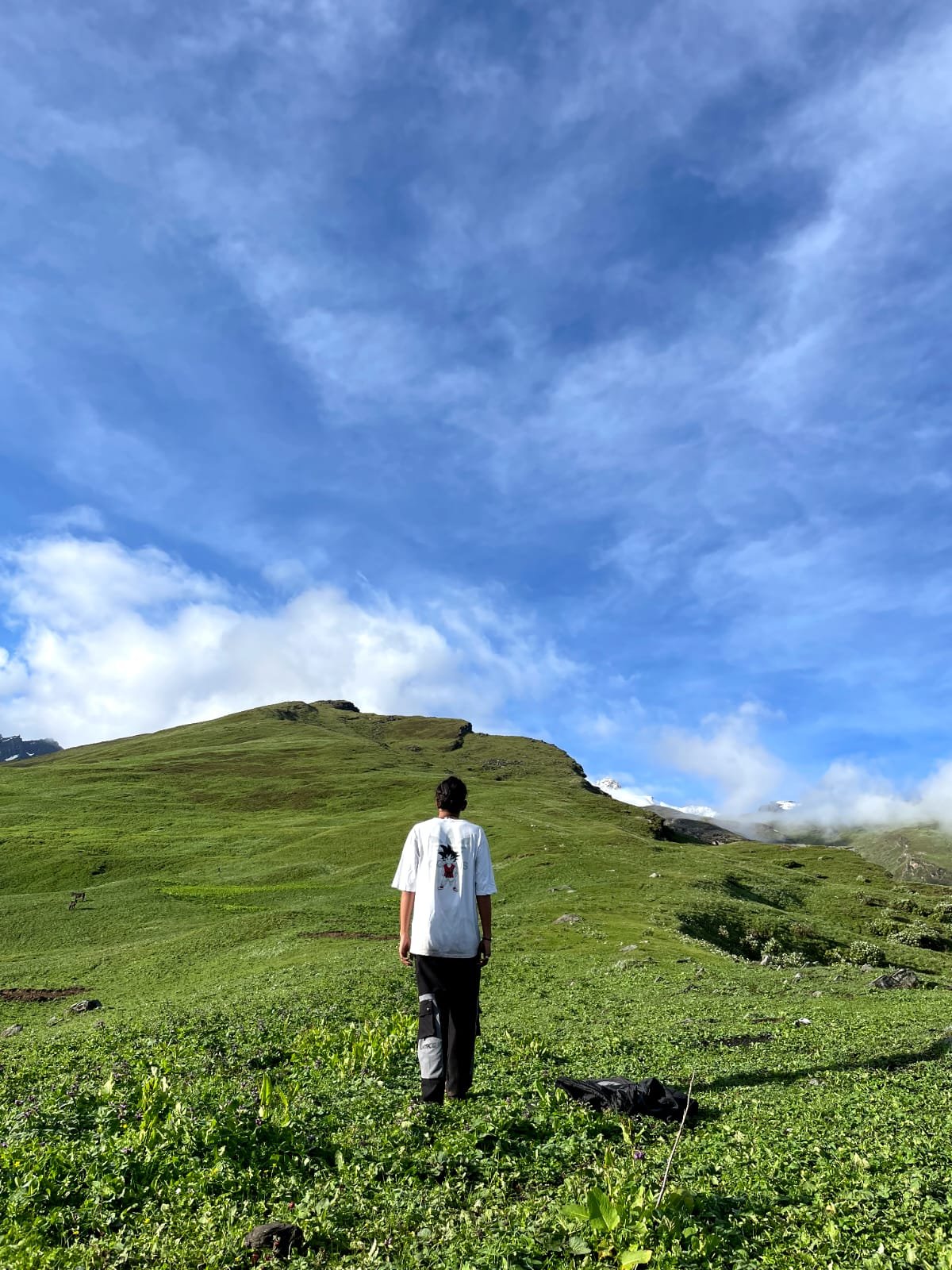
The Jhinda Bugyal Trek is a high-altitude meadow trek in Uttarkashi district, starting from Dharali village near Harsil and climbing roughly 9 km one-way to the alpine grassland of Jhinda Bugyal at approximately 3,680 m (12,073 ft), with a further optional climb to the Srikanth View Point at around 4,418 m (14,494 ft). “Bugyal” is the Garhwali term for high-altitude meadows above the tree line, and Jhinda Bugyal is one of the quieter examples in the Uttarkashi region — used seasonally for grazing and rarely crowded even in peak trekking months.
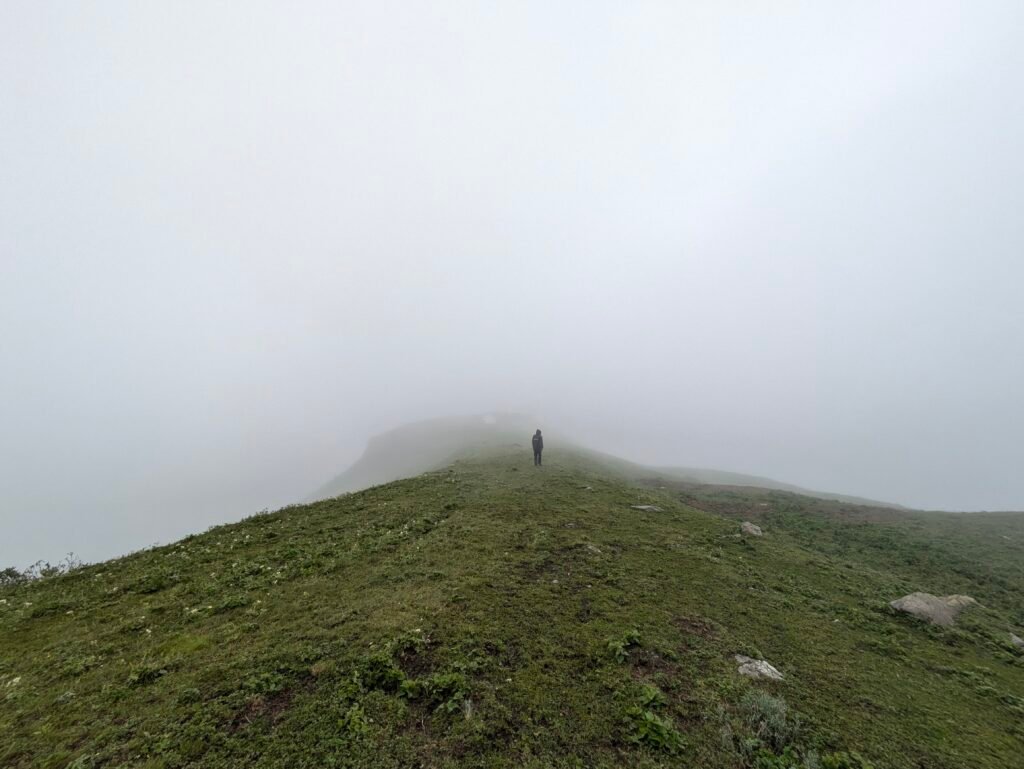
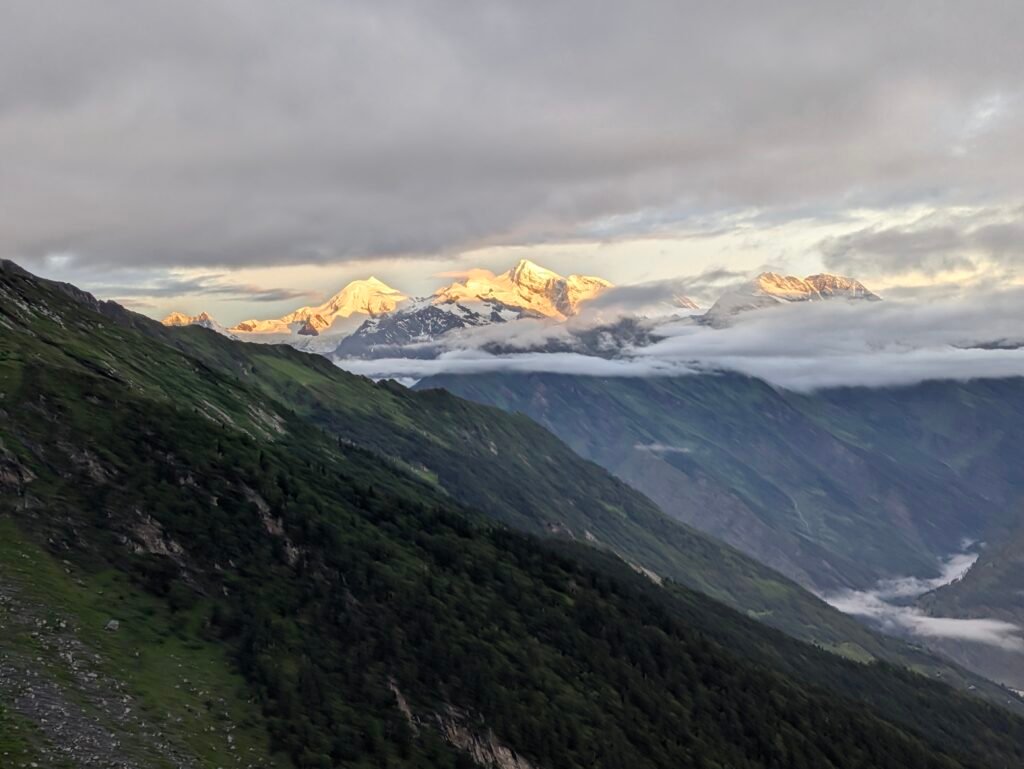
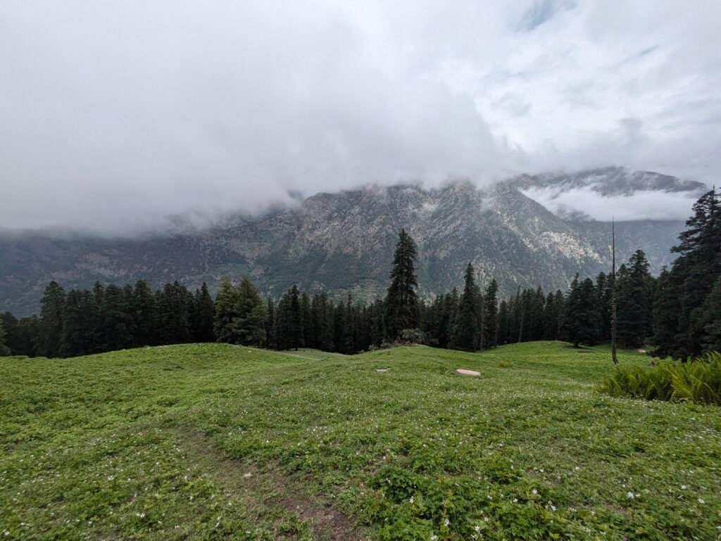
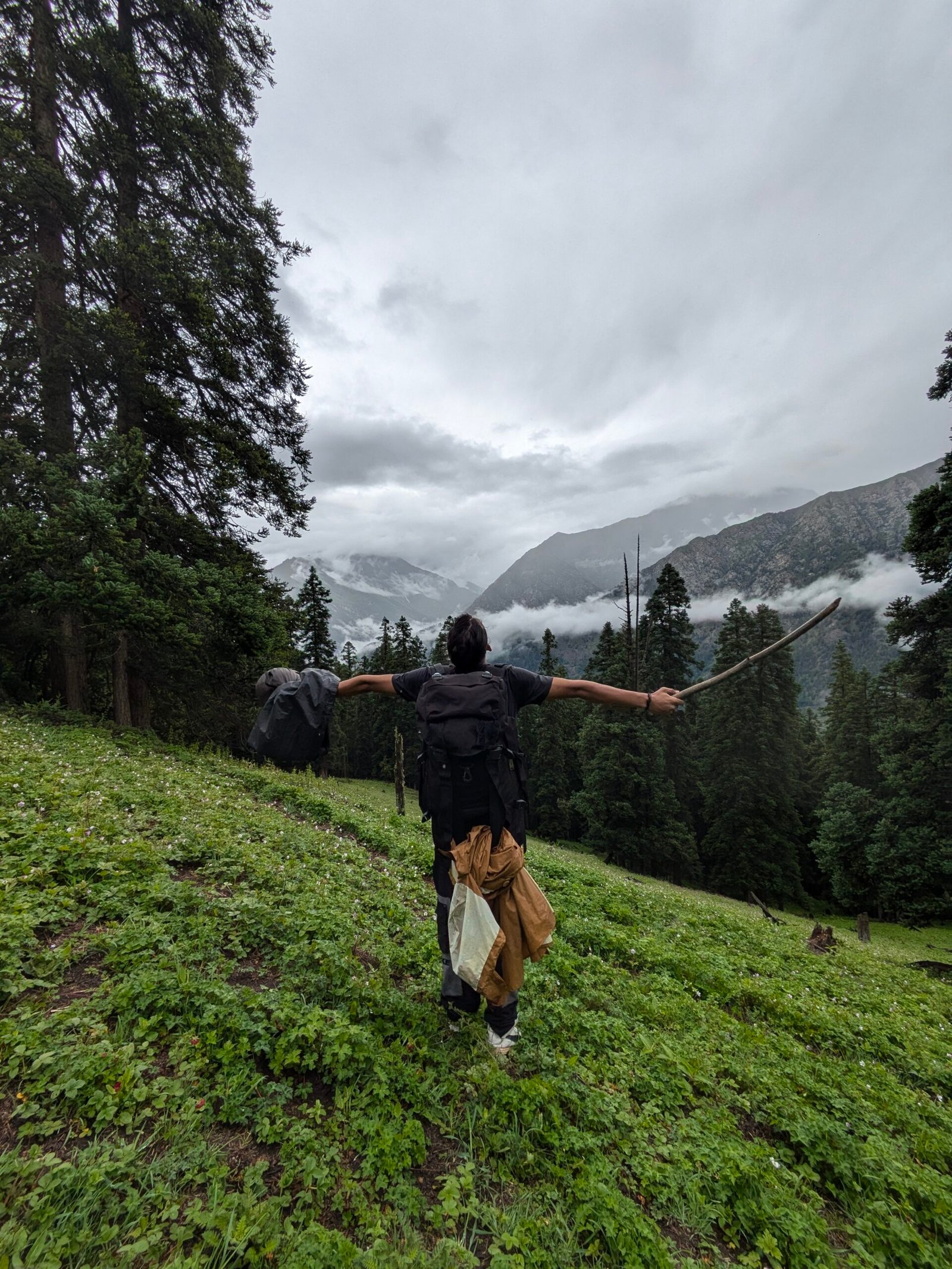
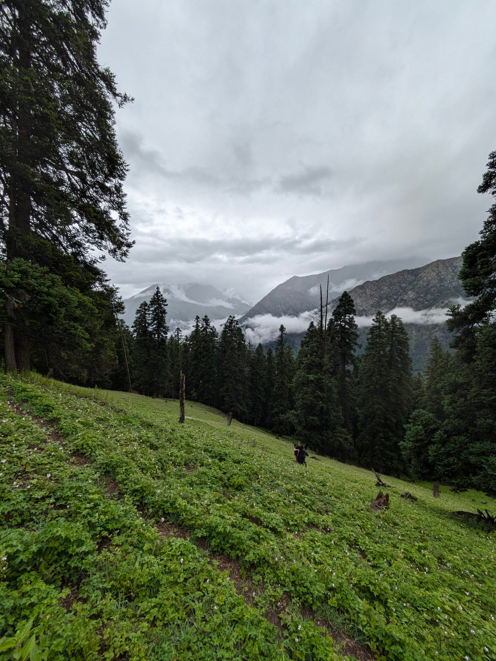
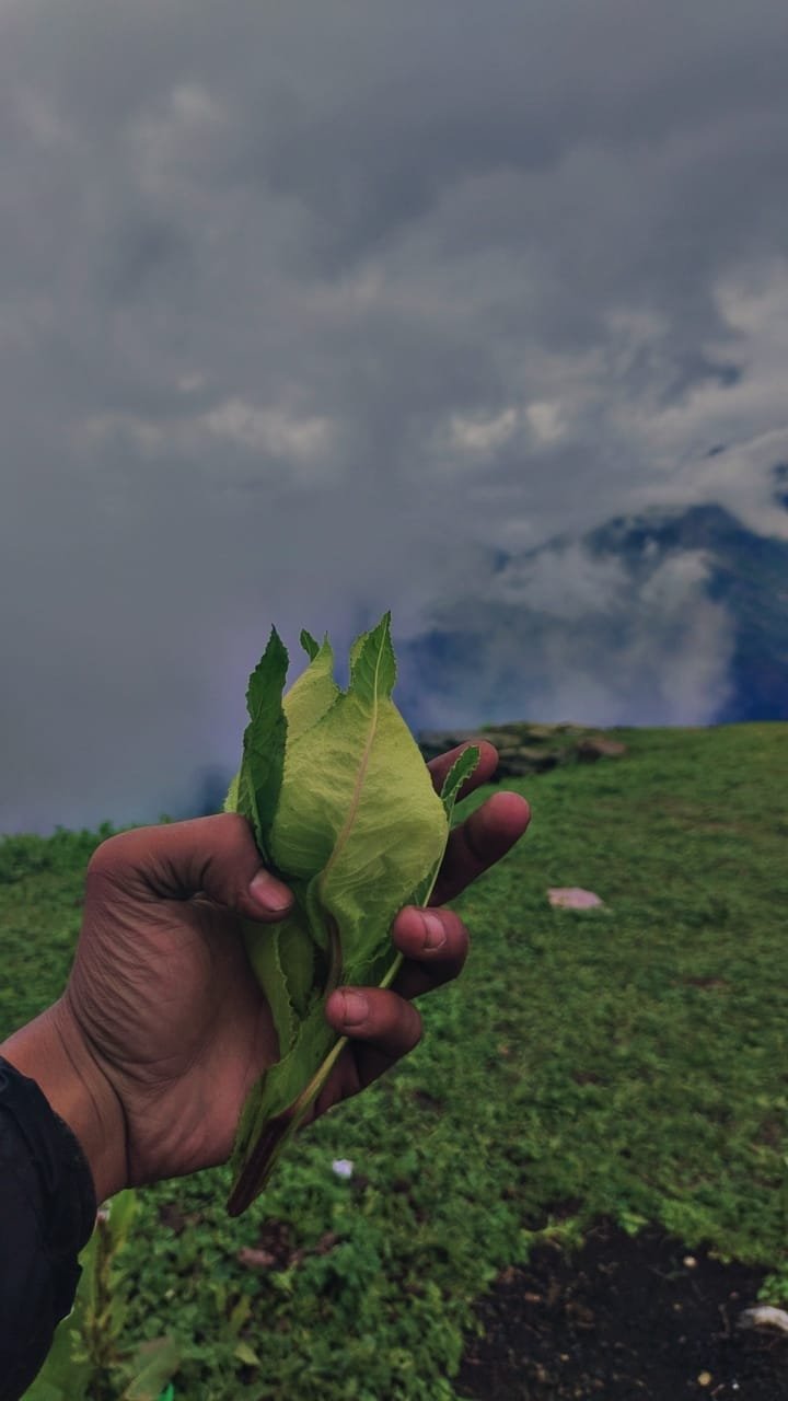
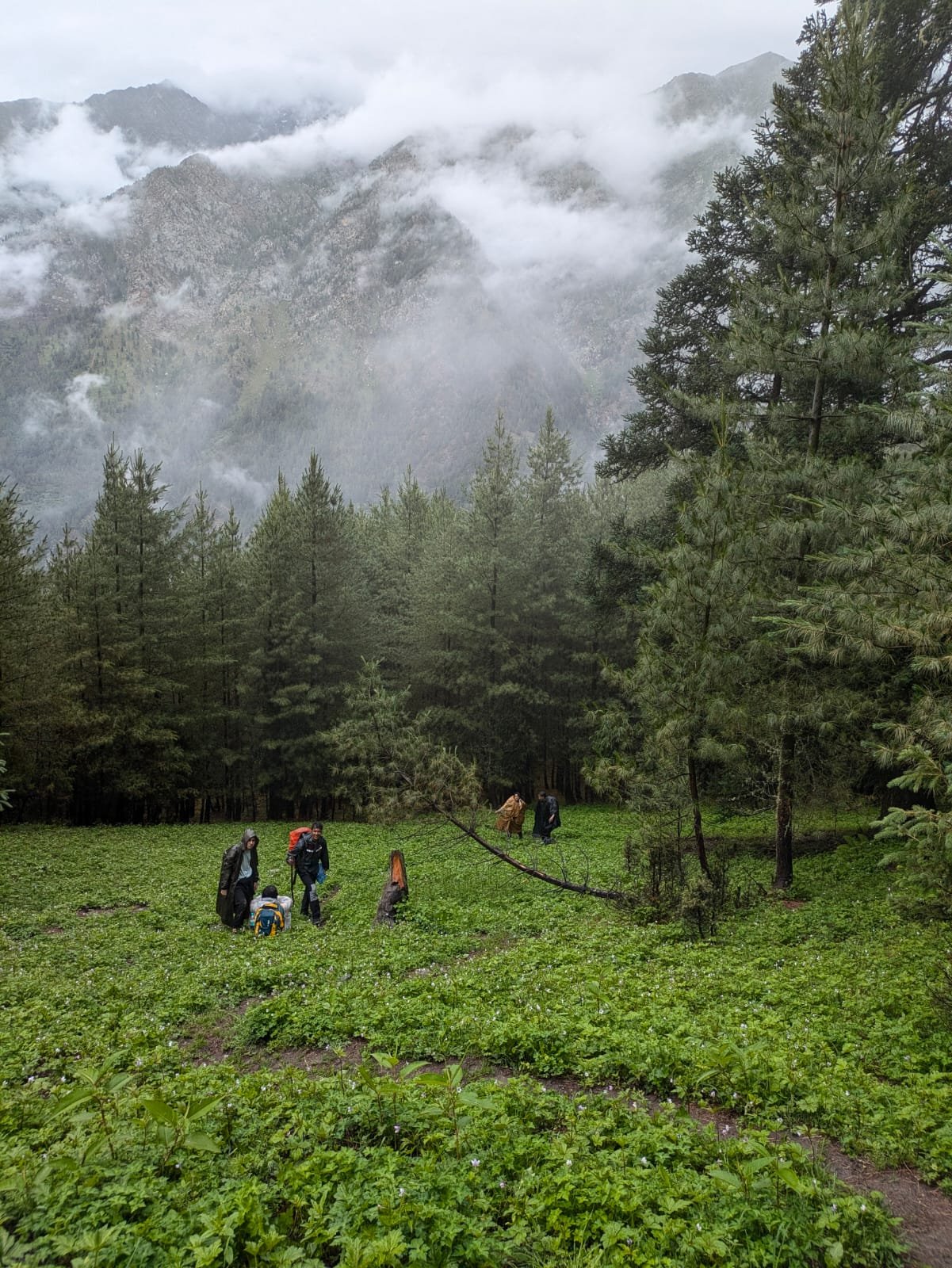
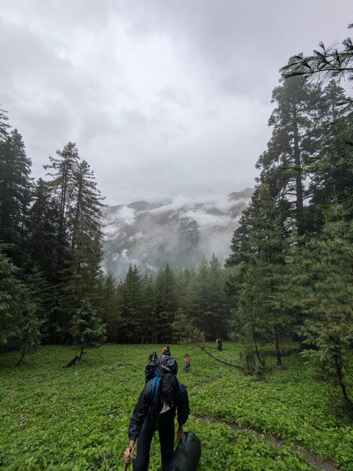
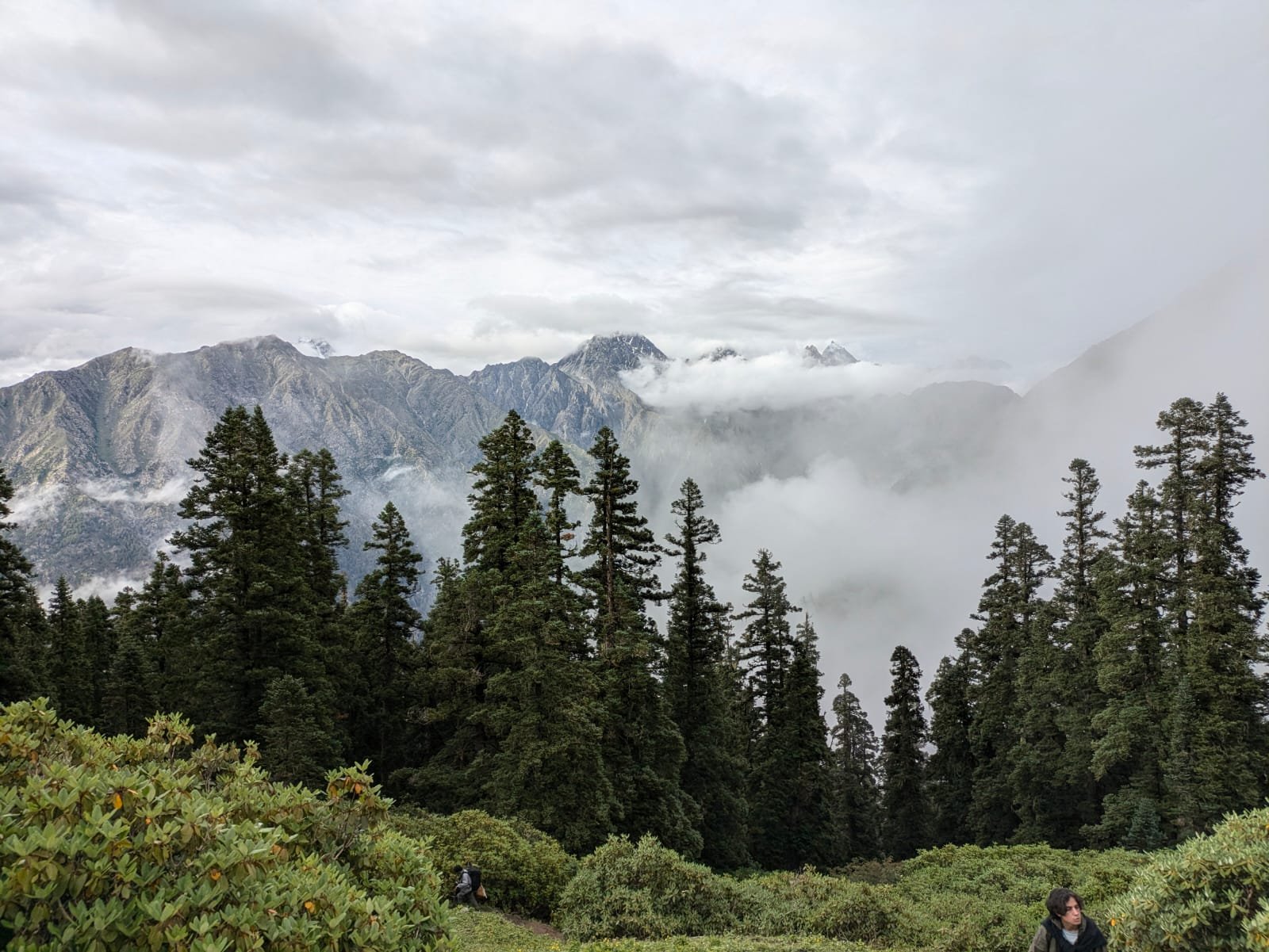
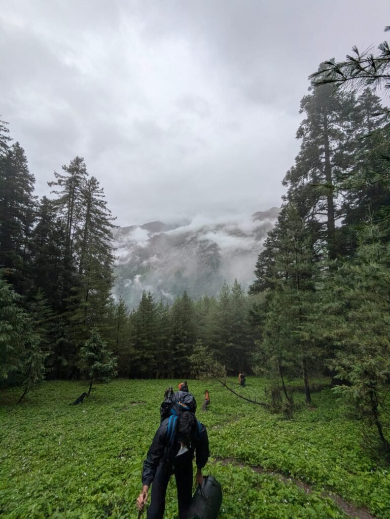
What makes this trek distinct is the combination of a genuinely steep, forested approach with a summit-style finish. Most bugyal treks in this part of Uttarakhand top out at the meadow itself; Jhinda Bugyal adds a real high-altitude viewpoint push on top of that, which is part of why it’s rated moderate to difficult rather than easy. The trail climbs through dense cedar, pine, oak, and rhododendron forest before opening into wide, isolated grassland, with panoramic views down into the Bhagirathi and Harsil valleys and out across the surrounding Garhwal peaks from the higher points.
Quick Trek Information
| Detail | Information |
|---|---|
| Starting Point | Dharali village, near Harsil |
| Ending Point | Dharali village (out-and-back route) |
| Base Village | Dharali (~2,680 m) |
| Trek Distance | ~9 km one-way to Jhinda Bugyal; ~17–18 km round trip |
| Additional Summit Distance | ~3–4 km each way, Jhinda Bugyal to Srikanth View Point |
| Trek Duration | 5 nights / 6 days (standard itinerary) |
| Highest Altitude | Jhinda Bugyal ~3,680 m (12,073 ft); Srikanth View Point ~4,418 m (14,494 ft) |
| Trek Difficulty | Moderate to Difficult — continuous steep inclines |
| Camping | Tented camping at Yakhna Camp and Jhinda Bugyal |
| Best Season | April–June and September–November |
| Guide Required | Strongly recommended; limited signage and steep, exposed terrain |
| Permit Requirement | Forest/eco-tourism permit typically required — confirm current status before travel |
Precise distances and altitude figures for lesser-documented treks like this one can vary slightly between sources and operators. The figures above reflect the standard route Kashi Of North operates — confirm current trail status with us before booking.
Why Visit Jhinda Bugyal?
Jhinda Bugyal is worth choosing specifically if you want a steeper, higher-altitude meadow trek with a real summit component, away from Uttarakhand’s more heavily trekked bugyal routes. Here’s what stands out:
A genuine high-altitude finish. The optional push to Srikanth View Point at ~4,418 m gives this trek a proper high-altitude payoff that many meadow treks in the region don’t offer.
Very light foot traffic. Jhinda Bugyal doesn’t see anywhere near the volume of trekkers that Dayara Bugyal does, which means quieter campsites and a trail that still feels genuinely offbeat.
Forest diversity on the approach. Cedar, pine, oak, and rhododendron all appear across the climb from Dharali, giving the lower sections of the trek real botanical variety rather than a single forest type.
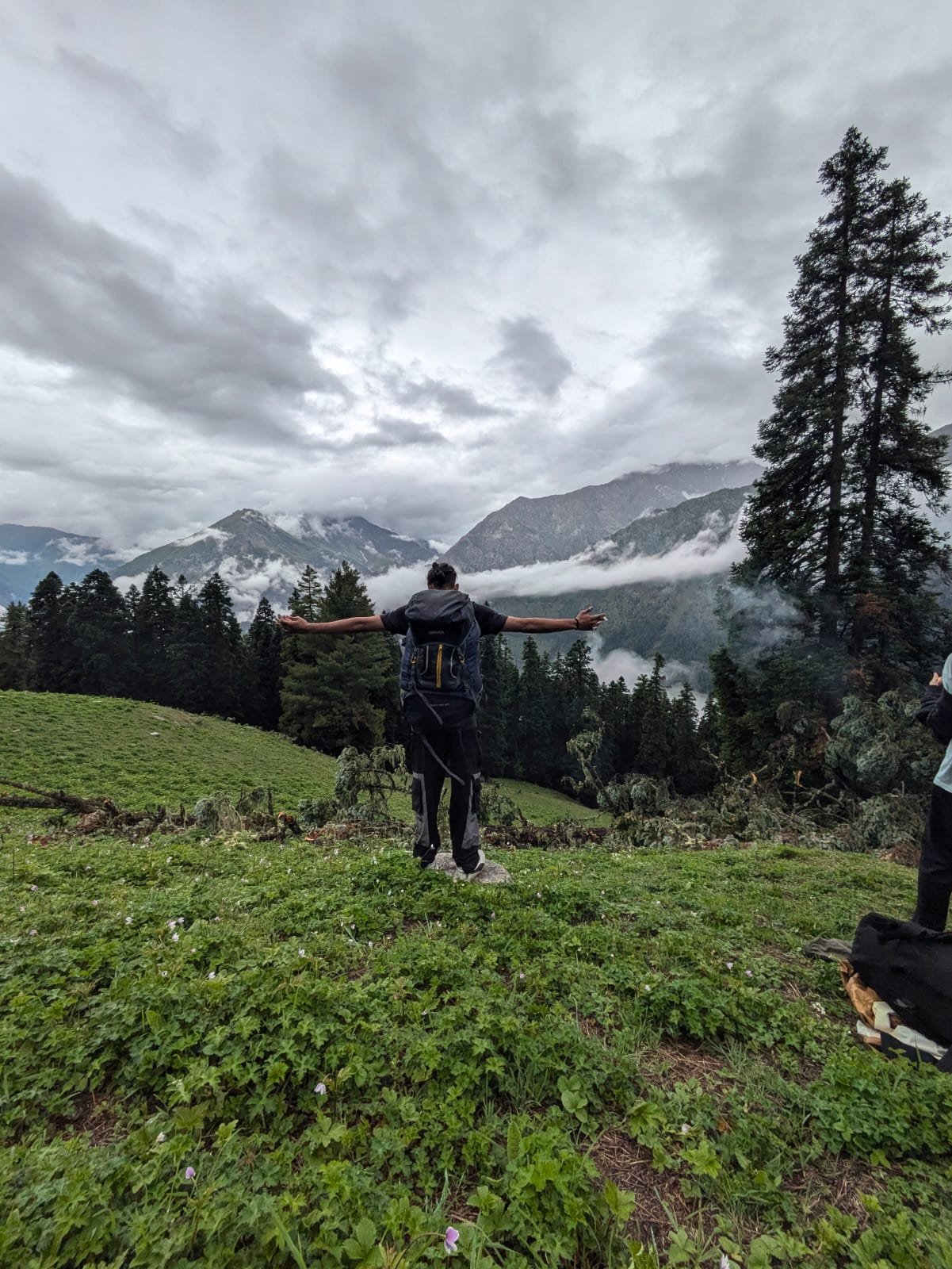
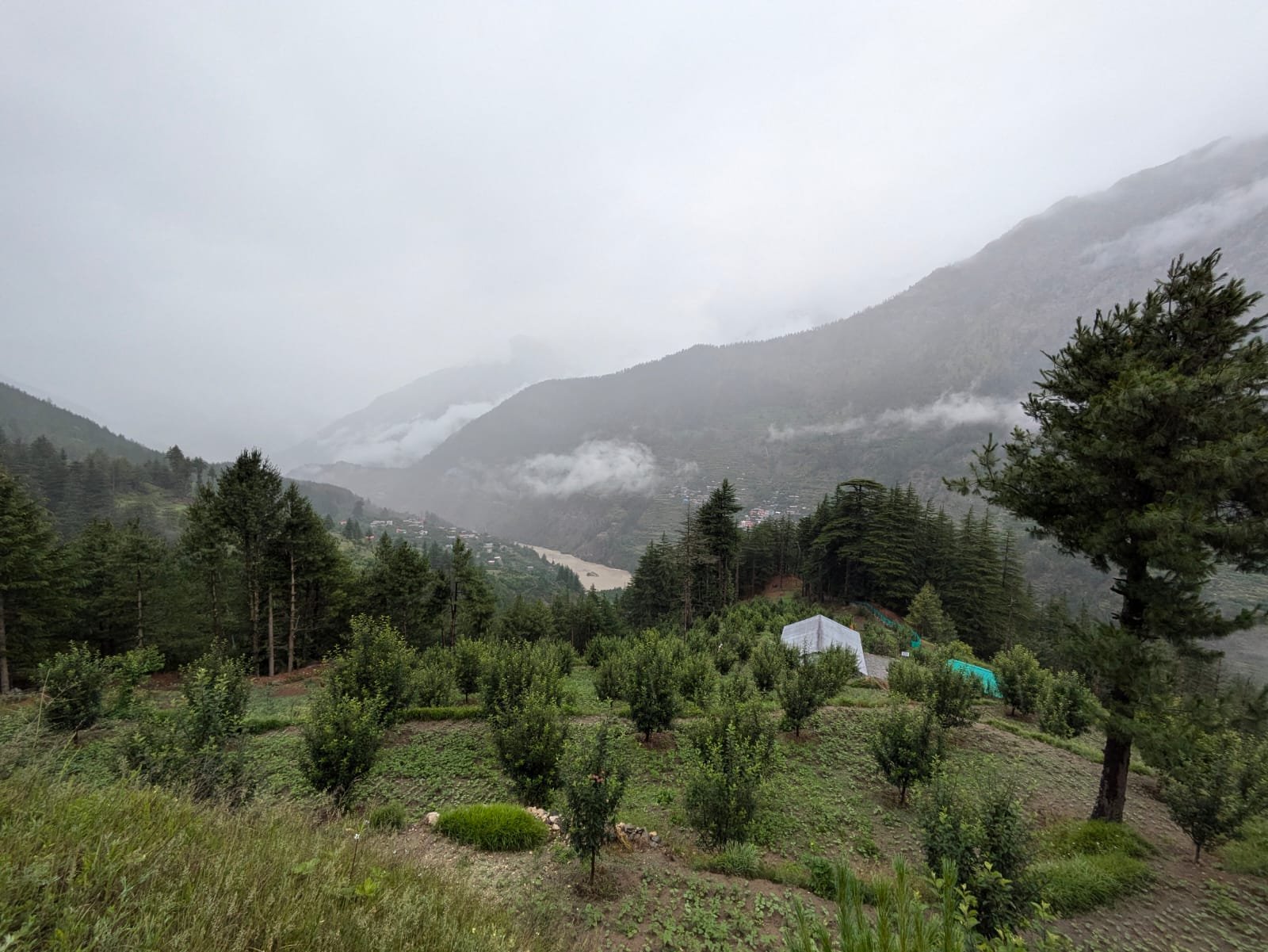
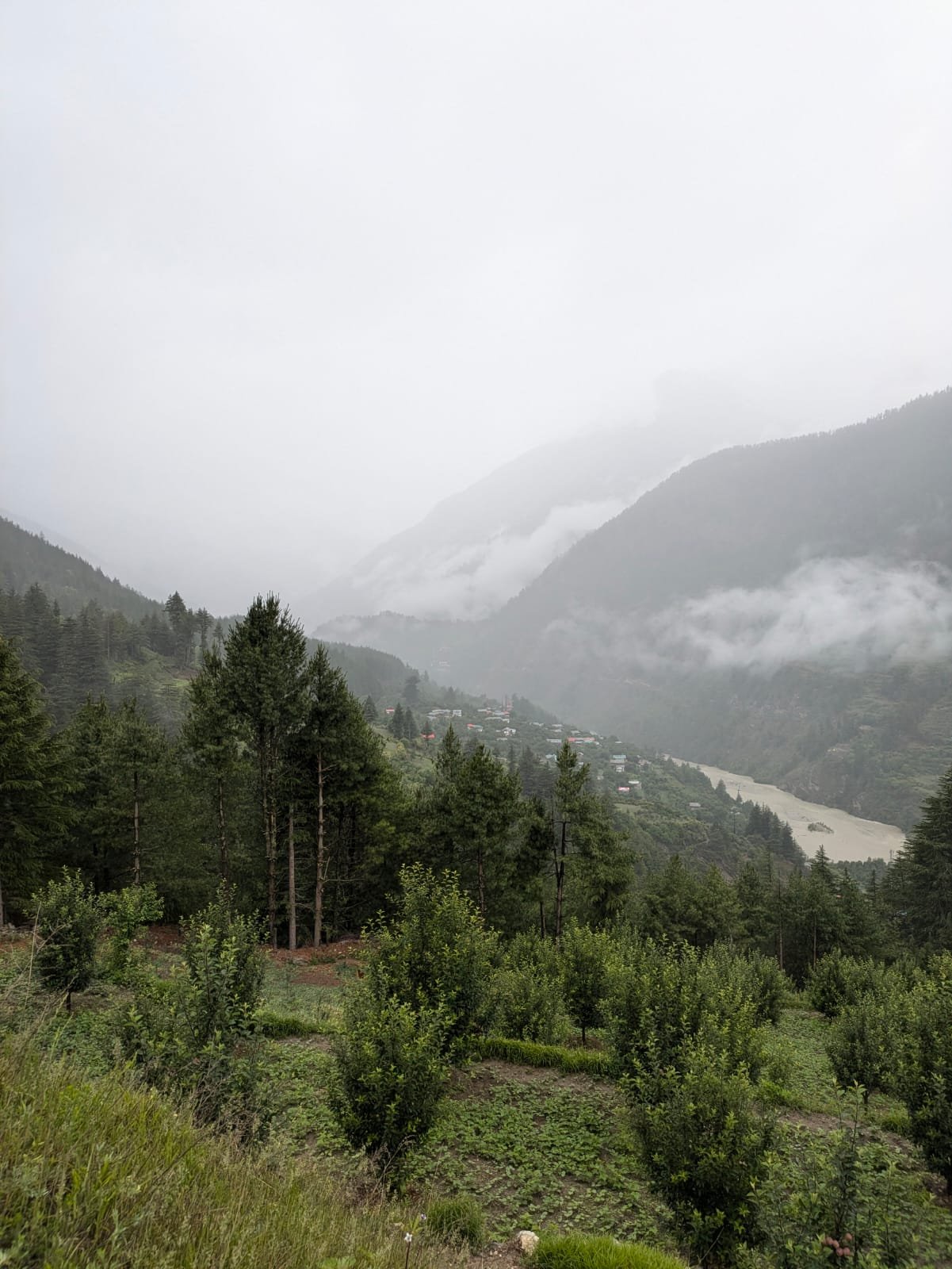
Valley views on the way up, mountain views at the top. The lower trail offers views down into the Bhagirathi and Harsil valleys; the meadow and summit points open up wider Garhwal Himalayan panoramas.
A legitimate camping experience. Two established campsites — Yakhna Camp and Jhinda Bugyal itself — give this trek proper multi-night camping character.
Achievable in under a week. At 5 nights / 6 days including travel, this is a realistic trek for a long weekend-plus-a-couple-of-days, without requiring the two-week commitment of a high Himalayan expedition trek.
Trek Route
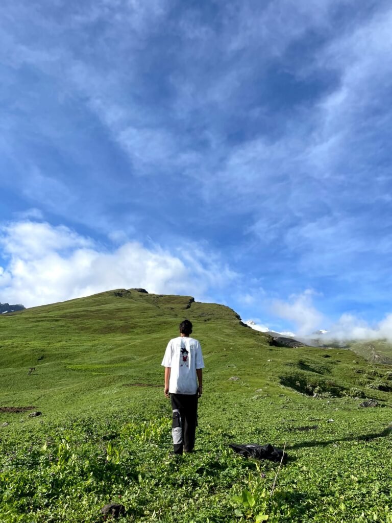
The Jhinda Bugyal Trek follows a single main route — an out-and-back trail from Dharali village rather than a loop, which keeps navigation relatively straightforward even though the terrain itself is demanding.
From Dharali (~2,680 m), the trail climbs steeply through dense cedar and pine forest for the first stretch, gaining altitude quickly toward Yakhna Camp, the first overnight stop. Natural mountain springs provide water at this and other points along the route, though carrying a filtration bottle is sensible practice rather than relying entirely on untreated sources.
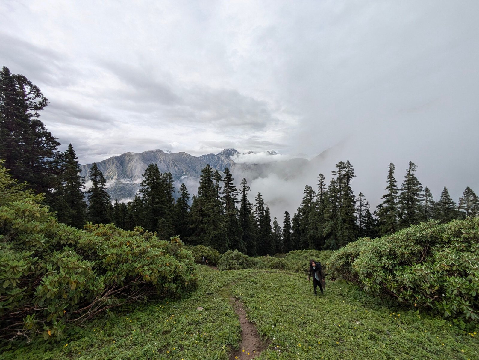
Beyond Yakhna Camp, the forest composition shifts to include more oak and rhododendron as the trail continues climbing toward the tree line. The transition from forest to open meadow is the visual highlight of the approach — the trail breaks out of the trees into the wide, isolated grassland of Jhinda Bugyal itself at approximately 3,680 m, where the main meadow campsite is set.
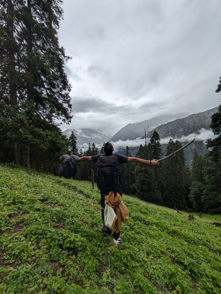
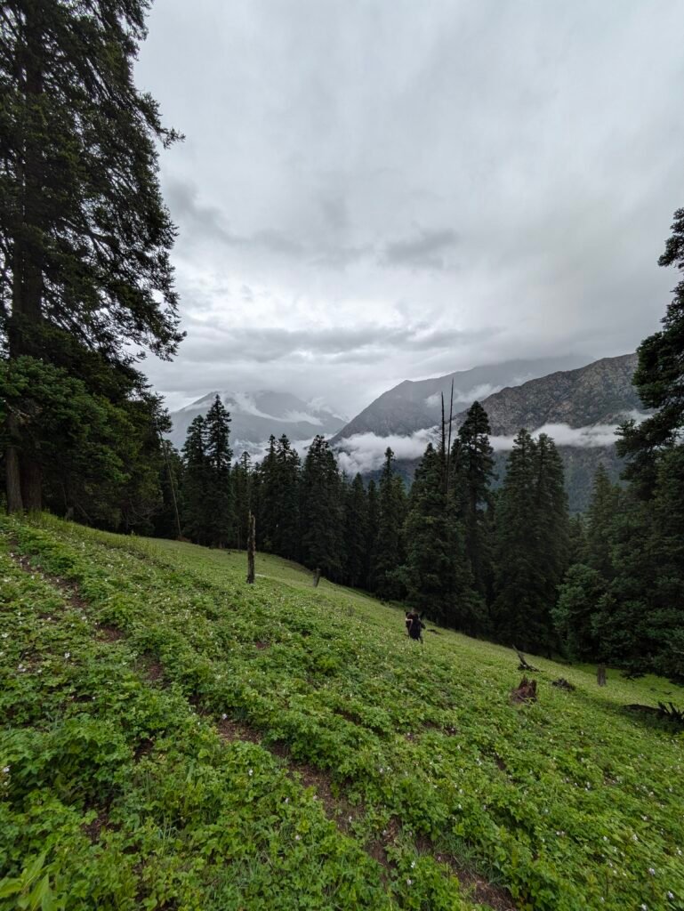
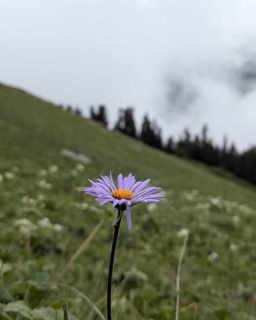
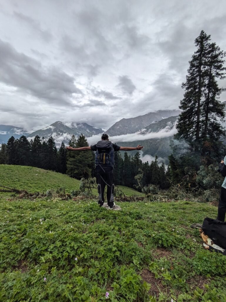
From the Jhinda Bugyal camp, a further climb of roughly 3–4 km leads to the Srikanth View Point, at approximately 4,418 m — the trek’s highest point and the best vantage across the surrounding Garhwal ridgelines. This is typically done as a there-and-back push from the meadow campsite on the same day, returning to camp at Jhinda Bugyal for the night rather than camping at the summit itself.
The descent retraces the same trail back through Jhinda Bugyal’s meadow, back down through the forest belt, past Yakhna Camp’s approximate location, and down to Dharali — typically covered as a single, continuous 9 km descent by groups with good acclimatization and fitness.
Trek Difficulty
The Jhinda Bugyal Trek is rated moderate to difficult, primarily because of the continuous steep inclines on both the approach to Yakhna Camp and the climb from Yakhna to Jhinda Bugyal, combined with the additional altitude gain to Srikanth View Point on day four. This isn’t a trek for complete beginners — prior trekking experience and solid cardiovascular fitness make a real difference to how enjoyable the steeper sections feel.
Technical climbing skills aren’t required — there’s no rope work or glacier travel — but the sustained gradient, combined with maximum altitudes above 4,400 m at the summit point, means altitude-related fatigue and breathlessness are realistic concerns for underprepared trekkers. The trail itself has limited signage in places, which is part of why going with an experienced guide matters more here than on better-marked, more frequently trekked routes. Most fit adults in their late teens through fifties, with prior trekking experience and a few weeks of preparation, can manage this trek comfortably; it isn’t recommended as a first-ever Himalayan trek.
Best Time to Visit
April–June: The strongest window for lush, green meadows and wildflower growth at Jhinda Bugyal, with generally stable pre-monsoon weather. Some residual snow may linger on the higher sections of the summit trail early in this window — check current conditions if you’re planning an April departure specifically.
Monsoon (July–August): Not recommended. Heavy rainfall makes the already-steep forest trail significantly more slippery and increases landslide risk on the approach roads to Dharali.
September–November: The second recommended window, offering the clearest, crispest mountain views of the year as post-monsoon skies settle. Days are cooler than the spring window, and nights at altitude get genuinely cold, particularly into November.
Winter (December–March): Heavy snow accumulation on the higher sections, including the meadow and summit viewpoint, makes this trek impractical for standard guided departures without winter mountaineering equipment and experience.
Month-wise Weather Guide
| Month | Day Temp (Dharali) | Night Temp (Campsites) | Rainfall | Snow | Trek Conditions |
|---|---|---|---|---|---|
| April | 14°C–19°C | -1°C–4°C | Light | Possible at summit | Good, check summit snow status |
| May | 17°C–23°C | 2°C–7°C | Light | Rare | Very good |
| June | 19°C–25°C | 5°C–10°C | Light, pre-monsoon | None | Good — last stable window before monsoon |
| July | 17°C–21°C | 7°C–11°C | Heavy | None | Not recommended |
| August | 16°C–20°C | 7°C–11°C | Heavy | None | Not recommended |
| September | 15°C–20°C | 3°C–8°C | Light, decreasing | Rare | Very good |
| October | 11°C–16°C | -2°C–4°C | Minimal | Possible at summit late month | Excellent — clearest views |
| November | 6°C–12°C | -6°C–0°C | Minimal | Likely at altitude | Marginal — confirm snow status |
Temperatures are approximate and vary year to year. Always confirm current trail and weather conditions before departure.
Flora and Fauna
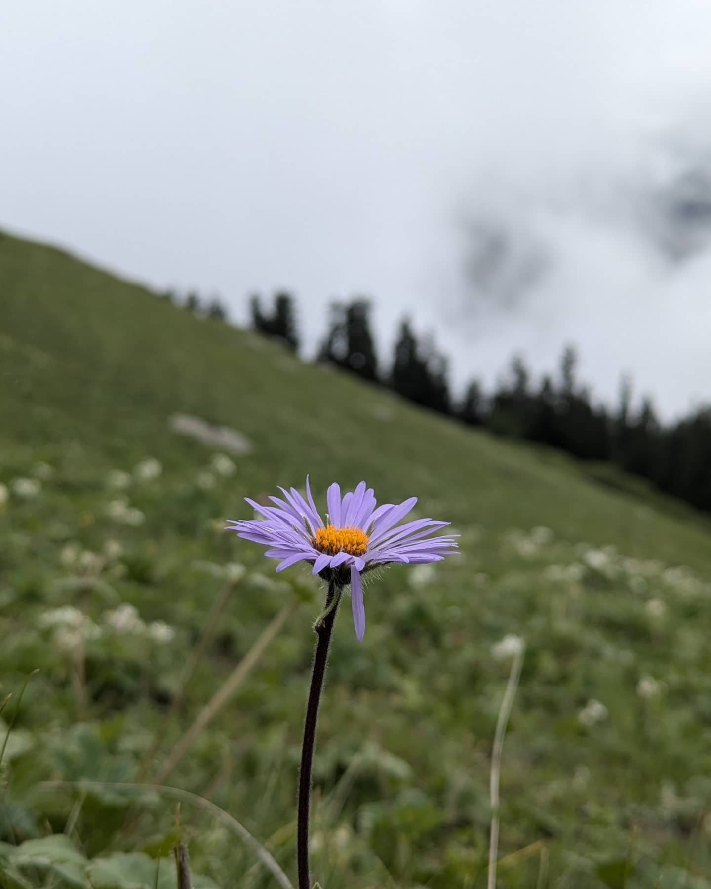
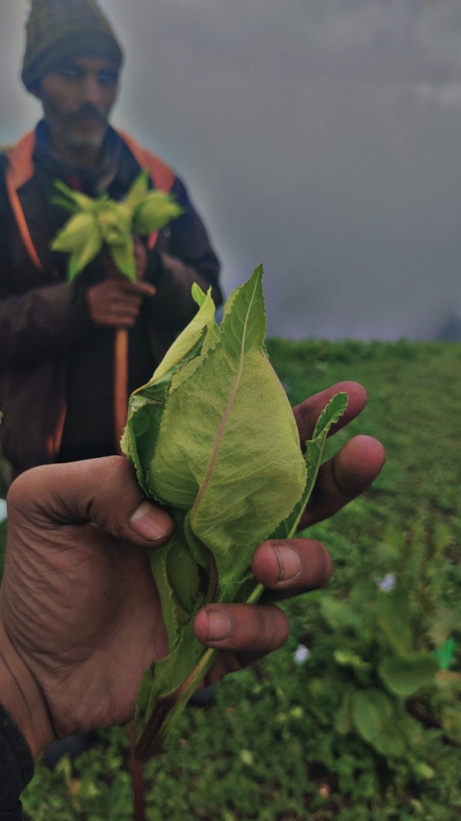
The forest belt between Dharali and Jhinda Bugyal is genuinely mixed — dense cedar and pine dominate the lower, steeper sections near Yakhna Camp, with oak and rhododendron becoming more prominent as the trail climbs toward the tree line. Above the tree line, the meadow itself supports typical high-altitude Garhwal grassland vegetation and seasonal alpine wildflowers, most visible during the April–June window.


Bird life along the forested sections is typical of this altitude band in the Garhwal Himalaya — expect to hear more birds than you see moving through the dense cedar and pine cover, with Himalayan Monal sometimes reported closer to the tree line. On the more open, rocky ground near the Srikanth View Point ascent, blue sheep (bharal) are occasionally spotted, though sightings aren’t a guaranteed feature of any given trek. As with any Himalayan trek, treat wildlife encounters as a bonus rather than an expectation, and keep a respectful distance from anything you do see.
Camping Experience
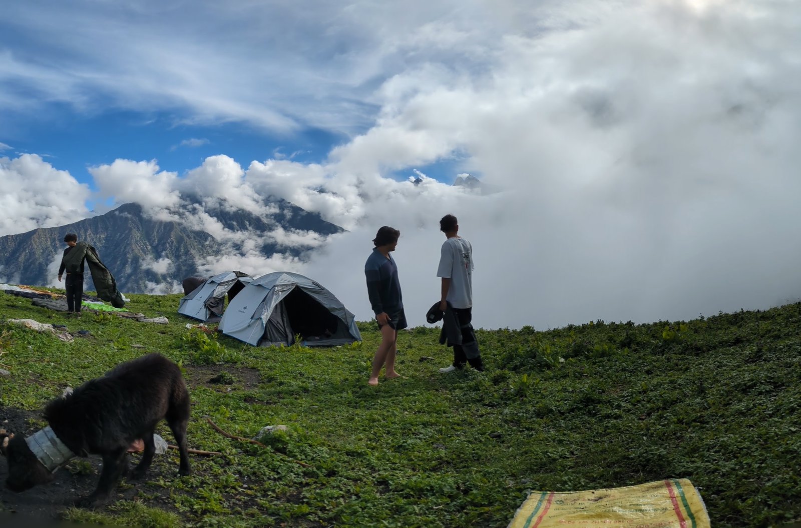
The standard itinerary uses two campsites: Yakhna Camp, set within the forest belt on the way up, and Jhinda Bugyal, the main meadow campsite used on both the ascent and the summit-push night. Both are reached via steep trail sections, so camp setup on a guided trek is typically handled by your trek crew rather than trekkers themselves.
Water is available from natural mountain springs at both campsites, though a filtration bottle or purification tablets are recommended rather than relying on untreated spring water. Twin-sharing tents are the standard camping arrangement on most guided departures, giving a reasonable balance of comfort and practicality for a trek at this altitude.
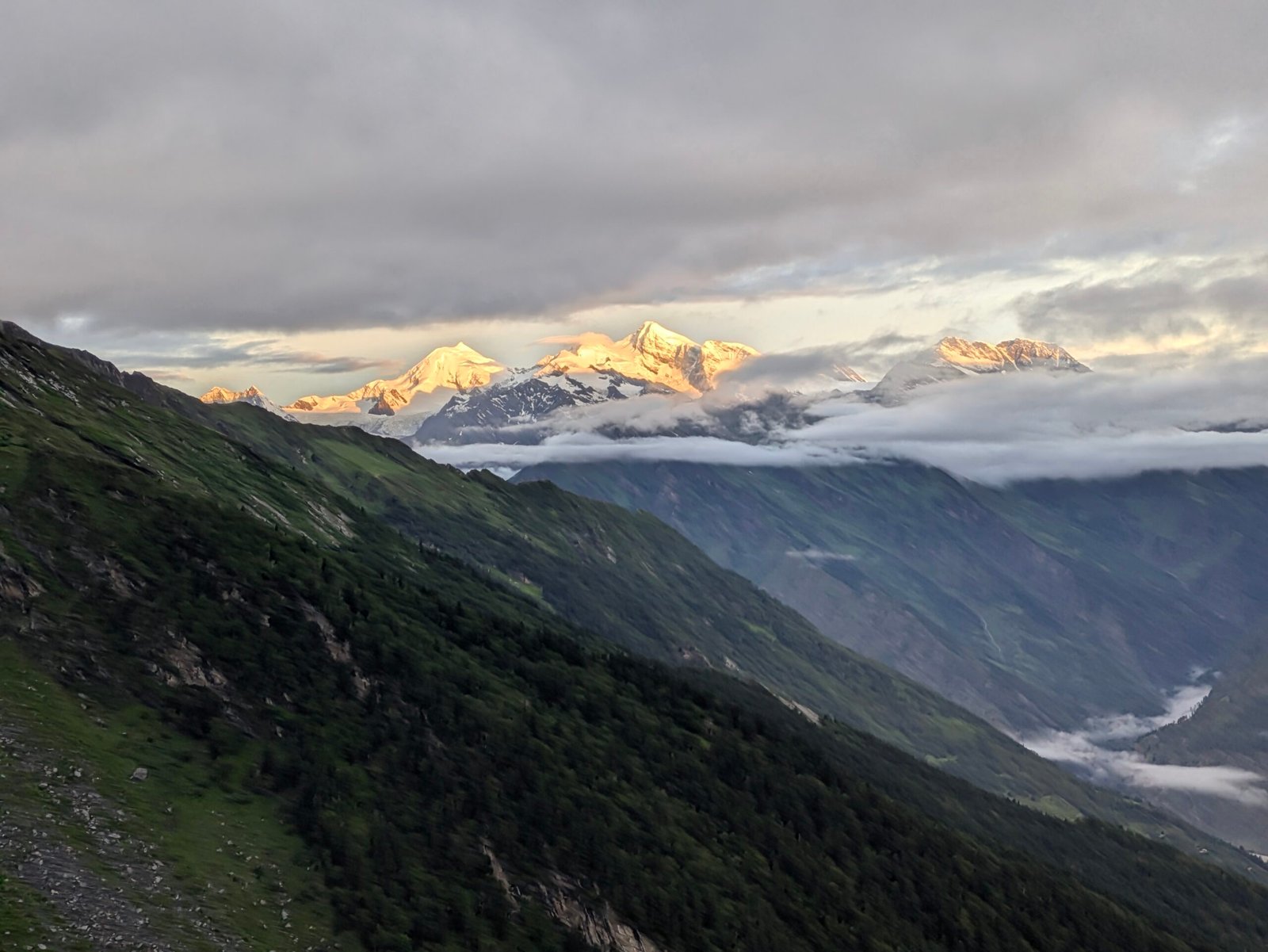
The meadow campsite at Jhinda Bugyal is the standout location for sunrise and sunset — with no obstruction across the open grassland, both ends of the day are worth being awake and outside for. Clear nights at this altitude, away from any light pollution, are also strong for stargazing, particularly around the new moon in the autumn window.
As always on a high-altitude meadow trek: pack out everything you bring in, avoid disturbing meadow vegetation by staying on established trail and camp areas, and follow your guide’s instructions on campfire restrictions, which are common across Uttarakhand’s forest and alpine zones.
Photography Guide
Sunrise and sunset at Jhinda Bugyal. The open meadow with no tree cover makes this one of the better sunrise and sunset spots on any Uttarkashi trek — get into position early, since good light here doesn’t last long.
Meadow and wildflower shots. Best in the April–June window, when seasonal alpine flowers are at their fullest across the grassland.
Landscape photography from Srikanth View Point. The trek’s highest point offers the widest panoramic views of the surrounding Garhwal ridgelines and down into the Bhagirathi and Harsil valleys — worth the extra climb specifically for photographers.
Forest photography on the approach. The mixed cedar, pine, oak, and rhododendron sections between Dharali and Jhinda Bugyal offer strong texture and light-filtering compositions, particularly in early morning light.
Milky Way and night sky. With minimal light pollution at either campsite, clear autumn nights are a strong window for night sky photography — bring a sturdy tripod and a fast, wide lens.
Drone regulations. Standard DGCA rules apply nationally, and forest department restrictions may apply locally given this is a protected forest and alpine zone. Confirm current requirements with your operator before carrying a drone.
Nearby Attractions
Jhinda Bugyal sits within reach of several other Uttarkashi district destinations, making it easy to build into a longer trip:
Harsil — The valley town nearest to Dharali, known for its apple orchards and river scenery. See our Harsil Travel Guide.
Uttarkashi — The district headquarters, roughly 2–2.5 hours from Dharali by road, with the fullest range of services and accommodation. See our Uttarkashi Travel Guide.
Gangotri — The Char Dham temple, a short further drive beyond Harsil. See our Gangotri Travel Guide.
Gangnani — Home to the Rishi Kund hot spring, a good stop for recovery on the drive back. See our Gangnani Travel Guide.
Dayara Bugyal — Uttarakhand’s best-known alpine meadow trek, useful for comparison if you’re weighing treks in the region. See our Dayara Bugyal Guide.
Kush Kalyan Bugyal — Another quieter meadow trek in Uttarkashi district, a good alternative or add-on for trekkers who want two bugyal treks on one trip. See our Kush Kalyan Bugyal Trek Guide.
Bhatwari — A service hub on the Gangotri Highway with a Saturday market. See our Bhatwari Travel Guide.
Netala — A quiet Garhwali village on the Gangotri Highway, worth a stop en route. See our Netala Travel Guide.
Suggested Trek Plans
Weekend Trek (Compressed) Fit, experienced trekkers with limited time occasionally compress this into a 4-day trip by combining the Dharali-to-Yakhna and Yakhna-to-Jhinda Bugyal legs into one long day. This isn’t the standard recommendation — ask Kashi Of North whether your group’s fitness level makes this realistic before booking a compressed schedule.
Full Adventure Trek (Standard 6-Day) The complete itinerary detailed above, including the Srikanth View Point summit push — the recommended plan for most trekkers.
Photography Trek Built around the standard itinerary but with an extra buffer night at the Jhinda Bugyal meadow campsite to allow for weather-dependent sunrise, sunset, and night-sky shooting without the pressure of a fixed descent day.
Camping-Focused Tour For trekkers who want more time at altitude rather than more distance covered, an extended stay at the Jhinda Bugyal meadow campsite — with the Srikanth View Point push as an optional rather than mandatory day — shifts the trip’s focus toward the camping experience itself.
Combined Bugyal Tour Given its proximity to other Uttarkashi meadow treks, Jhinda Bugyal can be combined with Kush Kalyan Bugyal or Dayara Bugyal into a longer, multi-trek itinerary for trekkers with 10–14 days available. Ask Kashi Of North about custom combined packages.
Given the altitude and steep terrain, this trek is not recommended as a family trek for young children — it’s best suited to fit adults and experienced teenage trekkers with adult supervision.
Accommodation
In Dharali (before and after the trek): Local homestays and guesthouses are the standard option, offering a straightforward base for the drive-in day and the recovery night after descending.
During the trek: Tented camping at Yakhna Camp and Jhinda Bugyal, arranged as part of your guided package.
In Harsil or Uttarkashi (optional extension): For a more comfortable recovery stay with a wider range of facilities than Dharali offers, Harsil and Uttarkashi are both within a couple of hours’ drive.
| Location | Options |
|---|---|
| Dharali | Homestays, basic guesthouses |
| Harsil | Guesthouses to mid-range hotels |
| Uttarkashi | Widest range — budget guesthouses through better hotels |
Kashi Of North can arrange homestay bookings in Dharali, camping logistics for the trek itself, and a comfortable recovery stay in Harsil or Uttarkashi afterward, all as part of one booked package.
Food
Meals on a guided departure are typically prepared by the trek crew — simple, energy-appropriate vegetarian food designed for trekking days, served hot at each campsite. Expect dal, rice, seasonal vegetables, and chapati as the core of most meals, with hot tea or soup on arrival at camp after a long climbing day and a packed lunch for the trail on the longer trekking days.
Given the steep, sustained climbing on this route, hydration matters as much as food. Natural mountain springs provide water at the campsites, but should always be treated or filtered before drinking. Carry your own trail snacks — nuts, dried fruit, energy bars — to supplement the main meals on the steeper stretches between camp and lunch stops.
Trek Cost
Trek cost varies by group size, season, and service level. As a general guide:
| Trek Type | What’s Typically Included | Approx. Cost Range (per person) |
|---|---|---|
| Budget Group Trek | Shared group, basic camping, standard meals | ₹9,000–₹13,000 |
| Standard Guided Trek | Full 6-day itinerary, dedicated guide, twin-sharing tents, all meals | ₹14,000–₹19,000 |
| Premium Trek | Smaller group, upgraded gear, additional support staff | ₹20,000–₹26,000 |
| Private Trek | Fully private group, flexible dates, dedicated guide and crew | ₹27,000+ (varies by group size) |
Given the steeper, more technical nature of this trek compared to easier bugyal walks, costs typically run somewhat higher than easy-rated treks of similar duration in the region. These are indicative ranges — contact Kashi Of North for a current quote based on your dates and group size.
Permits
A forest or eco-tourism entry permit is typically required for the Jhinda Bugyal Trek, since the route passes through protected forest and alpine grassland under local forest department jurisdiction. Permit requirements and fees can change seasonally and are generally arranged by your trek operator rather than something you’d handle independently at the trailhead. A guide is also strongly recommended — and in some cases required — given the limited signage and steep, exposed sections of trail.
Confirm current permit and guide requirements directly with your operator before finalizing travel dates; these details are more prone to change on a lesser-documented trek like this one than on Uttarakhand’s more established routes.
How to Reach Dharali
Dharali, the trek’s starting point, sits near Harsil in Uttarkashi district and is reached via Dehradun.
By Air
The nearest airport is Jolly Grant Airport, Dehradun, with regular flights from Delhi and other major cities. From Dehradun, it’s approximately a 220 km road journey to Dharali.
By Train
The nearest railway stations are Rishikesh and Haridwar. From either, continue by road via Dehradun and Uttarkashi to reach Dharali.
By Road / Self-Drive
From Dehradun, the route runs via Uttarkashi and Harsil to Dharali — a full day’s drive of roughly 220 km on mountain roads. From Delhi, add the initial stretch via Haridwar and Rishikesh to Dehradun before continuing.
By Taxi
Private taxis from Dehradun, Haridwar, or Rishikesh can be arranged directly to Dharali. Kashi Of North arranges taxi transfers as part of guided trek packages or as a standalone booking.
Distance Chart
| From | Approx. Distance to Dharali | Approx. Drive Time |
|---|---|---|
| Delhi | ~460–480 km | 13–14 hours |
| Dehradun | ~220 km | 7–8 hours |
| Haridwar | ~250–270 km | 8–9 hours |
| Rishikesh | ~230–250 km | 7.5–8.5 hours |
| Uttarkashi | ~75–85 km | 2–2.5 hours |
| Gangnani | ~55–65 km | 1.5–2 hours |
| Harsil | ~5–8 km | 15–20 minutes |
Road conditions in the upper Bhagirathi Valley, particularly beyond Uttarkashi, are subject to monsoon disruption — confirm current status before departure.
Packing List
Clothing
| Item | Notes |
|---|---|
| Thermal base layers | 2–3 sets |
| Insulated jacket (down or synthetic) | Essential for camp evenings and the summit push |
| Waterproof/windproof shell | Non-negotiable given the exposed summit section |
| Trekking trousers | Quick-dry, 2 pairs |
| Warm cap, sun cap, and buff/neck gaiter | Temperature swings are significant across the day |
| Insulated gloves | Waterproof outer preferred |
| Woolen socks | 3–4 pairs minimum |
Trek Gear
| Item | Notes |
|---|---|
| Backpack (50–60L) | If carrying your own gear |
| Daypack (20–30L) | For the Srikanth View Point summit push |
| Trekking poles | Strongly recommended given the sustained steep sections |
| Headlamp with spare batteries | Essential for early starts and camp use |
| Sleeping bag | Rated for sub-zero temperatures |
| Water bottles/hydration bladder | Minimum 2L capacity |
| Water filtration bottle or purification tablets | For natural spring sources |
Footwear
| Item | Notes |
|---|---|
| Trekking boots | Broken in, ankle support, waterproof — critical given the steep terrain |
| Camp shoes | Lightweight, for evenings at camp |
| Gaiters | Recommended for early and late-season snow patches |
Electronics
| Item | Notes |
|---|---|
| Camera and spare batteries | Cold drains batteries quickly at altitude |
| Power bank | No charging points beyond Dharali |
| Phone | Expect very limited to no signal on the trail |
Medical Kit
| Item | Notes |
|---|---|
| Personal medication | Full trek duration plus buffer |
| Basic first aid kit | Blister care, antiseptic, bandages |
| Altitude sickness medication | Consult your doctor before departure |
| Rehydration salts | Important given the sustained climbing effort |
Documents
| Item | Notes |
|---|---|
| Government-issued photo ID | Required for permits and check-posts |
| Trek booking confirmation | Physical or downloaded copy |
| Travel/high-altitude insurance details | Strongly recommended for this trek’s altitude profile |
| Emergency contact list | Physical copy |
Safety Tips
- Weather: Conditions can change quickly at altitude, particularly on the exposed summit push to Srikanth View Point — carry proper rain and wind protection regardless of the morning forecast.
- Altitude: With a maximum altitude above 4,400 m, altitude sickness is a genuine consideration on this trek. Report headache, nausea, or dizziness to your guide immediately rather than continuing.
- Hydration: The sustained steep climbing increases fluid loss — drink more than feels necessary, and don’t rely on thirst alone as a signal.
- Wildlife: Store food away from tents overnight and keep a respectful distance from any wildlife encountered.
- Navigation: Trail signage is limited in places — this is a trek to do with an experienced local guide rather than independently, particularly for the summit section.
- Responsible trekking: Stay on the established trail, especially across the meadow sections, where off-trail walking causes vegetation damage that’s slow to recover at this altitude.
Responsible Tourism
Leave No Trace. Carry out everything you carry in — there’s no waste infrastructure at either campsite.
Go plastic-free where possible. Carry a refillable bottle and minimize single-use plastic across the trek.
Respect local culture. Dharali and the surrounding villages are working communities, not trek infrastructure — engage respectfully with residents you meet on the drive-in and drive-out days.
Stay on marked trails. Particularly important across the open meadow at Jhinda Bugyal, where the grassland is slow to recover from repeated off-trail trampling.
Support local communities. Choose homestays and local guides where possible, and buy provisions locally in Dharali or Harsil rather than bringing everything from Dehradun.
Practical Information
Mobile network and internet: Very limited to none beyond Dharali — plan for a largely disconnected trek from Yakhna Camp onward.
ATM and cash: No reliable ATM access at Dharali — withdraw cash in Uttarkashi or Dehradun before heading to the trailhead.
Fuel: Fill up in Uttarkashi or Dehradun; limited to no fuel availability near Dharali.
Medical facilities: None at Dharali or along the trek route. The nearest significant medical facility is the District Hospital in Uttarkashi, roughly 2–2.5 hours away by road.
| Service | Contact |
|---|---|
| National Emergency | 112 |
| Uttarkashi Police | 01374-222100 |
| District Hospital, Uttarkashi | 01374-222026 |
| SDRF Uttarkashi | 01374-222755 |
| Uttarakhand Tourist Helpline | 1364 |
| Forest Department, Uttarkashi | 01374-222624 |
For trek bookings, permits, and planning assistance (not emergencies): Kashi Of North — WhatsApp/Call: +91 7253079221 — Email: kashiofnorth@gmail.com — Website: https://kashiofnorth.com
Travel Tips
Fitness preparation: Start training at least 4–6 weeks out, with a focus on sustained cardio (running, cycling, stair climbing) and leg strength — this trek’s continuous steep sections reward specific preparation more than general fitness.
Book with enough lead time. As a lesser-documented trek, availability of guides and permits can be tighter than for mainstream routes — booking a few weeks ahead gives more flexibility on dates.
Choose your guide carefully. Given the limited trail signage, an experienced local guide isn’t optional on this trek in the way it might be on better-marked routes.
Monitor weather in the days before departure, particularly for the shoulder-season windows (early April, late November), when summit-section snow can affect whether the Srikanth View Point push is feasible.
Travel responsibly. Small choices — packing out waste, staying on trail, supporting local homestays — matter more on quieter, less-visited treks like this one, where the trail infrastructure hasn’t been built up to absorb heavy visitor impact.
Trek Jhinda Bugyal with Kashi Of North
We help trekkers with:
- Jhinda Bugyal Trek packages (standard and custom itineraries)
- Experienced local trek guides
- Camping equipment and logistics
- Trek permit assistance
- Hotel and homestay bookings in Dharali, Harsil, and Uttarkashi
- Taxi services to and from the trailhead
- Customized multi-trek Uttarkashi itineraries
📞 WhatsApp / Call: +91 7253079221 📧 Email: kashiofnorth@gmail.com 🌐 Website: https://kashiofnorth.com
Frequently Asked Questions
1. What is Jhinda Bugyal? Jhinda Bugyal is a high-altitude alpine meadow in Uttarkashi district’s Harsil Valley, at approximately 3,680 m, reached via a trek from Dharali village.
2. Where does the Jhinda Bugyal Trek start? The trek starts and ends at Dharali village, near Harsil, in Uttarkashi district, Uttarakhand.
3. How long is the Jhinda Bugyal Trek? Approximately 9 km one-way from Dharali to Jhinda Bugyal, roughly 17–18 km round trip, with an additional 3–4 km each way for the Srikanth View Point summit push.
4. How difficult is the Jhinda Bugyal Trek? It’s rated moderate to difficult, due to continuous steep inclines and a maximum altitude above 4,400 m at the summit viewpoint.
5. What is the maximum altitude of the Jhinda Bugyal Trek? The meadow sits at approximately 3,680 m; the Srikanth View Point summit reaches approximately 4,418 m.
6. What is the best time to visit Jhinda Bugyal? April–June for lush green meadows and wildflowers, and September–November for the clearest mountain views.
7. Is Jhinda Bugyal suitable for beginner trekkers? Not recommended as a first Himalayan trek — the sustained steep sections and altitude are better suited to trekkers with some prior experience and solid fitness.
8. How many days does the Jhinda Bugyal Trek take? The standard itinerary is 5 nights / 6 days, including travel to and from Dehradun.
9. What is Srikanth View Point? The trek’s highest point, at approximately 4,418 m, reached via a side climb from the Jhinda Bugyal meadow campsite, offering panoramic Garhwal Himalayan views.
10. Is a permit required for the Jhinda Bugyal Trek? Yes, a forest/eco-tourism permit is typically required and is usually arranged by your trek operator — confirm current requirements before booking.
11. Is a guide mandatory for this trek? Strongly recommended and, depending on current forest department rules, may be required. Limited trail signage makes an experienced local guide important on this route.
12. What are the campsites on the Jhinda Bugyal Trek? Yakhna Camp, on the forested lower section, and Jhinda Bugyal, the main meadow campsite used on both the ascent and the summit-push night.
13. How much does the Jhinda Bugyal Trek cost? Typically ranges from around ₹9,000 for a basic shared-group trek to ₹27,000+ for a fully private departure, depending on group size, season, and service level.
14. Is Jhinda Bugyal the same as the Jhinda Bugyal near Chamoli? No — this guide covers the Jhinda Bugyal trek in Uttarkashi district’s Harsil Valley, near Dharali. Some sources describe a differently located meadow of a similar name near Urgam Valley in Chamoli district; confirm the specific route with your operator if you’ve seen conflicting details.
15. What wildlife might I see on this trek? Himalayan Monal is occasionally reported near the tree line, and blue sheep (bharal) are sometimes spotted on the more open ground near the summit ascent — sightings aren’t guaranteed on any given trek.
16. What is the trail like on this trek? A single out-and-back route through dense cedar, pine, oak, and rhododendron forest, opening into alpine meadow, with continuous steep sections throughout the ascent.
17. Is mobile network available on the trek? Very limited to none beyond Dharali — plan for a largely disconnected trek.
18. What is the water source on this trek? Natural mountain springs at the campsites; a filtration bottle or purification tablets are recommended.
19. What should I pack for the Jhinda Bugyal Trek? See the full Packing List above, covering clothing, trek gear, footwear, electronics, medical kit, and documents.
20. Can I do the Jhinda Bugyal Trek without camping? No — the standard itinerary requires two nights of tented camping (three, counting the return night at Jhinda Bugyal after the summit push) given the distance from Dharali.
21. Is altitude sickness a real risk on this trek? Yes, given the summit altitude above 4,400 m. The itinerary’s climb-high-sleep-low structure on day four supports acclimatization, but symptoms should always be reported to your guide immediately.
22. What kind of food is provided during the trek? Simple vegetarian trekking meals prepared by the crew — dal, rice, vegetables, and chapati, with hot tea or soup at camp and a packed lunch on trekking days.
23. Is this trek suitable for families with children? Not generally recommended given the altitude and continuous steep terrain — better suited to fit adults and experienced teenage trekkers with adult supervision.
24. How do I reach Dharali from Delhi? Via Haridwar, Rishikesh, and Dehradun, then Uttarkashi and Harsil to Dharali — roughly 460–480 km, about 13–14 hours’ drive.
25. What is the flora like on this trek? Dense cedar and pine forest on the lower sections, with oak and rhododendron becoming more prominent higher up, opening into alpine grassland at the meadow itself.
26. Is this trek open year-round? No — heavy snow at higher elevations typically makes December–March impractical for standard guided departures.
27. What is the ideal fitness level for this trek? Solid cardiovascular fitness and prior trekking experience are recommended given the sustained steep sections — a few weeks of dedicated preparation makes a real difference.
28. Are there toilets at the campsites? Basic arrangements are set up by the trek crew at each campsite on guided departures; don’t expect permanent facilities.
29. What is the best month for photography on this trek? October, for the clearest skies and sharpest views, though April–June offers the best wildflower and green-meadow photography.
30. Is camping equipment provided? Yes, on a standard guided package with Kashi Of North, including twin-sharing tents and camping gear; personal items like sleeping bags may need to be arranged separately depending on the package.
31. What is the total elevation gain on this trek? Approximately 1,000 m from Dharali to the Jhinda Bugyal meadow campsite, with a further roughly 740 m to Srikanth View Point on the summit day.
32. Can solo trekkers join this trek? Yes — solo trekkers can join a scheduled group departure. Contact Kashi Of North for upcoming dates.
33. Do I need trekking poles for this trek? Strongly recommended given the continuous steep gradient on both the ascent and descent.
34. What insurance is recommended for this trek? Travel and high-altitude trekking insurance covering emergency evacuation, given the summit altitude above 4,400 m — this isn’t included in standard trek packages.
35. Can Jhinda Bugyal be combined with other treks? Yes — it’s often combined with Kush Kalyan Bugyal or Dayara Bugyal for trekkers with 10–14 days available. Ask Kashi Of North about custom combined itineraries.
36. What is the trek’s difficulty compared to Dayara Bugyal? Jhinda Bugyal is notably more demanding — Dayara Bugyal is generally rated easy to moderate, while Jhinda Bugyal’s continuous steep sections and higher summit altitude place it at moderate to difficult.
37. Is there an ATM near Dharali? No reliable ATM at Dharali — withdraw cash in Uttarkashi or Dehradun beforehand.
38. How do I book the Jhinda Bugyal Trek? WhatsApp or call Kashi Of North at +91 7253079221, email kashiofnorth@gmail.com, or visit kashiofnorth.com to check dates and get a current quote.
39. What is the descent like on this trek? A continuous, direct 9 km downhill trek from Jhinda Bugyal back to Dharali, typically completed in a single day.
40. Is the Srikanth View Point summit push mandatory? No — it’s the standard part of the itinerary, but trekkers who prefer not to attempt it can spend the extra day at the Jhinda Bugyal meadow campsite instead. Discuss this option when booking.
Explore More Treks and Destinations in Uttarkashi
Conclusion
The Jhinda Bugyal Trek is one of the more rewarding meadow treks in Uttarkashi precisely because it asks more of you than the region’s easier bugyal walks. A steep, forested approach through cedar, pine, oak, and rhododendron; a genuine high-altitude meadow campsite at 3,680 m; and a real summit push to the Srikanth View Point at 4,418 m combine to give this trek a depth and a physical payoff that few other routes in the district can match — without the crowds that have built up around Uttarakhand’s better-known bugyal treks.
It isn’t a beginner’s trek, and it isn’t meant to be. For trekkers with some experience and solid fitness looking for a proper mountain challenge within a six-day window, Jhinda Bugyal delivers wide Garhwal Himalayan views, a genuine forest-to-alpine transition, and campsites that still feel quiet even at the height of the season.
Ready to book? Kashi Of North runs guided Jhinda Bugyal Trek departures with experienced local guides, full camping support, permit assistance, and transportation — and can build a custom itinerary or combine this trek with Kush Kalyan Bugyal or Dayara Bugyal for a longer trip.
📞 WhatsApp / Call: +91 7253079221 📧 Email: kashiofnorth@gmail.com 🌐 Website: https://kashiofnorth.com